
THE
NEOLITHIC
OF
THE
LEVANT
A.M.T.
Moore
University
College
Volume
2
Thesis
submitted
for the
Degree
of
Doctor
of
Philosophy,
Oxford
University
1978

Chapter
5
NEOLITHIC
3
About
6000
B.C.
there
is
evidence
in
the
archaeological
record
of
marked
changes
in
material
remains,
economy,
settlement
patterns
and
social
organi-
zation
signifying
the
emergence
of
a
new
stage
in
the
Neolithic
of the
Levant
which
I
shall
call
Neolithic
3.
The
Neolithic
2
tradition
of
building
recti-
linear
single
or
multiple-roomed
mud-brick
houses
was
continued
on
some
Neolithic
3
sites
but
on
others
the
inhabitants
lived
in
sub-circular
pit
dwellings.
Other
large
pits
which
may have
served
as
working
or
cooking
hollows
are
another
conspicuous
feature
of
many
Neolithic
3
settlements.
The
characteristic
flint
industry
of
Neolithic
2
was
modified
in
Neo-
lithic
3
though
many
of
its
general
features
were
preserved.
The
emphasis
of
Neolithic
3
flint
production
remained
the
manufacture
of
blade
tools
but
they
were usually
smaller
than
in
Neolithic
2.
Pyramidal
cores
were
now
preferred
which
yielded
shorter
blades
than
the
double-ended
cores
of
Neolithic
3.
Arrowheads
were
usually
smaller
though
in
Syria
and
Lebanon
several
types
of
very
large
arrowhead
continued
to
be
made
throughout Neolithic
3.
Short,
regular,
segmented
sickle
blades
hafted
in
composite
sickles
were
now
used
rather
than
the
large
blades
of
Neolithic
2.
These
segmented
sickle
blades
had
a
serrated
or
denticulated
cutting
edge
and
cut
most
effectively
when
the
sickle
was
used with
a
sawing
motion.
A
new
feature
of
the
flint
industry
on
some
Neolithic
3
sites
was
the
manufacture
of
large
axes,
adzes,
picks
and
other
heavy
flaked
tools.
These
tools
were
apparently
developed
to
cut
timber
and
prepare
land
in
areas
which
had
not
previously
been
favoured
for
permanent
settlement.
The
principal
cultural
innovation
in
Neolithic
3
was the
making
of
pottery,
Pottery
was
first
used
on sites
in
Syria
and
Lebanon
about
6000
B.C.
At
the
beginning
it
was made
in
small
quantities
but
the
craft
flourished
so
that
soon
after
its
introduction pottery
became
an
item
of
every
day
use
throughout

-
295
-
the
central
and
northern
Levant
although
pottery
was not
used
in
the
southern
Levant
until
several
centuries
later.
From
the
outset there
was
much
variety
in
fabric
and
decoration.
Pottery
is
such
a
conspicuous
item
in
the
archaeo-
logical
record
that
its
introduction
is
the
principal indicator
of
innovations
in
material
culture.
Other
important
changes
were
taking
place
in
economy
and
the
pattern
of
settlement
at
the
time
that
pottery
was introduced. These
changes
in
artifacts
and
way
of
life
are
the
main
evidence
that
a
new
stage
of
the
Neolithic
was
developing.
Pottery
is
the
most
easily
recognisable
new
artifact
and
for
this
reason
the
moment
when
its
manufacture
began
is
the
most
convenient
point
at
which
to
date
the
beginning
of
Neolithic
3.
Although
the
introduction
of
pottery
was
such
a
striking
innovation
the
changes
in
the
buildings
and
flint
industry
were
simply
a
modification
of
the
Neolithic
2
tradition.
In
general
there
was
cultural
continuity
from
Neolithic
2
to
Neolithic
3
in
the
Levant,
evidence
for
which
has
been
found
at
Abu
Hureyra,
Buqras,
Ras
Shamra,
Tell
Ramad
and
Tell
Labweh.
In
Palestine
the
Neolithic
2
pattern
of
existence
was
disrupted
and
the
Neolithic
3
way
of life
there,
when
finally
established,
was
somewhat
different
from
further
north.
The
Neolithic
3
economy
differed
in
several
ways
from
that
of
Neolithic
2
though
it
developed
from
it.
There
was
a
stronger
emphasis
on
agriculture
in
the
villages
of
Neolithic
3
than
in
Neolithic
2.
Herding
grew
markedly
in
importance
on
some
sites
while
hunting
and
the
gathering
of
wild
plants
contributed
less
to
the
diet
of
the
settled population
than
before.
The
settlement
pattern
underwent
considerable
modification
in
Neolithic
3
(Fig.
35)-
The
expansion
of
settlement
into
the
semi-arid
areas of
central
Syria,
TransJordan
and
in
the
extreme
south-east
of
the
Levant
which
had
taken
place
in
Neolithic
2
was
reversed.
No
permanent
Neolithic
3
settlements
have
been
found
in
these
areas
and
they
seem
to
have
been
occupied
no more than
intermittently
by
mobile
groups.
On the
other
hand
a
considerable
expansion
of
settlement
took
place
in
western
Syria
and
Lebanon
in
areas
that
were
quite
thinly
populated
in
Neolithic
2.
New
sites
were
founded
and
old
sites

Fig.35
Extent
of
Neolithic
3
settlement
A
sites
abandoned
early
in
Neolithic
3
scale
1
=
4,000,000

FIGURE
35
Extent
of
Neolithic
3
settlement
1
Tell
Chagar
Bazar
2
Tell
Halaf
3
Tell
Aswad
(Balikh)
4
Tell
Abu
Hureyra
5
El
Kum
6
Buqras
7
Judaidah
Jabbul
8
Tell
Judaidah
9
Tell
esh-Sheikh
10
Ras
Shamra
11
Tell Sukas
12
Hama
13
Tabbat
el
Hanunam
14
Kubbah
I
15
Byblos
16
Tell
Labweh
17
Tell
Neba'a
Faour
I
18
Kaukaba
19
Tell
Ramad
20
Kfar
Giladi
21
Hagosherim
22
Beisamun
23
Kabri
24
Shaar
Hagolan
25
Munhatta
26
Beth-Shan
27
Megiddo
28
Vadi
Rabah
29
Lydda
30
Jericho
31
Abu
Gosh
32
Teluliot
Batashi
33
Givat
Haparsa
34
Nizzanim
35
Tell
ed-Duweir

-
296
-
enlarged
along
the
Syrian
and
Lebanese
coasts
and
in
the
Beka'a
and
Orontes
valleys.
There
was
also
settlement
expansion
in
the
Amuq
basin
and
north-
west
Syria
to
the
west
of the Euphrates.
In
Palestine
the
old
settlement
pattern
was
considerably
disturbed.
Most
Neolithic
2
sites
were
abandoned
then
new
sites
were
founded
later
in
slightly
different positions.
The
population
of
the
Negev
and Sinai was
much
reduced
although
there
are
indications
that
these
areas
continued
to
be
inhabited.
Having
briefly
mentioned
the
most
important
developments
that
took
place
in
Neolithic
3 I
shall
now
consider
the
archaeological
evidence
in
detail
taking
each
region
in
turn.
Middle
Euphrates
The
principal Neolithic
2
settlement
sites
along the
Middle
Euphrates
were
abandoned
in
Neolithic
3.
Permanent
occupation
at
Mureybat
ceased
at
the
end
of
phase
IV
sometime
in
Neolithic
2
and
although
there
are
indications
that
the
site
was
used
in
later
periods,
even
possibly
in
Neolithic
3»
it
was
never
subsequently inhabited
as
a
permanent
settlement.
Abu
Hureyra
continued
to
be
occupied
until
early
in
Neolithic
3
so
that
here
one
can
trace
the
development
of
some
of
the
features
of
the
new
stage.
In
the
ceramic
Neolithic
phase
of
occupation
there
were
some
changes
in
the
structures
used
at
the
site
as
we
have
seen.
Shallow
pits
were
dug
between
the
buildings
which
continued
to
be
built
of
mud-brick
on
a
rectilinear
plan.
The
settlement
itself
shrank until
it
covered
only
half
the
area
of
the
aceramic
site.
There
were
slight
changes
in
the
flint
industry,
the
most
noticeable
being
an
increase
in
the
amount
of
retouch
by
squamous
pressure-
flaking
on
arrowheads
and
a
few
other
tools. The
other
artifacts
were
as
varied
as
they
had
been
in
the
later
ceramic
phase,
the
one
innovation
being
the
introduction
of
pottery.
This
and
the
other
new
features
found
in
the
excavation
were
sufficient
to
mark
a
new
phase
of
occupation,
the
ceramic
Neolithic,
even
if
it
was
obviously
a
continuation
of
the
later
aceramic

-
297
-
Neolithic
settlement.
The
appearance
of
pottery,
albeit
in
modest
amounts,
the
changes
in
the
flint
industry
and
the
digging
of
large
pits
around
the
mud-brick
"buildings
are
all
hallmarks
of
Neolithic
3
so
that
the
ceramic
Neolithic
phase
of
occupation
at
Abu
Hureyra
can
be
ascribed
to
this
stage.
The
remains
of
the
Neolithic
3
settlement
at
Abu
Hureyra
had
suffered
considerably
from
weathering
and
much
of
the
deposit
had
simply
been
eroded
away.
For
this
reason
it
is
difficult
to
know
exactly
when
the
settlement
was
abandoned
but
from
the
typology
of
the
artifacts
it
would
appear
that
occupation
ceased
about
the
same
time
as
at
Buqras,
that
is
early
in
the 6th
millennium.
Tell
Kreyn
near
Abu
Hureyra
was
certainly
occupied
in
Neolithic
2
and
again
in
the
Halaf.
The
foci
of these two
settlements
were
several
tens
of
metres
apart
and there
were
no
surface
indications
of
material
that
would
fill
the gap
between
the
two
phases
of
occupation,
a
gap that
corresponds
to
Neolithic
3.
The
inference
to
be
drawn
from
this,
admittedly
inconclusive,
evidence
is
that
the
site
was
abandoned
during
the 6th
millennium.
The
level
III
occupation
at
Buqras
also
falls
in
Neolithic
3
on
the
evidence
of
the
few
potsherds
that
were
found
in
the
deposit.
The
other
artifacts
were
similar
in
type
to
those
of
levels
II
and
I.
The
structures
in
level
III
consisted
of
mud-brick
walls
as
in
the
earlier
levels.
The
sequence
at
Buqras was
continuous
and
occupation
at
the
site
came
to
an
end
about
5900
B.C.,
as
we
have already
noted.
Abu
Hureyra,
Kreyn
and
Buqras
all
seem
to have
been
abandoned
in
the
first
half
of
the
6th
millennium
and
Mureybat
perhaps
a
little
earlier.
In
itself
such
a
break
in
the
occupation
of
sites
along
the
Euphrates
need
not
have
been
significant
since
few
excavated
Neolithic
sites
have
proved
to
be
continuously
occupied
for
more
than
several
centuries
at
a
time.
Each
may
have
been
abandoned
because
of
local
circumstances, perhaps
a
change
in
the
structure
of
the
settlement
or
the
local environment.
The
important
fact
to
note
is
that
once
these
sites
were
abandoned
no
others
were founded
along
the

-
298
-
Middle
Euphrates
until
much
later.
This
observation
is
based
upon
inadequate
information
since
the
course
of
the
Middle
Euphrates
has
not
yet
been
fully
surveyed
but
in
the
areas
which
have
been
examined Neolithic
2
and
Halaf
settlements
have
been
found
but
none
that
could
be
attributed
to
Neolithic
3.
This
is
most
obvious
in
the
area
above
the
new
Euphrates
dam
at
Tabqa
where
80
km
of
the
river
valley
have
been
carefully
surveyed.
There
are
three
Halaf
sites
known
in
this
area,
Shams
ed-Din
which
has
recently
been
excavated,
the
gas
station
site
at
Mureybat
(van
Loon,
1967
5
12)
and
Kreyn.
No
Neolithic
3
sites
have
been located
in
this
area
except
for
the
ceramic
Neolithic
phase
at
Abu
Hureyra.
The
same
observation
holds
true
for the
Jebel
Abdul
Aziz.
We
have
seen
that
the
Japanese
survey
team
found
Neolithic
2
sites
in
this
area
but
nothing
that
could
be
attributed
to
Neolithic
3.
Similar
results
were
obtained
by
the
same
team
when
they
surveyed
the
area
around
Palmyra.
All
the
Neolithic
sites
they
found
could
be
attributed
to
Neolithic
2
and
none to
Neolithic
3.
One
site
in
this
region,
El
Kum,
was
occupied
in
Neolithic
3.
The
remains
of
the
ceramic
Neolithic
settlement
were
substantial
consisting
of
at
least
two
superimposed
layers of
buildings.
The artifacts,
too,
were
abundant but,
except
for the
pottery,
little
different
from
those
of
the
aceramic Neolithic
phase
of
occupation.
For
this
reason
I
believe
El
Kum
may
not
have
been
occupied
for
more
than
the
earlier
centuries
of
the
6th
millennium
but
until
further
excavations
are
carried
out
in
the
untested
deposits
at
the
site
we
shall
not
know
for
certain.
A
great
deal of
pottery
was
found
in
the
brief
excavations
at
El
Kum.
The
soft,
straw-tempered
fabric
of most of
the
sherds
and
the
few
with
grit
filler
can
be
matched
on
most
Neolithic
3
sites
in
Syria
and
Lebanon.
The
red
painted
and
burnished
sherds
are
more
unusual
since
these
are
uncommon
on
sites
further
west
at
this
early
date.
Some
of
the
sherds
from
Buqras,
however,
have
a
similar
finish,
an
interesting
parallel
which
is
supported
by
the
similarities
in
the
flint
industries
and
other
remains
at
these
two
sites.

-
299
-
Having
considered
the
slight traces
of
Neolithic
3
settlement
in
the
Euphrates
region
I
will
now
turn
to
north-western
Syria where
many
Neolithic
3
sites
are
known
(Fig.
36)
and
describe
their
remains
in
turn.
North
Syria
Ras
Shamra
Ras
Shamra
was
occupied throughout Neolithic
3
and
its
deposits
provide
the
key
sequence
for
this
stage
in
north
Syria.
Remains
of
the
Neolithic
3
settlement have
been
found
in
the soundings
on
the
temple
acropolis
and
also
in
the
Palace
garden
(Schaeffer,
1962,
163)
so
it
appears to
have
"been
quite
as
extensive
as
the
Neolithic
2
site.
The
deposit
varied
from
2.6
to
3.3
m
in
depth
and
has
been
divided
into
two
phases,
V
B or
Middle
Neolithic
(N<§olithique
Moyen)
and
V
A
or Late
Neolithic
(Neolithique
Recent).
The
houses
in
Phase
V
B
were
separated
from
each
other
and
had
a
single
rectangular
room
with
stone
walls
and
a
mud-brick
superstructure
(Kuschke,
1962,
260;
de
Contenson,
1963,
36).
Plaster
floors
were
associated
with
these
buildings
in
some
layers
(de
Contenson,
1962,
507)
and
other
trodden
earth
floors
were
quite
common.
A
clay-lined
pit
full
of
burned
earth,
charcoal
and
stones
was
also
excavated
in
these
layers
(de
Contenson,
1962,
509).
Much the
same
kind
of
rectilinear
structures
built
of
walls
with
stone
footings
were
found
in
Phase
V
A
(Kuschke,
1962,
259).
The
remains of
the
superstructure
of
one
of
these
buildings
was
found
in
one
area;
it
consisted
of
large
timbers
which
had
been
covered
with
vegetable
matter
and
clay
(de
Contenson,
1962,
505).
Many
floor surfaces
and
some
hearths
were
also
found
around
the
buildings
of
this
Phase.
These
features
were similar
to
the
domestic
structures
of
Phase
V
C
at
Ras
Shamra
so
there
was
no
change
in
the
building
tradition
here
between
Neolithic
2
and
3.
The
flint
tools
were
also
in
the
same
tradition
as
before
which,
it
should
be
remembered,
was
a
little
different
from
other
sites
in
Syria.
The
main
tool
types
were
pressure-flaked tanged
arrowheads
and
sickle
blades
with
finely-

Fig.
36
Neolithic
3
North
Syrian
sites

FIGURE
36
Neolithic
3
North
Syrian
sites
1
Tell
Chagar
Bazar
2
Tell
Halaf
3
Tell
Hannnam
4
Tell
Aswad
(Balikh)
5
Tell
Khirbet
el
Bassal
6
Judaidah
Jabbul
7
Tell
Judaidah
8 Tell
Dhahab
9
¥adi
Hammam
10 Tell
Mahmutliye
11 Tell
Turundah
12
Tell
Faruq
13
Burj
Abdal
14
Gtfltepe
15
Tell
Davutpasa
16
Karaca
Khirbat
Ali
17
Tell
Qinanah
18
JJatal
Httylttk
19 Al
Kanisah
20
Myttktepe
21
Tell
Kurdu
22
Tell
Hasanusagi
23
Hasanusagi
al
Daiah
24
Qaddahiyyat
Ali
Bey
25
Tell
Karatas
26
Tell
esh-Sheikh
27
Janudiyeh
28
Ras
Shamra
29
Qal'at
er-Rus
30
Tell
Sukas
31
Qal'at
el
Mudiq
32
Kama
33
Horns
AH
Tell
Abu
Hureyra
B
Buqras
EK
El
Kum
M
Mersin
S
Sakcagflzu
1
T
Tarsus
TT
Tell
Turlu

-
300
-
denticulated
cutting
edges;
some
of
these
were
backed. Borers
and
scrapers,
including
at
least
one
fan
scraper
(de
Contenson,
1962,
505)
5
were
also
made.
Associated
with
these
tools
were
spherical
stone
hammers
which
may
have
been
used
in
flint
working
or
in
other
tasks.
A
little
obsidian
was
used
in
these
phases
but
from
which
sources
is
not
known.
The
flint
industry
gradually
"degenerated"
through
time,
to
use
de
Contenson's
phrase
(1962,
510)
which
means
that
fewer
of the
carefully-retouched
arrowheads
and
other
pressure-
flaked
tools
were
made.
This
is
an
indication
of
changing
needs
that
can
probably
be
linked
to
the
developments
which
were
taking
place
in
the
economy
of
the
site.
White plaster
ware
continued
to
be
made
in
the
lower
layers
of
Phase
V
B
(de
Contenson,
1962,
507)
"but
by
Phase
V
A
its
manufacture
had
been
discon-
tinued.
The
shapes
were
typical
of
those
found
on
Neolithic
2
sites
,
the
most
common
being
large
bowls
with
thick
walls
and
flat
or
hollow
bases.
The
surface
of
these
vessels
was
burnished
and
a
few
had
been
decorated
with
red
paint.
The
most
important cultural change
in
these
phases was
the
introduction
of
pottery.
This
new
artifact
is
the
main
distinguishing
feature
between
Phases
V
B
and
V
A
and
Phase
V
C.
The
earliest
pottery found
on
the
site
was
a
lightly
fired
crumbly
ware.
Sherds
of
this
pottery
were
found
in
some
quantity
at
the
bottom
of
the
V
B
layers
in
the
Palace garden
sounding
(Kuschke,
1962, 261)
but
only
a
handful
were
found
in
the
sounding
west
of
the
Temple
of
Baal
(de
Contenson,
1962,
50?).
The
most
common
class
of
pottery
was
a
series
of
thick-walled
vessels
made of
a
dark
fabric
with
grit
and
vegetable
filler
which
had
been
fired
quite
hard.
There
were
hemispherical
bowls,
globular
hole-mouth
jars,
jars
with
a
collar
neck
and
other
simple
shapes
(de
Contenson,
1962,
503,
507)
They
had
rounded
or
ring
bases
and
a
few
were
fitted
with
handles
or lugs
for
carrying.
One
or
two
fenestrated
bases
were
found
but
as
the
pieces
were
incomplete
we
do
not
know
how
they were
used.
The
surfaces
of
all
these

-
301
-
vessels
had
been
partly
or
completely
"burnished
and
a
few
were
decorated
with
incisions
or
even
red
paint.
One
unusual
group
of
vessels
made of
the
same
ware
was
a
series
of
"husking
trays"
found
in
Phase
V
A
(de
Contenson,
1962,
fig.
25)
which
resembled
those
found
in
Levels
II
to
VI
at
Tell
Hassuna
(Lloyd,
Safar,
19^5,
277ff).
Ras
Shamra
is
the only
site
in
the
Levant
at
which
these
unusual
vessels
have
been
discovered
so
it is
difficult
to
assess
their
significance
but
they
are
so
similar
to
the
Hassuna
examples
that
they
must indicate
a
cultural
connection
between
the two
regions.
Phase
V
A
immediately
precedes
Phase
IV
C,
the
phase
in
which Halaf
material
occurs,
so
the
"husking
trays"
may
be
the
first
indications
of
that
north
Mesopotamian
influence
which
became
so
marked
later
on.
The
third
class
of
vessels
was
a
group
of
thin-walled
globular
or
carinated
bowls
and
jars
with
short necks
made
from
a
dark
fabric
which
again
had
been
quite
hard
fired.
The
vessels of
this
fine
ware were
coloured
black,
brown
or
red
and
had
been
highly
burnished.
Some
of
them
were incised
with
a
dot
pattern
after
firing.
Another
characteristic
form
of
decoration
found
in
Phase
V
A
was
"pattern
burnishing"
in
which
a
series
of
lines
had
been
drawn
on
the
surface
of the
vessels
with
the
burnishing
tool
to
create
herring-
bone
and
diamond
patterns
(de
Contenson,
1962, figs. 26,
27).
The
name
"dark-faced
burnished
ware"
was
given
by
the
Braidwoods
(Braidwood,
Braidwood,
1960,
U9ff)
to
a
broad
category
of
black
and
brown
burnished
vessels
at
Tells
Judaidah
and
Dhahab.
This
term
has
since
been
used by
archaeologists
to
describe
almost
all
types
of
simple
burnished
pottery
found
on
Neolithic
3
sites
in
the
Levant
and
in
the
process
has
lost
much
of
its
descriptive
value.
For
this
reason
I
propose
to
avoid
using
the
phrase
except
when
discussing
material
from
the
Amuq.
sites
for
which
it
was
invented.
Another
term
is
still
needed
to
describe
that
class
of
highly-burnished
black
and
brown
fine
ware
found
at
Ras
Shamra
in
Phases
V
B
and
V
A, in
Amuq
B
and
on
other
sites
in
Syria.
I
propose
to call
this
distinctive
pottery
"dark
polished
ware".
One
other
group
of
sherds
was
found
in
Ras
Shamra
V
B.
These
had
a
white

-
302
-
plaster
coating
(de
Contenson,
1962,
507),
perhaps
to
make then
more
water-
tight.
Similar
sherds
were
found
at
Byblos
in
Neolithic
3
"but
neither
there
nor
at
Ras
Shamra
did
this
class
of
pottery
continue
in
use
very
long.
There
were
several other
classes
of
artifacts
in
these
levels
at
Ras
Shamra.
Fragments
of
stone
bowls
and
dishes
were
quite
common
(de
Contenson,
1962,
505);
these
were usually
made
of
limestone
"but
there
were
basalt
ones
too.
A
number
of small
polished
stone
axes
were
found
and
also
stone
grinding
tools
such
as
rubbers
and saddle
querns.
The
bone
industry
included
borers
and
hafts
for
other
tools.
Baked
clay
was
used
for
objects
other
than pottery,
one
of
which
was
a
spoon
and
another
a
stamp
seal
with
a
simple
linear
design
(de
Contenson,
1962,
5.05
9
fig-
32).
The
stamp
seal
seems
definitely
to
have
been
used
to
print
a
design
on
other
objects.
Personal
ornaments
made of
polished
stone
or
shell
were
another
abundant
group
of
artifacts
at
Ras
Shamra.
One
ll
*C
determination
has
been
obtained
for
each
of
these
two phases
at
Ras
Shamra,
5736
±
112
B.C.
P-U58
for V
B
and
523U
±
Qk
B.C.
P-U57
for
V
A
(de
Contenson,
196U,
U7).
Since
the
transition
from
Phase
V
C
to V
B
took
place
at
or
a
little
after
6000
B.C.
Phases
V
B
and
V
A
lasted
for
most
of
the
6th
millennium
on
the
evidence
of
these
dates.
These
are
the phases
that
fall
in
Neolithic
3
for
with
the
advent of
Phase
IV
C
the
occupation
at
Ras
Shamra
takes
a
different
course
from
that
on
other
sites
further
south
in
the
Levant.
Tell
Sukas
Tell
Sukas
lies
on
the
coast
of
Syria
6
km
south
of
Jeble.
It
is
situated
on a
promontory
between
two
small
bays
which
served
as
harbours
in
ancient
times;
two
streams
flow
into
these
bays
on
either
side of
the
site
(Riis,
Thrane,
197**>
8).
The
earliest
settlement
was
a
Neolithic
village
founded
on
a
low
natural
rise
about
U.5
m
above
sea
level.
This
was
covered
by
debris
from later
periods
of
occupation.
The
remains
of
the
Neolithic
settlement
were
found
at
the
bottom
of
a
sounding
made
beneath
the
later
city.
The deposit
was
3
m
deep.
The
earliest
occupation
(period
N11)
consisted
of
traces
of
plaster
floors
and
a
pit
60
cm

-
303
-
in
diameter
dug
into
the
natural
subsoil
(Riis,
Thrane,
197*+,
10ff).
Above
this
were
several
layers
in
which
remains
of
"buildings
were
found
(periods
N10-N6).
These
structures
were
rectilinear
with
at
least
two
rooms
in
some
instances
and
were
orientated
north-south.
The
walls
had
stone
footings
with
clay
or
mud-brick
walls.
Associated
with
these
buildings
were
plastered
and
trodden
floors,
pits,
hearths
and
much
occupation
debris.
The
upper
levels
(periods N5-N1)
consisted
of
more
plaster
floors
and
other
surfaces
with
pits
and
hearths
but
the
only
structure
was
a
stone
wall
found
in
layer
63
(Riis,
Thrane,
197**,
70).
The
remains
found
in
these
levels
indicate
that
the
area
excavated
was
then
an
open
space
between
buildings.
An
area
of
dark
loam
was
found
over
part
of
N1
which
was
thought
to
have
been
formed
after
the
Neolithic
settlement
was
abandoned
(Riis,
Thrane,
197*+,
80).
The
layer
above
this
has
been
dated
by
a
lk
C
determination
of
3960
±
100
B.C.
K-936
(Radiocarbon
15,
1973,
108)
so
occupation
of
the
Neolithic
settlement
must
have
ceased
well
before
to
allow
the
soil
to develop.
Relatively
few
flint
tools
were
found
at
Tell
Sukas,
doubtless
because
the
sounding
was
so
small.
Among
them
were
a
number
of
Amuq
1
and
2
arrow-
heads,
leaf-shaped
and
tanged
arrowheads,
a
few
sickle
blades,
a
burin
and
some
flake
scrapers
as
well
as
retouched
blades
(Riis,
Thrane,
197*+,
*+0,
18,
16).
Obsidian
was
used
throughout
the
life of
the
Neolithic
settlement.
Other
stone artifacts
were
also rare
but
they
included
polished
axes
and
adzes,
basalt
querns
and
rubbers,
and
bowls
(Riis,
Thrane,
197*+,
16,
55,
36,
80,
63).
Potsherds
were
abundant
in
nearly
all
the
layers.
Many
of
the
vessels
were
simple
in
shape,
consisting
for
the
most
part
of
hemispherical
bowls
and
collared
jars
with
ledge
handles
for
lifting
(Riis,
Thrane,
197*+,
23).
These
vessels
were
usually
black,
grey
or
brown
in
colour
with
a
burnished
surface
although
unburnished
pots
were
also
made.
Some
vessels
had
incised,
impressed
or
combed
decoration,
particularly
in
the
later
phases,
and
a
few
were
painted
(Riis,
Thrane,
197*+,
63,
68,
19).
Others
had
a
plaster
coating
and
one
was
pattern
burnished
(Riis,
Thrane,
197*+,
52,
18).
White ware
was
also
present

-
SOU
-
throughout
and
again
the
vessels
were
simple
in
shape.
The
two
principal
types
were
open
bowls
with
splayed
sides
and
hemispherical
bowls
some
of
which
had
ring
bases
(Riis,
Thrane,
197U,
26,
77);
a
few
of
these
vessels
were
painted.
The
buildings
and
artifacts
from
Tell
Sukas
have
much
in
common
with
Ras
Shamra,
particularly
in
Phase
V
B.
The
site thus
appears
to
have
been
first
occupied
early
in
the
6th
millennium
and
then
continuously
inhabited
until
quite late
in
Neolithic
3.
Tell
Sukas
may
be
ascribed
to
the
North
Syrian
group
although
it
has
certain
traits
such
as
impressed
and
combed
decoration
on
pottery
in
common
with
Tabbat
el
Ham-mam
and
other
sites
further
s
outh.
Qal'at
er-Rus
6
km
north
of
Jeble
may
also
have
first
been
occupied
in
Neolithic
3
since
plain
burnished
and
pattern
burnished
vessels
were
found
in the
lower
levels
(Ehrich,
1939,
10,
18).
Kama
The
River
Orontes
is
deeply
incised
into
the
Syrian
plateau
at
Hama.
The
ancient
mound
lies
on
a
terrace
in
the
valley beside
the
river
in
the
heart
of
the
modern
town.
The
site
was
excavated
from
1932
to
1938
but
only
the
upper
levels
were
cleared
to any extent.
A
Roman cistern
was
cleaned
out
and
below
this
a
sounding
was
dug
to
the
sterile
subsoil
(Fugmann,
1958,
12).
The
sounding
took
the
form
of
a
circular
shaft
1.5
m
in
diameter
which
enabled
the
excavators
to
ascertain
the
stratigraphic
sequence
but
was
too
narrow
for
much
to
be
learned
about
the
nature
of
the
earlier
settlements
(Fugmann,
1958,
pi.
IX).
This
deep
sounding,
G
11
X,
was sunk
in
the
northern
sector
of the
mound
near
the
river
(Fugmann,
1958,
fig.
9).
It
was
found
that
the
earliest
settlement
of
Period
M
was
established
on
the
natural
subsoil
and
that
the
deposit
was
6
m
deep.
Such
a
considerable
accumulation
of
debris
suggests
that
the
settlement
was
substantial
but
we
do
not
know,
of
course,
how
extensive
it
was.
Some
of
the
layers
were
ashy
and
others
pebbly.
These

-
305
-
were presumably
the
remains
of
occupation
debris
and
floors.
There
was
also
a
little
painted
plaster
from
buildings,
the
only
indication
of
substantial
structures.
The
finds
were
meagre
simply
because
the
sounding
was
so
small.
Pottery
of
two
sorts
was
found
throughout
Period
M.
One was
a
thick
coarse
ware
and
the
other
a
finer
ware
which
had
been
coloured
red
or
black
and
burnished
(ingholt,
19^-0,
11);
some
of
these
sherds
were
also
incised.
The
only
other
finds
reported
were
flint
and
obsidian
blades.
The
layers
of
Period
M
were
stratified
beneath
those
of
Period
L
which
contained
Halaf
pottery.
Its
position
in
the
stratigraphic
sequence
and
the
nature
of
the
pottery
indicate
that
the
settlement
of
Period
M
was
occupied
in
Neolithic
3
and
can
be equated
with
Ras
Shamra
V
B
and
V
A.
Horns
A
series
of
flints
was
collected
from
the
surface
of
a
prehistoric
site
near
Horns
and
is
now
in
a
private collection
(de
Contenson,
1969c,
63).
They
formed
a
homogeneous
group
and
can
be
quite
closely
dated
on
their
typology.
They
consisted
of
eight arrowheads and
eight
blank
blades.
The
arrowheads
were
all
Amuq
points,
that
is
long
pointed
blades
of
triangular
cross-section
with
a
stem
retouched
by
pressure-flaking
to
form
a
blunt
point.
Cauvin
has
defined
two
types
of
Amuq
point,
type
1
shaped
like
a
willow
leaf
with
retouch
over
much
of
the
ventral
and
sometimes
also
the
dorsal
surfaces
and
type
2
made
on
a
broader
blade
with
one
end
narrowed
by
retouch
to
form
a
tang
(Cauvin,
1968,
U9,
53).
Both
types
were
present
in
the
Horns
collection
(Fig.
37).
Amuq
points
have
been
found
in
late
Neolithic
2
contexts
such
as
the
later
aceramic
Neolithic
levels
at
Abu
Hureyra
and
in
Ras
Shamra
V
C
(de
Contenson,
1969c,
65).
They
are
more common
in
Neolithic
3
recurring
in
both
Ras
Shamra
V
B
and
Ne"olithique
Ancien
and
Moyen
at
Byblos
as
well
as
in
Amuq
A
and
B
(Braidwood,
Braidwood,
1960, figs.
30,
60,
37^;
pi.
65).
Thus
the
Horns
site
may
have
been
occupied
in
Neolithic
2
but
it
is
more
likely
it
was

Fig.
37
Horns
-
Amuq
points
(after
de
Contenson)
a
-
Amuq
1
b
-
Amuq
2

-
306
-
inhabited
in
Neolithic
3
sometime
during
the
6th
millennium
B.C.
Qal'at
el
Mudiq
Qal'at
el
Mudiq
lies
north-west
of
Kama
overlooking
the
valley
of
the
Orontes
from
the
east.
Numerous
flint
tools
and
scraps of
obsidian
have
been
found
on
the
lower
slopes
of
the
castle
mound
which
probably
came
from
the
earliest
levels
of
occupation
at
the
site.
The
few
diagnostic
tools
were
an
Amuq
arrowhead
and
several
segmented
sickle
blades
(Dewez,
1970,
pis.
11:5,
111:1-10.
Most
of
the
flakes
and
blades
found
had been
struck
off
prismatic
cores.
This
scanty
information
would
suggest
that
Qal'at
el
Mudiq
was
occupied
during
the
Neolithic,
probably
in
stage
3.
Janudiyeh
The
site
of
Janudiyeh
is
situated
on
the
heights
above
the
west
bank
of
the
Orontes
north
of
Jisr
esh-Shaghur.
Both
flint
tools
and
potsherds
have
been
collected
from
the
surface and
it
is
possible
to
ascertain
from
these when
the
site
was
occupied.
Many
of
the
flints
were
Amuq
arrowheads
of
both
types
1
and
2
while
there
were
also
retouched blades,
a
sickle
blade
and
flake
scrapers,
among
them
several
discoids
(de
Contenson,
1969c,
68ff).
The sherds
all
belonged
to
vessels
of simple
shapes
such
as
hemispherical
bowls
and
jars
with
hole-mouths
or
collared
necks
(de
Contenson,
1969c,
TO).
Almost
all
were
dark
in
colour
with
a
burnished
surface
while
a
few
had
incised
decoration.
The
flints
and
the
pottery
are
similar
to
the
material
found
at
Ras
Shamra
in
Phase
V
B
so
the
site
was
occupied
quite
early
in
Neolithic
3.
The
site
itself
is
unusual
as
it
is
at
an
elevation
of
about
500
m
in
what
was
then
forested,
hilly
country.
There
is
cultivable
land
nearby
so
Janudiyeh
could
have
been
either
an
agricultural
or
a
pastoral
settlement.
The
extreme
north-west
corner
of
the
Levant
is
today
the
Turkish province
of
the
Hatay.
The
Amanus
Mountains
on
the
west
separate
most
of
the
region

-
307
-
from
the
Mediterranean.
Behind
them
to
the
east
lies
the
Amuq
plain
and
here
the
Orontes
after flowing
north
through
Syria
turns
south-west
to
meet
the
sea.
Several
roads
pass
from
the
plain
through
low
hills to
the east
up
to the
Syrian
plateau
so
that
geographically
the
region
is
more
an
extension
of
Syria
than
a
part
of
Turkey
although
there
is
also
an
easy
route
to
the
north
up the
valley
of
the
Karasu.
The
fertile
plain
is
dotted
with
ancient
settlements
and
several
of
these
have
"been
shown
in
excavations
to
have
been
occupied
as
early
as
Neolithic
3.
The
remains
of
the
Neolithic
settlements
are
always
found
to
be
well
below
the
present
level of
the
plain
because
an
enormous
amount
of
alluvium
has
accumulated
since
the
lower
course
of
the
Orontes
was
blocked
in
the
earthquakes
that
destroyed
ancient
Antioch.
It
is
known
that
the
region
has
been
inhabited
since
the
lower
Palaeolithic
from
discoveries
made
in
the
hills
around
the
Amuq
plain
(Hours
et
al., 19T3
9
2U2)
but
sites
dating from
Neolithic
1
and
2
have
not
yet
been
found
there.
Any
settlement
sites
of
this date
founded
on
the
plain
itself
would
have
subse-
quently
been
buried.
Much
of
our
information
about
the
sequence
of
Neolithic
occupation
on
the
Amuq
plain
comes
from
the
excavations
of
the
Oriental
Institute
of
CTiicago
University
at
Tell
Judaidah
and
Tell
Dhahab
both
of
which
lie
in
the
south-
eastern
corner
of
the the
Amuq
plain
near
Rehanli.
The
Neolithic
deposits
at
Tell
Judaidah,
designated
level
XIV,
were
divided
on
the
typology
of the
pottery
into
two
phases,
A
and
B,
both
of
which
fall
in
Neolithic
3.
The
only
Neolithic
occupation
at
Tell
Dhahab
was
a
short-lived
settlement
of
phase
A
(Braidwood,
Braidwood,
1960,
U6).
Tell
Judaidah
The
lowest
layers
reached
at
Judaideh
were
below
the
water
table
which
seriously
impeded
the
excavation and
limited
the
information
that
could
be
recovered
from
the
deep
sounding
made
there.
No
buildings were
found
in
phase
A
though
they
may
have
existed
(Braidwood,
Braidwood,
1960,

-
308
-
Remains
of
rectilinear
buildings
with
stone
foundations
and
perhaps
mud-brick
or
mud
walls
were
found
in
the
phase
B
layers
above
(Braidwood,
Braidwood,
1960,
68).
23
The
chipped
stone
industry
was
of
the
same
character
throughout
phases
A
and
B.
Most
of the
tools
kept
for
study
were
made
on
blades
struck
from
single-ended
pyramidal
or
conical
cores,
the
by-products
of
which
included
crested
blades
and
core
tablets.
The
most
abundant
tools
seem
to
have
been
arrowheads
and
sickle
blades
(Payne,
1960,
525,
526).
Many
of the
arrowheads
were
of
the
types
called
Amuq
1
and
2
by
Cauvin.
These
were
mostly
quite
long,
long
enough
to be called
javelin
heads
in
the
published
account,
although
on
ethnographic
analogy
all
could
have
been
used
to
arm
arrows
.
They
were
extensively
pressure-flaked
on
the
upper
surface
and
had
some
retouch
on
the
back
at
the
tip
and
tang.
Most of the
type
2
arrowheads
had
swollen
tangs.
Some
of
the
arrowheads
though
still
tanged
were
much
shorter
than
these
and
a
few
were
finished
with
abrupt
retouch.
All
the
sickle
blades
were
segmented
and
usually
about
3.5
cm
in
length.
Most
of these
blade
sections
had
been
snapped
off
at
the
required
length
although
a
few
were
made
by
the
notch
technique.
The
cutting
edge
of
many
of
the sickle
blades
had
been
slightly
retouched
but
they
were
not
backed.
Many
still
retained
traces
of
the
mastic
which
secured
them
in
the
sickle.
Among
the
other
tools
were
borers
on
blade
segments
and
single-blow,
angle
and
dihedral
burins. There
were
also
end-scrapers
on
blades
and
flake
scrapers
some
of
which
were
discoid
(Payne,
1960,
52?)
Obsidian
was
quite
plentiful
as
a
raw
material
and
was
worked
on
the
spot,
the
evidence
for
this
being
pyramidal
cores,
crested blades
and
core
tablets
(Payne,
1960,
528,
529).
Not
only
were
there obsidian
blades and
flakes
but
also
small
borers
and
arrowhead
tangs.
One
piece
has
been
analysed
from
Judaidah
which
was
found
to
have
come
from
the
Ciftlik
source
(Renfrew
et
al.,
1966,
65).
The
chipped
stone
industry
is
in
general
quite
similar
to
what
we
know
of
the
material from
Ras
Shamra
V
B
and
V
A
although
there
are
differences
in
the

-
309
-
types
of
sickle
blades
preferred
at
each site
and
the
quantities
of
obsidian present,
a
function
of
ease
of
communication
with
and
distance
from
the
sources.
The
other
stone tools
at
Judaidah were
both
abundant
and
varied.
Trapezoidal
stone
axes
and
adzes
were
particularly
common
(Braidwood,
Braidwood,
1960,
58,
87).
These
were
quite
thin
and
had
straight
sides
with
a
bevelled
cutting
edge.
All
were
ground
and
partly
polished.
They
were
made
in
both
large
and
small
sizes
so
would
have
been
suitable
both
for
preparing
rough
timber
and
shaping
wooden
artifacts.
Disc rubbers
were
abundant
while
hammers
and
slingstones
were
also
present
(Braidwood,
Braidwood,
1960,
55,
61, 86,
90).
One
macehead
was
found
in
the
phase
B
levels,
a
grooved
stone
in
phase
A
and
several
stamp
seals
in
both
phases
(Braidwood,
Braidwood,
1960,
61,
63,
90,
9^).
The
stamp
seals
were
incised
with
geometric
patterns
which
in
most
cases
consisted
of
criss-cross
lines.
Spindle
whorls
were
made from
both
stone
and
baked
clay
while
circular
stone
dishes
were
also
used.
These
were
usually ground
and
polished
and
at
least
one
had
a
spout
for
pouring
(Braidwood,
Braidwood,
1960,
fig. 32,
8).
Decorative
stone
objects
were
also
made,
among
them
two
studs,
pendants
and beads.
The
latter
included
several
butterfly
beads
of
the
kind
found
in
such
abundance
at
Abu
Hureyra
in
both
Neolithic
3
and
Neolithic
2
contexts (Braidwood,
Braidwood,
1960,
figs.
36:
5~7,
67:7).
The
usual
bone
awls,
needles
and
spatulae
were
also
used
at
the
site
(Braidwood,
Braidwood,
1960,
65-67,
97~99).
Three
principal
types of
pottery
have
been
distinguished
from
Judaidah
although
there
were
small
quantities
of
several
others
in
phase
B.
The
shapes
of the
vessels
were
quite
simple,
consisting
for the
most
part of
globular
hole-mouth
jars,
some
collared
jars
and
bowls
with
flat
bases.
The
most common
type
was
dark-faced
burnished
ware,
a
group
of
thick-walled
medium-fired
vessels
made
of clay
tempered
with
grit,
sand
and
some
organic
matter
(Braidwood,
Braidwood,
1960,
^9ff).
When
fired
the
core
was
usually
dark
grey
or
black.
The
surface
colour
of
these
pots
varied
from
buff
to

-
310
-
black
but
most
of
them
were
in
shades
of
brown.
All
had
been
roughly
bur-
nished.
Surface
decoration
was
limited
to
jabs
and
incised
shell
or
finger-
nail
impressions
on
a
few
pots.
Some
jars
had
ledge
handles
for
lifting.
In
phase
B
certain
vessels
were
made
with
thinner
walls
and
given
more
even surface
treatment
(Fig.
38).
Some
of
these
pots
were
decorated
with
pattern
burnish
(Braidwood,
Braidwood,
1960,
77).
Carinated
bowls
were
made
for the
first
time
in
phase
B
which,
together
with
a
few
other
pots,
could
be
classed
as
dark
polished
ware.
The
second
type of
pottery
was coarse
simple
ware,
a
group
of
thick-walled
vessels
of
a
softer
fabric
with
much
straw
filler
(Braidwood,
Braidwood,
1960,
U7ff)
The
surface colour
of
the
pots
ranged
from
light
buff
to
orange
and
brown.
The
third
type
was
washed
impressed
ware,
a
series
of
vessels
with
the
varied
surface
colours
of
the
other
varieties
but
which
had
been
partly
covered
in
thin
red
paint
(Braidwood,
Braidwood,
1960,
52ff).
The
rims
were
painted
red
and
often
burnished
with
a
band
of
impressed
decoration
below
usually
done
with
the
edge
of
a
shell.
The
pottery
was
a
little
more
elaborate
in
phase
B
with
more
varied
surface
treatment
(Braidwood,
Braidwood,
1960,
69).
A
number
of
vessels
were
coated
with
red
slip
and
burnished,
a
type
of
finish
quite
rare
in
phase
A.
A
brittle
painted
ware
could
be
distinguished,
the
vessels
of
which
were
painted
with
lines
of
reddish
paint
on
a
burnished
surface
(Braidwood,
Braidwood,
1960,
80ff).
Other
pots
were
decorated
more
extensively
with
incised
lines
and
shell-impressed
patterns.
Amuq
A
and
B
pottery
was
found
in
great
quantity
at
Judaidah
which
enables
us
to
see
just
how
varied
in
fabric
and
decoration
the
finished
product
was.
The
pots
were
probably
made
by
many
individuals
using
methods
that
would
have
been
irregular
and
subject
to
uncertainty.
The
vessels
were
probably
fired
in
bonfires
which
would
account
for
the
uneven
colours
and
textures
of
the
fabrics.
Because
the
pottery
was
made
in
this
way
the
result
was
bound
to
vary
considerably
from
site
to
site.
One cannot
use
pottery
at

\
J
SC.
1=3
SC.
1:3
Fig.
38
Pattern-burnished
vessels
a-Tell
Judaidah
(after
Braidwood
and
Braidwood)
b
-
Byblos
(after
Dunand)

-
311
-
this
early
stage,
therefore,
for
a
precise
chronological
or
cultural
comparison
between
sites
in
the
way
one
can
with
Halaf
and
later
stages.
That
being
said,
it
is
still
possible
to
make
certain
general
comparisons
between
the
pottery
of
different
sites
in
Neolithic
3.
The
Amuq
A
and
B
dark-faced
burnished
ware
bears
a
general
resemblance
to
the
burnished
wares
of
Ras
Shamra
V
B
and
V
A.
Dark
polished
red and
black
ware,
so
abundant
at
Ras
Shamra,
is,
however,
quite
rare
at
Judaidah.
The
pattern
burnished
vessels
are
generally
similar
at
both
sites.
The
Amuq
coarse
simple
ware
has
some
features
in
common
with
the
unburnished
grosser
vessels
at
Ras
Shamra
but
the
washed
impressed
ware
is
virtually
absent
so
far
as
we
know.
Painted
pottery
seems
to
have
been
more common
in
the
Amuq
than
at
Ras
Shamra.
Judaidah
and
Ras
Shamra
are
separated
from
each
other
by
the
Jebel
Akra
(Mount
Cassius)
massif.
This
geographical
separation
is
reflected
in
the
cultural
differences
in
the
chipped
stone
industry
and
pottery
that we have
noted between
the
sites.
One
would
also
point
out
that
the
stamp
seals,
butterfly
beads
and other
carefully-worked
stone
objects
found
at
Judaidah
are
virtually
absent
at
Ras
Shamra
and
that
polished
stone
axes
are
much
less
common
at
the
latter
site.
Nonetheless
the
chipped
stone
industries
at
both
sites
are
fundamentally
of the
same
tradition
both
in
core
technique and
tool
types.
A
good
deal
of
the
Judaidah
pottery
and
some
of
the
other
objects
can
also
be
paralleled
at
Ras
Shamra.
One
may,
therefore, place
both
sites
in
the
same
cultural
group
while
taking
note of
the
differences that
are
apparent
in
the
two
assemblages.
If
we knew
more
about
the
deposits of
these
two
sites
and
others
in
their
vicinities
we
might
be
able
to
draw
finer
cul-
tural
distinctions
but
that cannot
be
done
at
present.
The deposits
of
Amuq
phases
A
and
B
were stratified
beneath
the
First
Mixed
Range
and
phase
C
in
which
the
earliest
Halaf material
was
found
(Braidwood,
Braidwood,
1960,
11U,
138).
Their
stratigraphical
position
and
the
typological
parallels
with
Ras
Shamra V
B
and
V
A
place
Amuq A
and
B

-
312
-
firmly
in
Neolithic
3.
No
14 C
determinations
have
ever
been
made
on
samples
from
Judaidah
so
the
duration
of phases
A
and
B
cannot
be
determined
with
certainty. The
substantial
nature
of the
deposits
suggests
that
the
site
was
occupied
for
much
of
Neolithic
3,
that
is
for
most
of
the
6th
millennium
B.C.
The
Oriental
Institute
team
surveyed
all the
other
mounds
in
the
Amuq
plain.
From
the
sherd
collections
they
made
they
estimated
that
several
other
sites
had
been
occupied
in
the
Amuq
A
and
B
phases,
Six
mounds,
GUltepe,
Tell
Kurdu,
Tell
Hasanusagi,
Qaddahiyyat
Ali
Bey,
Tell
Davutpasa
and
Karaca
Khirbat
Ali
were
believed
to
contain
Neolithic
3
deposits
(Braidwood,
1937,
25, 29,
30,
32,
36,
37)
and
ten
others,
Al
Kanisah,
BUyuktepe,
Tell
Turundah,
Tell
Mahmutliye,
Burj
Abdal,
Tell
Faruq,
Hasanusagi
al
Daiah,
Tell Karatas,
Catal
Huyttk
and
Tell
Qinanah
were
thought
possibly
to
have
been
occupied
then
(Braidwood,
1937,
22,
2U, 26,
27,
29,
31,
37)
on
the
evidence
of
the
surface
material.
The
edge of
the
Amuq
plain
near
Tell
Judaidah
is
marked
by
limestone
hills
cut
by
several
wadis.
A
deep
shelter
in
the
Wadi
Hammam
was
excavated
by
O'Brien
at
the
same
time
that
the
Oriental
Institute
was
investigating
the
tells
on the
plain.
The
shelter
and
a
little
of
the
terrace
were
shown
to
have
been
occupied
in
the
Neolithic,
the
deposits
extending
over
an
area
of
about
120
sq
m
(O'Brien,
1933,
17^).
They
consisted
of
layers
of
dark
soil
and
ashes;
one
hearth
was
found
but
no
other
structures
were
noted.
Several
of
the
occupation
layers
were
separated
by
debris
which
had
fallen
from
the
roof
indicating
that
the
cave
could
not
have
been
inhabited
continuously.
Nevertheless
the
Neolithic
material
remains
were homogeneous
and
belonged
to
a
single
cultural
phase.
The
Wadi
Hammam
shelter
produced
a
varied
collection
of
finds
though
no
great
quantity
of
any
particular
type
apparently.
Among
the
flints
were
an
Amuq
2
arrowhead,
points and
retouched
blades
or
knives.
There
was
also
a
disc
core
or
scraper
and
a
flint
hammer
as
well
as
several
obsidian
blades
(O'Brien,
1933,
pi. 0).
A
number
of
small
greenstone
axes
and
chisels
were

-
313
-
found
in
the
Neolithic
deposits
and
also
a
stone
pestle.
Slender
points
were
the
only
"bone
tools
reported.
At
least
four
carefully
fashioned
stone
beads
or
pendants
were
found,
one
of
which
was
a
"butterfly
bead
(O'Brien,
1933,
pi.
0,
fig. 2,
h)
similar
to
examples
from
Abu
Hureyra
and
also
probably
made
of
serpentine.
Two
of
the
pendants
with
incised
designs
(O'Brien,
1933,
pi.
0,
fig.
k
9
3,
10)
may
have
been
used
as
stamp
seals.
A
few
human
bones
of
both
babies
and
adults
were
found
in
the
shelter
(O'Brien,
1933,
177).
These
may
have
been
all
that
was
left
of
intentional
burials
which
had
subsequently
decayed
in
the
soil
or
been
disturbed.
Pottery
was
quite
abundant
in
the
shelter
and
at
least
two
wares
were
represented.
One was
a
coarse
buff
ware
with
straw
temper.
Parts
of
at
least
two
vessels
were
found
in
this
ware,
one
a
hole-mouth
bowl
with
incised rim
decoration
and
the
other
a
collared
jar
with
a
strainer
incorporated
in
the
neck
(O'Brien,
1933, figs.
5:12;
6).
The
second
ware
was
coloured
red,
brown
or
black
on
the
surface
and
highly
burnished.
Hole-mouth
pots,
carinated
bowls
and
collared
jars
were
all
made
in this
ware
(O'Brien,
1933,
176,
177)-
Several were
decorated
with
incised
zig-zags
or
patterns
of
short
incisions
usually
just
below
the
rim.
The
flint tools
,
other
stone
artifacts
and
the
pottery
can all
be
parallel-
ed
closely
in
the
Amuq
A
and
B
deposits
at
Tells
Judaidah
and
Dhahab
nearby.
The
Wadi
Hammam
shelter
was
thus
occupied
during
Neolithic
3,
perhaps
at
the
same
time
as
the tells.
It
would
seem,
therefore,
that
there
was
intense
occupation
of
this
corner
of
the
Amuq
plain,
indeed
of
the
whole
lower
Afrin
drainage,
during
the 6th
millennium
B.C.
The
size
of
the
Wadi
Ha.Tmna.Tn
shelter
and
the
nature
of
the
occupation
deposits
within
it
suggest
that
it
was
inhabited
by
a
few
families
from
time
to
time
over
several
centuries.
The
variety
of
artifacts
found
indicates
that
it
was
a
settlement
site
rather
than
a
temporary
camp.
Tell
Dhahab
nearby
was
probably
a
small
village
while
Tell
Judaidah
was
a
much
larger
settlement.
Thus
groups
of
different
sizes
were
occupying
sites
close
together
in
Neolithic
3.

-
31U
-
Tell
esh-Sheikh
One
other
Neolithic
site,
Tell
esh-Sheikh,
has
been
excavated
in
the
Amuq
plain.
It
lies
a
little
south of
Jisr
el
Hadid
and
west
of
the
present
course of the
Orontes.
When Woolley
excavated
Tell
Atchana
he
found
that
the
city
was
first
settled
in
the
Early
Bronze
Age.
Seeking
to
obtain
a
record
of
earlier
periods
of
occupation
than
this
in
the
Amuq
plain
he
excavated
Tell
esh-Sheikh
because
the
surface
material indicated
that
the
site
was
older
than
Atchana
(Woolley,
1953,
22).
The
site
was
probably
a
large
mound
original-
ly
but
most
of
it
has
been
buried
under
the
alluvium
of
the
plain.
12
levels
of
occupation
could
be
distinguished,
11
of
which
had
affinities
with
Halaf
and
northern
Ubaid
(Woolley,
1950,
6U).
The
settlement
of
Level
XII
had
been
founded
on
the
natural
subsoil
and
was
the
earliest
occupation
on
the
site.
It
consisted
of
rectilinear
mud-brick
buildings
with
associated
floor
levels.
The
excavation
has
never
been
fully
published
so
that
we
do
not
know
how
varied
the
artifacts
were.
From
the
little
material
I
have
seen
in
Ankara
and
Antakya
it
would
seem
that the
chipped
stone
industry
of
Level
XII
consisted
of
Amuq
2
type arrowheads,
abruptly-retouched
tanged
arrowheads,
segmented
backed
sickle
blades,
single-blow
burins, end-scrapers
on
blades, discoid
and
side-scrapers.
These
artifacts
are
broadly
comparable
with
those
found
in
Amuq A
and
B
although
the
sickle
blades
are
a
slightly
later
type
which
may
have
come
from
the
upper
levels
at
Tell
esh-Sheikh.
The
pottery
was
a
fairly
uniform
hard-fired
ware
with
a
dark
fabric
incorporating
a
little sandy
filler.
The
vessels
were
mostly
simple,
rather
heavy
bowls
with
thickened
plain
rims.
Their
surfaces
had
been
coloured
black
or
red
and
some
pots
had
been
burnished.
This
pottery
is
related
to
Amuq
A
and
B
dark-faced
burnished
ware
although
the
fabric
is
a
little
different
from
most
of
the vessels
at
Tell
Judaidah.
The
settlement
at
Tell
esh-Sheikh
XII
is
stratified
beneath
the
earliest
Halaf
deposit
of
Level
XI.
Since
the
affinities
of
the
material
remains
are
with
Amuq
A
and
B
this
settlement
was
occupied
in
Neolithic
3.
The
pottery
and
flints
are
more
closely
related
to
Amuq
B
at
Tell
Judaidah
which
suggests

-
315
-
that Tell
esh-Sheikh
was
not
occupied
until fairly
late
in
Neolithic
3.
The
Amanus
Mountains
mark
the
western
limit
of
the
North
Syrian
group
of
Neolithic
3
sites.
Beyond
the
mountains
lies
the
Cilician
plain,
a
region
which,
like
the
Amuq,
is
clearly
defined
geographically
and
rich
in
visible
remains
of
ancient
sites.
Neolithic
settlements
have
been
revealed
in
excavations
at
the
base
of
two
of
these,
Mersin
and
Tarsus.
It
used
to
be
thought
that
these
sites
were
closely
related
to
contemporary
settlements
in
the
Amuq
and
at
Ras
Shamra.
Archaeologists
joined
them
together
with
the
North
Syrian
sites
I
have
discussed
in
a
"Syro-Cilician" group
(Braidwood,
1955»
7*0.
The
excavations
which
have
taken
place
on
the
Konya
plain
since
1961
have
set
the
Cilician
sites
in a
new
perspective.
It
can
now
be
seen
that
while
culturally
they
share
certain
features
with
the
North
Syrian
settlements
they have
much
in
common
with
the
Anatolian
sites
of
Catal
HUyUk
East
and
West
and Can
Hasan
situated
on
the
northern
side
of
the Taurus,
a
link
which
Mellaart
has
recently
emphasised
(1975
5
125).
Mersin
Mersin
was
never
excavated
to
the
natural
subsoil
since
the
earliest
deposit
lay
below
the
present
water
table. The
lowest levels
reached,
XXXIII
to
XXVII,
were
designated Lower Neolithic
by
Garstang
(1953,
13).
A
date
of
6000
±
250
B.C.
W-617
"was
obtained
from
a
charcoal
sample
taken
from
one
of
these
levels
in
1955
(Radiocarbon
2,
1960,
183).
This
date
should
be of
the
right
order
of
magnitude
for
such
a
deposit even
though the
determination
was
made
so
long
ago.
Above
these
levels
were
the
Upper
Neolithic
levels
XXVI
and
XXV
(Garstang,
1953,
27).
The
settlements
of
these
levels
were
occupied
during
approximately
the
same
period
as
the
Neolithic
3
North
Syrian
sites.
It
is
possible
that
the
Proto-Chalcolithic
level
XXIV
and
the
Early
Chalco-
lithic
levels
XXIII
to
XX
were
also
contemporaneous
with
the
latter
part of
Neolithic
3.

-
316
-
Remains
of
straight
vails
"built
of
stones
from
the
river
which
flows
beside
the
site
were
found
in
the
Lower
Neolithic
levels
but
no
complete
structures could
be
made
out
(Garstang,
1953,
1*0.
Two
rectilinear
buildings
with
stone
walls
and
cell-like
rooms
were
excavated
in
Level
XXVI
(Garstang,
1953,
fig.
12)
but
their
function
was
uncertain.
The
chipped
stone
industry
at
Mersin
was
quite
homogeneous
throughout
the
earlier
levels.
Most
of the
tools
were
made
of
obsidian
and
only
a
few
from
flint.
The
use
of large
quantities
of
obsidian
is
one
important
differ-
ence
between
Mersin
and
the
North
Syrian
sites.
Mersin
is
quite close
to
the
obsidian
sources
around
Aksaray
so
the
inhabitants
could
easily
obtain
it.
The
considerable
quantity
of
obsidian
found
at
Mersin
indicates
that
the
inhabitants
were
in
frequent
contact
with
the
plateau
by
way
of
the
Cilician
Gates.
2U
Most
of
the
tools
were
made
on
blades struck
from
pyramidal
cores.
The
arrowheads
which
were particularly
numerous
were
usually long
and exten-
sively
retouched
by
pressure-flaking
(Garstang,
1953,
15).
These arrowheads
often
had
tangs
with
slight
shoulders
but
on a
few
the
tang
was
not
separated
from
the
blade,
a
type
similar
to
Amuq
1
points.
Some
arrowheads
were
leaf-
shaped
and
much
shorter.
The
other common
obsidian
tools
were
borers
on
blades,
backed
blades
and
flake
scrapers.
Sickle
blades
were
made
on
flint
obtained
locally.
One
or
both
edges
of
these
were
lightly
retouched
but
usually
they
were
not
backed.
The
chipped
stone
industry
of
levels
XXIV
to XX
was
of
the
same
character
though
the
proportions
of
arrowheads,
awls
and
scrapers
diminished
markedly
(Garstang,
1953,
50).
The
assemblage
from
these
levels
was
composed
princi-
pally of
plain
and
retouched
blades.
Flint sickle
blades
were
also
used
in
greater
numbers.
The
chipped
stone
industry
of
the
lower
levels
at
Mersin
bears
a
general
resemblance
to
the
Neolithic
3
industry
from
Tell
Judaidah.
The
core
technique
and
use of
pressure-flaking
are
similar
while
Amuq
1
arrowheads
are
common
to
-
317
-
both
assemblages.
In
other
aspects
there
are
important differences
in
detail
between
the
two.
The
usual
form
of
Mersin
tanged
arrowhead
is
rarely
found
at
Tell
Judaidah.
The
Mersin
sickle
blades
are
normally
complete
blades
while
those
at
Judaidah
are
segmented.
Burins
are
found
in
some
numbers
at
the
latter
but
are
virtually
absent
at
Mersin.
Most
of
the
important
features
of the
Mersin
industry
can
be
seen
in
the
assemblage
from
Catal
Huytik
East
although
here
again
there
are
certain
tools
common
at
the
latter
which
are
not
present
at
Mersin.
Both
industries
are
based
on
the
production
of
blades
from pyramidal
obsidian
cores.
All
the
Mersin
types
of
arrowhead,awls
and
scrapers
are
found
in
abundance
at
Catal
HUyUk
(Bialor,
1962,
69ff)
though
not
the
sickle
blades.
Very
few
sickle
blades
could
be
distinguished
at
Catal
HUytlk,
perhaps
because
they were
made
of
obsidian. The
Mersin
flint
sickle
blades
appear
to
be
a
specific Cilician
type
in
this
period.
If we
consider
the
pottery
from
Mersin
we find
that,
like
the
flints,
there
are
certain general similarities
between
it
and
the
Amuq.
material
but
that
the closest
parallel
is
the
pottery from
the
plateau
sites.
There
were
two
classes
of
pottery
in
the lowest
levels
at
Mersin,
a
fine
burnished
ware
and
a
coarse
ware
(Garstang,
1953,
18,
19).
The
fine
ware
was
quite
hard
fired
and
usually
had
a
brown
or
black
surface
although
some
vessels
were
buff
or
red.
The
coarse
ware
was more
plentiful;
this
had
a
softer
buff
or
brown
fabric
with
straw
and
grit
filler.
Its
surface
was
usually
brown
or
grey
in
colour
and
smoothed
not
burnished.
Hole-mouth
pots,
bowls
and
dishes
were
made
in
both
wares
and
a
few
carinated
vessels
in
the
fine
burnished
ware.
The
vessels
had
both
flat
and
rounded
bases.
Some
pots
were decorated
with
incised
patterns.
In
levels
XXVI
and
XXV
larger
globular
jars
with
collared
rims
were
made
(Garstang,
1953,
35ff)
Some
vessels
were
burnished
to
a
high
gloss
and
a
few
pots
were
painted
for
the
first
time.
Their
surfaces
were
covered
with
designs
in
red
paint
which
was
sometimes
applied
over
a
slip.
In
levels
-
318
-
XXIV
to
XX
the
burnished
and
coarse
wares
continued
to
"be
made
but
the red
painted
vessels
were
decorated with
more
elaborate
designs (Garstang,
1953,
58ff,
78ff).
The
burnished
ware
at
Mersin
is
quite
like
the
dark-faced
burnished
ware
at
Tell
Judaidah
and
the
highly
burnished
vessels
also
resemble
the
North
Syrian
dark
polished
wares.
Pattern
burnish,
that
distinctive
decoration
on
some
North
Syrian
pottery,
is
not
found
at
Mersin, however.
The
coarse
ware
at
Mersin
again
is
somewhat
like
the
Judaidah
coarse
simple
ware
though
not so
heavy but
the
Judaidah
washed
impressed
ware
is
not
found
at
Mersin.
Another
important difference
between
the
pottery
from
the
two
sites
is
that
nothing
like
the
Mersin
painted
ware
of
level
XXV and
later
is
found
at
Judaidah. The
patterns
of
the
Mersin
ware
are
much
bolder
than
the
Judaidah
painted
pottery
while
the use
of
a
cream
slip
as
background
is
unknown
in
the
Amuq.
Plain
burnished
pottery
and
some
lighter
buff
wares
very
similar
in
shape
and finish to
those
found
at
Mersin were made
at
Catal
HuyUk
East, Catal
Huytlk
West
and
Can
Hasan
(Mellaart,
1965,
136;
1967,
216,
217;
French,
1966,
118,
120);
the
only
difference was
that
incised
decoration
was
hardly
ever
used
on
the
plateau
sites.
The
Mersin
coarse
ware
is
not
found
on
the
plateau
and
since
it
is
a
little
different
to
the
Tell
Judaidah
coarse
simple
ware
it
seems
that
this
pottery
is
specifically
Cilician.
The
Mersin
painted
pottery
of
level
XXV
and
later
can
be
closely
paralleled
across
the
Taurus
since
vessels
of
similar
shape
and
decoration
were
made
at
Catal
HUyUk
West,
parti-
cularly
the
"Catal
Huytlk
West
ware",
and
Can
Hasan
in
levels
3
and
2B
(Mellaart,
1965,
135ff;
French,
1966,
118,
120).
The
pottery
at
both
sites
was
painted
red
both
on
a
plain
background
and
a
cream
or
white
slip
as
at
Mersin.
The
main
difference
in
the
painted
pottery
of
the
two
areas
is
that
the
designs
on
the
Catal
HUyUk
West
and
Can
Hasan
pots.were
often
more
elaborate
than
at
Mersin,
particularly
in
the
later
levels
at
both
sites.
-
319
-
Insufficient
is
known
about
the
buildings
and
other artifacts from
Mersin
for
these
to
be
usefully
compared vith
sites
in
neighbouring
regions
but
the
flint
tools
and
pottery
are
varied
enough
for
us
to
deduce
their
cultural relationships.
While
some
of this
material
is
quite
like
flints
and
pots
made
in
the
Amuq
and
on
other
sites
in
the
North
Syrian
group
it
resembles
much
more
closely
the
artifacts
used
on
contemporary
sites
on
the
southern
Anatolian
plateau.
Certain
artifacts
which
do
not
match
either
plateau
or
Amuq
material
are
of
local Cilician
inspiration.
When
thought
of
in
human
terms
these cultural
comparisons
suggest that
the
inhabitants
of
Mersin
had
a
local
tradition
of
making
objects
of
everyday
use.
They
also
maintained
close
contact
with
the
inhabitants
of
the
southern
Anatolian
plateau
from
where
they
obtained
their
obsidian.
Some
more general
relationship
existed
between them
and
their
contemporaries
to
the
east
of
the
Amanus.
The
same
observations
may
be
made
about
the
site
of
Tarsus
situated
about
26
km
north-east
of
Mersin.
The
Neolithic
and
Chalcolithic
levels
here
were
sounded
in
a
small
trench
from
which
relatively
little
material
was
recovered;
the
bottom
of
the
site
was
not
reached
because,
as
at
Mersin,
it
lay
beneath
25
the
present
water
table
(Goldman,
1956,
3).
The
pottery
from
Tarsus
matched
that
from Mersin
very closely
throughout
the
lower
levels,
as
might
be
expected
since
the
sites
are
so
close
together.
The
dark
burnished
wares
at
Tarsus
were
rather
finer
than
in
the
Amuq,
a
trait
which
the
Mersin
pottery
shares.
At
least
one
pattern
burnished
sherd
was
found
here,
now
in
the
Peabody
Museum.
Tarsus
and Mersin
are
the
only
two
Neolithic
sites
excavated
on
the
Cilician
plain.
Their
material
remains
suggest
that
both enjoyed
a
flourishing
local
culture
that
also
closely
reflected
the
Anatolian
sequence.
The
Cilician
sites
in
Neolithic
3,
though
sharing
certain
features
with
the
North Syrian
settlements,
formed
a
distinct
group
on
their
own.
Material
comparable
to
that
from
Ras
Shamra
and
Tell
Judaidah
in
Neolithic
3
has
been
found
at
several
sites
north
and
east
of
the
Amuq.
-
320
-
I
will
now review
the
evidence from
these
sites
to see
whether
or
not
they
belong
within
the
North
Syrian
group
in
Neolithic
3.
SakcaggzU
The
Rift
valley
extends northward
from
the
Amuq
plain
as
far
as
Maras
where
it
ends.
Some
90
km
up
the
valley
from
the
Amuq
there
is
a
marshy
area
which
forms
the
watershed
between
the
Karasu
and
Aksu
rivers.
The
mounds
at
Sakcagb'zti
are
to
be
found
a
little
to
the
east
of
this
section
of
the
Rift
valley.
The
principal
excavations
conducted
at
the
site
were
carried
out
by
Garstang
in
1908
and
1911.
He
dug
two
soundings,
A
and
Z,
in
the
north-east
slope
of
the
mound
of
Jobba
Huytlk
and
discovered
at
the
bottom
traces
of
a
prehistoric
settlement
(Garstang
et
al.,
1937,
121ff).
This
was
founded
on
the
natural
subsoil
and
its
remains
comprised
the
three
lowest
strata
11
to
13,
designated
Period
I
(Garstang
et
al.
,
1937,
128).
Period
I
was
stratified
beneath
the
remains
of
Period
II
in
which
Halaf
material
was
found.
Further
excavations
were
carried
out
at
the
site
in
19^9
in
which
Period
I
levels
were
reached
in
the
south-east
sector
of
the
mound
(du
Plat
Taylor
et
al.
,
1950,
55)
The
structures
of
Period
I
consisted
of
hearths,
small
sub-circular
chambers
built
partly
of
stone
and
traces
of
a
lime
plaster
floor
(Garstang
et
al.,
1937,
121,
127).
The
published
section
and
plan
also
show
rectilinear
structures
at
the
bottom
of
sounding
Z
which
belonged
to
Period
I
(Garstang
et
al.,
1937,
pl«
XXII).
Several
pits
and
ditches
but
no
buildings
were
found
at
the
bottom
of
the
trench
in
the
south-east
sector
(du
Plat
Taylor
et
al.,
1950,
7*0-
We
do
not
know
enough
about
these
pits
and
structures
to
deduce
their
function
but
the
buildings
are
not
inconsistent
in
shape
with
those
on
contemporary
sites
further
south.
Both
obsidian
and
flint
artifacts
were
found
but
in
small
quantities
only
(Garstang
et
al.,
1937,
133).
The
flints
were
mostly
flakes
from which
it
is
not
possible
to
make
comparisons
with
material
from
other
sites
but
a
great
deal
of
pottery
was
recovered
in
Period
I
which
does
permit
one
to
draw
-
321
-
conclusions
about
its
affinities.
Of
the
three
wares
which
could
be
distinguished
the
most
abundant
was
a
well-fired
grey
gritty
ware with
a
grey
or
black
burnished
surface
(Garstang
et
al.,
1937
5
132ff).
Some of
this
pottery
carried
incised
patterns
of chevrons,
cross-hatching
or
dashes
usually
near
the
rim.
The
incised
patterns
on
certain
vessels
had
been
filled
with
white
clay.
Other
vessels
had
been
pattern
burnished
in
zig-zag
or
lattice
patterns.
The
second
ware
which
was
much
less
common
had
a
buff
or
brown
fabric
and was
decorated
with
lines
of
red
or
black
paint.
The
third
was
a
plain
coarse
ware
of variable
colour. The
vessels
in
this
group
were
usually
made
in
the
simplest
shapes
with
thick
walls.
The
shapes of
the
other
vessels
were
a
little
more
varied.
There
were globular
jars
with
hole-
mouth
or
everted
rims
and
also
collared
jars.
Many of
the
dark
burnished
and
incised
vessels
were
dishes
or
bowls
with
flat
bases,
splayed
straight
sides
and
a
plain
rim.
The
painted
and
plain
wares
at
SakcagGzll
are
somewhat
similar
to
the
washed
impressed ware
and
coarse
simple
ware
at
Tell
Judaidah
for
example
or
the
painted
and
coarse
wares
at
Ras
Shamra.
The
grey
or
black
burnished
ware,
while
sharing
certain general
traits of
colour
and
finish,
is
different
from
that
found
on
more
southerly
sites.
The
flat-bottomed
dishes
with
splayed
sides
typical
of
SakcogOztl
occur rarely
if
at
all
further
south
while
the
distinctive
carinated
bowls
found
at
Ras
Shamra,
in
the
Amuq
and,
as
we shall
see,
Tell
Ramad,
are not
known
on
the
northern
site.
Some
of
the
incised
patterns
with
their
white
filling
are
characteristic
of
SakcagOztl,
the
bands
of
decoration
forming
a
cross
on
the
bottom
of
some dishes
for
example
(Garstang
et
al.,
1937»
pi-
XXIV,
9),
but
are
not
found
on
the
southern
sites.
Period
I
at
SakcogOztl
has
for
long
been
linked with
Tell
Judaidah,
Ras
Shamra
and
other
sites
over
a
wide
area
stretching
from
Cilicia
through
north
Syria
into
Mesopotamia
because
it
was
thought
that
all
shared
a
common
pottery
tradition
typified by
dark
burnished
wares
and
other
general
cultural
charac-
teristics
(Seton
Williams,
19^8,
35ff;
Braidwood,
Braidwood,
1960,
502,
506;
Mellaart,
1975,
225,
231).
I
do
not
think
that
this
view
can
be
maintained
-
322
-
any
longer.
Enough
sites
have
been excavated
now
for
us
to
determine
regional
cultural
variations
and
so
subdivide
the
older
broader
groupings.
Period
I
at
SakcagOzU
is
characterised
by
dark
burnished
pottery
vessels
of
simple
shapes
and
the
deposits
are
stratified
beneath
Halaf
levels.
This
is
sufficient
to
indicate
its
contemporaneity
with
Neolithic
3
in
the
Levant.
On
the
evidence
of
the
pattern
burnished
pots
one
could
even
equate
it
with
Amuq
B
and
Ras
Shamra
V
A,
that
is
quite
late
in
Neolithic
3.
Yet,
as
we
have
seen,
while
SakcagQztl
has
certain
general
cultural traits
and
a
few
detailed
ones
in
common
with
those
sites
the
differences
are
still quite
marked.
For
that
reason
I
do
not
think
Sakcagb'zll
can
properly
be
included
within
the
North
Syrian
group
of
Neolithic
3
sites
even
though
it
has
much
in
common
with
them.
It
is
best
thought
of
as
a
site
at
the
border
of
the
North
Syrian
group
which
has
certain
features
more
typical
of
the
region
beyond.
Tell
Turlu
Tell
Turlu
lies
about
k5
km
east
of
Gaziantep
on
the
road
to
Nizip
(Watson,
1965s
TO).
It
is
a
substantial
mound
with
a
long
sequence
of
late
prehistoric
occupation
as
well
as
other
material.
Perrot
sounded
the
site
in
1962
and
established
that
the
earliest
settlement
of levels
1
and
2
had
been
founded
on
the
natural
subsoil
(Mellink,
196U,
156).
These
levels
were
stratified
beneath
levels
3
and
h
from
which Halaf
pottery
was
recovered.
The
houses
in
levels
1
and
2
and
also
levels
3
to
6
above
were
circular
and
built
of
stone
with
silos
nearby.
The
excavation
has
not
been published
so
that
we
do
not
know
the
full
range
of
what was
found
there.
I
have
seen
a
little
of
the
material
in
the
Gaziantep
Museum
and
so
can
describe
some
of
the
pottery
and
flints.
The
main
class
of
pottery
in
levels
1
and
2
was
a
buff
or
brown
coarse
ware
with
straw
filler,
some
vessels
of
which were
lightly
burnished.
A
few
vessels
of
this
buff
ware
had
been
painted
with
red
and
black
lines.
There
was
also
a
quite
hard
fired
dark
ware coloured
grey,
black
or
occasionally
red and
then
-
323
-
well
burnished
(Perrot,
1968,
col.
UOT).
Hole-mouth
jars
or
jars
with
everted
rims
and
collared
jars
were
made
in
"both
wares;
some
of
these
vessels
had
flat
bases.
The
stone
artifacts
included
a
number
of
polished
greenstone
axes
as
well
as
many
flint
and
obsidian
tools.
Most
of the
flint
tools
were
made
on
broad
blades
and
large
flakes.
Flake
side-scrapers
and
end-scrapers
on
blades
were
quite
common
as
were
borers
on
blades. Some of
the
sickle
blades
had
nibbled
edges
with
no
other
retouch
but
most
were
segmented
and
backed
with
abrupt
retouch.
The
assemblage
included
a
few
pressure-flaked
tanged
arrowheads.
The
dark
burnished
pottery
at
Tell
Turlu
may
be
compared
with
that
in
Amuq
A
and
B
but we
must
remember
that
this
kind
of
pottery
was
in
use on
sites
over
a
wide
area
for
a
long
period.
The
coarse
buff
ware
also
may
be
compared
with
Amuq
types
though
it
is
more
like
the
plain
ware
at
SakcagOztl.
The
flints,
with
the
exception
of the
arrowheads,
differ
from
Amuq A
and
B
in
the
use
of
large
flakes
and
broad
blades
as
well
as
segmented
sickle
blades,
a
trait
that
is
found
in
the
Amuq
in
later
phases.
The
Tell
Turlu
flints do
resemble
quite
closely
the
little
material
we
know
of
from
SakcagOzti.
The
settlement
of Tell
Turlu
levels
1
and
2
was
on
stratigraphic
evidence
occupied
before
Halaf.
The
pottery
and
flints
may
be
compared
with
Neolithic
3
material
in
the
Amuq
and
at
SakcagQzll
but
on
the
evidence
of
the
flint
industry
it
would
appear
that
the
site
was
occupied
late
in
this
stage.
The
material
is
more like
that
from
SakcagOztl
than
the
Amuq
which
suggests
that
Tell
Turlu
also
lies
on
the
fringe
of
the
North
Syrian
group
of
Neolithic
3
sites.
A
survey of
ancient
sites
was
carried
out
in
the
spring
of
1939
on
the
plain
between
Aleppo
and
Meskene
and
north-east
as
far
as
Membij
(Maxwell
Hyslop
et
al.,
19^2,
18).
The
area
is
studded
with
tells
most
of
which
were
found
to
have
been
occupied
in
late
prehistoric
and
historic
times.
Two
sites,
Judaidah
Jabbul
and
Sheikh
Ahmed,
were
thought
to
have
been
occupied
-
32k
-
earlier
than
any
of
the
others
(Maxwell
Hyslop
et
al.
,
19^2, 2k).
It
is
possible
that
some
of
the
larger
tells
may
also
conceal
early
settlements
within
their
bulk
but
artifacts
typical
of
these
deposits
were
not
exposed
on
their
surfaces.
The
earliest
pottery
noted
at
Judaidah
Jabbul
and
Sheikh
Ahmed
was
Ubaid
and
Halaf
with,
in
addition,
a
red
or
black
painted
buff
ware
(Maxwell
Hyslop
et
al.,
19^2, figs.
15,
16,
17).
It
is
not
known
for
certain
if
there
are
Neolithic
deposits
at
Sheikh
Ahmed
but,
having
visited
Judaidah
Jabbul
myself,
I
am
certain
that
this
site
was
occupied
in
pre-Halaf
times.
Judaidah
Jabbul
The
mound
of
Judaidah
Jabbul
is
situated
east
of
Aleppo
and
a
little
south
of
the
present
road
to
Meskene
and
the
Euphrates
valley.
It
lies
on
the
left
bank
of
the
Wadi
ed-Dahab
where
it
joins
the
old
north
shore
of
the
Jabbul
salt
lake.
The site
is
a
long
mound
about
12
m
high
with gentle
contours
except
on the
west
side
where
the
wadi
has
washed
away
some of
the
deposit.
The
site
extends
south
under
the
present
village
of
Judaidah
and
rises
again
beyond
to
form
a
subsidiary
mound.
The
two
mounds
were
distinguish-
ed
as
separate
sites
in
the
original
survey
(Maxwell
Hyslop
et
al.
,
19^-2,
3^-).
Much
of
the
painted
pottery
to
be
seen
on
the
surface
today
is
of
Halaf
or
Ubaid
type
as
was
noted
by
Maxwell
Hyslop
and
her
collaborators.
There
are
also
sherds
of
grey,
black
and red
burnished
wares,
much
coarse
buff
straw-
tempered
ware
and
buff
pottery
painted
simply
with
red
lines.
None
of
these
sherds
is
sufficiently
diagnostic
to
indicate
that
the
site
was
occupied
in
the
Neolithic
for
all
these
wares
continued
to
be
used
into
Halaf
times.
The
flint
artifacts
decide
the
matter
since
there
are
many
blade
tools,
among
them
sickle
blades
with
little
or
no
backing
and
tanged
arrowheads
finished by both
abrupt
retouch
and
pressure-flaking.
These
tools
are
similar
to
those
in
the
ceramic
Neolithic
levels
at
Abu
Hureyra
as
is
some
of
the
pottery.
The
pottery
and
flints
are
also
similar
to
material
found
in
Amuq
A
and
B
so
we
may
con-
clude
from
these
surface
indications
that
Judaidah
Jabbul
was
occupied
at
least
-
325
-
as
early
as
Neolithic
3
and
that
it
belongs
within
the
North
Syrian
group
of
sites.
Archaeologists
have
thought
that
several
sites
situated
on
the
Euphrates
or
beyond
in
the
northern
Jezireh
were
occupied
in
Neolithic
3.
The
question
is
important
since
these
sites
would
lie
on
the
northern
and
eastern
limits
of
the
North
Syrian
group.
Unfortunately
there
is
insufficient
evidence
from
several
of
the
sites
concerned
for
us
to
be
certain
they
were
occupied
in
Neolithic
3.
I
will now
attempt
to
reconstruct
the
pattern
of
settlement
in
this
area by
briefly
reviewing
the
information
we
have
about
these
sites.
The
westernmost
site
is
Carchemish
situated
on
the
right
bank
of
the
Euphrates
at
the
point
where
it
flows
across
the
Syro-Turkish
frontier.
A
deep
cut
was
excavated
on
the east
side
of
the
citadel
mound
facing
the
river
(Woolley,
193^,
158ff)«
Some
dark
burnished
and
incised
sherds
were
found
here
at
the
bottom
of
the
cut
but
always
in
association
with
painted
pottery
of
Halaf
type.
The
earliest
deposits
for
which
we have
evidence
in
the
Carchemish
citadel
are
Halaf,
therefore,
although
it
remains
possible
that
a
Neolithic
3
settlement
may
lie
within
the
heart
of
the
mound.
Much
brown,
grey,
black
and
red
burnished
pottery,
some
of
it
with incised
decorations,
was
also
found
in
the
Yunus
Kilns
just
outside
the
walls
of
Carchemish
but
it
had
been
made
at
the
same
time
as
painted
Halaf
pottery
and
was
associated
with
Halaf
flint
tools
(Woolley,
193^,
1^9,
15^).
There
is
no
reason
to
suppose
that
the
kilns
were
used
in
Neolithic
3
despite
the
resemblance
of
the
burnished
pottery
to
Neolithic
3
wares.
One
site
in
the
Balikh
valley,
Tell
Aswad
(Balikh)
was
certainly
occupied
in
Neolithic
3.
There
were
three
kinds
of
pottery
at
the
site,
a
brown
or
red
burnished
ware,
a
coarse
buff
ware
with much
straw
temper
and
a
little
red
painted
ware.
These
can
be
paralleled
in
the
ceramic
Neolithic
levels
at
Abu
Hureyra
and
Buqras
III
as
we have
noted
in
the
preceding
chapter.
They
also
bear
a
general
resemblance
to
much
of
the
pottery
found
in
Ras
Shamra
V
B
and
V
A.
-
326
-
It
is
possible
that
the
site
of
Tell
Khirbet
el
Bassal
discovered
by
Cauvin
was
also
occupied
in
Neolithic
3.
We
have
seen
that
it
was
probably
occupied
in
Neolithic
2
as
well
as
the
Halaf
but
the
presence
of
brown
burnished
sherds
(Cauvin,
1970,
287)
suggests
that
the
site
may
also
have
been
inhabited
during
the
intervening
stage
of
Neolithic
3.
One
other
site
on
the
Balikh,
Tell
Hammam,
may
have
been
inhabited
during
Neolithic
3.
This
mound
is
situated
3-5
km
south
of
Tell
Abyad
(Mallowan,
19^-6,
136);
the
upper
levels
date
from
the
Bronze
Age
and
Classical
times
but
the
heart
of
the
tell
is
much
older.
A
few
sherds
described
as
pre-
Ubaid
were
found
here
and
also
a
collection
of
flint
tools
with
an
obsidian
blade
(Mallowan,
19^6,
fig.
13:1-8).
Two
of
these
artifacts
were
tanged
arrowheads
and
at
least
one
other
was
an
end-scraper
on
a
flake.
The
arrow-
heads
are
the
most
diagnostic
of
the
tools:
the
tang of
one
was
retouched
abruptly
and
the
other
with
pressure
flaking.
Neither
arrowhead
was
retouched
very
extensively.
These
two
arrowheads
are
typical
of
the
later
aceramic
and
ceramic
Neolithic
levels
at
Abu
Hureyra
and
so
probably
belong
in a
late
Neolithic
2
or early
Neolithic
3
context.
In
view
of
the
presence
of
early
pottery
at
Tell
Hammam
the
likelihood
is
that
the
flints
were
of
the
same
age
or
not
much
earlier
than
the
sherds
so
that
the
site
may
have
been
inhabited
in
Neolithic
3.
We
know
that
Tell
Aswad
(Balikh)
was
occupied
in
Neolithic
3
even
if
we
cannot be
certain
that
the other
sites
I
have
mentioned were
inhabited
contemporaneously.
The
material
from
Tell
Aswad
(Balikh)
places
it
firmly
within
the
North
Syrian
group
so
that
we
know
the
Balikh
valley
should
be
included
in
this
zone
of
sites
with
similar
remains.
Tell
Halaf
which
lies
on
a
tributary
of the
upper
Khabur
3
km
south-west
of
Ras
el
Ain
was
also
probably
occupied
in
Neolithic
3.
Von
Oppenheim
dug
several
deep
trenches
on
the
northern
side
of
the
mound
which
revealed
something
of
the
prehistoric
remains
at
the
heart
of
the
site.
Beneath
levels
containing
Halaf
material
he
found
deposits
characterised
by
plain
or
burnished
dark
brown,
grey
and
-
327
-
black
pottery
(Schmidt,
19^3,
25ff).
Many
of
the
vessels
were
globular
or
flat-based
hole-mouth
jars
with
ledge
handles
or lugs
for
lifting.
There
were
also
splayed
bowls
with
ring
bases.
This
pottery
was
accompanied
by
a
range
of
flint
and
obsidian
tools
which
included
tanged
arrowheads,
end-scrapers
on
blades
and
borers.
These artifacts
and
their
stratigraphic
position
would
suggest that Tell
Halaf
was
occupied
in
Neolithic
3
though
we
cannot
be sure
of
the
cultural
relationships of
these
early
levels
without
further
exploration.
Braidwood
collected
a
sample
from
the
lowest
Halaf
deposit
at
Tell Halaf,
immediately
above
the
Neolithic
3
levels,
which
gave
a
date
of
5620
±
35
B.C.
GrN-2660
(Radiocarbon
6,
196U,
355).
If
correct
this
would
indicate that
the
Neolithic
3
settlement
was
occupied
in
the
first
half
of
the
6th
millennium.
We
do
not
know
how
much further
east
and
north
the
North
Syrian
group
of
sites
extended because
few
of
the
earliest
settlements
on
the
Khabur
and
Jaghjagha
rivers
have
been
investigated.
Tell
Chagar
Bazar
h3
km
north-north-
east
of
Hassake
on
the
road
to
Amuda
may
have
been
first
settled
in
Neolithic
3
but
the
evidence
is
inconclusive.
Mallowan
sounded
the
earliest
deposits
in
a
deep
trench
at
the
north-west
end of the
site
(Mallowan,
1936,
7)«
He
found
that
the
lowest
level,
level
15
s
rested
on
the
virgin
soil
(1936,
11).
No
buildings
could
be
discerned
in
this
level
but
two
pits,
presumably
dug
down
from
a
higher
level,
contained
Samarra pottery
(1936,
17).
Within
level
15
there
were
sherds of
both
painted
Halaf
and
grey
or
black
burnished
ware.
The
burnished
sherds
were
found
together
in
a
"cache"
(1936,
11)
which
suggests
that
they
had
been
deposited
separately from
the
Halaf
pottery
and
so
may have
come
from
an
earlier
settlement,
perhaps
Neolithic
3
in
date.
More
substantial
remains
of
such
a
settlement
may
lie
beneath
the centre
of
the
site
which
was
not
tested
in a
deep
sounding.
Some
of
the
burnished
pottery from
level
15
had
been
decorated
with
incised
designs (Mallowan,
1936,
12)
in
a
similar
manner
to
vessels
from
Ras
Shamra V
B
and
V
A
although
one
sherd
(Mallowan,
1936,
pi.
Ill,
10)
had
rows
of
incised
cross-hatched
triangles
reminiscent
of
vessels
from
SakcagQzU.
-
328
-
Another
sherd
had
been
pattern
"burnished
(Mallowan,
1936,
12).
The
affinities
of
this
material
are
mostly
with
sites
in
the
North
Syrian
group
"but
the
sherds
would
not
be
out
of
place
in
a
Halaf
context
so
we
cannot
be
sure
that
there was
a
Neolithic
3
settlement
at
Chagar
Bazar.
Davidson
carried
out
a
survey
of
early
sites
in
the
northern Jezireh
in
197^
(Davidson,
McKerrell,
19?6,
^5ff)
"but
the
earliest
sites he
discovered
were
all
of
Halaf
type.
He
has
told
me
that
he
found
no
certain
traces
of
Neolithic
3
settlement
in
the
area.
This
does
not
necessarily
mean
that
the
region
was
uninhabited
then,
an
unlikely
hypothesis
I
would
think
since
so
much
of
north
Syria
further
west
but
in
the
same
latitude
was
settled
in
Neolithic
3.
There
is
a
great
density
of
tells
in
this
area
indicating
its
suitability
for
settlement
in
ancient
times
and
remains
of
Neolithic
3
sites
may
be
concealed
within
these
mounds.
There
appears
to
have
been
some soil
movement
which
has
raised
the
level
of
parts
of
the
north
Jezireh
plain
since
the
lower
deposits
on
several
sites
are
below
the
present
ground
surface.
This
process
may
have
buried
other
Neolithic
3
settlements.
Only
when
definite
indications
of
Neolithic
3
occupation
have
been
found
in
excavation
on
the
Khabur
and
Jaghjagha
headwaters
will
we
know
if
the
area
was
occupied
by
people
using
similar
equipment
to
those
on
North
Syrian
sites
further
west
and
along
the Euphrates.
I
have
now
discussed
all the
known
Neolithic
3
sites
that
belong
within
the
North
Syrian
group.
There
is
another
series
of
Neolithic
3
sites
in
southern
Syria
and
Lebanon
which
I
shall
call
the
South
Syrian
group
(Fig.
39)
The
material
remains
on
these
sites
are
more
varied
than
in
the
North
Syrian
group
so
that
one
may
distinguish
sub-groups
on
the
Lebanese
coast,
in
the
Beka'a
and
the
Damascus
basin.
The
type-site
for the
whole
area
is
Byblos
which
I
shall
describe
first.
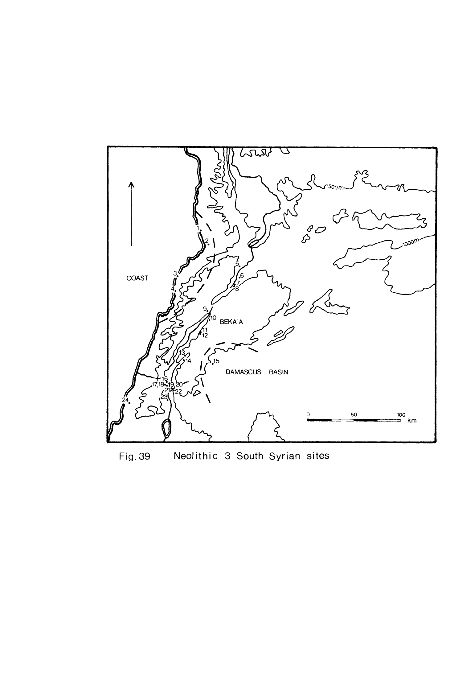
DAMASCUS
BASIN
Fig.
39
Neolithic
3
South
Syrian sites
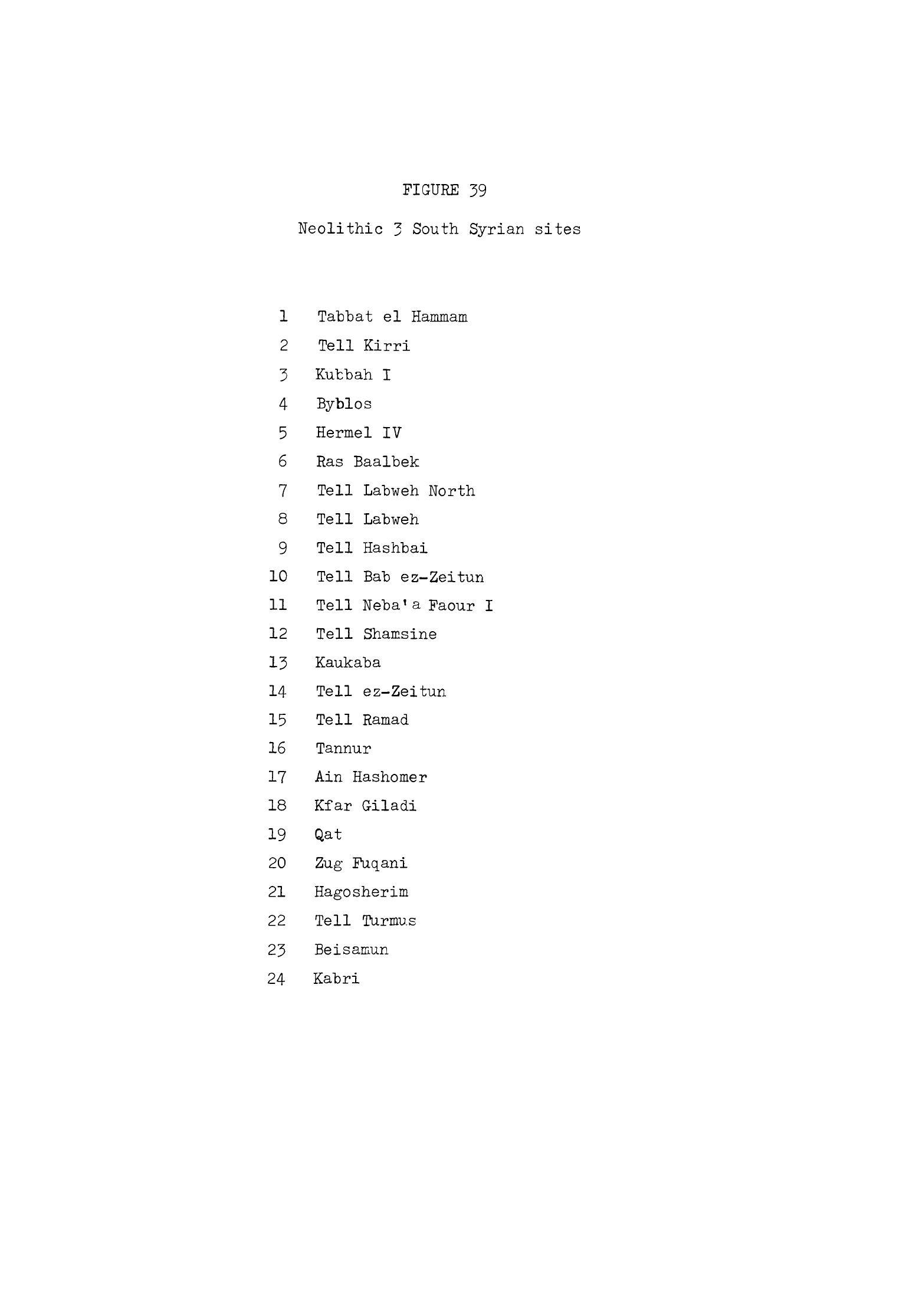
FIGURE
39
Neolithic
3
South
Syrian
sites
1
Tabbat
el
Hammam
2
Tell
Kirri
3
Kubbah
I
4
Byblos
5
Hermel
IV
6
Ras
Baalbek
7
Tell
Labweh
North
8
Tell
Labweh
9
Tell
Hashbai
10
Tell Bab
ez-Zeitun
11
Tell
Neba'a
Faour
I
12
Tell
Shamsine
13
Kaukaba
14
Tell
ez-Zeitun
15
Tell
Ramad
16
Tannur
17
Ain
Hashomer
18
Kfar
Giladi
19
Qat
20
Zug
Fuqani
21
Hagosherim
22
Tell
Turmus
23
Beisamun
24
Kabri
-
329
-
South
Syria
Lebanese
coast
Byblos
Byblos,
now
the little
town
of
Jubail,
lies
about
30
km
north-east
of
Beirut
on
the
Lebanese
coast.
To
the
east
of
the
site
there
is
a
narrow
though
fertile
coastal
plain
and
then
the
Mountains
of
Lebanon
which
rise
steeply
behind.
The
ancient settlement
is
situated
on
a
promontory
just
to
the
south
of
a
tiny
inlet.
This
inlet
is
the
old
port
of
Byblos
which
is
still
used
as
a
fishing
harbour.
On
the
south
side
of
the
promontory
there
is
another
cove
at
the
mouth
of
a
little
valley
which
ran
across
the
site
before
it
became
filled
with
occupation
debris. This cove
was
probably
a
subsidiary
landing
place
in
ancient
times
(Dunand,
1973,
5);
it
may
have
been
used
more
by
the
Neolithic
inhabitants
than
the
inlet
to
the
north
which
lay
further
away
down
a
steep
slope.
Beyond
this cove
is
an
open
sandy
beach
which
would
have
been
a
good
landing
place
in
fine
weather.
It
is
important
to
remember
that
the
sea
probably
only
reached
its
present
height
during
the
6th
millennium
as
we
saw
in
Chapter
1
so
that
it
was not
until
Neolithic
3
that
Byblos
could
have
served
as
a
port.
By
the
same
reasoning
it
would
only have
been
during
this
period
that
the
bay
of
Minet
el
Beidha
to
the
west
of
Ras
Shamra
would
have
assumed
its
present
configuration
and
provided
a
convenient
harbour
for the
large
settlement
a
little
way
inland.
We
know
that
fish
were
eaten
in
considerable
quantities
at
Byblos
during
this
period
since
their
remains
comprised
1%
of the
bones
identified
from
the
site
(Dunand,
1973,
36)
and
they
were
still
probably
consumed
at
Ras
Shamra
as
fish
vertebrae
had
been
recovered
in
the
Neolithic
2
levels.
It
is
likely
that
by
now
some
of
these
fish
were
caught
from
boats
at
sea
which
could
have
conveniently
been
launched
from
the
new
harbours.
We have
no
evidence
that
maritime
trade
had
commenced
along
the Levant
coast
in
Neolithic
3
though
since
we
know
that
small
quantities
of
many
materials
were
being
exchanged between
sites
it
would
not
be
surprising
if
a
little of
-
330
-
this
traffic
was
conducted
by
sea.
In
the
absence
of
positive
evidence,
however,
we
must conclude
that
the
potential
of
the
harbours
at
Byblos and
Ras
Shamra
was
not
realised
until
much
later.
The
ancient
site
of Byblos
has
been
excavated
almost
continuously
by
Dunand
for
over
ho
years,
At
least
1.5
ha
has
now
been
cleared
to
bedrock
so that
a
greater
area
of
the
prehistoric
settlement
at
the
base
has
been
exposed
than
on
any
other
site
in
the
Levant.
A
considerable
amount
of
information
has
thus
been
recovered
about
the
structures
of
the
successive
Neolithic
settlements
and
the
artifacts
used
by
their
inhabitants.
The
original
topography
of
the
site
has
also
been
determined
fairly
precisely.
The
promontory
at
Byblos
once
consisted
of
two
hills,
one
higher
than
the
other,
separated
by
a
little
valley
in
which
lay
a
spring
of
good
water
(Dunand,
1973,
1,
^,
pi.
C).
The
higher
of
the
two
hills
was
on
the
west
side
of
the
valley.
The first
substantial
settlement
at
Byblos was
established
on
the
seaward
slope
of
this
hill
and
later
spread
south
into
the
valley
(Dunand,
1973,
10,
33).
This
phase of
settlement
has
been
designated
"Ne"olithique
And
en"
by
Dunand.
The
principal
attractions of
the
site
have
always
been
the
spring,
the
protected
landings
for
boats
and
the
fertility
of
the
immediate
hinterland;
presumably
these
factors
also
induced
the inhabitants
of
the
Ne"olithique
Ancien
site
to
settle
here.
We
may
note
in
passing
that
the
site
was
occupied briefly
at
an
earlier
period.
A
small
deposit
was
found
which
contained
no
pottery
but
which
yielded
a
tanged
and
notched
arrowhead
as
well
as
several
microliths,
one
of
them
backed
with
Helwan
retouch
(Dunand,
1973,
k2.
,
n. 5;
Cauvin,
1968,
92).
This
suggests
that
a
group
may
have
lived
here
for
a
while
in
one
of
the two
earlier
Neolithic
stages
or
Mesolithic
2.
The
debris
of
the
N olithique Ancien
settlement
was
spread
over
about
1.2
ha,
an
area
that
would
have
been
more
extensive
originally
since
part
of
the
site
has
washed
away
on
the
seaward
side
(Dunand,
1973,
pi.
G).
Much of
the
deposit
was
composed
of
occupation
soil,
building
remains
being
concentrated
on
an
area
of
only
5000
sq.
m.
Dunand estimated
that
about
20
houses
were
-
331
-
occupied
at
one
time
and
that
the
settlement
was
no
more
than
a
small
village
(1973,
90).
These houses
had
been
robbed
for
building
materials
so
that
in
some
instances
little
of the
original
dwelling
remained.
It
seems
probable
to me
that
there
were
more
houses
in
the
village
than
Dunand
suggests
and
that
some
of
these
were
completely
destroyed
by
robbing
and
disturbance after
they were
abandoned.
Thus
the
likely
area
of
intensive
occupation
would
have
been
greater
than
the
5000
sq
m
proposed
by
Dunand.
The
houses
were
rectangular
with
a
single
room to
which
other
more
lightly
built
structures
were
sometimes
added
(Dunand,
1973
S
10,
17)-
These
houses
varied
in
size
(Fig.
ho)
but
several
were
about
5
m
long
and
k
m
wide.
Their
walls
were
built
of
stone
but
none
was
found
standing
more than
1
m
high.
The
entrance
was
in
the
long
side
of
a
room.
The
floors
were
usually
made
of
hard
white
lime
plaster laid
on
a
bed
of
pebbles
which
sometimes
curved
a
little
way
up
the
walls
(Dunand,
1973,
12).
The
surface
of
the
plaster
was
then
polished.
Dunand
did
not
think
that
the
stone
walls
of
many
of
the
houses
ever
stood
much
higher
than
1
m.
This
led
him
to
suggest
that
the
houses
were
framed
and
roofed
with
poles
covered
by
mats
or skins
(Dunand,
1973,
1^).
He
believed
that the
wall
posts
must
have
been
set
up
outside
the
low
stone
walls
as
no
trace
of
roof
supports
was
found
within
the
buildings
(Dunand,
1973,
fig.
3)
;
we
may
note
in
passing
that
he
does
not
report that
post-holes
were
found
along
the
outsides
of
the
walls
either.
The
stone
walls
and
plaster
floors
of
the
Ne"olithique
Ancien
houses
were
stoutly
and
carefulJybuilt
so
it
is
probable
that
their
superstructures
were
completed
in
a
similar
fashion.
We
have
already
seen
that
the
walls
of
these
buildings
were
damaged
by
robbing,
an
observation
supported
by
the
absence of
collapsed
walling
within
them
(Dunand,
1973,
1U).
The
walls
may
have
been
built
high
enough
to
support
the
roof
but
subsequently
were
reduced
by
robbing
to no
more than
stubs.
If the
walls
had
originally
carried
the
roofs
that
would
explain
why
no
trace
of
wall
or
roof
supports was
found
inside,
or
outside
the
houses.
\
v-
V
V
\
V
\
\
\
\
\\
•''
\
\
:
:'^'
3
SC.
1
=100
Fig.
40
Byblos-
Neolithique
Ancien
houses
(after
Dunand)
-
332
-
Several
of
these
houses
had
a
little
platform
built
inside
against
one
of
the
short
walls
(Dunand,
1973,
12).
These
may
have
been
hearths
but
Dunand
preferred
to
think
of
them
as
associated
with
a
domestic
cult.
In
one
house
a
mortar
had
been
set
in
the
floor
(Dunand,
1973,
13)
while
in
others
a
depression
was
found
on
the
floor
where
mortars
or
querns
had
probably
stood
(Dunand,
1973,
20).
Scattered
on
the
floors
were
grinding
tools
and
other
domestic
artifacts.
Outside
the
houses
stubs
of
walls
and
other
stones
were
used
as
benches
(Dunand,
1973,
17,
18).
The
houses
were
aligned
either
north-south
or
east-west.
This
happened
to
be
the
most
convenient
way
to
build
them
because
of
the
slope
of
the
ground
but
it
also
meant
that
the
doorways of
many
of
the
houses
faced
the
sun.
The
houses
were
rebuilt
on
the
same
spot
on
about
the
same
alignment
usually
three
times
but
in
one
area
as
much
as
six
or
seven
(Dunand,
1973,
15).
Each
house
stood
alone and was
separated
from
its
neighbours
by
large
open
spaces
(Dunand,
1973,
pi.
Ha).
A
little
paving
was
found
in
these
open
spaces
and
also
heavy
stone
grinding
tools left
in
place,
bedrock
mortars
and
hearths
(Dunand,
1973,
29).
The
dead
were
buried
in
the
settlement
between
the
buildings.
The
corpses
were
laid
in
a
crouched
position
on
their
left
sides
in
shallow
graves
(Dunand,
1973,
30);
the
bodies
of
infants
were
buried
in
jars
(Dunand,
1973,
32).
Two
groups
of
adult
burials
were
noted,
one
in
which
the
bodies
were
placed
in
simple
graves
with
a
few
artifacts
and
a
second
in
which
the
corpses
were laid
on
a
bed
of
stones
with
more
grave
goods;
the
former
was
more
common.
The
accompanying
artifacts
consisted
of
flint
tools,
polished
stone
axes,
pottery
and
occasional
ornaments.
33
burials
were
found
alto-
gether,
not
many
when
one
considers
the
size
of
the
settlement
and
the
length
of
time
it
was
occupied.
Dunand
noted
that some
graves
may
have
been
destroyed
by
building
activity
in
this
and
later
phases
and
also
remarked
that
not
all
the
dead
may
have
been
buried
within
the
village
anyway
(1973,
32).
The
inhabitants
of
the
Neolithic
settlements
at
Byblos
obtained
their
-
333
-
flint
from nodules
on
the
floors
of
neighbouring
wadis.
In
the
Wadi
Deir
el
Banat
which
reaches
the
sea
just
south
of
Byblos beds
of
excellent
flint
exposed
in
either
bank
were
apparently
quarried
for
raw
material
(Cauvin,
1968,
i|0).
Not
many
cores
were
found
on
the
site
(Cauvin,
1968,
92)
which
implies that
blades
were
usually
prepared
where
the
flint
was quarried.
Such
cores
as
were recovered
were
pyramidal
or
double-ended
in
type
(Cauvin,
1968,
fig.
33).
18
pieces of
obsidian were
found
in
the
Ne"olithique
Ancien
settle-
ment
three
of
which
have
been
analysed
spectrographically.
Two
came
from
the
1
e-f
source,
probably
Acigo"!
near
Kayseri,
and
one
from
Ciftlik
(Renfrew
et
al.
,
1966, 63,
65).
Most
of
the flint
tools
found
at
Byblos
were
of
four
classes:
sickle
blades,
arrowheads,
burins
and
axes
with
chisels.
The
sickle
blades
were
all
made
on
segmented
blades
and
hafted
together
to
form
composite
sickles
(Cauvin,
1968,
TO).
They
were retouched
straight
or
obliquely
at
one
or
both
ends
and
some
were
abruptly
retouched
along
the
back
(Fig.
Ma).
The
cutting
edge
was
denticulated
but
sometimes
both
long
sides
were
retouched
in
this way.
A
great
many
truncated
blades
were
found
in
one
spot
in
the
Ne"olithique
Ancien
settlement
(Cauvin,
1968,
73)
which
were
in
the
process
of
being
made
into
segmented
sickle
blades.
The
place
where
they were
found
was
thus
a
working
floor
for
the
manufacture
of
these
tools.
The
sickles
of
which
these
segmented
denticulated
blades
make
up
the
cutting
edge
are
poor
tools
with
which
to
cut
cereals
although
they
could
have
been
used
to scrape
ears
of
wheat
off
the
stalks
into
baskets.
It
has
also
been suggested
that
they
may
have
been
used
to
cut
down
plants
with
tough
siliceous
stems
such
as
reeds.
The
problem
is
difficult
to
resolve
since
there
is
evidence
for
both
cereal
agriculture
and
the
use of
reeds
at
Byblos
and
at
other
sites
on
which
these
tools
have
been
found.
As
I
have
explained
elsewhere
(Moore,
1973,
U3)»
we
do
not
know
if
these
sickles
were
used
for
harvesting
cereals
or some
other
plant and
so
cannot
definitely
associate
them
with
agricultural
activities
as
Cauvin
has
done
(1968,
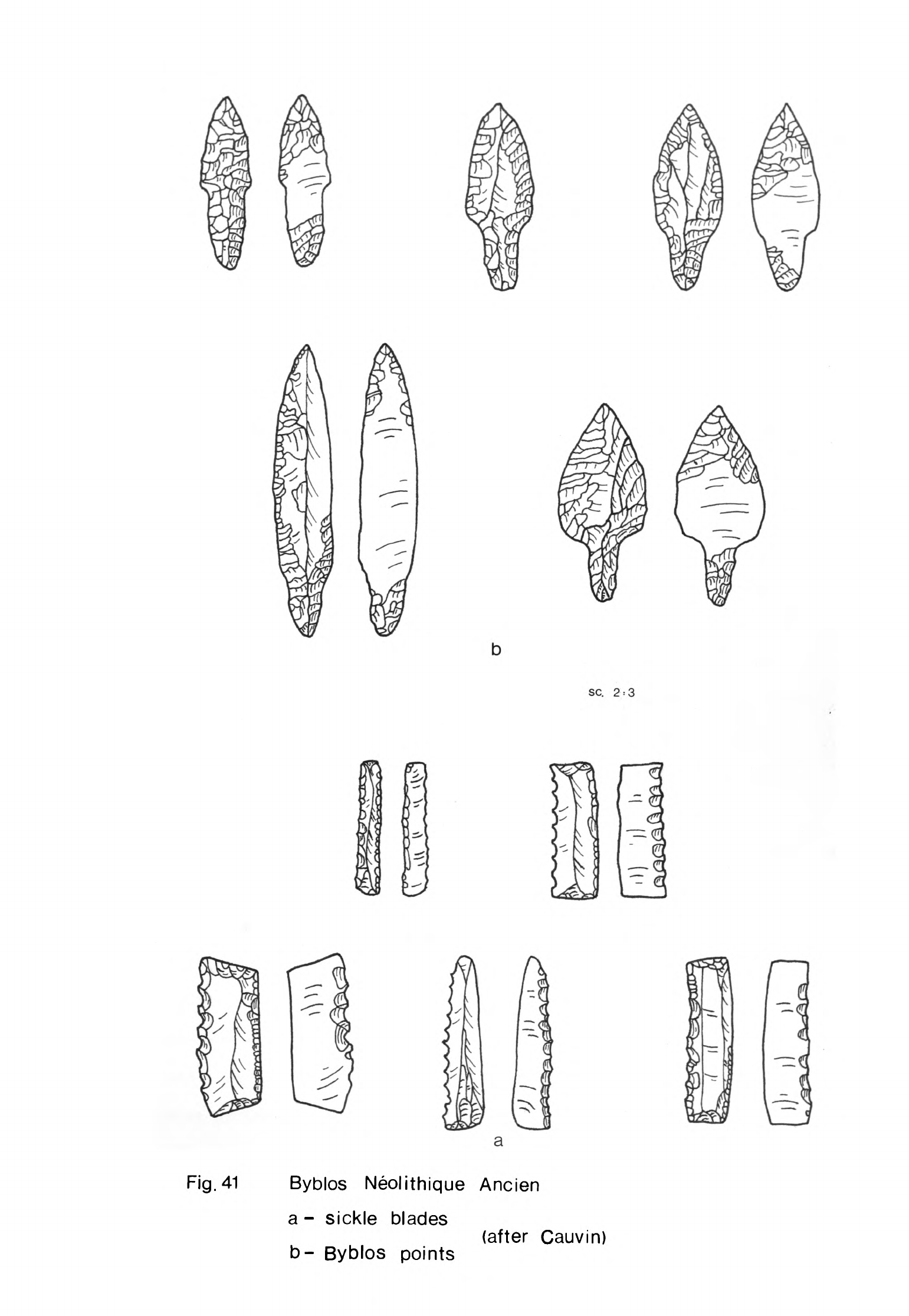
SC.
2
=
3
A
^
Fig.
41
Byblos
Neolithique
Ancien
a
-
sickle
blades
b-
Byblos
points
(after
Cauvin)
-
33^
-
Most
of
the
arrowheads
were
of
three
types
,
all
of
which
were
tanged.
Two
were
the
Amuq
points
1
and
2
and
the
third
was
what
Cauvin
has
called
the
"Byblos
point"
(1968,
55).
Byblos
points
had
a
tang
defined
by
pronounced
shoulders
or
occasionally
a
pair
of
notches
(Fig.
^1b).
They
were
retouched
by
pressure-flaking
around
the
tang,
tip
and
part
or
all
of
the
shaft.
A
few
were
from
10
to
17.8
cm
in
length
but
most
were
between
5
and
10
cm
long.
Several
leaf-shaped
arrowheads
retouched
by
pressure-flaking
were
also
found.
Some
very
large
oval
retouched
blades
retouched
in
a
similar
manner
were
classed
as
daggers
by
Cauvin
(1968,
66).
The
three
principal
types
of
burins
found
at
Byblos
were
burins
on
lateral
preparation,
burins
on
truncation
and
dihedral
burins
(Cauvin,
1968,
89).
Some
single
or
multiple
blow
burins
on
a
break
or
natural
surface
were
also
recovered
as
well
as
a
few
of
other
types.
The
Byblos
axes
were
usually
made
of
flint
but
there
were
some
examples
in
limestone,
granite
and
basalt
(Cauvin,
1968,
7^).
The
commonest
type
was
trapezoidal
or
rectangular
in
shape,
flaked
all
over
and
with
abruptly
re
touched
sides
(Cauvin,
1968,
figs.
2k
9
25).
The
cutting
edge
of
most
of
these
had
been
flaked
almost
straight
and
then
polished.
A
group
was
of
much
the
same
shape
but
with
vertically
flaked
sides
(Cauvin,
1968,
80)
;
these
were
also
thicker
in
cross-section
and
heavier.
The
third
group
was
composed
of
almond-shaped
axes,
again
usually
with
a
polished
cutting
edge
(Cauvin,
1968,
76).
Almost
all
of
these
tools
were
probably
used
as
axes
but
a
few
with
asymmetric
cross-sections
may
have been
used
as
adzes.
Among
the
other
heavy
flint
tools
were
a
number
of
chisels
made
in
a
similar
fashion
to
the
axes.
They
were
quite
narrow
and
plano-convex
or
biconvex
in
lengthwise
cross-section
(Cauvin,
1968,
Qk).
They
were
flaked
all
over
and
had
a
narrow
cutting
edge
which
was
usually
polished.
Both
these
and
the
axes
were
probably
used
to
cut
and
shape
timber.
The
coastal
plain
and
the
mountains
behind
the
site
had
a
dense
cover
of
forest
at
the
time
the
Neolithic
settlement
was
occupied
and
these
tools
indicate
that
much
use
was
-
335
-
made of
this
raw material.
Several
small
greenstone
axes
and
chisels
were
also
found
in
the
Ne"olithique
Ancien
settlement
(Dunand,
1973,
80ff).
These
were
made
of
steatite
and
two kinds
of
hard
stone,
amphibolite
and
gabbro.
The
steatite
axes
could
hardly
have
"been
used
as
tools
but
the
others
when
hafted
would
have
been
most
serviceable
artifacts
for
finishing
wooden
objects
which
had
already
been
partly
shaped
by
the
axes
and
chisels.
%
The
remainder
of the
Ne"olithique
Ancien
assemblages
at
Byblos
consisted
of
a
few
borers
and
scrapers
with
a
number
of
notched
and
denticulated
pieces
(Cauvin,
1968,
87ff).
Most
of
the
borers
had
broad
points
which
were
more
suitable
for
piercing
materials
such
as
leather
rather
than
making
deep
holes.
The
scrapers
included
both
end-scrapers
on
blades
and
side-scrapers
on
flakes.
Other
kinds of
stone
tools
were
very
common
at
Byblos.
The
querns
were
s.addle-shaped
and
made
of
limestone
or
more
rarely
of
sandstone
or
basalt
(Dunand,
1973,
36ff).
The
rubbers
with
which
the
grain
was
ground were
of
the
appropriate
plano-convex
type.
Mortars and
pestles
were
made
of
the
same
rocks
as
the
querns
and
rubbers.
Stone
dishes
were used
in
the
Ne*olithique
Ancien
settlement
but
not
in
great
numbers
(Dunand,
1973,
39).
They
were
circular
or
elliptical
in
shape
with
a
shallow depression
in
the
centre.
The
bases
were
rounded
in
the
simplest
ones,
flat
or
hollow
in
the
others.
One
retained
traces
of
pigment
in
the
bowl
(Dunand,
1973,
ko).
Several
coarse porous
stone
vessels
had
been
coated
with
lime
plaster
to
make
them
watertight.
The
Ne*olithique
Ancien
pottery
was
simple
in
technique
and
shape.
Thick
sherds
of
a
buff
coarse
ware
were
found
but
no
vessels
of
this
fabric
could
be
reconstructed
(Dunand,
1973,
^-3).
The
more
common
ware
had
an
even
fabric
with
a
little
straw,
limestone
and
quartz
filler.
Vessels
made
of this
fabric
were
carefully
smoothed
on
the
outside
and
fired
until
the
surface
was
buff
in
colour
and
the
core
buff
or
pink.
The
surface
of
the
vessels
was
then
lightly
burnished
or
in
a
few
cases
highly
burnished
to
an
even
shiny
finish.
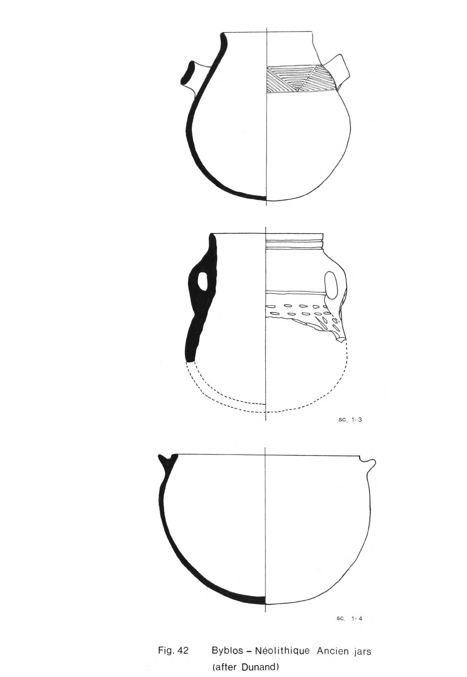
SC.
1:3
SC.
1.4
Fig.
42
Byblos
-
Neolithique
Ancien
jars
(after
Dunand)
-
336
-
None
of these
vessels,
however,
resembled
the dark
grey
burnished
or
dark
polished
ware
of
sites
in
the
North
Syrian
group
although
the
technique
of
manufacture
was
much
the
same
at
Byblos
as
further
north.
The
shapes
of
these
Byblos
vessels
were
of
the
simplest.
The
two
principal
classes
of
vessels
were
globular
jars
(Fig.
U2)
and
hemispherical
bowls
(Fig.
^3).
Some
of
the
jars
were hole-mouths
while
others
had
everted
rims
(Dunand,
1973,
pis.
LX-LXIl);
a
few
had
collared
necks
(Dunand,
1973,
figs.
18,
25).
These
jars
were
mostly
quite
large
vessels
but
some
with
the
same
shapes
were
no
more
than
13
or
15
cm
high.
Several
of
the
larger
vessels
had
ledge handles
or
sets
of
two
or four
pierced
lugs
for suspension.
The
bowls
also
varied
markedly
in
size.
Some
with
handles
are
best
described
as
cups
while
others
were
quite
deep
(Dunand,
1973,
fig.
16,
pl.LVIl).
A
few
of
these
bowls
were
carinated.
The
fabric
of these vessels
seems
to
have
been
quite
porous
for
a number
of
the
bowls
were
lined with
white
plaster
which
was
then
polished,
presumably
to give
them
a
waterproof
lining
(Dunand,
1973,
kh).
In
addition
to
the
bowls
there
were
a
few
open
dishes
with
ring
bases
and
also
two
rough
spoons
(Dunand,
1973,
53,
pi.
LVl).
Almost
all
the
jars
and
bowls
had
rounded
bases
but
a
few
had
flat
bottoms
or
even
ring
bases
like
the
dishes.
Many of
these
vessels
were
decorated
with
impressed
or
incised
designs.
The
most
characteristic
patterns
were
made
with
the
back
of
a
cardium
shell
"^ich
was
pressed
into
the
clay
all
over
the
surface
of
many
of
the
globular
jars
(Dunand,
1973,
kh).
Other
patterns
were
made
by
scraping
with
the
edge
of
the
shell
over
the
surface
of
the
pots.
A
few
sherds
of
cord-impressed
ware
were
found
but
this
type
of
decoration
was
not
much
favoured.
Many
of
the
bowls
and
a
few
of
the
jars
were
decorated
with
rows
of
horizontal
lines
often
just
below
the
rim
(Dunand,
1973,
U5).
Sometimes
the
surface
was
divided
by
groups
of
vertical
lines
and
the
spaces
between
filled
with
stab
marks.
Another
common design was
rows
of
pendant
triangles
or
loops
incised
below
the
rim
lines
and
then
filled
with
stabs.
Rows
of
oblique
lines or
herringbone
patterns
were
also
incised
around
the
pots.
These
incised
SC.
1-3
Fig.
43
Byblos
-
Neolithique
Ancien bowls
(after
Dunand)
-
33T
-
patterns
were
sometimes
filled
with
a
white
paste.
A
few
sherds
were
found
which
had
been
decorated
in
relief
with applied
clay
pieces
but
this
technique
was
rare
at
Byblos.
The
inhabitants
of
the
Ne*olithique
Ancien
settlement
also
made
a
few
white
plaster
vessels.
These
were
all
open
bowls
on
ring
bases
(Dunand,
1973,
U1).
The
very
large
plaster
jars
found
on
some
Neolithic
2
sites
were
not
made
at
Byblos
in
Neolithic
3.
A
large
number
of
bone
tools
was
preserved
at
Byblos.
51
borers made from
sheep
or
goat
metapodials
were
found
(Dunand,
1973,
72).
Almost
all
were
the
same
type
with
a
stout
handle
and
fine
point.
There
were
18
spatulae
mostly
made
of sheep
or
goat
bones.
Among
the
more unusual
tools
were
six
fishhooks
and
a
needle.
There
were
also
eight
bone
hafts
and
objects
of
adornment
such
as
beads
and
amulets
(Dunand,
1973,
7*0
A
curious
object
was
a
sheep
spatula
with
a
row
of
incisions
along
one
edge
(Dunand,
1973,
pi.
XCIX)
which Dunand
interpreted
as
a
musical
instrument.
It
could,
perhaps,
have
been
used
in
this
way
but
more
probably
served
as
a
counting
or
recording
device.
Among
the
other
tools
was
a
series
of
baked
clay
spindle
whorls
with
a
biconical
cross-section
(Dunand,
1973,
75).
Several
stone
discs
pierced
through
the
centre
may
have
served
the
same
purpose.
Another
curious
group
of
objects
consisted
of
several
discs
and
rectangles
made
of
sherds
which
had
a
groove
cut
around
the
edge (Dunand,
1973,
77).
Dunand
thought
a
cord
might
have
been
wrapped
around
the
edge
and
pressed
into
the
surface
of
new
pots
to
produce
cord-impressed
patterns;
however
they
were
used,
they
and
the
cord-impressed
ware
were
only
found
in
the
Ne"olithique
Ancien
settlement.
A
distinctive
class
of artifacts
at
Byblos
was
the
stamp
seals
made
for
the
most
part
in
baked
clay
although
a
few
were
cut
from
stone.
Dunand
divided
these
into
two
grpups,
a
series
of
baked
clay
"pintaderas" and
an
assortment
of
other
seals
(1973,
8U).
The
pintaderas
were
oval
in
shape
with
a
curved sealing
surface
and
a
knob
on
the
back
to
be
gripped
by
a
thumb
and
forefinger.
Simple
patterns
of
chevrons,
concentric
ovals
and
straight
or
-
338
-
oblique
lines
were
incised
all
over
the
sealing
surface.
The
other
seals
made
of
baked
clay
and
stone
had
a
flat
surface
with
a
similar
range
of
simple
incised
patterns
(Dunand,
1973,
87).
The two
other
main
classes
of
artifacts
were
objects
of
adornment
and
figurines.
The
beads
were
discoid
or
cylindrical
and
made
of
greenstone,
steatite
and
carnelian
as
well
as
dentalium
shells
(Dunand,
1973,
82).
Rectangular
shell
pendants
were
also
found
and
a
number
of
carved bone
amulets.
More
unusual were
two tiny
squatting
human
figures
carved
in a
crystalline
greenstone
and
pierced
for
suspension
(Dunand,
1973,
8U).
Several
small
grooved
stone
and
baked
clay
objects
were
also
recovered which
may
have
been
nose
ornaments,
labrets
or
buttons
(Dunand,
1973,
82).
One group of
figurines
consisted
of
long
pebbles
with
a
few
lines
incised
at
one
end
to
indicate
human
features
(Dunand,
1973,
77).
There
were
fifteen
of
these
of
which
five
were
found
in
one
area
and
six
in
another
(Dunand,
1973,
79)
so
most
of
them
were
made
or
used
in
two
restricted
locations.
The
other
figurines
were
made of
baked
clay
but
there
were
very
few
of
these
(Dunand,
1973,
79).
Several
were
recognisably
human
and
some
others
were
four-legged
animals
but
of
what
species
could
not
be
determined.
One
of
the
human
figurines
was
a
stylized
type
found
on
other
sites.
It
was
a
female
with
arms
placed
against
the
front
of
the torso;
the
head
was
pointed
and the
eyes
were
marked
with
incised
blobs
of
clay
shaped
like
coffee
beans
(Dunand,
1973,
pi.
CXIII).
It
is
possible
to
estimate
the
duration
of
the
Neolithique
Ancien
phase
at
Byblos
from
two
ll|
C
determinations made
on
charcoal
samples
from
different
layers.
The
first
sample
which
came
from
a
level
in
the
middle
of
the
Neolithique
Ancien
sequence
was
collected
and
processed
in
1957.
The
Groningen
laboratory
at
first
obtained
a
date
of
7000
±
80
B.P.
or 5050
±
80
B.C.
for
this sample.
They
sent
the
result to
Dunand
who
published
it as
50^3
±
80
B.C.
(1973,
3*0.
For
many
years
it
was
thought
that
this
was
the
true
figure
from
which
it
was
estimated
that
Neolithique
Ancien
Byblos
was
first
occupied
in
-
339
-
the
second
half
of
the 6th
millennium.
This
determination
has
since
been
corrected
by
the
laboratory which
has
now
published
it
as
5^10
±
70
B.C.
GrN-15^1*
(Radiocarbon
1U,
1972,
50).
This
figure
is
nearly
four
centuries
earlier
thus
considerably
lengthening
the
Ne"olithique
Ancien
phase
of
occupa-
tion.
It
now
appears
that
Ne"olithique
Ancien
Byblos
must
have
been
occupied
in
the
first
half
of
the
6th
millennium,
perhaps
about
5600
or
5700
B.C.
The
second
sample
was
collected
in 1955
from
a
level
late
in
the
Ne*olithique
Ancien
sequence.
When
processed
in
1957
this
gave
a
date
of
k60Q
±
200
B.C.
W-627
(Radiocarbon
2,
1960,
183)
which
was
published
by
Dunand
as
U593
±
200
B.C.
(1973,
3*0.
The
first
point
to
note
about
this
determination
is
that
the
standard
error
is
quite
high.
Secondly,
the
determination
was
made
long
ago
and has
not
since
been
corrected.
Samples
processed
more
recently from
Neolithic
sites
in
the
Levant have
tended
to
give
earlier
dates
than
those
obtained when
the
technique
was
being
developed.
I
think,
there-
fore,
that
the
Ne"olithique
Ancien
phase
at
Byblos
ended
about
kQOO
or
even
5000
B.C.
rather
than
k^OO
B.C.
as
this
determination
would
suggest.
The
chipped
stone
industry
of
Ne"olithique
Ancien
Byblos
is
noticeably
more
developed
than
that of the
Neolithic
2
sites
of
Tell
aux
Scies
,
Saaideh
and
even
Tell
Labweh
in
Lebanon
and
other
Neolithic
2
sites
in
the
West
Syrian
group.
It
would
appear
that
several
centuries
elapsed
between
the
end
of
Neolithic
2
about
6000
B.C.
and
the
foundation
of
Ne"olithique
Ancien
Byblos.
This
lends
weight
to
the
suggestion
based
on
the
evidence
of
the
llf
C
deter-
mination
GrN-15^
that
the
settlement
of
Ne*olithique
Ancien
Byblos
was
founded
about
5600
or
5700
B.C.
rather
than
at
the
beginning
of
Neolithic
3.
It
then
appears
to have
been
occupied
throughout
Neolithic
3
until
the end of
the
6th
or
early
in
the
5th
millennium
B.C.
Kubbah
I
Kubbah
I
is
a
low
mound
which
lies
near
the
mouth
of
the
Nahr
el
Joz
2
km
north-north-east
of
Batrun
on
the
Lebanese
coast
(Copeland,
Wescombe,
-
3^0
-
1965,
101).
The
mound
is
on
the
north
side
of
the
river
and
has
been
cut
through
by
the
railway
which
runs
from
Tripoli
to
Beirut.
The
site
has
never
been
excavated
but
material
has
been
collected
from
the
surface
by
a
number
of
archaeologists
and
much
of
it
deposited
in
the
University
Saint-Joseph
in
Beirut
where
I
have
seen
it.
From
the
surface
finds
we
know
that
the
site
was
occupied
as
late
as
the
early
Bronze
Age.
The
material
from
the
site
which
is
typologically
earliest
consisted
of
flint
tools
and
a
potsherd.
The
arrowheads
were
all
tanged
and
of
both
Amuq.
and
Byblos
type.
All
the
sickle
blades
were
segmented
with
fine
or
coarse
denticulation along
the
cutting
edge.
The
third
group
of
diagnostic
tools
was
the
flaked
flint
axes.
There
were
both
trapezoidal
and
almond-shaped
examples
of
these
with
flaked
or
polished
cutting
edges.
The
potsherds
came
from
the
rim
of
a
hand-made
hole-mouth
jar.
The
fabric
was
brown
in
colour
with
a
little
mineral
and
straw
filler
and
the
sherd
had
been
medium
fired.
There was
a
ledge
handle
attached
to
it
and
the
outside
surface
of
the
whole
piece
had
been
burnished.
The
affinities
of
these
flints
and
the
sherd
are
all
with
the
Ne'olithique
Ancien
of Byblos
,
as
Cauvin
has
noted
(1968,
219,
n.
1).
This
means
that
there
was
a
settlement
as
Kubbah
I
in
Neolithic
3.
There
is
one
other
site
in
north
Lebanon,
Tell Kirri,
3
km
south
of
the
border
with
Syria
on
the
Akkar
plain
which
was
also
occupied
in
Neolithic
3
(Copeland,
Wescombe,
1966,
70).
Some
black
and
buff
burnished
sherds
decorated
with
shell
combing
and
incisions
which
resembled
Ne*olithique
Ancien
pottery
from
Byblos
were
found
in
a
cut
made
in
the
side
of
the
tell.
A
few
flint
tools
were
also
collected but
little
else
of
this
phase
that
was
diagnostic.
The
site
continued
to
be
occupied
in
the
Bronze Age
and
later.
Two
other
stations
in
and
near
Beirut,
Beirut
VI
and
Dikwene
II,
may
have
been
occupied
in
Neolithic
3
(Copeland,
Wescombe,
1965,
7^,
W
but
insufficient
is
known
about
either
for
us
to
be
certain
of
this.
Tabbat
el
Hammam
Tabbat
el
Hammam
is
a
mound
situated
beside
the
sea
17
km
south
of
Tartous.
It
was
occupied
in
various
periods
from
the
Neolithic
to
the
Hellenistic and
at
times
a
much
wider
area
than
the
tell
itself
was
inhabited
(Braidwood,
19^0,
iSjff).
Braidwood
excavated
a
series
of
trenches
on
the
site
and
in
the
vicinity
in
1938.
One
of these
TT-I,
was
a
step
trench
dug
on
the
seaward
slope
of
the
mound.
The
lowest
level
on
bedrock,
designated
section
I
floor
1,
was
about
50
cm
deep
and
contained
Neolithic
material
(Braidwood,
19^0,
197).
Several
floor surfaces
and
hearths
could
be
discerned
in
this
level
but
no
structures.
A
small
collection of
flint
and
obsidian
tools
and
pottery
was
recovered
from
TT-I,
I,
land
is
now
in
the
Oriental
Institute,
Chicago
where
I
have
seen
it.
At
least
four
pieces
of
the
obsidian
have
been
analysed
and
all came
from
Ciftlik
(Renfrew
et
al.,
1966,
60;
1968,
81
;
Wright,
1969,
26).
53
of
the
322
flints
recovered
were
sickle
blades
(Hole,
1959,
160).
These
were
made
on
seg-
mented
blades
which
had
been
snapped
and
occasionally
retouched
at
the
ends.
Most
had
nibbled
or
slightly
retouched
cutting
edges
but
a
few
were
denticulated.
Some
had
retouch
along
both
edges
but
none
had
steep
backing.
The
16
burins
were
of
several
types:
single
blow,
dihedral,
burins
on
preparation
and
multi-
ple
burins
(Hole,
1959»
162).
Notched
and
denticulated
blades
and
flakes
were
all
quite
common.
Only
12
arrowheads
were
found,
most
of
them
broken.
All
were
tanged
(Hole,
1959,
fig.
5)
and
partially
pressure-flaked.
Both
Amuq
2
and
Byblos
arrowheads
were
present
but
the
tang
of
one
other
arrowhead
and
parts
of
others
were
retouched
abruptly
(Hole,
1959»
fig.
5:1).
The
other
chipped
stone
tools
consisted
of
flake
scrapers,
borers
on
blades,
a
tabular
flint
knife, two
picks,
an
adze
and
two
chisels.
The
adze
and
chisels
were
flaked
all
over
and
had
polished
cutting
edges
(Hole,
1959,
16U)
;
the
adze
was
oval
and
the
chisels
trapezoidal
in
cross-section.
Two
double-ended
cores
were
found
(Hole,
1959,
17*0
together
with
a
core
tablet
and
crested
blades
There
was
also
a
fragment
of
a
spherical
macehead.
The
closest
parallels
for
these
tools
are
to
be
found
at
Byblos
where
the
chipped
stone
core
technique,
the
arrowheads
and
heavier
flaked
tools
were
all
similar.
The
use
of
abrupt
retouch
on some
arrowheads
is
a
slightly
older
technique
still
used
in
northern Syria
early
in
Neolithic
3
at
sites
such
as
Abu
Hureyra
and
Tell
Judaidah.
The
macehead
is
like
several
found
at
Byblos.
The
only
similarity
between
the
Tabbat
el
Hammam
and
Byblos sickle
blades,
on
the
other
hand,
is
that
they
were
segmented.
They
are
much
more
like
those
of
Tell
Judaidah
which
were
also
segmented
but
lightly retouched
along
the
cutting
edge
and
unbacked.
The
pottery
was
buff,
brown
or
grey-black
in
colour,
most
of
the
sherds
being
various
shades
of
brown.
The
fabric
had
sand
and
grit
filler
with
a
little
straw.
The
ware
was
usually
medium
fired
but
the
variation
in
colour
on
the
surface
of
some
pots
indicates
that
the
firing
was not
well-regulated.
The
vessels
consisted
of
globular
hole-mouth
jars
and
bowls,
some of
which
were
carinated
(Hole,
1959,
15^-ff).
A
few
of
the
jars
had
collar
necks
or
everted
rims.
Some
of the
larger
vessels
also
had
ledge
handles,
knobs or
even
strap
handles
for
carrying.
Most
of
the
pots
were
burnished
and
some
had
incised
or
impressed
decoration.
These
included
horizontal
lines
and
herringbone
patterns.
Many
of the
sherds
had
been
decorated
with
cord
impressions.
A
few
sherds
had
been
coloured
with
red
wash
as
on
sites
further
north
and
two
had
been
painted.
The
latter
are
more
like
Halaf
pottery
than
anything
found
in
Neolithic
3
and
may
be
intrusive
since
there
was
much
disturbance
of
the
early
levels.
One
piece
of
a
white
plaster
bowl
was also
recovered.
The
pottery
was
quite
varied
in
finish
as
is
most
of
the
hand-made
pottery
from Neolithic
3
sites.
The
shapes
of
the
vessels
and
their
decora-
tion,
especially
the
cord
impressed
vessels,
are
very
like
the
Byblos
material
The
similarity
of much
of
the
pottery
and
flints
to
the
artifacts
of
Ne"olithique
Ancien
Byblos
places
Tabbat
el
Hammam within
the
South
Syrian
group
even
if
there
are
a
few
traits
better paralleled
further
north;
Tabbat
el
Hammam
is,
after
all,
not
very
far
south
of
Ras
Shamra
and
Tell
Sukas.
The use
of
abrupt
retouch
on
some
of
the
arrowheads
hints
as
a
relatively
early
date
within
Neolithic
3
so
it
may
be
that
Tabbat
el
Hammam
was
first
occupied
at
the
beginning
of
this
stage.
The
sites
in
the
South
Syrian
group
which
we have
considered
so
far
are
all
on
the
coast.
A
number
of
other
sites
in
the
Beka'a
are
known
to
have
been
occupied
in
Neolithic
3
and
I
shall
consider
them
next.
Their
remains,
though
generally
quite
similar
to
the
material
found
at
Byblos
and
Tabbat
el
Hammam,
differ
in
certain
details.
These
differences
can
largely
be
explained
by
the
separation
of
these
sites
from
those
on
the
coast
by
the
Mountains
of
Lebanon.
Beka'a
Tell
Labveh
Tell
Labweh
was
first
occupied
at
the
end
of
Neolithic
2
as
we
have
seen
but
continued
to
be
inhabited
well
into
Neolithic
3.
The
rectangular
building
just
below
the
surface
in
Trench
A
and
the
upper
Neolithic
pits
in
Trench
B
belonged
to
this
stage (Kirkbride,
1969,
^6ff).
The
layers
associated
with
these
structures
contained
flints,
pottery
and
white
plaster
vessels
which
may
be
compared
with
material
from
Byblos.
Among
the
arrowheads
were
Byblos
points
found
in
this
region
late
in
Neolithic
2
but
also
characteristic
of
Neolithic
3.
The
sickle
blades
from
the
upper
levels
at
Labweh
differed
from
those
in
the
basal
deposits
in
that
they
were
segmented
and
backed
with
denticulated
cutting
edges
like
some of
those
from
Ne"olithique
Ancien
Byblos
(Kirkbride,
1969,
50).
Not
much
pottery
was
found
at
Labweh
(Kirkbride,
19^9,
^8)
but
the
sherds
that
were
recovered
were
all
of
a
well-fired
ware
with
a
little
grit
and
straw
filler.
Most
of
the
vessels
were
brown
or
black
in
colour
although
some
had
a
red
surface.
Their
forms
were
either
hole-mouth
jars
or
bowls
and
most
had
been
burnished.
One
sherd
came
from
a
vessel
that
had
been
wiped
over
with
a
handful
of
straw,
a
kind
of
finish
rare
in
Syria
and
Lebanon
but
found
on
several
Palestinian
sites
in
this
and
the
next
stage.
Some
of
the
vessels
had
been
decorated with
chevrons
and
other
combed
and
incised
patterns
as
well
as
cord
impressions.
Burnished
vessels
of
this
type
are
characteristic
of
the
Ne*olithique
Ancien
of
Byblos
though
combed
decoration
is
not
found
there;
this
seems
to
have
been
more common
on
inland
sites.
Labweh
is
one
of
the few
excavated
sites
occupied
in
both
Neolithic
2
and
Neolithic
3
and
the
flints
and
other material
from
the
site
reveal
some
aspects
of
this
transition.
The
remaining
sites
which
I
shall
describe
have
been
found
in
surface
surveys; none
of
them
has
been
excavated.
Tell
Labweh North
Tell
Labweh
North
is
a
substantial
site
which
occupies
a
low
spur
a
few
hundred
metres
north
of
Tell
Labweh
on
the
other
side
of
the
Orontes
springs
?6
(Copeland,
Wescombe,
1966,
7U).
Flints,
pottery
and
a
fragment
of
obsidian
were
collected
from
the
surface
of
the
site.
The
most
diagnostic
flint
tools
were
tanged,
pressure-flaked
arrowheads,
a
series of
backed,
segmented
sickle
blades
with
fine
denticulation
and
flaked
trapezoidal
axes
with
polished
cutting
edges.
Some
of
the
sherds
came
from
brown
or
black
burnished
vessels
which
had
been
decorated
with
cord
impressions.
There
were
also
a
few
pattern
burnished
sherds,
a
rare
occurrence
on sites this far
south,
as
well
as
sherds
with
a
red
slip
which
had
been
burnished
in
some
instances.
A
few
pieces
of
white
plaster
ware were
also
recovered
from
the
site.
Most
of
the
flints
and
pottery
together
with
the
white
plaster ware
resemble
material
found
at
Tell
Labweh
and
Ne*olithique
Ancien
Byblos.
This
would
indicate
that
the
site
was
occupied
in
Neolithic
3.
The
sickle
blades
are
of
a
type
found
at
Tabbat
el
Hammam
and
on
other
sites
in
this
region
in
the
next
stage.
The
red
slipped
and
burnished
pottery
is
a
slightly
later
type
so
the
site
may
have
continued
to
have
been
inhabited
into
the
next
stage.
Tell
Neba'a
Faour
I
Tell
Neba'a
Faour
I
lies
on
the
east
side
of
the
Beka'a
at
the
foot
of
an
outlier
of the
Anti-Lebanon
not
far
from
the
present
road from
Beirut
to
Damascus
(Copeland,
1969,
87).
A
stream
now
flows
at
its
foot
but
we
do
not
know
if
it
was
there
in
the
Neolithic.
The
site
is
a
large
low
mound
which
has
been heavily
eroded
since
its
abandonment
and
has
recently been
damaged
by
road
and
house
building.
Plaster
floors
laid
on
beds
of
stones
could
be
seen
in
exposed
sections
(Copeland,
1969,
88).
A
considerable
amount
of
chipped
stone,
pottery
and
some
other
material
was
collected from
the
Neolithic
layers
in
sections
opened
up
by
recent
dis-
turbance.
Flint
blades
were
struck
off
pyramidal
and
double-ended
cores.
All
the
arrowheads
were
tanged
and
pressure-flaked;
some of
them were
Byblos
points
and
Amuq
points
of
types
1
and
2
(Copeland,
1969,
fig.
2A).
The
sickle
blades were
segmented
and
some
were
backed;
they
had
either
fine
or
coarse
denticulation
along
their
cutting
edges.
Two
flaked
axe-like
tools
with
polished
edges
were
found
but
these
had
been
reused
as
other
tools
and
were
not
really
diagnostic.
The
remaining
tools
consisted
of
a
variety
of
scrapers,
burins
and
retouched
blades.
A
little
obsidian
was
found
at
the
site.
Fragments
of querns
and
basalt
rubbers
were collected
as
well
as
stone
vessels.
One
of
the
latter
came
from
a
fine
hemispherical
bowl
with
a
bead
rim.
A
number
of
white
plaster
vessel
fragments
of
large
dishes
and
bowls
with
ring
bases
were
also
picked
up
from
the
site
(Copeland,
1969,
fig.
2B).
The sherds
were
buff,
brown,
grey
and
black
in
colour
with
a
little
grit
and
straw
filler.
Despite
this
variety
in
colour
the
range
of
shapes
and
decoration
was
limited.
The
vessels
were
either
hole-mouth
jars or
hemispheri-
cal
bowls
some
of
which
had
the
unusual
feature
of
ring
bases.
They
were
supported
by
ledge
handles
and
pierced
lugs.
Most
of
the
pots
were
burnished
and
a
few
were
decorated
with
incised
or
combed
patterns;
one
was
scraped
with
a
cardiurn
shell
like
so
much
of
the
pottery from
Byblos
(Copeland,
1969,
89).
A
few
vessels
were
painted
in
red but
it
is
not clear
if
these
belonged
to
this
or
a
later
phase
of
occupation.
The
diagnostic
flints,
white
plaster
ware
and
the
simple
burnished
pottery
all
resemble
the
material
from
Ne*olithique
Ancien
Byblos
despite
a
few
local
idiosyncracies.
Tell
Neba'a
Faour
I
like
the
Labweh
sites
was
occupied
in
Neolithic
3.
-
3U6
-
Tell
Shamsine
Tell
Shamsine
is
situated
a
little
south
of Tell
Neba'a
Faour
I
on
the
spring
line
at
the
foot
of
the
Anti-Lebanon
like
the
other
Beka'a
sites
I
have
discussed.
It
is
near
the
Anjar
springs
and
a
stream
from
the
mountains
flows
beside
the
site
(Copeland,
Wescombe,
1966,
8U).
The
tell
was
occupied
in
the
Neolithic,
during
the
Bronze
Age
and
in
later
periods
also.
The
Neolithic
material
collected
on
the
site
was
sparse
but
characteristic,
It
included
tanged,
pressure-flaked
arrowheads
of
Byblos
type,
coarsely
denti-
culated
sickle
blades
and
a
few
larger
limestone
tools.
A
few
pieces
of
obsidian
were
also
found
there.
The sherds
were brown
or
grey
in
colour and
burnished.
Fragments
of
quite
large vessels
made
of
a
coarse
ware were
also
collected. The
affinities
of
the
diagnostic
flint
tools
and
sherds
are
with
the
Beka'a
sites
I
have
discussed
and
Ne"olithique
Ancien
Byblos
indicating
that
the
site
was
occupied
in
Neolithic
3.
Tell
Hashbai
Tell
Hashbai
lies
on
the
west
side
of
the
Beka'a
at
the
foot
of
the
Mountains
of
Lebanon
opposite
the sites
I
have
considered
so
far
(Copeland,
Wescombe,
1966,
6^-,
65).
It
too
is
near
abundant
running
water
since
it
is
situated
beside
the
Wadi
Hashbai
not
far
from
its
source
at
Ain
Hashbai.
The
site
is
large
and
was
occupied
as
late
as
the
Bronze
Age.
Among
the
Neolithic
finds
were
tanged,
pressure-flaked
arrowheads and
coarsely denticu-
i
lated
sickle
blades.
A
limestone
pestle
and basalt
rubber
were
found
and
obsidian
was
present.
The
pottery
included
a
variety
of
burnished
sherds
and
some
which
had
been
covered
in a
red
slip.
The
material
from
this
site
may
once
again
be
likened
to that
from
Ne*olithique
Ancien
Byblos
(Copeland,
1969,
87)
indicating
that this site also
was
occupied
in
Neolithic
3.
All
the
sites
I
have
discussed
so
far
are
situated
at
the
sides
of
the
Beka'a
near
abundant
water
supplies.
Copeland
has
linked
this
distribution
of
sites
to
a
phase
of
dry
climate
during
the 6th
millennium
(1969,
91).
We
know
that alterations
in
the
pattern
of
settlement
did
occur
in
the
6th
millennium
partly
because
of
environmental
changes
but
it
is
not
necessary
to
invoke
such
large-scale
causes
in
this
instance.
These
sites
all
lie
in
the
central
section
of
the
Beka'a
where
deposition
of soil
on
the
valley
floor
has
buried
the
early
sites.
The
only
ones
that
remain
on
the
surface
to
be
found
are
at
the
sides
of
the
valley.
Other Neolithic
3
sites
have
been
found
further
north
and
south
which
are
situated
away
from
the
feet
of
the
mountains
on
either
side.
One
would
expect
that
Neolithic
settlement
sites
would
be
located
near
a
good
water
supply,
as
they
were
here, but
the
local
geomorphology
best
explains
the
distribution
of
Neolithic
sites
found
in
surface
survey
in
the
Beka'a.
Although
the
bulk
of
the
material
from
the
sites
I
have
mentioned
resembles
quite
closely
the
finds
from
Byblos
there
are
some
differences
in
both
flints
and
the
pottery.
Many
of
the
sickle
blades
were
segmented,
coarsely
denticulated
and
sometimes
backed
like
those
at
Byblos,
others
not.
There
were
fewer
heavy
flaked
tools
on
these
sites
than
at
Byblos
and
those
that
were
found
were
often
slightly
different
in
shape.
Although
the
shapes
of the
pots
were
the
same
simple
ones
found
at
Byblos
the
finish
was
often
much more
varied.
A
greater
range
of
fabric
colours
was
found
on
the
Beka'a
sites
because
different
clays
were
used
and
the
vessels
were
fired
unevenly.
There
were
also
differences
in
the
patterns
of
incised
and
impressed
decoration,
much
less
use
of
the
cardium
shell
for
example;
this
type
of
decoration
was
partly
replaced
by
combing,
a
technique
not
used
at
Byblos.
This
first
Neolithic pottery
differs
quite
markedly
from
site
to
site even
in
the
same
area
simply
because
it
was
all
hand-made
locally
and
baked
in
bonfires
or
pits.
Nevertheless
there
are
elements
in
the
colour
and
decoration
of
these
vessels
which
link
the
sites
on
which
they
were
made
so
that
we
may
speak
of
a
Beka'a
group
of
sites.
It
should
also
be
noted
that
more
white
plaster
ware
seems
to
have
been
made
on
the
Beka'a
sites,
Tell
Labweh
and
Tell
Neba'a
Faour
I
in
particular,
than
at
Byblos.
This
may
be
partly
a
matter
of
local
custom
but
also
a
factor
of
chronology.
Tell
Labweh was
certainly
occupied
early
in
Neolithic
3
before
the
Ne*olithique
Ancien
settlement
at
Byblos
was
founded
and
this
may
also
have
been
true
of
Tell
Neba'a
Faour
I.
White
plaster
ware
was
used
at
the
beginning
of
Neolithic
3
then
gradually
ceased
to
be
made.
The
Beka'a
Neolithic
3
sites
all
belong
with
Byblos
and
Tabbat
el
Hammam
in
a
South
Syrian
group
but
the
minor
differences
in
material
equipment
between
them
and
the
coastal
sites
are
sufficient
for
us
to
distinguish
a
Beka'a
sub
group
of
settlements
within
the
larger
area.
Several
more
Neolithic
3
sites
have
been
found
in
the
Beka'a
but
since
the
material
recovered
from
them
is
scanty
I
will
describe
their
locations
briefly.
Hermel
IV
is
in
the
northern
Beka'a
a
little
to
the
south-east
of
Hermel
near
the
Orontes.
The
site
has
yielded
some
Neolithic
3
material
as
well
as
finds
of
later
periods
(Copeland,
Wescombe,
1966,
32,
33).
There
is
a
rock
shelter
500
m
east
of
Ras
Baalbek
in
the
northern
Beka'a
in
which
Neolithic
3
flints
have
been
collected,
including
a
tanged,
pressure-flaked
arrowhead,
a
burin
and
retouched
blades
(Besancon,
Hours,
1968,
80,
81).
Tell
Bab
ez-Zeitun
overlooks
the
Wadi
Yahfoufa
to
the
east
of
Rayak
in
the
central
Beka'a
(Copeland,
1969,
87,
92);
this
site
is
not
far
from
Tell
Neba'a
Faour
I
and
is
in
a
similar
location.
The
remaining
sites
are
in
the
southern
Beka'a.
The
Kaukaba
station
is
in
a
low
pass
on
the
road
from
the
Karaoun
dam
to
Rachaya
(Copeland,
Wescombe,
1966,
39).
The
plentiful
surface
material
from
this
site
included
obsidian,
basalt
vessels,
flint
adzes,
axes,
sickle
blades
and
arrowheads,
all
of
Neolithic
3
type.
Tell
ez-Zeitun,
the
furthest
south
of
these
sites,
is
situated
in
the
upper
Hasbani
valley
north-east
of
the
village
of
Dnaybe
(Besancon,
Hours,
1968,
81).
The
site
has been
visited
by
several
workers
who
have
collected
fragments
of
tanged
arrowheads,
segmented
sickle
blades
and
heavy
flaked
tools
from
the
surface
as
well
as
material
of
later
periods.
The
Beka'a
is
part
of
the
Rift
valley
which
may
be
traced
from
Maras
in
-
3^9
-
southern
Turkey
down
through
the
Levant
to
the
Gulf
of
Aqaba
and
Red
Sea
then
on
into East
Africa.
The
section
of
the
Rift
valley
immediately
south
of
the
Beka'a
is
the
upper
Jordan
valley.
The
two sections
are
separated
by
broken
hill
country
which
may
be
traversed
by
way
of the
Hasbani
valley.
The
southern
Beka'a
and
upper
Jordan
valley
have
a
similar
environment
being
both
hemmed
in
by
mountains
or
high
hills
on
the
east
and
west.
Several
Neolithic
3
sites
have
been
found
in
the
upper
Jordan
valley,
the
material
from
which
resembles
that
collected
from
the
Beka'a
sites
I
have
just
discussed.
Such
a
correspondence
stems
principally
from
the
geographical
similarity
of
the
two
areas.
Beisamun
The
extensive
site
of
Beisamun
was
occupied
until
some
time
in
Neolithic
3.
As
no
pottery
was
found
there
the
site
was
probably
abandoned
quite
early
in
the 6th
millennium.
A
few
of
the
flints
were
of
types
found
on
Neolithic
3
sites
in
the
Beka'a
and
at
Ngolithique
Ancien
Byblos.
Most
of
the
arrowheads
were
tanged
and
retouched by
pressure-flaking
and
some
of
these
were
Amuq
1
and
2
types.
The
Amuq
1
type
was
already
being
made
in
Palestine
late
in
Neolithic
2
as
Perrot
has
pointed
out
(1969,
1^2)
but
the
presence of
both
these
types
and
other
flints
characteristic
of
Neolithic
3
must
indicate
that
the
site
was
occupied
in
the
early
centuries
of
the
6th
millennium.
Arrowheads
were
sparsely
represented
in
the
collections
from
the
site
and
sickle
blades,
although
more
numerous,
still
formed
only
1%
of
the
tools
which
were
found
(Le
Brun,
1969,
116).
Almost
all
these
were
segmented
and
retouched
across
the
ends
but
a
few
were
backed.
The
most
numerous
tools
were
the
axes,
picks
and
chisels
which
together
comprised
over
51%
of
the
total.
The
axes
were
the
most
numerous
and
varied
of
the
heavy
flaked
tools.
Those
with
straight
cutting
edges
were
rectangular
or
trapezoidal
in
outline
while
the
curved
edge
ones
were
oval or
almond-shaped;
a
few
had
polished
edges.
10$
of
these
axes
had
split
in
use
on the
site
where their
remains
were
found
(Le
Brun,
1970,
93).
Presumably
they
had
been used
to
shape
timber
for
the
-
350
-
large
houses
at
Beisamun
among
other
tasks.
All
these
flint
artifacts
compare
closely
with
those
from
the
Beka'a
sites
I
have
already
discussed
and
Neolithique
Ancien
Byblos
confirming
that
Beisamun
was
occupied
in
Neolithic
3.
Several
surface
sites
are
known
in
the
extreme
north-west
corner
of
the
upper
Jordan
valley
but
no
structures
have
been
found
on
them.
Tannur
Tannur which
lies
on
the
east
bank
of
the
Wadi
Ayun
is
the
furthest
north
of
these
sites.
A
few
rough
potsherds
were
found
there
which
may
be
Neolithic
(Lechevallier,
Dollfus,
1973,
12*).
Among
the
flint
tools
were
a
number
of
tanged,
pressure-flaked
arrowheads. Some
of
these
were
Amuq
types
1
and
2;
the
tang
of
one
of
the
latter
was
swollen
at
the
base
(Lechevallier, Dollfus,
1973,
figj
2:1),
a
trait
found
rarely
on
arrowheads
in
Lebanon
but
common
enough
further
north.
There
was
also
a
tanged
and
notched
arrowhead
(Lechevallier,
Dollfus,
1973,
fig.
2:8)
of
a
type
found
at
Munhatta
and
Tell
Ramad
in
Neolithic
2.
Most
of
the
sickle
blades
were segmented
and
backed;
these
were
usually
coarsely
denticulated
but
some
were
nibbled
(Lechevallier,
Dollfus,
1973,
10*).
The
blades
for
these
and
other
tools
were
almost
all
struck
off
pyramidal
cores
although
one
double-ended
core
was
collected
from
the
site.
Flaked
axes
were
the
most numerous
tools
found
at
Tannur.
Oval
and
almond-shaped
ones
were
more
common
than
those
with
straight
cutting
edges
(Lechevallier,
Dollfus,
1973, 12*);
the
latter
were
triangular,
trapezoidal
or
rectangular
in
shape.
Some
of
these
tools
had
polished
cutting
edges.
An
adze
and
a
few
picks
were
collected
at
the site
but
it
seems
that
other
heavy
flaked
tools
were
rare.
Two
large
stepped,
open-ended
basalt
querns and
fragments of
several
more
were
found
at
Tannur
(Lechevallier, Dollfus,
1973,
12*).
These
were
like
querns
found
at
Jericho,
Munhatta
and
Tell
Ramad
in
Neolithic
2.
There
were
also
a
number
of
basalt
rubbers and
a
fragment
of
a
basalt
bowl.
-
351
-
Some
of
the
finds
from
Tannur
are
types
found
on
excavated
sites
in
Neolithic
2
contexts
so
presumably
the
site
was
first
occupied
then.
The
rest
of
the
material,
particularly
the
arrowheads and sickle
blades,
is
more
typical
of
Neolithic
3
so
it
seems
that
the
site
continued
to
be
occupied
until
sometime
in
the
6th
millennium.
Sat
Qat
is
situated
on
the
right
bank
of
the
Wadi
Ayun.
No
pottery
was
found
here
but
flint
tools
were
plentiful.
Two
double-ended
cores
were
collected
but
the
others
were
prismatic
or
pyramidal
(Lechevallier,
Dollfus,
1973,
12*).
Most
of
the
arrowheads
were
tanged
and
pressure-flaked
and
a
few of
these
were
like
Amuq^
points.
The
sickle
blades
were usually
segmented
and denti-
culated
as
at
Tannur.
129
axes
were
found
at
Qat
which
constituted
about
half
the
retouched
tools
found
at
the
site;
they
formed
the
same
proportion
of
the
assemblage
here
as
at
Tannur.
Almond-shaped
and
oval
axes
were
the
most
common
types
at
Qat
as
at
Tannur
(Lechevallier,
Dollfus,
1973,
1U*).
The
others
were
rectangular,
trapezoidal
and
triangular
in
shape.
Some
of
the
axes
had
polished
cutting
edges.
Among
the
other
heavy
flaked
tools
were
picks
and
chisel-like
tools.
One
scrap
of
obsidian
was
collected
here
and
also
several
basalt
grinding
tools (Lechevallier, Dollfus,
1973,
17*).
The
assemblage
from
Qat
is
so
similar
to
most
of
the
material from
Tannur
that
the
sites
were
probably
occupied
at
the
same time
by
groups
engaged
in
similar
activities.
There
are
fewer
definite
Neolithic
2
artifacts
at
Qat
so
the
site
may
first
have
been
occupied
a
little
later
than
Tannur
and
then
continued
to
be
inhabited
in
the
earlier
part
of
Neolithic
3.
Ain
Hashomer
Fewer
artifacts
have
been collected from
Ain
Hashomer
than
from
Tannur
and
Qat
but
more
classes
of
material
are
represented
in
the
finds
from
the
site.
Some
potsherds
were
picked
up
there,
among
them
several
sherds
of
a
-
352
-
coarse
ware
and
also
a
fragment
of
a
carinated
"bowl
(Lechevallier,
Dollfus,
1973,
19*).
One
of
the
more
interesting
finds
was
a
piece of
a
white
plaster
bowl;
Ain
Hashomer
is
one
of
the
most
southerly
sites
on
which
this
ware
is
known
to
have
occurred.
The
arrowheads
were
mostly
fragmentary
"but
they
were usually
retouched
by
pressure-flaking
and
two
were
tanged;
one
was
leaf-shaped
(Lechevallier,
Dollfus,
1973,
17*).
The
commonest type of sickle
blade
was
a
denticulated
segment.
Axes
were
no more
numerous
than
arrowheads and
sickle
blades
at
Ain
Hashomer.
There
were
trapezoidal
and
triangular
axes
as
well
as
almond-shaped
and
oval
ones
in
the
assemblage;
a
few
were
partly
polished.
An
obsidian
blade
and
a
fragment of
a
limestone
bowl
was
found
on
the
site.
Bone
borers
were
also
collected
from
the
surface.
This
material,
though
sparse,
quite
closely
resembles
that
from
Beisamun,
Tannur
and
Qat
as
well
as
the
Beka'a
sites.
Like
them
Ain
Hashomer
was
occupied
early
in
Neolithic
3.
A
number
of
flint
tools
and
a
fragment
of
a
basalt
object
were
found
on
the
surface
of
another
site
in
this
group,
Zug
Fuqani
(Lechevallier,
Dollfus,
1973,
20*)
.
The
most
diagnostic
flints
were
several
finely-denticulated
sickle
blades,
a
pressure-flaked
arrowhead
and
19
flaked
axes,
most
of
which
were
almond-shaped.
The
quantity
of
axes
found
here
and
the
typology
of
the
tools links
Zug
Fuqani
with
Beisamun,
Tannur
and
the
other
sites
in
this
area
which
I
have
considered
so
it,
too,
was
probably occupied
in
Neolithic
3.
Kfar
Giladi
The
prehistoric
site
of
Kfar
Giladi
is
situated
on
a
hill
to
the
north
of
the
village
of
the
same
name.
During
excavations
in 1958
and
1962
a
Neolithic
settlement was
found
on
the
natural
subsoil
with
Chalcolithic
and
Early
Bronze
Age
remains
on
top
of
it
(Kaplan,
1958a,
27^;
1966,
273).
Two
levels
were
distinguished
in
the
Neolithic
deposits,
an
occupation
layer
of
earth
and
ashes
below
and
a
stone
wall
1.2
m
thick
with
associated
debris
above.
The
artifacts
were
of
the
same
character
in
both
levels.
-
353
-
The
pottery
which
I
have
examined
was
a
medium-fired
ware
with
grit
filler.
The
fabric
was
often
pink
in
colour
but
the
surface
of most
sherds
was
a
fairly
uniform
grey.
A
few
were
brown
or
black
in
colour.
The
surface
of
the
vessels
was
either
scraped
smooth
or
burnished.
The
pots
were
simple
in
shape,
ranging
from
hole-mouth
jars
to
hemispherical
bowls
and
cups.
A
few
were
decorated
with
incisions
or
cord
impressions.
The
flints
included
tanged,
pressure-flaked
arrowheads,
segmented
sickle
blades
and
partly
polished
adzes
and
chisels.
Some
bone
tools
were
found
in
the
excavations
and
also
part of
a
baked
clay
female
figurine.
A
charcoal sample
from
the
lowest
Neolithic
level
has
given
a
14 C
date
of
6955
±
320
B.C.
MATJ-1
(Kaplan,
1966,
273).
This
would
appear
to
be too
early
a
date
for the site
since
it
is
inconsistent
with
the
typology
of the
artifacts
found
there.
The
sample
was
taken
from
the
lowest
level
so
it
is
possible
that
there
was
an
earlier
deposit
at
the
bottom
which
was
not
recognised
in
the
excavation
for
which
this
lif
C
date
is
the
only
evidence.
The
typology
of
the
flints
would
suggest
that
Kfar
Giladi
was
occupied
in
Neolithic
3
or the
next
stage
but
we
do
not
know
enough
about
them
to
decide
which
it
was.
The
pottery
is
more
helpful
since
the
shape,
finish and
decoration
of
the
vessels
resembles
that
found
at
Tell
Neba'a
Faour
I
and
some
of
the
pots
from
Tell
Labweh.
The
grey
colour
of
much
of
the
Kfar
Giladi
pottery
is
a
more
southern
characteristic
found
on
several
sites
in
northern
Palestine.
When
writing
about
Kfar
Giladi
several
years
ago
I
said
that
the
pottery
and
some
of the
flints
were
like
those
of
sites
in
Palestine
which,
on
other
evidence,
appeared
to
have
been occupied
in
the
5th
millennium
(Moore,
1973,
5*0.
I
was
not
then
inclined
to
accept
the
suggestion
made
by
Copeland
(1969,
87)
that
Kfar
Giladi
was
occupied
in
the
6th
millennium.
I
now
believe
that
the
Palestinian
sites
should
be
dated
earlier
as
I
shall
explain
later
in
this
chapter
and
this
new
dating
would
also
place
the
occupation
at
Kfar
Giladi
further
back
in
time.
The
comparison
that
Copeland
made
between
Kfar
Giladi
and
the
Beka'a
sites
and
that
I
made
between
it
and
the
sites
in
Palestine
are
thus
both
valid.
Kfar
Giladi
does
indeed
seem
to
have
been
occupied
sometime
in
Neolithic
3
though
perhaps
a
little
later
than
the
other
sites
from
the
same
area
that
I
have
discussed.
Hagosherim
Hagosherim
lies
between
two
streams
at
the
northern
end
of
the
upper
Jordan
valley.
Like
Beisamun
the
site
was
discovered
when
fishponds
were
being
made.
Most
of
the
material
was
collected
from
the
fishponds
and
the
surface
of
the
site
but
some
was
found
in an
excavation
which
is
as
yet
unpublished.
The
site
covered
several
hectares
but
no
substantial
structures
were
found
on
it
(Perrot,
1968,
col.
U11).
All
the
arrowheads
from
Hagosherim
were
tanged
and
some
were
pressure-
flaked.
One
had
a
stubby
tang
defined
by
a
pair of
notches
and
another
pair
of
notches
on
the
shaft.
Another
was
an
Amuq
2
arrowhead
with
a
swollen
tang.
Most
of
the
sickle
blades
were
segmented
and
some
were
backed;
some
had
nibbled
or
finely-denticulated
cutting
edges, others
coarse
denticulation.
The most
distinctive
artifacts
were
the
numerous
flaked
axes
and
chisels,
some
of
which
were
partly
polished
(Perrot,
1968,
fig.
8^U).
Some
were
oval
or
almond-shaped,
others
D-shaped,
sub-rectangular
or
trapezoidal.
Most
of
the
pottery
from
the
site
was
a
medium
or
soft-fired
ware
with
a
reddish
or
brown
surface.
The
fabric
was
tempered
with many
grits
and
much
chopped
straw.
Some
of the vessels
were
jars
with
lug
or
strap
handles.
There
were
also
flat-bottomed
dishes and
bowls
with
splayed
sides.
A
few
of
the
vessels
were
decorated
with red
paint
or
burnished.
One
of the
thinner
bowl
sherds
had
been
coloured
black
and
burnished.
Several
of
the
querns
from
Hagosherim
were
the
open-ended
stepped
type
and
others
were
simple
saddle
querns.
Many
rubbers
were
found there
and
also
grooved
pebbles
and
stone
ornaments. Some
bone borers were
also
recovered
from
the
site.
The
stepped
querns,
notched
arrowhead
and
some
of
the
tanged
arrowheads
all
belong
in
a
Neolithic
2
context
so
Hagosherim
must
first
have
been
-
355
-
occupied
then.
The
other
flint
tools
compare
closely
with
Ne"olithique
Ancien
Byblos
and
the
Beka'a
sites
as
well
as
Beisamun
and
the
neighbouring
surface
stations
in
the
upper
Jordan
valley.
Some
of
the
axes,
particularly
the
D-shaped
ones,
and
sickle
blades
are
very
like
examples
from
Tell
Ramad
Levels
II
and
III
and
the
dark
burnished
sherds also
match
sherds
from
Tell
Ramad
III
(Moore,
1973,
^O).
These
comparisons
suggest
that
Hagosherim
was
occupied
for
much
of
Neolithic
3.
It
should
be
noted
that
most
of
the
pottery
is
unlike
that
found
on
the
Beka'a
sites
or
at
Kfar
Giladi.
It
is
unburnished
and
quite
coarse,
traits
it
shares
with
the
earliest
Neolithic
pottery
from
Jericho
which
I
shall
discuss
later.
Before
leaving
Hagosherim
we
should
note
that
some
of
the flints
seem
later
in
type than those
found
on
stratified
Neolithic
3
sites
(Moore,
1973,
hi}.
It
may
be
that
Hagosherim
was
occupied
in
a
later
stage
of
the
Neolithic
or even
the
Chalcolithic.
Tell Turmus
Tell
Turmus
is
a
small
mound
perhaps
about
300
sq.
m
in
area
on
one
of
the
tributaries
of
the
Jordan
a
little
to
the
east
of
Hagosherim
(Dayan,
1969,
65).
The
site
was
occupied
in
two periods,
during
the
Neolithic
(strata
3
to
6)
and
again
in
the
Chalcolithic
(strata
1
and
2).
Several
stone
walls
paved
areas
and
floors
were
found
in
the
Neolithic
levels
together with many
potsherds
and
flint
implements.
Both
thick,
coarse
wares
and
thinner-walled
finer
vessels
were
used
in
the
Neolithic
levels
(Dayan,
1969»
70).
The fabric
of
these
pots
was
tempered
with
grits
and
some
straw
which
was
then
fired
to
produce
a
range
of
surface
colour
from
pink to
brown
or
even
black.
The
vessels
were
all
of
simple
shapes
such
as
hole-mouth
jars
or
collared
jars,
some
of
which
had
handles.
A
few
were
decorated
with
incised
lines
in
herringbone
patterns
or
loops
filled
with
stab
marks and
some
vessels
were
burnished.
This
pottery
is
somewhat
like
pottery
from
Kfar
Giladi
and
Hagosherim
while
the
incised
patterns
are
like
designs
used
at
Byblos
in
Ne"olithique
Ancien.
Tell
Turmus
would
thus
-
356
-
appear
to
be
another
site
at
the
headwaters of
the
Jordan
occupied
in
Neolithic
3.
Kabri
Kabri
is
on
the
western
edge
of
the
Galilee
hills
near
the
coast.
Following
the
discovery
of
fine
obsidian
and
stone
objects
on
the
site
an
excavation
was
undertaken
here
in
1958
(Prausnitz,
1969,
137).
These
objects
came
from
a
Chalcolithic
settlement
near
the
surface
but
below
that
there
were
Neolithic
deposits.
The
earliest
settlement
of
layer
III
had
circular
paved
areas
ringed
with
upright
stones,
perhaps
the
remains
of
huts.
Some
contracted
burials
were
found
under
these
paved
areas
accompanied
by
a
pot
and
flint
axes,
arrowheads
and
knives.
We
know
very
little
about
the
pottery from
the
site
but
some
information
about
the
flints
has
been
published.
There
were
leaf-shaped
and
also
tanged
and
pressure-flaked
arrowheads
in
the
deposit
together
with
segmented,
coarsely
denticulated
sickle
blades.
Both
trapezoidal
and
rectangular
axes
were
found,
some
of
which
were
partly
polished.
One
of
the
rectangular
axes
had
split
in
use.
Some
small
greenstone
axes
were
also
found
in
this
deposit
(Prausnitz,
1959, 268)
but
little
else.
The
affinities
of
this
material
are
with
Ne"olithique
Ancien
Byblos
further
up
the
coast
and the
Neolithic
3
sites
in
the
upper
Jordan
valley
and
the
Beka'a.
Kabri
was
thus first
occupied
in
Neolithic
3
although
the
site
was
also
used
in
later
stages.
Damascus
basin
One
site
in
the
Damascus
basin,
Tell
Ramad,
is
known
to
have
been
occupied
in
Neolithic
3.
The
remains
from
here
are a
little
different
from
those
on
other
sites
in
the
South
Syrian
group
as
one
might
expect
on
a
settlement
separated
from
others
to
the
west
by
the
Anti-Lebanon
mountains.
-
357
-
Tell
Ramad
Deposits
of
the
third
phase
of
occupation
at
Tell
Ramad,
Level
III,
have been
found
near
the
summit
on
the
west
side
and
on
the
shelf
in
the
south-east
corner
of
the
mound
(de
Contenson,
van
Liere,
196^,
118;
de
Contenson,
197^-j
18).
Much
of
Level
III
had
eroded
away
so
that
these
deposits
were
no
more
than
1
m
deep
when
found.
It
would
appear
that
the
Level
III
settlement
once
covered
at
least
half
the
mound,
an
area
of
about
1
ha,
but
may
have
been
more
extensive.
There
is
no
evidence
of
a
break
in
occupation
between
Levels
II
and
III
but
the
nature
of
the
structures
altered
markedly
in
Level
III.
No
buildings
could definitely
be
attributed
to
this
Level
although
a
number
of
floor
surfaces
and
hearths
were
recognised
in
it.
The
principal
remains
were
several
large
pits
which
were
as
much
as
2.5
m
deep
and
filled
with
ashes
and
other
burned
material
(de
Contenson,
van
Liere,
1966,
168).
The
flint
industry
of
Level
III
did
not
differ
greatly
from
that
in
Level
II.
The
sickle
blades
were
usually
segmented
with
coarsely
denticula-
ted
cutting
edges
and
were
sometimes
backed.
The
arrowheads
were
tanged
and
pressure-flaked
like
Byblos
points.
Another
common
tool
was
a
large
flake
knife
with
a
serrated
edge.
There
were
also
a
few
flaked
and
partly
polished
flint
axes
and
a
number
of
small
polished
greenstone
axes.
Obsidian
continued
to
be
imported
in
Level
III.
A
few
stone
bowl
fragments
and
basalt
grinding
tools
belonged
in
this
level.
Most
of
the
pottery
in
Level
III
was
a
medium
or
hard-fired
ware
with
some
grit
temper.
The
pots
were
usually
brown
or
grey
in
colour
although
some
were
fired
buff
or
red.
The two
main
vessel
shapes
were
a
hemispherical
bowl
or
cup
sometimes
with
a
ring base
and
a
jar
with
a
collar
neck
or
everted
rim
(de
Contenson,
van
Liere,
196^,
118).
Some
of
the
jars
had
lugs
or
handles.
These
pots
were
either
burnished
all
over
or
around
the
rim.
Some
had
incised
or
combed
decoration
and
a
few
were
even
scraped
with
a
shell
in a
manner
reminiscent
of
vessels
from
Ne"olithique
Ancien
Byblos.
A
few
vessels
were
-
358
-
coated
with
white
plaster
(de
Contenson,
1969a,
26).
A
number
of
the
bowls
had
been
burnished
very
thoroughly
so
that
they
resembled
the
dark
polished
ware
found
on
some
North
Syrian
sites.
A
large
number
of
fragments
of
white
plaster
ware
was
found
in
Level
III
(de
Contenson,
197^
5
18).
Vessels
of
this
substance
thus
continued
to
be
made
at
Tell
Ramad
after
the
introduction
of
pottery
as
was
also
the
case
on
a
number
of
other
Neolithic
3
sites.
The
other
artifacts
in
Level
III
consisted
of
bone
borers
and
spatulae
together
with
a
limestone
stamp
seal
(de
Contenson,
1969a,
26).
A
few
fragments
of
baked
clay
animal
figurines
were
found
and
several
baked
clay
stylised
human
figurines
have
also
been
attributed
to
this
level
(de
Contenson,
1971
5
285);
they
had
rod
heads
with
little
pieces
of
clay
applied
to
represent
the
eyes,
nose
and
ears.
The
surface
of
these
figurines
was
burnished.
The
cultural
affinities
of
Tell
Ramad
III are
more
with
the
South
Syrian
group
of
sites
than
those
further
north.
Tell
Ramad
has the
same
segmented
sickle
blades
and
arrowheads
as
Byblos
and
several
of
the
Beka'a
sites.
The
shapes
and
decoration
of
much
of
the
pottery
are
also
quite
similar
though
here
we
should
note
that
some
of
the
burnished
Ramad
bowls,
particularly
the
dark
polished
ones,
are
more
like
pottery
from
Ras
Shamra
or Tell
Judaidah.
The
Ramad
pits
have
much
in
common
with
those
in
the
ceramic
Neolithic
level
at
Abu
Hureyra
and
also,
as
we
shall
see,
on
several
Palestinian
sites;
these
pits
are
not
a
normal
feature
of
other
South
Syrian
sites.
Tell
Ramad
III
thus
has
certain distinctive
traits
in
common
with
sites
to
the
north
and
south
even
if
culturally
it
belongs
to
the
South
Syrian
group.
It
is
best
thought
of
as
a
settlement
which belongs
to
a
third
sub-group
within
the
South
Syrian
complex
even
if for
the
time
being
no
other
contemporary
sites
are
known
in
the
Damascus
basin.
We
do
not
know
exactly
when
or for
how
long
Tell
Ramad
III
was
occupied.
The
one
carbon
1^
determination
for
this
Level
is
5930
±
55
B.C.
GrN-U823
(Radiocarbon
9»
1967
5
129)
which
is
virtually
the
same
as
the
date
at
which
-
359
-
Tell
Ramad
II
was
first occupied.
The
Tell
Ramad
II
settlement
probably
lasted
for
several
centuries
so
Tell
Ramad
III
cannot
have
been
inhabited
before
5800
or
5700
B.C.
if
even
then.
The
affinities
of
the
material
from
Tell
Ramad
III
are
mostly
with
sites
occupied
in
the
early
or
mid
6th
millennii
B.C.
The
inhabitants
may
finally have
left
the
site
about
5500
B.C.
or
a
century
or
two
later
but
this
is
no
more than
an
estimate.
Lum
I
now wish
to
consider
the
Palestinian
sites
which
were occupied
in
Neolithic
3.
The
material
found
on
these
sites
differs
sufficiently from
that
on
settlements further north
for
them
to
be
regarded
as
a
third
regional
group.
Palestine
There
are
a
number
of
sites
in
Palestine
with
characteristic
structures,
flint
assemblages
and
pottery
which
were
occupied
later
than
Neolithic
2
and
before
the
Palestinian
Chalcolithic,
that
is
the
culture
typical
of
Ghassul
and
related
sites.
I
described
the
material
remains
and
economy
of
these
sites,
their
sequence
of
development
and
place
within
the
Neolithic
of the
Levant
in
an
article
published
in
1973.
I
placed
all
these
sites
in a
single
period
which
I
called
the
"Late
Neolithic"
of
Palestine.
This
period
was
divided
into
early
and late
stages
called
phases
1
and
2.
I
distinguished
two
local
geographical
groups
in
phase
1
and
three
in
phase
2. I
had
to
determine
the
Late
Neolithic
sequence
of
development
and
the
geographical
divisions
on
comparative
stratigraphy
and
artifact
typology
since
there
were
no
carbon
1U
determinations
available
from
any
site
occupied
in
that
period.
We
can
be
fairly
sure
that
the
transition
from
the Late
Neolithic
to
the
Chalcolithic
in
Palestine
took
place
about
3750 or
3500
B.C.
(Moore,
1973,
6U)
but
we
do
not
know
for
certain
when
it
began.
Much
depends
on
quite
general
typological
comparisons
between
the
Late
Neolithic
sites
in
Palestine
and
contemporary
sites
to
the
north
such
as
Byblos
which
are
themselves
not
very
precisely
dated.
All
too few
carbon
1U
determinations have
been
made
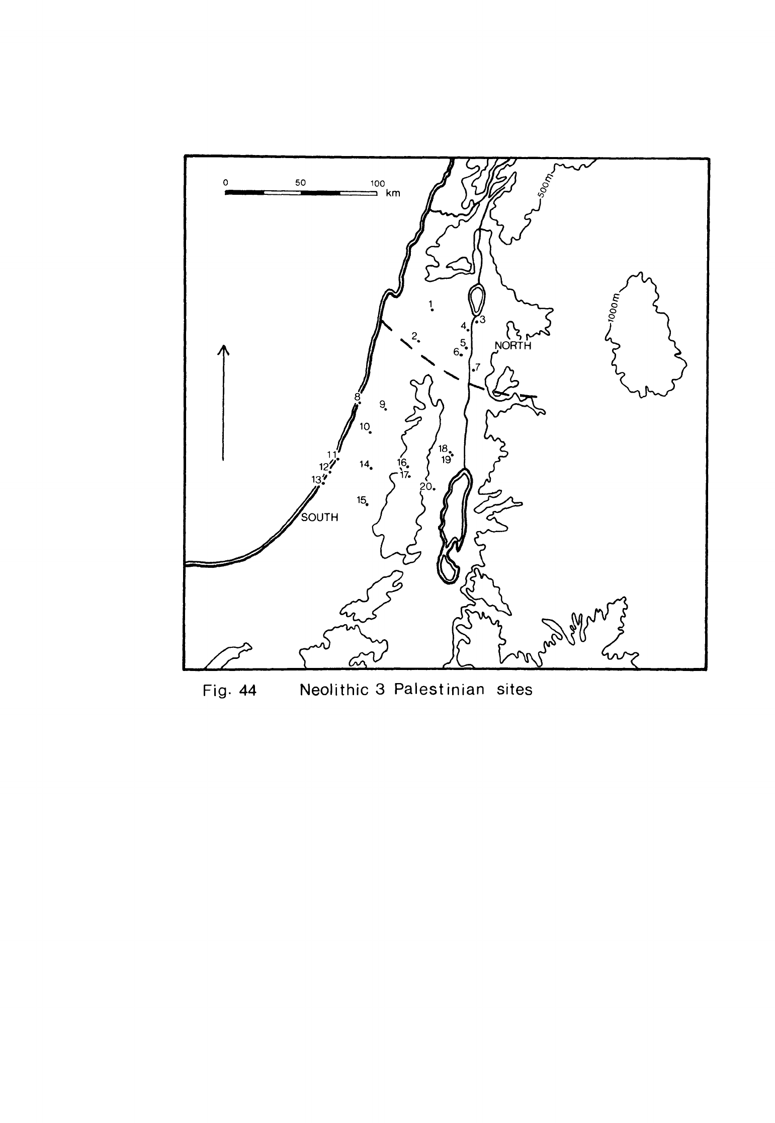
Fig.
44
Neolithic
3
Palestinian
sites
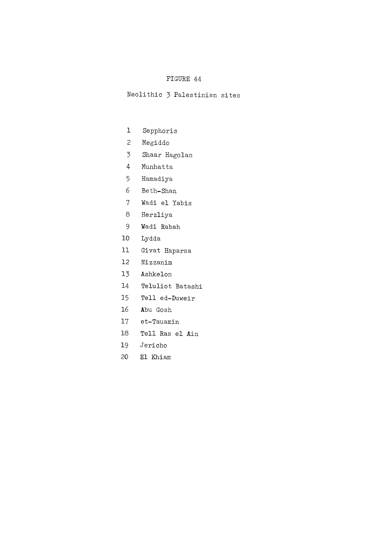
FIGURE
44
Neolithic
3
Palestinian
sites
1
Sepphoris
2
Megiddo
3
Shaar
Hagolan
4
Munhatta
5
Hamadiya
6
Beth-Shan
7
¥adi
el
Yabis
8
Herzliya
9
¥adi
Rabah
10
Lydda
11
G-ivat
Haparsa
12
Rizzanim
13
Ashkelon
14
Teluliot
Batashi
15
Tell
ed-Buweir
16
Abu
Gosh
17
et-Tauamin
18
Tell
Ras
el
Ain
19
Jericho
20
El
KM
am
-
360
-
on
material
from
sites
in
the
Levant
occupied
in
the
6th,
5th
and
hth
millennia,
partly
because
so
many of
them
were
excavated
many
years
ago.
Recently
excavated
sites
which
were
occupied
in
Neolithic
1
and
2
can
be
much
more
precisely
dated
simply
because
several
of
them
have
a
series
of
carbon
'\k
dates.
The
late
Neolithic
sequence
I
was
able
to
establish
for
Palestine
still
seems
valid
for
that
region although
the
term
"Late
Neolithic" itself
does
not
accord
very
well with
the general
terminology
I
am
using
in
this
thesis
for
the
Neolithic
of
the
Levant.
I
will
not,
therefore,
use
"Late
Neolithic"
here
but
will
treat
the
sites
concerned
as
they
occur
in
each
stage
of
the
Neolithic
of
the
Levant.
I
hope
to
be
able
to
show
that
the
sites
I
previously
described
as
Late
Neolithic
phase
1
fall
within
Neolithic
3
of
the
Levant
and
those
of
Late
Neolithic
phase
2
within
the
last
stage,
Neolithic
h.
I
will
now
briefly
describe
the
principal
phase
1
sites
in
each
geo-
graphical
group.
I
shall
also
mention
the
other
known
phase
1
sites
which
I
did
not
discuss
in
my
earlier paper
in
order
to
determine
as
fully
as
possible their
distribution
(Fig.
kh).
South
Palestine
The
site
with
the
most
ample
record
of
phase
1
occupation
is
Jericho.
After
a
long
period
between
Neolithic
2
and
Neolithic
3
when
the
mound
was
inhabited,
the
site
was
occupied
once
more
in
what
Kenyon
has
termed
the
Pottery
Neolithic
A
phase
(Kenyon,
1970,
62).
The
earliest
deposits
of
this
phase
consisted
of
trodden
floor
surfaces
with
hearths.
Then
the
inhabitants
dug out
numerous
pits
which
apparently
served
as
dwellings
and
working
hollows.
Some
of
the
early
pits
were
as
much
as
5
m
deep
but
others
were
much
shallower
though
still
several
metres
wide.
Their
sides
were
recut
periodically and
lined
with
stone
and
clay
walls
for
support.
The
interiors
had
successive
trodden
earth
floors
testifying
to
their
use
over
a
long
period.
An
oven
and
numerous
hearths
were
found
on
the
floors
in
these
pits.
There
were
low
stone
walls
around
the
rims
of
some
pits
which
supported
a
roof,
traces
of
which
-
361
-
were
found
within
the
pits
themselves.
These
pits
were
found
in
Trenches
15
II
and
III
and
in
areas
M
and
E,
that
is
all
over
the
mound
so the
Pottery
Neolithic
settlement
was
probably
as
large
as
those
of
the
preceding
Neolithic
stages.
The
Pottery
Neolithic
flint
industry
was
different
in
a
number
of
aspects
from
that
of
Neolithic
2
at
Jericho.
The
raw
material
was
usually
buff,
brown
or
grey
flint,
very
few
tools
being
made
on
the
pink,
purple
or
honey
coloured
flint
of
earlier
stages.
A
very
little
obsidian
was
also
used
in
this
phase.
Most
of
the
tools
were
made
on
blades struck
off
pyramidal
cores.
These
tools
were
quite
small,
the
arrowheads
for
example
being
usually
about
3
or
U
cm
long.
These
were
tanged
and
often
had
marked
shoulders
or
wings
(Moore,
1973,
fig.
^).
The
tips
of
some
of
them
were
thinned
to
a
sharp
point.
All
these
arrowheads
were
extensively
retouched
by
pressure-flaking.
The
sickle
blades
were
always
segmented
and
often
had
flat
retouch
along
the
back.
They
were
usually
about
3
to
k
cm
long
and
1
to
2
cm
wide.
This
type
has
a
coarsely
denticulated
cutting
edge
(Moore,
1973,
fig.
2).
Another
which
was
more than
2
cm
wide
had
flat
retouch
over
part
or
all
of both
surfaces.
The
cutting
edges
were
finely
or
coarsely
denticulated
and
a
few
were
backed
(Moore,
1973,
fig.
3).
A
third
characteristic
tool
was
a
knife
made
on
thin
tabular
flint.
This
had
a
cutting
edge
retouched
by
squamous
pressure-flaking
which
was
usually
bifacial.
There
were
some
flake
side-scrapers
and
also
a
characteristic
flake
scraper with
a
retouched
side
and
end
meeting
to
form
a
right
angled
corner.
Among
the
other
tools
were end-scrapers
on
blades,
small
borers
and
several
types
of
burin.
The
heavy
tools
at
Jericho
were
also
quite
small
like
the
arrowheads
and
sickle
blades.
These
consisted
of
axes,
adzes
and
chisels
which
had
been
flaked
all
over.
They
were
elliptical
in
cross-section
or
more
rarely
oval
and
had
rounded,
flaked
cutting
edges
which
were
sometimes polished.
The
assemblage
also
included
a
few
small
picks.
-
362
-
The
pottery
of
this
phase
at
Jericho
was
all
made
of
clay
tempered
with
much
straw
and
some
grit.
There
was
a
coarse
plain
ware,
some
sherds
of
which
were
very
thick
and
crumbly,
and
also
a
painted
fine
ware.
The
most
common
shapes
were
baggy
jars
with
flat
bases,
globular
hole-mouth
pots
and
other
jars
with
a
collar
neck
(Moore,
1973,
figs.
6,
7).
There
were
also
simple
bowls
and
cups
with
flat
bases
and
splayed
sides.
The
larger
vessels
had
knobs,
ledge
or
strap
handles
for
lifting.
These
pots
were
built
up
in
strips
or
coiled
and
then
scraped
or
wiped
on
the
surface,
a
technique
that
left
a
character
istic
rough,
striated
surface.
The
decorated
vessels
were
coloured
with
cream
and
red
slips
to
produce
reserved
chevron
and
triangle
patterns
which
were
sometimes
burnished.
A
very
few
vessels
had
a
little
incised
decoration.
The
rest
of
the
artifact
inventory
was
quite
simple.
There
were
some
borers
and
other
bone
tools
but
most
of
the
remaining
artifacts
were
made
of
stone.
These
consisted
of
simple
bowls,
querns
and
rubbers
as
well
as
some
pestles
and
mortars.
Tell
Ras
el
Ain
is
north-west
of
Jericho
and
a
little
to
the
west
of
the
springs
of
Ain
Duq
and
Ain
Nu'eima
on
the
edge
of
the
Jordan
valley.
The
tell
was
occupied
in
the
Bronze
Age
but
there
are
indications
from
surface
collections
that
the
site
was
also
inhabited
in
the
Neolithic.
Several
arrow
heads
were
found
here,
one
of
which
was
tanged
and
pressure-flaked,
and
also
denticulated,
segmented
sickle
blades
(Mallon,
1931,
162)
as
well
as
other
flint
tools.
Among
the
sickle
blades
were
examples
of
the
broad,
flat,
exten
sively
pressure-flaked
type
found
at
Jericho
in
Pottery
Neolithic
A.
Tell
Ras
el
Ain
was
thus
definitely
occupied
in
the
later
Neolithic,
probably
in
phase
1.
Abu
Gosh
on
the
Mediterranean
side
of
the
Judean
hills
was
also
occupied
in
this
phase.
The
surface
level
at
the
site
contained
a
mixture
of
material
from
several
periods
(Dollfus,
Lechevallier,
1969,
279)
which
included
some
flints
and
sherds
resembling
Pottery
Neolithic
A
artifacts
from
Jericho.
No
structures
were
found
in
this
level
although
there
were
a
few
shallow
pits
-
363
-
dug
into
earlier
levels.
The
site
can
have
covered
no
more
than
1000
sq
m
in
this
phase
and
so
was
quite
small.
Perrot
found
a
few
Neolithic
sherds
in
this
level
during
his
excavations
at
the
site
(I952b,
1^0).
They
were
coarse
fragments
with
much
straw
filler
and
one
of
them
has
been
roughly
wiped
on
the
surface.
Among
the
other
finds
from
this
level
were
narrow,
segmented,
coarsely
denticulated
sickle
"blades
and
burins.
Perrot
also
found
many
flaked
and
polished
trapezoidal,
oval
and
almond-shaped
axes
and other
heavy
tools
which
we
now
know
mostly
came
from
this
level
although
a
few
have
been
found
in
level
1,
the
level
beneath
the
surface
layer
containing
remains
of
a
Neolithic
2
settlement.
The
pottery
and
sickle
blades
indicate
that
Abu
Gosh
was
inhabited
briefly
at
a
time
approximately
contemporary
with
Jericho
in
Pottery
Neolithic
A
though
we
do
not
know
if
this
phase
of
occupation
immediately
succeeded
the
Neolithic
2
settlement.
The
axes
and
other
flaked
tools
have
been
found
on
very
few
other
Palestinian
settlements
but
they closely
resemble
those
found
at
Beisamun,
Tannur and
other
Neolithic
3
sites
at
the
headwaters
of
the
Jordan.
Another
site
which
was
probably
occupied
in
phase
1
is
the
cave
of
et-Tauamin
in
the
Wadi
Said
west
of
Bethlehem.
Neuville
excavated
a
thin
deposit
here
which
contained
a
mixture
of
Bronze
Age,
Roman
and
Byzantine
artifacts
and
also
a
hollow
with
Neolithic
material
(1930,
65).
The
hollow
was
about
2
m
across
and
within
it
was
a
homogeneous
collection
of
flints
and
pottery.
Among
the
flints
were
two
small
tanged
arrowheads,
one
of
which
was
winged,
an
oval
flaked
axe
with tranchet
edge
and
some
segmented,
denti-
culated
sickle
blades
(Neuville,
1930,
pi.
I:
2-U,
9).
Several
of
the
latter
were
wide
and
flat
with thinning
retouch
of
the
type
found
at
Jericho
in
phase
1
(Neuville,
1930,
fig.
3:
A).
The
pottery
was
coarse
with
grit
filler.
One
of
the
vessels
was
a
small
necked
globular
jar
with
a
handle
at
the
junction
of
the
neck
and
body
(Neuville,
1930,
72).
There
were
also
fragments
of
several
bowls
and
cups
in
the
hollow
and
some
of
these
sherds
had
been painted
in
red
with
lines
and
chevrons.
The
other
finds
consisted
of
bone
borers,
spatulae
and
a
needle,
spindle
whorls
made
from potsherds
and
a
small
basalt
ring.
Some
of
these artifacts
are
characteristic
of
phases
1
and
2
in
Palestine
but
the
evidence
of
the
sickle
blades
and
the
fabric
and
decoration
of
the
pottery
would
suggest
that
the
site
was
in
fact
occupied
in
phase
1.
A
little
material
of
this
stage
was
found
in
the
upper
levels
of
El
Khiam.
This
consisted
of
several
denticulated
sickle
blades,
a
few
of
which
were
of
the
flat,
pressure-flaked
type
found
in
Pottery
Neolithic
A
Jericho
(Neuville,
193^,
pi.
XX:
3;
Perrot,
1951,
171).
Some
sherds of
coarse,
straw-tempered
pottery
were
also
recovered
(Perrot,
1951
5
17*0
which
may
be
of
phase
1
type.
This
evidence
suggests
that
El
Khiam
was
used
occasionally
in
phase
1
as
it
continued
to
be
in
later
periods.
More
phase
1
material
was
found
by
Kaplan
at
Lydda
on
the
coastal
plain
(Kaplan,
1959a,
18).
The
pottery
and
flints
were
mixed
with
Chalcolithic
artifacts
but
could
clearly
be
distinguished
from
them.
We
do
not
know
if
there
were
any
structures
on
the
site
but
it
seems
to
have
been
another
small
settlement
which
was
not
inhabited
for
long.
Several
diagnostic
types
of
flint
tools
were
found,
among
them
two
small
tanged
arrowheads,
one
of
which
was
also
winged
and
notched.
There
were
also
segmented,
coarsely
denticulated
sickle
blades
and
a
few
of
the
wider,
flat
retouched,
denticulated
sickle
blades
found
at
Jericho.
The
other
recognisably
Neolithic
tools
consisted
of
flake
scrapers
and
knives.
Some
of
the
pottery
fabrics
were
like
Pottery
Neolithic
A
vessels
from
Jericho
being
buff
or
brown
in
colour
with
much
straw
filler.
Other
vessels
were
made
of
a
grey
ware
which
contained
a
little
straw
and
grit.
The
shapes
of
the
vessels
resembled
the
Jericho
pots
and
they
had
the
same
handles.
Some
of
these
vessels
were decorated with
triangles
or
chevrons
painted
in
red.
occasionally
on
a
cream
slip
as
at
Jericho.
The
surface
of
these
vessels
was
then
usually
burnished.
-
365
-
Kaplan
found
a
little
more
phase
1
material
in
his
excavations
at
the
site
of
Wadi
Rabah
situated
a
few
kilometres
north
of
Lydda
and
to the east
of
Tel
Aviv.
The
diagnostic
pottery
consisted
of
some
painted
sherds
and
a
knob
handle
resembling
the
material
found
at
Jericho
(Kaplan,
1958b,
fig.
^:
1,
2,
7).
Among
the
flints
were
several
of
the
broad,
segmented
sickle
blades
also
typical
of
phase
1
at
Jericho.
The
principal
phases of
occupation
at
Wadi
Rabah
were
in
Late
Neolithic
phase
2
and
the
Chalcolithic
but
this
evidence
indicates
that
the
site
was
inhabited
briefly
in
the
preceding
stage
also.
More
phase
1
material
was
found
at
Teluliot
Batashi,
another
site
exca-
vated
by
Kaplan.
This
site
is
to
the
south
of
Lydda
and
is
situated
on
a
terrace
in
the
Wadi
Sorek.
It
consists
of
several
small mounds and
was
first
occupied
in
the
Neolithic
then
in
several
subsequent
periods.
Two
"shelter-
pits"
were
found
in
level
IV
at
the
bottom
together
with
much
pottery
and
some
flints
of
phase
1
type
(Kaplan,
I958c,
83*).
The
pottery
consisted
of
plain
and
painted
jars
and
bowls,
some
of
which
had
ledge
handles
or
pierced
lugs
for
support.
The
painted
designs
consisted
of
broad
bands,
chevrons
and
triangles
in
red
or
brown
paint.
Some
of
both
the
painted
and
plain
wares
were
burnished.
Among
the
flints
were
several
tiny
arrowheads,
segmented
denticulated
sickle
blades
and
an
oval
flaked
axe
with
a
round
polished
cutting
edge.
Further
south
but
also
at
the
junction
of
the
central
plain
and
the
hills
of
Judea
lies
the
site
of
Tell
ed-Duweir.
A
painted
sherd
of
phase
1
type
was
found
here
in
Cave
6019
(Tufnell,
1957,
300,
fig.
1).
The
sherd
has
since
been
lost
(Moore,
1973,
n.
93)
so
that
it
is
not
now
possible
to
check
this
attribution.
It
is
possible, however,
that
the
site
was
occupied
in
Neolithic
3.
Givat
Haparsa
is
situated
in
the
dunes
on
the
coast
a
little
north
of
Ashdod.
Some
shallow
dwelling
pits
or
working
hollows
were
excavated
here
and
hearths
were
also
found
(Burian,
Friedmann,
1960,
U3ff).
The
excavation
yielded
a
few
rough
potsherds
as
well
as
a
rich
assemblage
of
flint tools
and
some
carved
stone
objects.
-
366
-
The
diagnostic
flint
tools
were
"both
tanged
and
tanged
and
winged
arrowheads,
most
of
which
were
small,
denticulated
segmented
sickle
blades
and
bifacially
retouched tabular
flint
knives.
All
match
the
Jericho Pottery
Neolithic
A
material
very
closely.
The
arrowheads
were
particularly
numerous,
680
being
found
(Burian,
Friedmann,
1963-6^,
IV).
Among
the
other
flint
tools
were
many
small
borers,
another
typical
tool
of
phase
1
and
2
assemblages,
and
burins.
There
were
also
a
few
flaked
oval
axes
and
some
trapezoidal
flaked
and
polished
axes.
The
structures
and
flints
at
Givat
Haparsa
are
all
characteristic
of
phases
1
and
2
in
Palestine.
The
pottery
gives
the
best
indication
of
when
the
site
was
actually
occupied
since
it
resembles
the
coarser
Pottery
Neolithic
A
wares
at
Jericho.
This
suggests
that
the
site
was
inhabited
in
phase
1
although
since
the
arrowheads
are
mostly
developed
types
it
may
not
have
been
used
until
quite
late
in
that
phase.
Nizzanim
is
in
the
dunes
a
little further
south
down
the
coast.
Several
pits
about
2
m
in
diameter
and
from
30
to
TO
cm
deep
have
been
excavated
27
here
which
may
have
been
dwellings
or
working
hollows.
Associated
with
the
pits
were
floors
of
crushed
sandstone
and
hearths
on
beds
of
pebbles.
Among
the
flints
were both
tanged
and
tanged
and
winged
arrowheads
as
well
as
rod
points,
all
of
which
were
pressure-flaked.
The
sickle
blades
were
denticulated
and
usually
segmented.
The
other
diagnostic
tools
were
tabular
flint
knives
with pressure-flaked
edges
while
the
remaining
flint
tools
consisted
of
burins
and
scrapers.
There
were
also
stone
grinding
tools
and
some
ornamental
objects,
including turquoise
beads. The
pottery
was
distinctive and
homogeneous.
There
were
hole-mouth
jars
with
flat
or
ring
bases
which
had
lug,
knob or strap
handles
for
lifting. Some of
these
jars
had
collar
necks.
The
other
vessels
were
simple
bowls
and
cups.
A
number
of
vessels
were
painted
with
red
designs
of
parallel
lines
or
chevrons.
The
surface
was
then
highly
burnished.
Most of
the
flint
tools
are
quite
typical
of
phase
1
and
2
sites.
The
-
36?
-
pottery
is
all
of
one
kind,
that
of
Pottery
Neolithic A
at
Jericho,
which
indicates
that
Nizzanim
was
occupied
in
phase
1
only.
Ashkelon
is
another
site
in
the
dunes
which
was
discovered
when
the
new
port
was
built.
Perrot
excavated
it
and
found
a
number
of
pit
dwellings
from
2
to
5
m
in
diameter
and
as
much
as
1
m
deep
(1968,
col.
Uo8).
There
were
also
smaller
hollows
interpreted
as
storage
pits
and
hearths.
The
arrowheads
were
either tanged
or
leaf-shaped,
often
with
very thin
points.
The
sickle
"blades
were
segmented
and
denticulated.
There
were
several
flaked
and
polished
trapezoidal and
oval
axes
as
well
as
"bifacially
retouched
tabular
flint
knives.
The
remainder
of
the
chipped
stone
assemblage
consisted
of
burins,
borers and
scrapers
and
also
a
scrap
of
obsidian.
No
pottery
was
found
at
Ashkelon
but
there
were
a
number
of
other
finds,
among
them
grinding
tools,
stone
bowls
and
bone
points.
There
were
several
orna-
mental
objects such
as
stone
bracelets
and
shell
beads
together
with
some
spindle
whorls.
The
affinities
of
the
flint
tools
are
with
other phase
1
sites
but
the
absence
of
tanged
and
winged
arrowheads
and
also
pottery
suggests
that
the
site
may
have
been
occupied
quite
early
in
this
phase.
A
small
site
was
discovered
several
years
ago
near
Herzliya
north
of
Tel-Aviv
and
has
since
been
excavated
(Prausnitz
et
al.,
1970,
16).
This
site,
too,
is
in
the
dunes
near
the
coast.
Several
small
pits
which
were
too
small
for
dwellings,
a
number
of
trodden
floors
and
some
hearths
were
found
here.
The
chipped
stone
assemblage
included
several
standard
phase
1
and
2
types
such
as
tabular
flint
pressure-flaked
knives,
segmented,
denticulated
sickle
blades
and
both
tanged
and
tanged
and
winged
arrowheads.
There
were
also
some
tranchet
arrowheads
which
have
been
found
on
several
other coastal
sites,
some
oval
flaked
axes
and picks,
scrapers,
burins
and
blade
knives.
Among
the
sickle
blades were
several
of
the
broad,
flat,
segmented
type
found
only
in
the
Pottery
Neolithic
A
levels
at
Jericho
(Prausnitz
et
al.,
1970,
fig.
10.

-
368
-
A
number
of
coarse
gritty
potsherds
were
found
in
the
excavation,
some
of
which
had
been
painted
with
a
red
wash.
The
most
remarkable
find
was
a
complete
jar
which
had
a
small
flat
base,
splayed
sides
broken
with
a
carination
and
a
flat
rim
(Prausnitz,
1970b,
9).
The
upper
part of
the
body
had
a
series
of
knobs
and
strap
handles
for
lifting.
The
fabric
was
also
a
coarse,
gritty
ware
and
the
surface
was
covered with
a
red
wash.
This
vessel
was
found
sitting
upright
in
a
pit,
the
position
in
which
it
had
been
made
to
stand.
The sickle
blades
are
characteristic
of
phase
1
rather
than
phase
2.
The
pottery
is
of less
diagnostic
value
since
the
complete
jar
is
a
unique
object.
The
fabric
of
the
pottery
from
Herzliya
is
coarse
enough
for
phase
1
but
the
red
wash
finish
is
a
typical
phase
2
feature.
I
believe
the
site
was
probably
occupied
in
phase
1
on
the
evidence
of
the
flints
though
perhaps
late
in
the
phase
but
we
cannot
be
sure
on
the
evidence
available.
Many
surface
stations
with
chipped
stone
assemblages
characteristic
of
phases
1
and
2
have
been
found
in
the
coastal
dunes.
No
pottery
has
been
found
on
these
sites
and
it
is
not
possible
to
decide
from
the
flints
alone
in
which
phase
they
were
inhabited.
I
will
describe
all
of
them
in
the
next
chapter
in
which
I
shall
consider
the
last
stage
of
the
Neolithic
but
we
should
remember
that some
of
these
sites
may
have
been
occupied
in
this
phase.
North
Palestine
Megiddo
was
first
inhabited
towards
the
end
of
Neolithic
2
but was also
occupied
in
the
next
stage.
A
layer
of
debris,
designated
Stratum
XX,
which
contained
a
mixture
of
Neolithic
and
Chalcolithic
material
was
found
on
the
rock
in
Area
BB
on
the
north-east
side
of
the
mound.
A
number
of
post-holes
and
small
pits,
mostly
about
1
m
in
diameter
had
been
cut
in
the
rock
here.
Built
on
the rock
were
the
footings
of
a
curved
stone
wall
and
also
a
mud-brick
wall
(Loud,
19^8,
60)
which
may
have
been
parts
of
dwellings
originally.
There
were
no
arrowheads
among
the
flints
from
Stratum
XX
but
there
were
oQ
a
number
of
segmented
sickle
blades
with
fine
or
coarse
denticulation
-
369
-
(Crowfoot,
19^8a,
1^3).
These
are
similar
in
type
to the
group
of sickle
blades
found
in
Stratum
-XX.
There
were
also
two
denticulated
"blades
,
an
end-scraper
on
a
blade,
a
piece
of
delicately
retouched
tabular
flint
and
a
fragment of
obsidian.
The
sickle
blades
are
the
most
diagnostic
type
and
these
resemble
examples
from
phases
1
and
2
at
Jericho.
One
of
the
broad,
segmented
sickle
blades
with
extensive
retouch
characteristic
of
phase
1
at
Jericho
was
found
on
the
surface
at
Megiddo
in
1925
and
is
now
in
the
Oriental
Institute,
Chicago.
It
probably
originated
in
Stratum
XX.
Both
coarse
and
finer
Neolithic pottery
was
found
in
Stratum
XX
at
Megiddo.
The
most
common
vessel
shapes
were
hole-mouth
pots
with
knobs
or
lugs
and
collared
jars
with
strap
handles
(Loud,
19^8,
pi.
1:
1U-22,
2^).
Some
of
these
pots
had
rounded
bases. The
fabric was
tempered with
white
grit
and
straw.
Some
vessels
were
wiped
over
and
their
surfaces
left
rough
but
others
were
burnished.
The
pots
were usually
grey
in
colour
on
the
surface.
The
finer
vessels
had
thinner
walls
and
were
decorated
with
horizontal
bands
or
rows
of
zigzag lines
painted
in
red
(Loud,
19^-8,
pi.
2:
30-3U).
The
shapes of these
vessels
and the
decoration
of the finer
ware
resemble
the
pottery
of
Pottery
Neolithic
A
at
Jericho
but
the
burnished
grey finish
of
many
of
them
is
a
northern
feature
found
also
at
Kfar
Giladi.
The
similarities
between
the flints
and
pottery
from
Megiddo
and material
from
Pottery
Neolithic
A
Jericho
and
Kfar
Giladi
indicate
that
the
site
was
occupied
in
phase
1.
It
is
also
fairly
clear,
despite
the
mixture
of
material
in
each
stratum,
that
the
phase
1
settlement
of
Stratum
XX
was
inhabited
not
long
after
the
Neolithic
2
occupation
of
Stratum
-XX.
It
is
thus
possible,
though
incapable
of
proof
given
the
evidence
we
have,
that
Megiddo
was
continuously
occupied
from
the
end
of
Neolithic
2
into
Neolithic
3.
Mallon
found
a
Neolithic
surface
station
at
Sepphoris
a
little
way
north
of
Nazareth
(1925,
190,
191).
He
collected
a
number
of
flat
flaked
trapezoidal
flint
axes
there
on
what
seems
to
have
been
a
workshop
site
used
also
in
other
periods.
These
axes
are
similar
to
some
found
at
Abu
Gosh,
Tannur
and
-
370
-
Qat
in
Neolithic
3
so
the
flint
at
Sepphoris
was
probably
worked
then
as
well
as
at
other
times.
The
great
mound
of
Beth-Shan
was
first
occupied
in
this
stage.
The
earliest
habitations
were
large
pits
dug
into
the
subsoil
at
the
bottom
of
the
site
(Fitzgerald,
193^,
12*iff).
Some
simple
pottery
was
found
in
these
pits
though
very
little
was
kept
for
later
study.
The
sherds
still
in
museum
29
collections
consist
for
the
most
part
of
a
series
of
strap
and
other
loop
handles.
One
of
these
and
several
other
sherds
were
painted
with
thin
lines
in
chevron
or
criss-cross
patterns
(Fitzgerald,
1935»
7;
pis.
2:
25;
3:
18).
This
pottery
is
quite
like
the
phase
1
material
from
both
Megiddo
and
Jericho
in
shape
and
decoration
while
the
dwelling
pits
found
at
the
site
are
another
indication
of
Neolithic
3
occupation.
The
site
of
Wadi
el
Yabis
is
beside
a
spring
on
the
west
side
of
the
road
from
Deir
Alia
to
Khirbet
esh-Shuneh
in
the
Jordan
valley.
It
was
dis
covered
when
a
cistern
was
made
and
all
the
material
recovered
came
from
this
pit.
No
pottery
was
noticed
but
a
number
of
flint
and
ground
stone
artifacts
were
recovered.
The
most
diagnostic
flints
were
denticulated,
segmented
sickle
blades
and
a
pressure-flaked
tanged
arrowhead
though
long
nibbled
blades,
a
burin
on
a
blade
and
several
flake
scrapers
were
also
found
(Kirkbride,
1956,
57
5
58).
Most
of
the
ground
stone
tools
were
made
of
basalt
and
the
remainder
of
limestone.
Among
these
were
several
hammers
and
pestles,
a
ring
which
may
have
been
a
weight
and
an
axe
with
a
straight
edge
and
rounded
butt
(Kirkbride,
1956,
56,
57).
The
sickle
blades
indicate
that
the
site
was
occupied
in
phase
1
but
the
arrowhead
and
nibbled
blades
taken
together
with
the
absence
of
pottery
suggest
that
the
site
was
occupied
at
the
beginning
of
this
phase,
that
is
early
in
Neolithic
3.
The
ground
stone
tools
would
also
fit
such
a
context.
Munhatta
was
inhabited
again
in
both
Neolithic
3
and
Neolithic
h.
The
deposits
of
these
stages
have
been
called
phase 2.
Phase
2
at
Munhatta
has
been
divided
into
a
later
sub-phase,
2A
or
the
Wadi
Rabah
phase,
and
two
-
371
-
1
2
earlier
sub-phases,
2B
or
the
Munhatta
phase
and
2B
or
the
Shaar
Hagolan
phase
(Perrot,
1968,
col.
U15).
The
levels
of
2A
are
later
than
the
stage
which
we
are
considering
in
this
chapter
so
it
is
only
phase
2B
which
concerns
us
here.
2
In
2B
the
inhabitants
seem
to
have
lived
in
large
pits
3
to
k
m
in
diameter
which
contained
paved
areas,
benches
and
hearths.
There
were
also
some
bell-shaped
pits
about
1
m
deep
which
may
have
been used
for
storage.
In 2B
the
large
pits
were
replaced
by
shallow
hollows
which
were
as
much
as
10
or
12
m
in
diameter.
The
floors
of
these
hollows
were
pock-marked
with
smaller
pits
and
depressions.
One
had
a
circular
structure
in
the
middle
with
walls
of
bun
bricks
on
stone foundations.
The
two
principal
flint
tool
types
were
segmented,
denticulated
sickle
blades
and
tanged
arrowheads,
The
sickle
blades
were
quite
abundant
and
included
some
relatively
wide
and
flat ones
like
those found
at
Jericho.
The
tanged
arrowheads
were retouched
by
pressure
flaking
and
were
mostly
quite
small,
2
A
few
large
flaked
axes
with rounded
polished
cutting
edges
were
found
in
2B
but
none
in
2B
;
they
resemble
examples
from
Abu
Gosh
and
the
sites
in
the
upper
Jordan
valley.
The
only
other
stone
tools
were
small
flat
basalt
querns.
Some
obsidian found
in
the
phase
2
levels
at
Munhatta
has
been
analysed.
It
may
have
come
from
the
2B
settlement.
Two
pieces
were from
Ciftlik,
one
from
Nemrut
Dag and
a
fourth
from near
Lake
Van
(Wright,
Gordus,
1969,
86).
The
pottery
of
phase
2B
was
tempered
with
grit
but
relatively
little
straw
compared
with
sites
in
the
southern
group.
The
shapes
included collared
jars
with
loop
handles
at
the
base
of
the
neck,
hole-mouth
jars
also
with
loop
handles
or
lugs
and
handled
cups.
The
pots
were
grey
or
buff
in
colour
and
their
surfaces
were scraped
or
wiped
before
firing.
Some
of the
vessels
were
burnished.
The
fabric and
surface
finish of the
vessels
resemble
the grey
wares
of
Megiddo
and
Kfar
Giladi.
This
pottery
was
decorated
with
incised
designs
or
paint.
The
incised
designs
usually
took
the
form
of
lines
of
-
372
-
herringbone
incisions
which
ran
around
the
vessel
near
the
rim
and
in
zigzag
bands
around
the
body
(Perrot,
1968,
fig.
8^5).
These
designs
were
sometimes
combined
with
areas
of red
wash.
There
were
also
many
vessels
painted
with
groups of lines
in
chevron patterns
or
bands
of
paint
which
formed
simple
patterns
on
the
body.
This
painted
decoration
resembles
that
found
at
Jericho,
Megiddo
and
Beth-Shan
in
phase
1.
The
incised
herringbone
patterns
are
characteristic
of
phase
2
at
Jericho
and
elsewhere but
seem
to have
been
used
earlier
on
this
northern
group
of
sites.
Several
other
kinds
of
object
were
o
made
of
baked
clay
in
Munhatta
2.B
,
among
them
rods
with
a
conical
end,
animal
and
human
figurines
(Perrot,
1968,
pi.
IV:
1-U,
6).
The
human
figurines
were
females
with pointed
heads and
eyes
and
ears
made
of
applied
pieces
of
clay,
the
eyes
being
shaped
like
coffee beans.
These
stylised
figurines
were
made
in
the
same
way
as
those
from
Tell
Ramad
III
and
they
are
quite
like the
one
from
Kfar
Giladi.
It
is
also
of
interest
that
a
number
of
pebbles
were
found
in
this
level
which
had
been
marked
with
a
few
lines
to
represent
human
beings
(Perrot,
1968,
pi. IV:
7)
just
like
ones
from
Ne"olithique
Ancien
Byblos.
The
large
pit
dwellings,
the
typology
of
the
flint
tools
and
pottery
together
with
unusual
objects
found
on
other
sites
such
as
the
human
figurines
in
baked
clay and
on
pebbles
all
indicate
that
Munhatta
2B
was
occupied
in
phase
1.
There
are
changes
in
both
the
flint
industry
and
the
pottery
as
the
settlement
developed
which
imply
that
the
site
was
occupied
for
longer
than
would
seem
to
be
the
case on
most
of
the
sites
I
have
discussed
so
far.
The
site
of
Shaar
Hagolan
is
situated
about
3
km
south
of
the
Sea
of
Galilee
on
the
present
course
of
the
Yarkon
river
a
little
way
upstream
from
its
junction
with
the
Jordan.
It
thus
lies
only
6
km
north
of
and
across the
valley
from
Munhatta.
The
site
was
found
about
30
years
ago
when
an
anti-tank
ditch
was
dug.
Additional
material
was
collected
in
later
years
as
more
of
the
site
was
exposed
when
fishponds
were
made
there.
A
little
of
the
site
has
been
tested
in
archaeological
excavation
but
most
of the
considerable
amount
of
material collected
has
been
picked
up
from
these
other
disturbances.
-
373
-
The
principal
phase
of
occupation
was
in
the
Neolithic
from
which
stage
most
of
the
artifacts
date
but
the
site
was
also
inhabited
in
periods
as
late
as
the
Bronze
Age.
A
wide
variety
of
flint
tools
has
been
found
on
the
site.
The
arrow
heads
were
usually
tanged
or
leaf-shaped
and
retouched
by
pressure-flaking.
At
least
two
Amuq
points
were
collected
and
one
arrowhead
with
a
swollen
tang
(Stekelis,
1966,
fig.
25:
3,
k,
9)»
types
familiar
in
Neolithic
3
contexts
further
north,
particularly
on
sites
in
the
North
Syrian
group.
The
numerous
sickle
blades
were
segmented
and
most
were
narrow
with coarse
denticulation
(Stekelis,
1966,
fig.
23).
The
other
tools
included
some
burins,
flake
scrapers
and
very
many
small
flake
borers
(Stekelis,
1966,
figs.
20,
2k,
27-32).
These
tools
were
made
on
flakes
and
blades
struck
off
prismatic,
pyramidal
and
also
double-ended,
hump-backed
cores
(Stekelis,
1966,
figs.
21,
35,
37).
A
considerable
number
of
core
tools
have
also
been
found
at
Shaar
Hagolan.
Most
of
these
were
relatively
small,
often
between
5
and
7
cm
in
length,
and
flaked
all
over
although
a
few
had
polished
cutting
edges.
The
principal
types
were
axes,
chisels
and
picks
(Stekelis,
1966,
figs.
13-19).
These
core
tools
are
usually
found
on
phase
1
and
2
sites
though
rarely
in
such
quantities
as
at
Shaar
Hagolan.
The
pottery
at
Shaar
Hagolan
consisted
of
collared
jars
with
loop
handles
at
the
base
of
the
neck
and
deep
hole-mouth
jars
with
lugs
or
loop
handles
at
the
rim;
all
had
flat
bases
(Stekelis,
1966,
fig.
U3).
The
fabric
of
these
vessels
was
relatively
well
levigated
with
grit
and
straw
filler.
Their
surfaces
were
grey
or
brown
in
colour,
hand-smoothed
or
scraped
and
then
bur
nished
in
some
instances.
Many
of
the
collared
jars
and
a
few
of
the
other
vessels
were
decorated
with
incised
or
incised
and
painted
decoration.
The
incised
patterns
were
usually
bands
of
oblique
dashes
or herringbones
between
parallel
lines
running
horizontally
or
in
zigzag
fashion
around
the
pots.
These
bands
were
sometimes
outlined
with
red
paint.
A
very
few
pieces
were
decorated
with
lines
of
red
paint
alone,
occasionally
on
a
cream
slip.
-
37^
-
The
remaining
artifacts
from
Shaar
Hagolan
included
a
range
of
bone
borers
and
hafts,
hollow
querns
and
many
small
stone
cups
and
dishes
(Stekelis,
1966,
figs.
39-^1,
73).
There
were
also
numerous
incised
pebbles,
spindle
whorls
and
a
conical-ended
rod
like
those
from
Munhatta
(Stekelis,
1966,
figs.
57-61).
Many
of
these
incised
pebbles
were
stylised
human
beings
similar
to
those
from
Munhatta
and Byblos
(Stekelis,
1966,
figs.
6U,
65).
Another
link
with
Munhatta,
Tell
Ramad
III
and
other
sites
was
a
group
of
clay
figurines
with
pointed
heads,
coffee
bean
eyes
and
applied
ears
(Stekelis,
1966,
frontispiece).
When
discussing
Shaar
Hagolan
in
my
earlier
article
I
placed
it
in
phase
2
because
I
thought
the
pottery
with
its
characteristic
herringbone
patterns
was
contemporary
with
similar
pottery
found
at
Jericho
in
the
phase
2
stage
there,
Pottery
Neolithic
B
(1973,
60).
I
thought
that
certain
typologically
earlier
elements
in
the
flints,
notably
the
Amuq
and
other
tanged
arrowheads
and
the
double-ended
cores,
were
evidence
of
an
earlier
Neolithic
2
occupation
not
recognised when
the
site
was
found
(1973
5
^9).
In
reviewing
the
evidence
I
believe
this
interpretation should
be
modified.
Firstly,
most
of
the
flints
and
pottery
seem
to
form
a
homogeneous
group
with
the
exception
of
certain
obvious
Chalcolithic,
Bronze
Age
and
other
elements
not
discussed
here.
Secondly,
this
material
is
matched
closely
in
the
stratified
deposits
of
Munhatta
2B
and there
are
general
parallels
also
for
much
of
it
in
Byblos
Ne"olithique
Ancien,
Tell
Ramad
III,
and
at
the
Neolithic
3
sites
at
the
head
of
the
Jordan
valley
and
in
the
Beka'a.
Thirdly,
there
is
none of
the
fine
red
wash
and
red
burnished
ware
at
Shaar
Hagolan typical
of
Pottery
Neolithic
B
Jericho,
Munhatta
2A
and
other
phase
2
sites
all
over
Palestine.
The
presence
of
relatively
early
elements
among
the
flint
tools
such
as
Amuq
arrowheads
and
double-ended
cores
would
indicate
that
the
site
was
first
settled
early
in
Neolithic
3
at
a
time
when
Beisamun,
Tannur,
Qat
and
Abu
Gosh
were
probably
inhabited.
The
pottery
resembles
that
from
Munhatta
2B,
Megiddo
and
Kfar
Giladi
though there
is
very
little
of
the
painted
pottery
-
375
-
found
at
Munhatta
and
Jericho
in
Pottery
Neolithic
A.
It
now
appears
to
me
that
the
grey
incised
pottery
typical
of
Shaar
Hagolan,
Munhatta
and
other
sites
in
the
Northern
Palestine
group
came
into
use
earlier
there
than
at
Jericho
though
it
continued
to
be
made
well
into
phase
2
as
the
evidence
of
Pottery
Neolithic
B
Jericho
makes
clear.
Shaar
Hagolan,
then,
was
probably
occupied
quite
early
in
phase
1
on
the
evidence
of
the
flints
and
may
have
been
inhabited
as
late
as
phase
2
since
its
characteristic
pottery
was
made
in
both
phases.
One
other
phase
1
site
has
been
excavated
at
Hamadiya
east
of
Beth-Shan
on
the
edge
of
the
Jordan
valley.
Some
pits,
floors
and hearths
were
found
here
and
also
a
chipping
floor
on
which
sickle
blades
were
made
(Kaplan,
1965,
^kk).
These
sickle
blades were
segmented
and
coarsely
denticulated.
The
pottery
was
in
general like
that
from
Shaar Hagolan
although
there
were
some
painted
and
coarse
sherds
more
like
those from
Pottery
Neolithic
A
Jericho.
Among
the
other
finds
were
baked
clay
spindle
whorls
and
female
figurines.
It
will
be
clear
from
the
descriptions
I
have
given
of
phase
1
sites
in
Palestine
that
they form
a
distinct
group somewhat different
from
Neolithic
3
sites
further
north.
The
only
habitations
found
on
most
of
them
are
pit
dwellings
and
buildings
of
any
sort
are
rare
whereas further
north
the
normal
type
of
house
is
a
rectilinear
structure
with
several
rooms.
The
phase
1
flint
industry
has
much
in
common
with
sites
further
north
since
its
core
technique
and
several
types
of
tools
such
as
the
tanged
arrowheads
and
segmented
denti-
culated
sickle
blades
are
similar
to
those
of
Ne"olithique
Ancien
Byblos
,
Tell
Ramad
III
and
other
sites
in
the
South
Syrian
group.
Nonetheless
the
phase
1
industry
differs
in
certain
details
from
that
of
these
sites:
for
example
the
arrowheads
are
mostly
quite
small,
the
large arrowheads
of
the
Byblos
and
Amuq
types
being
absent
on
most
sites.
On
the
other
hand
the
small
winged
Palestinian
arrowheads
are
rarely
found
further
north.
The
differences
between
the
pottery
of
the
Palestinian
sites
and
those
-
376
-
further
north
are
more
striking.
There
is
a
link
between
the
grey,
incised
burnished
pottery
of
the
North
Palestine
group of
sites
and
that
of
Kfar
Giladi,
then
at
a
greater
distance
Tell
Ramad
III,
Labweh
and
Ne"olithique
Ancien
Byblos.
The
painted
pottery,
particularly
of
the
South
Palestine
group,
is
a
local
development
not
seen
elsewhere
in
the
Levant.
Certain
unusual
objects
provide
a
cultural
link
with
sites
in
the
South
Syrian
group.
These
are
the
human
pebble
figurines
of
Shaar
Hagolan
and
Munhatta which
are
found
at
Byblos
and
also
the
distinctive
baked
clay
figurines
which
are
matched
at
Tell
Ramad
III
and
Kfar
Giladi.
The
sites
in
the
upper
Jordan
valley,
Kfar
Giladi,
Hagosherim,
Tannur
and
the
others,
provide
a
cultural
link
between
the
sites
in
Palestine proper
and
those
further north
in
the
Beka'a,
on
the
Lebanese
coast
and
east
of
the
Anti-Lebanon.
Phase
1
in
Palestine
thus
appears
to be
a
distinctive
local variant of
Neolithic
3
in
the
rest
of
the
Levant
and
is
probably
broadly
contemporary
with
it.
The
question
of
chronology
is
of
importance
for
another
problem
connected
with
the
beginning
of
Neolithic
3
in
Palestine.
It
will
be
apparent
from
my
description
of
Palestine
phase
1
or
Neolithic
3
sites
that
the
remains
on
most
of
them,
their
structures,
flint
industry
and
other
finds,
are
different
from
those
on
Neolithic
2
sites
in
the
region.
The
same
is
true
of
the
settlement
pattern
since
although
a
few
Neolithic
2
sites
were
also
occupied
in
Neo-
lithic
3
most
were
not
and
the
majority
of
Neolithic
3
sites
are
in
different
locations.
There
is
thus
apparently
a
cultural
break
and
an
abrupt change
in
settlement
pattern
between
Neolithic
2
and
Neolithic
3
in
Palestine
more
complete
than
anything
that
took
place
in
Syria.
We
may now
ask
how
long
did
this
cultural
break
last
and
was
Palestine
partly
or
completely
abandoned
during
that
period?
I
will
discuss
these
questions
now
and
consider
the
reasons
for
this
cultural
break
and
its
implications
for the
economy
and
society
of
the
inhabitants
of
the
region
later
in
the
chapter.
The
fact that
there
was
a
cultural
break, hiatus
or
gap
in
the
Palestinian
sequence
between
Neolithic
2
and
Neolithic
3
has
been
accepted
by
most
-
377
-
archaeologists
for
some
time
although
views
have
differed
on
the
degree of
depopulation
that this
implied
(Perrot,
1968,
cols.
U08-U12;
Mellaart,
1975,
238).
When
discussing
the
problem
in
my
earlier
article
I
could
see
no
evidence
of
settlements
in
Palestine
which
followed
on
directly
from
those
of
Neolithic
2
and
so
reluctantly
accepted
that
Palestine
was
completely
abandoned
(1973,
38).
I
argued
then
that
this
gap
in
occupation
must
have
lasted
at
least
1000
and
perhaps
as
much
as
1500
years,
that
is
from
about
6000
B.C.
to
5000
or
1*500
B.C.
(1973,
6k).
I
arrived
at
these
dates
by
comparing
the
Palestinian
sequence
of
phases
1
and
2
with
sites
in
Lebanon
which
were
dated
by
14
C
determinations.
The
most
important
of
these
was Byblos
with
two
deter-
minations
for
the
Ne'olithique
Ancien
phase.
There
is
now
new
evidence
to
take
into
account
in
discussing
the
question
of
chronology
and
we
also
know
more
about
the
cultural
changes
that
took
place
at
the
end
of
the
7th
and
during
the
6th
millennia
B.C.
Firstly
as
I
mentioned
earlier
in
the
chapter following
the
definitive
publication
of
the
Byblos
dates
by
the
Groningen
laboratory
it
now
appears
that
Ne'olithique
Ancien
Byblos
was
settled
about
5600
or
5700
B.C.,
perhaps
four centuries
earlier
than
we
had
thought.
I
also
think
that
the
transition
from
Ne'olithique
Ancien
to
Moyen
at
Byblos
took
place
about
5000
or kQOQ
B.C.
rather
than
1*500
B.C.
as
was
once
supposed.
The
two
original
llf
C
determinations
from
which
I
have
derived
these
dates
were
made long
ago
and
so
could
be
greatly
in
error.
In
any
case
it
is
unsatisfactory
to
have
to
rely
on
only
two
1!
*C
determinations
for
the
chronology
of
Neolithic
3
not
only
in
Lebanon
but also
in
Palestine.
Although
this
remains
a
serious
difficulty
fortunately
we
do
not
have
to
depend
upon
these
dates
alone.
There
is
now
a
great
deal
of
evidence
from
the
material
remains
of
the
South
Syrian
group
of
sites
to
indicate
that
they were
occupied
approximately
contemporaneously
with
those
in
the
North
Syrian
group,
that
is
during
the
6th
millennium,
and
with
this
my
proposed
dating
for
Byblos accords
very
well.
Within
the
South
Syrian
group
itself
there
is
supporting
evidence
for
this
dating.
Tell
Ramad
III
was
probably occupied
soon after
Ramad
II
or
-
378
-
even
as
a
continuation
of
it.
The
site
was
then
inhabited
until
perhaps
5500
B.C.
The
material
from
Ramad
III
has
always
seemed
to
be
like
that
of
Ne"olithique
Ancien
Byblos
yet Byblos
was
believed
to
be
so
much
later
in
date
and
so
out
of
step
in
its
cultural
development.
On the
new
dating
which
I
am
proposing
the
Neolithic
3
occupation
at
the
two
sites
would
be
almost
contem-
porary which
fits
the
cultural sequence much
better.
We
have
seen that
there
are
resemblances
between
the
material
remains
on
Neolithic
3
sites
in
Palestine,
particularly
those
in
the
Northern
group,
and those
in
the
South
Syrian
group,
especially
Byblos.
Neolithic
3
in
Palestine
probably
began
a
little
after
the
earliest
developments
in
southern
Syria
and
certainly
well
after
the
abandonment
of late
Neolithic
2
sites
such
as
Munhatta
in
Palestine.
Bearing
in
mind
the
new
dates
for Byblos
I
would
now
suggest
with
due
caution
that
this
might
have
happened
about
5500
B.C.
The
second
factor
which
needs
to
be
considered
when
discussing
the
length
of
the gap
in
occupation
between
Neolithic
2
and
Neolithic
3
in
Palestine
is
the
effect of
calibration
on
the few
llf
C
determinations
we
have.
I
have
not
calibrated
the
llf
C
determinations
discussed
in
this
thesis
since
I
do
not
believe
that
it
is
possible
yet
to
do
so,
as
I
explain
in
the Appendix.
Calibration
would,
however,
alter
the
apparent
length
of
the gap
between
Neolithic
2
and
Neolithic
3
in
Palestine
so
in
this
instance
its
effects
should
be
considered.
The
published
calibration
curves,
for
example
those
of
Switsur
(1973,
137),
Ralph
et
al.
(1973,
16)
and Clark
(1975,
25*0, all
extend
back
in
time
no
further
than
the
mid
5th
millennium
B.C.
at
which
time
the
difference
between
the
1£t
C
determinations
and
the
corrected
dates
obtained
from
them
is
between
700
and
850
years.
Although
the
graphs
published
so far
extend
no
further
back
in
time
they
do
indicate
that
the
difference
between
the
ll
*C
determinations
and
the
corrected
dates
is
slightly
reduced
in
the
earlier
5th
millennium.
It
is
thought
that
this
trend
continues
during
the
6th
and
7th
millennia
until
a
point
is
reached
at
which
ltf
C
determinations
are
believed
to give
the
approximately
correct
absolute
dates.
Thus
there
would
still
be
a
difference
of
several
hundred
years
between
a
mid
6th
millennium
14
C
-
379
-
determination
and
the
calibrated
date
but
this
difference
would
be
a
few
centuries
less
in
the
7th
millennium.
This
means
that
the
apparent
difference
between
the
Byblos
date
of
5^10
±
70
B.C.
GrN-15UU
and
the
dates
for
middle
and
late
Neolithic
2
sites
in
the
7th
millennium
would
be
greater
before
than
after
calibration
perhaps
by
as
much
as
two
or
three
centuries.
Thus
an
apparent
gap
of
500
years
between
the
end
of
Neolithic
2
and
the
beginning
of
Neolithic
3
in
Palestine
would
be
significantly
reduced
if
these
figures
were
converted
to
absolute
dates.
Given
the
uncertainties
surrounding
the
dates
themselves
it
would
not be
helpful
to
attempt
to
give
precise
figures
in
absolute
years
for
this
gap
except
to
say
that
it
may
have
lasted
no
more
than
a
few
centuries.
Was
Palestine
completely
abandoned
during
that
time?
Now
that
we
know
more
about
Neolithic
2
and
Neolithic
3
it
seems
that
there
was
some
continuity
of
occupation
though
on a
much
reduced
scale,
a
possibility
that
Perrot
indicated
some
years
ago
using
other
evidence
(1968,
col.
Uo8).
It
is
clear
that
occupa-
tion
continued
on
sites
in
the
upper
Jordan valley from
late
in
Neolithic
2
well
into
Neolithic
3
though these
sites
belong
within
the Syrian
zone
both
culturally
and
geographically
(Moore,
1973,
39).
The
chipped
stone
assemblage
in
the
surface
layer
at
Abu
Gosh
resembles that of the
sites
in
the
upper
Jordan
valley
quite
closely
so
it
would
seem
that
it
was
occupied
very early
in
Neolithic
3
as
they
were
even
if
we
do
not
know
for
certain
that
Abu
Gosh
was
inhabited
continuously
from
late
Neolithic
2.
The
presence
of
Amuq
arrow-
heads,
double-ended
cores
and
even
tranchet
axes
at
Shaar
Hagolan
indicates
that
this
site,
too,
was
inhabited
at
the
end
of
Neolithic
2
or
the
beginning
of
Neolithic
3.
There
was
certainly
a
long
gap
in
occupation
between
the
Neolithic
2
and
Neolithic
3
settlements
at
Munhatta
but
since
the
large
flaked
2
and
polished
axes
found
in
Munhatta
2B
,
though
not
in
later
phases,
are
similar
to
those
at
Abu
Gosh
and
the
upper
Jordan
valley
sites
it
may
be
that
this
site,
too,
was
occupied
very
early
in
Neolithic
3.
The
evidence
from
these three
sites,
Abu
Gosh,
Shaar
Hagolan
and
Munhatta,
suggests
that
Palestine
was
not
completely
abandoned
between
Neolithic
2
and
-
380
-
Neolithic
3
but
that
the
area
continued
to
be
inhabited
albeit
by
much
smaller
groups.
We
can
also
see
an
element
of
typological continuity
between
the
flint
industries
of
Neolithic
2
and
Neolithic
3
in
Palestine
at
these
sites
which
means
that
the
culture
of
Neolithic
3
could
have
developed
locally,
at
least
in
part,
and
need
not
have
been
brought
in
completely from
further
north
by
new
colonists.
This
helps
to
explain
the
strictly
local
style
of
painted
pottery
made
on
sites
in
the
South
Palestine
group
and also
some
of
the
Palestinian
idiosyncracies
in
the
Neolithic
3
chipped
stone
industry.
I
do
not
think
there
was
a
complete
gap
in
occupation
between
Neolithic
2
and
Neolithic
3
in
Palestine
but
it
remains
true
that
there
is
very
little
archaeological
evidence
of
any
settlement
in
Palestine
between
about
6000
and
perhaps
5500
B.C.
on
the
carbon
1U
chronology.
Most
sites
were
deserted
during
this
period
so
that
one
must
suppose
there
was
a
serious
disruption
in
the
way
of
life
practised
in
Neolithic
2.
It
should
also
be
noted
that
relatively
few
sites
were
inhabited
in
Neolithic
3
and
some
of
them
only
quite
late
in
the
period
so
that
Palestine
was
not
occupied
so
intensively
as
before.
Principal
cultural
characteristics
of
Neolithic
3
settlements
The
structures
of
Neolithic
3
sites
in
the
North
and South
Syrian
groups
were
built
in
the
Neolithic
2
tradition.
They were
rectilinear,
usually
multi-
roomed
and constructed
of mud-brick,
stone
and
timber
if
these
were
available
in
the
locality.
Their
interiors
lacked
the
decoration
found
in
many
Neolithic
2
houses,
since, if
they
had
plaster
floors,
these
were
not
coloured
and
there
was
no
painted
plaster
on
the walls.
There
was
a
change
in
both
the type
of
settlement
and
the
style
of
building
in
Palestine.
The
inhabitants
of
Neolithic
3
sites
in
this
region
lived
in
pit
dwellings
and
constructed
few
substantial
buildings.
The
pit
dwellings
were
made
of
timber,
branches
and
reeds
with
very
little
mud-brick
or
stone.
They
would
only
have
been
habitable
for
a
few
years
at a
time
in
contrast
with
the
houses
on
sites
further north
which
would
have
stood
for
a
-
381
-
generation
or more.
The pit
dwellings
on
the
Palestinian
sites
were
thus
occupied
for
much
shorter
lengths
of
time
than
the
houses
on
other
Neolithic
3
sites
which
may
imply
that
the
sites
were
inhabited
for
shorter
periods
also.
There
is
much
evidence
of
continuity
of
tradition
in
the
chipped
stone
industry
although
there
were
certain
significant
changes.
The
two
main
types
of
flint
tool
on
most
sites
were
arrowheads
and
sickle
"blades.
Arrowheads
were
less
numerous
on
most
Neolithic
3
sites
than
they
had
been
in
Neolithic
2,
a
trend
which
is
probably
linked
with
a
decline
in
hunting.
The
proportion
of
sickle
blades
appears to
have
risen
slightly
on
most
sites
though
these
were
made
differently
from
the
usual
Neolithic
2
varieties.
The
finely-
denticulated
ones
were
almost
certainly
principally
used
to
harvest
cereals
but
we
do
not
know
if
the
coarsely-denticulated
ones
were
used
for
this
purpose
or
for
cutting
tough-stemmed
plants
such
as
reeds.
The
increase
in
the
manu-
facture of sickle
blades
is
associated
with
more
intensive agriculture
in
Neolithic
3
but
probably
also
reflects
a
more
methodical
and efficient
exploita-
tion
of
plants
other
than
cereals.
Large
flint
flaked
axes, adzes
and
chisels
were
conspicuous
tools
on
some
Neolithic
3
sites.
They
often
had
polished
edges for
more
efficient
cutting.
They
have
been
found
in
the
Amuq.
at
Tell
Judaidah,
at
sites
along
the
coast
such
as
Tell
Sukas,
Kubbah
I
and
Byblos,
in
the
Beka'a
at
Tell
Labweh
North,
in
the
upper
Jordan
valley
at
Beisamun,
Tannur,
Hagosherim
and
else-
where,
at
Tell
Ramad
III
and
in
Palestine
at
Abu
Gosh
and
Munhatta.
All
these
sites
were
in
the
Mediterranean
forest
zone
where
these
tools
were
used
to
cut
and
work
timber.
They
have
not
been
found
at
sites
in
the
intermediate
open
forest
zone
and
the
steppe
where
trees
were
much
more
scattered.
Small
polished
axes
and
chisels
usually
made
from
imported
hard
greens-tones
were
more
common
in
Neolithic
3
than
Neolithic
2
and
were
also
associated
with
an
increase
in
woodworking.
We saw
in
Chapter
1
that
the
pollen
cores
show
that
man
was
now
exploiting
the
timber
in
the
Mediterranean
forest
zone
in
sufficient
quantity
to
alter
the
vegetation.
-
382
-
Blade
and
flake
scrapers
were
noticeably
less
common
on
most
Neolithic
3
sites
than
before.
These
tools
were
used
particularly
to
clean animal
skins
so
the
decline
in
their
use
was
probably
another
reflection
of
a
reduction
in
hunting.
The
manufacture
and
use
of
pottery
began
about
6000
B.C.
on
sites
in
the
North
and
South
Syrian
groups.
The
idea
of
making
pottery spread
rapidly
throughout
this
region.
Only
in
Palestine
was there
any
delay
since
it
was
not used
much
there
until
new
Neolithic
3
sites
were
founded
following
the
almost
complete collapse
of
the
Neolithic
2
way
of
life.
The
making
of
pottery
began
several
centuries
earlier
in
Anatolia
if
the
carbon
1U
dates
from
Catal
HUyUk
are
correct
since
it
was
used
there
at
least
as
early
as
6300
B.C.
(Mellaart,
1975,
98,
10U).
It
is
possible,
therefore,
that
the
idea
of
potting
spread
south
from
Anatolia
into
the
Levant
rather
than
arising
locally. Most
Neolithic
3
pottery
was
simple
in
shape,
finish
and
manufacture
as
one
would
expect
with
such
a
new
product
but
almost
at
once
regional
styles
of
decoration
and
even
painting
grew
up.
The
pots
were
made
locally,
probably
at
each
settlement
site.
The
wares
were
too
poor
to
withstand
much
rough
treatment
or
to
be
carried
very
far
so
the
product
was
not
traded
in
Neolithic
3.
The
new
type
of
container
must
have
answered
a
universal
need
since
its
widespread
adoption
was
so
rapid.
Pottery
also
came
to
supersede
other
kinds
of
vessels.
Fewer
stone
dishes
and
bowls
were
made
in
Neolithic
3
than
in
Neolithic
2
and
of
those
that
were used
only
a
small
proportion
were
of
the
highly-polished
variety
made
of
attractive
stones
which
were
quite common
in
Neolithic
2.
Most
white
plaster
vessels
were
relatively
large
and
may
have
served
as
storage
vessels.
These
continued
to be
used
well
into
Neolithic
3
and
only
then
were
superseded.
It
probably
took
some
time
to
develop
large
pots
of
fine
enough
quality
to
be
used
instead
of the
plaster
vessels
so
it
was not
until
this
happened
that
they
went
out
of
use.
Querns,
rubbers
and
other
grinding
tools
were more
common
on
many
Neolithic
3
sites
than they
had
been
earlier.
Almost
certainly
this
increase
reflects
a
greater
intensity
of
agricultural
activity.
-
383
-
The
use
of
bone
for
tools
seems
not
to
have
altered
significantly
in
Neolithic
3.
The
same
types
of
borers, spatulae, hafts
and
needles
were
made
as
in
Neolithic
2
and,
so
far
as
we
know,
in
about
the
same
quantity.
These
everyday
tools
seem
to
have
been
used
in
the
same
way
as
before.
Other
arti-
facts
were
made
in
greater
variety
than
in
previous
stages.
Stone
maceheads
have
been
found
on
a
number
of
Neolithic
3
sites
which
could
have
been
used
as
weapons
or
weights.
Spindle
whorls
were
certainly
more
common
so
presumably
more
yarn
was
being
spun.
Ornamental
artifacts
were
also
made
in
greater quantity
and
variety.
Colourful
stone
beads
and
amulets
often
made
of
exotic stones
have
been
found
on
most
Neolithic
3
sites
in
the
North
and South
Syrian
groups
though
they
were
less
common
in
Palestine.
Seals,
while
still
rare,
were
certainly
used
more
than
in
Neolithic
2.
A
number
of
examples
have
been
found
on
the
large
settlement
sites
such
as
Tell
Judaidah
and
Byblos.
The
designs
on
them
usually
consisted
of
simple
linear
patterns
but
each
was
different
from
the
others.
I
think
it
reasonable
to
assume
they
were
actually
used
as
seals
or
stamps.
Fewer
human and
animal
figurines
were
made
in
Neolithic
3
than
in
Neolithic
2.
The
human
figurines
that
have
been
found
like
those
at
Munhatta,
Shaar
Hagolan
and
other
southern
sites
were
more
stylised
and
elaborately
fashioned
than
before.
Other
forms
of
human
representation
such
as
the
pebble
figurines
from
Byblos
were
also more
stylised.
The
richer
artifact
inventory
found
on
the
larger
settlement
sites
is
a
sign
of
increased
wealth
among these
communities.
It
is
also
an
indication
that
crafts
were
flourishing
in
response
to
a
greater
demand.
Timespan
of
Neolithic
3
We
know
that
the change
from Neolithic
2
to
Neolithic
3
happened
about
6000
B.C. on
sites
in
the
North
and South
Syrian
groups.
The
chief
indicator
of
this
change
was
the
spread
of
pottery
which
took
place
so
rapidly.
Although
I
believe
we
can
now
distinguish
some
continuity
of
settlement
in
Palestine
from
Neolithic
2
most
Neolithic
3
settlements
there
were
not
founded
until
much
later,
perhaps
after
5500
B.C.
on
the
carbon
1U
chronology.
The
end
of
Neolithic
3
in
north
Syria
was
marked
"by
imports
of
Halaf
pottery
from
sites
east
of
the
Euphrates,
pottery
made
locally
in
the
Halaf
style
and
certain
other
changes
in
material
culture.
The
date
of
this
change
is
difficult
to
determine
precisely
since
there
are
few
carbon
1^
dates
from
sites
occupied
in
the
late
6th
and
early
5th
millennia.
The
date
of
5620
±
35
B.C.
GrN-2660
from
an
early
Halaf
level
at
Tell
Halaf
itself
would,
if
correct,
indicate
that
the
Halaf
culture
crystallized
very
early
in
its
heartland.
There
are
dates
from
Arpachiyah
of
5077
±
83
B.C.
P-58U
for
level
TT8
and
611U
±
78 B.C.
P-585
for
the
more recent level
TT6
(Radiocarbon
7,
1965,
188).
The
chronology
indicated
by
these determinations
is
the
reverse
of
their
stratigraphic
position
and
both
are
widely
separated
in
time
so
they
can
only
give
a
very
general
indication
of
the
period
when
the
site
was
occupied.
Nevertheless
they
are
in
the
same time
range
as
the
determination
from
Tell
Halaf.
These
three determinations
suggest
that
the
change
from
Neolithic
3
to
Halaf
on
sites
east
of
the
Euphrates
and
in
Assyria
where
Halaf
developed
took
place
well
before
5000
B.C.,
perhaps
about
5500
B.C.
Neolithic
3
continued
longer
in
north-west
Syria
since
the
influence
of
Halaf
was
not
felt
in
this
region until
several centuries
after
it
began
further
east.
The
14C
date
of
523
1
*
±
8U
B.C.
P-^57
for
Ras
Shamra V
A
indi-
cates
that
this
could
not
have
taken
place
until
near
the
end
of
the
6th
millennium.
It
seems
probable
that
Neolithic
3
was
subsumed
within
Halaf
in
north
Syria
about
5000
B.C.
or
a
century
or
so
earlier.
The
change
from
Neolithic
3
to
Neolithic
h
in
south
Syria took
place
perhaps
a
little
later.
I
have
already
indicated
that
I
believe
this
could
have
happened
about
5000 or
U800
B.C.
at
Byblos.
There
are
three
dates
ranging
from
^920
±
130
B.C.
K-1U32
to U8UO
±
130
B.C.
K-1U3^
from
a
phase
of
occupation
early
in
Neolithic
k
at
the
site
of
Ard
Tlaili
in
the
Beka'a
(Kirkbride,
1969,
55;
Mellaart,
1975,
287)
so
the
transition
must
have
already
-
385
-
occurred
by
this
time
there.
There
can
hardly
have
been
much
difference
between
the
timing
of
this
change
at
Byblos
and
on
sites
in
the
Beka'a
so
I
would
suggest that
it
took
place
about
5000
B.C.
or
perhaps
a
century
later
on
sites
in
the
South
Syrian
group.
The
transition
from
Neolithic
3
to
Neolithic
h
in
Palestine
probably
occurred
slightly
later
still given the
tendency
for
cultural
changes
in
the
6th
and
5th
millennia
to
occur
here
a
little
after their
development
further
north.
hQOO
B.C.
might
be
a
reasonable
estimate
for
the
date
of
this
transition
in
Palestine.
Distribution
of
sites
The
north
Syrian
plain
is
a
huge
area of
fertile
land stretching
away
south
from
the
hill
country
between
the
Amanus
and
the
upper
Tigris.
The
northern
strip
of this
plain
was
relatively
well-watered
in
Neolithic
3
making
it
attractive
for
settlement.
Neolithic
3
sites
(Fig.
35)
have
been
found
from
as
far east
as
the
headwaters
of
the
Khabur
westward
to
Aleppo
(Tell
Halaf, Tell
Aswad
(Balikh),
Judaidah
Jabbul).
Further
west
beyond
the
plateau
lies
the
Amuq.
plain
which
was
densely
settled
in
Neolithic
3
(Tell
Judaidah,
Tell
Dhahab, Wadi
Hammam).
The
fertile
plain
of
western
Syria
also
received
adequate rainfall
and
this
area,
too,
was
settled
in
Neolithic
3
(Hama,
Horns).
Just
to
the
west
lay
the
Ghab
section
of
the
Rift
valley
and
at
least
one
site
is
known
to
have
been
occupied
here
(Qal'at
el
Mudiq.).
Sites
have
been
found
high
in
the
Jebel
Alawiye
between
the
Orontes
and
the
coast
(Janudiyeh)
and
then
in
the
series
of
small plains
between
the
mountains
and
the
sea
(Ras
Shamra,
Tell
Sukas,
Tabbat
el
Hammam).
This
pattern
of
coastal
settlement
extended
further
south
into
Lebanon
(Byblos,
Kubbah
I)
and
Palestine
with
sites
near
the sea
(Givat
Haparsa,
Nizzanim,
Ashkelon)
and
also
further
inland
on
the
coastal
plain
(Lydda,
Wadi
Rabah).
The
whole
of
the
Beka'a
was
settled
(Tell
Labweh,
Tell
Neba'a
Faour
I,
Kaukaba)
and
also
its
southern
extension,
the
upper
Jordan
valley
(Beisamun,
Tannur,
Hagosherim)
The
Damascus
basin
east
of
the
Anti-Lebanon
was
also
occupied
(Tell
Ramad).
In
Palestine
as
well
as
the
sites
on
the
coastal
plain
there
were settlements
-
386
-
in
the
foothills
(Teluliot Batashi)
and
in
the
Judean
mountains
themselves
(Abu
Gosh).
Further north
the
Plain
of
Esdraelon
was
inhabited
(Megiddo)
and
the valleys
running
eastward
to
the
Jordan
(Beth-Shan).
Several
more
settle-
ments
were
situated
in
the
Jordan
valley
itself
(Jericho,
Wadi
el
Yabis,
Munhatta,
Shaar
Hagolan).
Nearly
all
these
sites
were
situated
in
areas
of fertile
land with
sufficient
rainfall
for
agriculture.
They
were
also
usually
on
terraces
in
river
valleys,
on
the
edge
of
inland
plains
or
on
the
plains
along the
coast
and
near
running
water
or
springs.
Their
catchments
thus
included
a
high
proportion
of
arable
land.
The
pattern
of
Neolithic
3
settlement
was quite
dense
in
the
most
favoured
areas
such
as
the
Amuq
plain,
the
Beka'a
and
the
Jordan
valley.
In
contrast
very
few
sites
were
to
be
found
in
the
hill
country
and
mountains
of
the
Levant,
certainly
far
fewer
than
in
Neolithic
2.
The
few
sites
known
in
these
upland
regions,
Janudiyeh,
Tannur,
Qat
and
Abu
Gosh
for
example,
were
different
types
of site
from
those
in
the
lowlands
with
little
arable
land
nearby.
Except
for
these
upland
sites
most
Neolithic
3
settlements
throughout
the
Levant were
similarly
located
in
positions
that
offered
good
arable
land,
reliable
rainfall
and
a
permanent
water
supply.
This
settlement
pattern
existed
in
Neolithic
2
but
only
as
part of
a
much more
generalised
distribution
of
sites
in
every
environmental
zone.
There
was
a
great
displacement
of
settlement
in
the
Levant
and
in
the
north-east
of
Syria
during
Neolithic
3.
We
have
seen
that
at
the
outset
there
were
settlements
along
the
Euphrates
from
Abu
Hureyra
as
far
downstream
as
Buqras
at
the
confluence
with
the
Khabur.
This
area
ceased
to
be
inhabited
early
in
Neolithic
3.
The
steppe
zone
east
and
west
of
the
Euphrates
was
also
abandoned.
This
included
the
area
around
Palmyra
in
which
many
stations
had
been
inhabited
in
Neolithic
2;
only
El
Kum
which
was
located
in
a
unique
position
near
a
permanent
source of
water
on
the
route
through
the
hills
from
Palmyra
to
Risafe
and
Raqqa
continued
to
be
occupied
into
Neolithic
3
but
even
this
site
seems
to
have
been
abandoned
during
the
6th
millennium.
Only
one
site,
Tell
Ramad,
is
known
to
have
been
occupied
in
the
Damascus
basin
-
38?
-
in
Neolithic
3.
Further
south
the
TransJordan
plateau
was
abandoned
completely
so
far
as
we
know
from
present
evidence.
There
were
no
sites
to
the
east
of
the
Wadi
Arabah
in
the
Jafr
basin
or
further
to
the
south-east
as
there
had
been
in
Neolithic
2.
One
or
two
surface
stations
in
the
Negev
and
Sinai
may
have
been
occupied
during
Neolithic
3
but
otherwise
this
vast
area,
known
to
have
been
inhabited
in
Neolithic
2,
was
also
abandoned.
In
Palestine
itself
occupation
ceased
almost
completely
for
several
centuries
and
settlements
were
only
gradually
founded
later
in
Neolithic
3.
Such
a
major
alteration
in
the
settlement
pattern took
place
in
response
to
important
changes
in
the
climate,
vegetation
and
economy
as
I
shall
explain
later
in
the
chapter.
Almost
all
Neolithic
3
sites
were
in
the
open,
the
only
exceptions
known
to
me
being
et-Tauamin
and
Wadi
Hammam,
the
second
of
which
was
low-lying
with
good
access
to
well-watered
agricultural
land
like
most of
the
other
settle-
ments.
The
types
of
sites
were
somewhat
different
from
those
of
Neolithic
2.
There
were
very
few,
if
any,
hunting
stations,
the
only
possible
ones
being
several
surface
sites
in
Palestine
which
may
have
been
occupied
in
Neolithic
3.
Other
specialised
stations
such
as
factory
sites
were
also
rare,
Sepphoris
being
the
only
sure
example.
Every
other
Neolithic
3
site that
I
have
described
was
a
settlement
with
a
wide
range
of
material
equipment
and,
on
the
excavated
sites,
remains
of
houses
and
other
kinds
of
habitation.
A
full
artifact
inventory
and
traces
of
dwellings
in
several
instances
have
even
been
found
on
the
upland
sites.
The
settlements
varied
greatly
in
area.
Hamadiya
was
100
sq
m
(Kaplan,
1965,
5kk)
,
Tell
Turmus
apparently
about
300
sq.
m
and
Abu
Gosh
perhaps
1000
sq
m
but
these
were
unusually
small.
Most
were
larger
although
since
so
many
lie
beneath
great tells
or
are
known
only
from
surface
surveys
we
cannot
be
sure
how
extensive
they
really
were.
Tell
Ramad
was
at
least
1
ha
and
Byblos
1.2
ha
as
no
doubt
were
many
other
Neolithic
3
sites.
Several
settlements
were
comparable
in
type
to
the
very
large
ones
of
Neolithic
2.
Jericho covered
h
ha
-
388
-
and
Abu
Hureyra
between
5
and
6
ha
before
it
was
abandoned.
Tell
Judaidah
may
have
been
of
the
same
order
of magnitude.
Hagosherim
also
extended
over
several
hectares
but
does
not
seem
to
have
been
so
densely
populated
as
the
other
very
large
sites.
The
Neolithic
3
settlement
at
Ras
Shamr.a
covered
at
least
8
ha
as
had
its
Neolithic
2
predecessor
making
it
the
largest
known
site
of
this
stage
in
the
Levant.
Neolithic
3
lasted
about
the
same
length
of
time
as
Neolithic
2
and
approximately
the
same
proportion
of
sites
that
once
existed
in
both
periods
have
probably been
found.
One
may
thus
deduce
what
change
in
population,
if
any,
took
place
between
Neolithic
2
and
Neolithic
3.
I
have
mentioned
80
sites
which
I
believe
were
occupied
in
Neolithic
3.
This
is
fewer
than
the
123
Neolithic
2
sites
I
listed
in
the
previous
chapter.
Accurate
information
about
the
sizes
of
Neolithic
3
sites
is
scarce
but
I
believe
that
many
of
the
settlement
sites
were
somewhat
larger
than
those
of
Neolithic
2.
Some
were
occupied
only
briefly
but
many
such
as
Tell
Judaidah,
Ras
Shamra, Byblos
and
Jericho
were
inhabited
for
at
least
half
and
in
certain
instances
all
of
Neolithic
3.
There
thus
seems
to
be
no
evidence
of
any
marked
increase
or
decrease
of
population
in
the
Levant
as
a
whole
even
though
the
Neolithic
3
settlement
pattern
was
so
different
from
that of
Neolithic
2.
This
conclusion
while
valid
for the
Levant
in
general
does
not
hold
true
in
Palestine.
I
have
listed
20
Palestinian
sites
known
to
have
been
occupied
in
Neolithic
3
whereas
the
total
for
Neolithic
2
was
about
double
this
number.
Moreover
many
of
the
Neolithic
3
sites
were
occupied
relatively
briefly
as
we have
seen.
The
population
here
did
apparently
decrease
in
Neolithic
3.
Economy
Many
Neolithic
3
sites
were
excavated long
ago
and
little evidence
for
their
economies
was
recorded
while
few
animal
bones
and
plant
remains
have
been
found
on
others
dug
more
recently.
For
these
reasons
we have
much
less
information
about
the
economies
of
Neolithic
3
than
of
Neolithic
2
sites.
I
will
briefly
review
such
evidence
as
there
is
region
by
region
in
order
-
389
-
to
present
an
outline
of
how
the
inhabitants
of
Neolithic
3
settlements
supported
themselves
and
in
what
ways
the
economies
of
these
sites
had
changed
since
Neolithic
2.
The
inhabitants
of
the
Neolithic
3
settlement
at
Tell
Abu
Hureyra
grew
three
principal
kinds
of
domestic
cereals,
emmer,
both
one
and
two-grained
einkorn,
and
both
naked
and
hulled
six-rowed
barley.
Some
oats
were
also
grown.
Lentils,
chick-peas
and
common
vetch
were
cultivated
while
capers
and
prosopis were
collected
in
the
neighbourhood.
Study
of
the
flotation
samples
from
Abu
Hureyra
has
shown
that
the
inhabitants
depended
upon
culti-
vated
cereals
for
food to
a
greater
extent
in
this
phase
than
earlier
and
that
they
grew
more
of
the
relatively
developed
strains.
More
legumes
were
also
grown
in
this
phase and
fewer plants
collected
from
the
wild.
Agriculture
now
provided
nearly
all
the
plant
foods
that
were
eaten
and
wild
plants
were
no longer
important
in
the
diet.
A
faunal
sample
from
the
Neolithic
3
levels
which
has
been
analysed
proved
to
contain
several
species
in
much
the
same
proportions
as
the
sample
from
the
late
Neolithic
2
levels
(Legge,
1975,
7*0.
By
far
the
largest
number
of
bones
was
from
sheep
with
some
goat
also
present
(69%
together).
Gazelle
were
the
second
most
numerous
species
(22%)
but
cattle and
pig
were
much
less
common.
A
few
fallow and
roe
deer
together
with
equid
and
hare
were
also
killed.
In
addition
to
these
ruminants
the
inhabitants
continued
to
eat
significant
amounts
of
freshwater
mussels
and
fish
which
they took
from
the
Euphrates.
We
believe
that
the
sheep
and
goat
were
herded
while
the
gazelle
may
also have
been
subject
to
some
kind
of
control.
The status
of
the
cattle
is
difficult
to
determine
but
we
know
that
both
Bos
primigenius
and
a
smaller
kind
were
being
killed.
The
other
animals
eaten
were
probably
all
wild.
It
appears
that
this
pattern
of
animal
exploitation
had
stabilised
several
centuries
earlier
and
then
did
not
alter
significantly
before
the
settlement
was
abandoned.
-
390
-
Some
information
is
available
about
the
fauna
of
the
Neolithic
3
settle-
ment
at
Buqras
though
not
enough
for
us
to
determine
with
certainty
the
pattern
of animal
exploitation
there.
Cattle
bones
both
of
a
large
animal
thought
to
be
Bos
primigenius
and
a
smaller
one
were
found
and since
many
of
the
bones
of
the
smaller
species
came
from
juveniles
this
beast
was
probably
domesticated
(Hooijer,
1966,
193).
Sheep
and
goat
bones
were
very
common,
sheep
being
three
times
more
abundant
than
goat
(Hooijer,
1966,
19*0-
It
is
not
known
if
the
sheep
were
domesticated
but
Hooijer believes
that
the
goats
were
on
the
evidence
of
the
horn
cores
found
in
these
levels.
Such
morpholo-
gical
criteria
are
not
always
thought
to
be
the
best
indications
of
domesti-
cation
on
early
sites
now
and
it
is
therefore
of
some
interest
that
the
outline
pattern
of
animal
exploitation
at
Buqras
has
much
in
common
with
that
at
Abu
Hureyra.
Sheep
and
to
a
much
lesser
extent
goats
seem
to
have
been
the
important
food
animals
at
both
sites
with
some
cattle
also
being
eaten.
I
have
already
suggested
that
ovicaprines
were
herded
at
Buqras
in
Neolithic
2
as
we
believe them
to
have
been
at
Abu
Hureyra
and
it
seems
this
strategy
was
maintained
until
the
settlement
was
abandoned.
Some animal
bones
were
found
at
Tell
Sukas,
sufficient
to
enable
us
to
deduce
something
of
the
economy
of the
Neolithic
3
site.
Pig
bones
were
particularly
common
while
sheep, goat,
gazelle
and
cattle
seem
to
have
been
the
other
mainstays
of the
diet
(Riis,
Thrane,
197^-j
16,
31,
59»
73).
Remains
of
dog
and
equid
were
also
found
together
with
red and fallow
deer.
This
indicates
that
red
deer
had
not
quite
disappeared from
the
Levant
although
their
numbers
are
thought
to
have
sharply
diminished
by
this
time.
The
principal
food
animals
are
those
of
other
Neolithic
3
sites
in
the
Levant
though
pigs
seem
to have
been
eaten
here
in
greater
quantity
than
was
usual
elsewhere.
Presumably
the
sheep
and
goat
were
domesticated
while
the
pig,
gazelle
and
cattle
may
also
have
been
controlled.
Tell
Sukas
is
beside
the
sea
with
good
natural
harbours
which
were
already
in
existence
in
the 6th
millennium
so
the
inhabitants
probably
caught
and
ate
fish
even
if
fish
remains
were
not
found
in
the
excavation.
-
391
-
Even
less
is
known
about
the
economy
of
Ras
Shamra
during
Neolithic
3.
The
principal
food
animals
were
pig,
cattle
and
sheep
which
are
thought
to
have
been
domesticated
(de
Contenson,
1963,
36).
Presumably
sea
fish
were
also
eaten.
The
inhabitants
ate
a
greater
proportion
of
meat
from
their
herds
later
in
Neolithic
3
than
they
had
earlier.
This
pattern
of
exploitation
resembles
that
from
Tell
Sukas
more
than
Abu
Hureyra
further
east.
Both
Tell
Sukas
and
Ras
Shamra
are
situated
in
areas
of good
arable
land
but
flocks
and
herds
could
have
been pastured
on
fallow
land
at
a
little
distance from
the
main
settlements.
Much
the
same
pattern
of
animal
expolitation
seems
to
have
been
practised
further
north
at
Tell
Judaidah.
Here
again
the
main food
animals
were
pigs,
sheep
or
goats
and
cattle
(Braidwood,
Braidwood,
1960,
67,
99).
Some
of
the
cattle
may
have
been
Bos
primigenius
since
the
horn
cores
found
were
particu-
larly
large.
It
is
believed
that
these
species
were
domesticated.
Red
and
fallow
deer
were
also
killed
as
at
Tell
Sukas
and
there
is
indirect
evidence
that
an
equid
was
exploited
(Helbaek,
1960,
5^3).
We
know
that
gazelle
were
eaten
at
the
Wadi
Hammam
(O'Brien,
1933,
177)
so
they
were probably
also
killed
by
the
inhabitants
of
Tell
Judaidah.
About
one
third
of
the
surrounding
catch-
ment
at
Tell
Judaidah
consisted
of
limestone
slopes
which
would
have
provided
good
grazing
for
sheep
and
goats
and
some
pasture
for cattle.
The
pigs
could
have
foraged
very
well
among the
thickets
bordering
the
streams of
the
Amuq.
plain.
The
catchment
of
the
Wadi
Hammam
cave
included
a
much
higher
proportion
of
the
limestone
slopes
so
presumably
herding
and
perhaps
hunting
were
more
important
to
the
inhabitants.
Helbaek
found
the
impressions
of
grains
of
several
cereals
in
the
tempering
of
sherds
of
coarse
simple
ware
from
Tell
Judaidah.
Two
kinds,
emmer
and
hulled
barley,
would
have
been
the
important
food
crops
while
two
others,
oats
and
rye
grass
(Lolium
cf.
Gaudini),
were
present
as
weeds
in
the
fields
of
cereals
(Helbaek,
1960,
5^0,
5^2,
5^3).
It
would
seem
from
this
scanty
data
that
the
main
cereals
cultivated
at
Tell
Judaidah
-
392
-
were
similar
to
those
at
Abu
Hureyra
and
other
Neolithic
3
sites.
We
know
more
about
the
economy
of
Byblos than of
the
other
sites
near
the
Levant
coast
since
a
wider
range
of
plant
and
animal remains
has
been
recovered
from
the excavations.
The
inhabitants
cultivated
wheat
and
barley
and,
it
is
thought,
vetch,
lentils
and
beans
(Dunand,
1973,
35).
They
also
used
the
fruits
of
the
olive
and
the
vine.
Dunand
has
suggested
that
they
cultivated
almonds
and
pomegranates,
figs
and
carob.
If
this
were
true
then
the
agriculture
of
Neolithic
3
Byblos
would
already
have
been
broadly-based.
About
60%
of
the
animal
bones
studied
were
from
domesticated
species.
The
food
animals
were
cattle,
sheep,
goat
and pig
while domesticated
dogs
were
also
kept.
A
wide
range
of
wild
animals
was still
hunted,
deer
in
particular
since
red,
fallow and
roe
deer bones
were
also
found.
Gazelle
and
wild
boar
were
eaten
and
a
few
bear,
hippopotamus
and
crocodile
were
also
killed.
No
less
than
7%
of
the
identified
bones
came
from
fish.
Fish
bones
decay
before
those
of
ruminants
and
so are
always
under-represented
in
faunal
collections.
Where
such
a
large
proportion
of
fish
bones
has
been
found
one
may
presume
that
their
numbers
originally
were
much
greater.
The
economy
of
the
Neolithic
3
Byblites
was
based
upon
cereal
and legume
agriculture, herding,
fishing
and
hunting.
The
same
species
of
plants and
animals
were
domesticated
as
on
other
sites
on or
near
the
sea
but
at
Byblos
there
are
indications
that
a
wide
range
of fruits
and
nuts
was
also
being
cultivated.
Fishing
was
an
important
supplement
and
hunting
still
seems
to
have
provided
much
of
the
meat
that
was
eaten,
more
than
at
Abu
Hureyra
for
example.
The
hinterland
of Byblos
beyond
the
arable of
the
narrow
coastal
plain
was
hilly
with
forest
and
abundant
surface
water.
Wild
ruminants
would
have
found
ample
sustenance
and
good
cover
in
such
country
which
partly
explains
why
they
could
still
provide
substantial
quantities
of
meat.
The
Neolithic
3
settlement
at
Byblos
was
not
very
large
so
these
species
were
not
over'exploited
as
may
have
happened
in
the
area
around
Abu
Hureyra.
-
393
-
During
the
investigation
of
Hagosherim
in
the
upper
Jordan valley
a
small
sample
of
animal
"bones
was
collected
of
which
197
were
subsequently
identified,
63.5%
of
these
were
from
cattle
mostly
of
moderate
size
and
the
rest
from
gazelle,
sheep,
goat,
an
equid
and
fallow
and
roe
deer
(Ducos,
1968,
88;
1969,
table
1;
Perrot,
1968,
col.
1*11).
Ducos
was
able
to
determine
the
age
at
death
of
the
cattle
and
from
this
deduced
that
they
had
been
culled
from
domesticated
herds.
Perrot
preferred
to
interpret
the
age
pattern
as
evidence
of
selective
hunting
of
herds
roaming
freely
in
the
enclosed
basin
of
the
upper
Jordan
valley.
We
have
seen
that
there
is
good
reason
to
suppose
that
a
similar
species
of
cattle
was
domesticated
at
Sheikh
Ali and
Ras
Shamra
in
Neolithic
2
so,
allowing
for the
difficulty
of
interpreting
such
a
small
sample,
I
believe
that
Ducos
is
probably
correct
in
his
interpretation.
The
gazelle,
sheep
and
goat
eaten
at
Hagosherim
may
also
have
come
from
herds
controlled
by
man.
At
Tell
Ramad
the
same
species
of
cereals
and
legumes
were
cultivated
in
Neolithic
3
as
in
Neolithic
2.
These
were
hulled
two-row
barley,
emmer,
einkorn,
club
wheat
and
lentils, emmer
being
more
common
than
the
other
cereals
(van
Zeist,
Bottema,
1966,
179
5
180).
The
principal
food
animals
were
sheep, goats,
pigs,
cattle
and gazelle
(Hooijer,
1966,
195).
It
is
thought
that
the
first
four
together with
the
dog
were
domesticated
(de
Contenson,
19715
285).
The
inhabitants
of
Neolithic
3
Ramad
thus
depended
upon
their
crops
and
herds
for
food
supplemented
a
little
by
wild
plants
and
game.
This
is
a
different
system
from
that
practised
by
the
inhabitants
in
Neolithic
2
since
although
they
were
growing
the
same
plants
they
now obtained
most
of
their
meat
from
three
new
domesticates,
sheep, goats
and
cattle.
There
is
even
less
evidence
for
the
economies
of
the
Palestinian
sites
than
for
those
further
north;
the
fauna!
samples
are
modest
at
best
and
plant
remains
have
been recovered
only
from
Pottery
Neolithic
levels
at
Jericho.
The
seeds
here
included
hulled
two-rowed
barley,
einkorn
and
emmer
(Hopf,
1969,
356)
all of
which
had
been
cultivated
at
the
site
in
Neolithic
2.
Few
other
plant
remains
were recovered
from
these
levels.
The
position
of
most
other
sites
suggests
that
their inhabitants
needed
well-watered
fertile
arable
land
for
agriculture.
Many
grinding
tools
have
been
found
at
these
sites
which
may
have
been
used
to
process
the
crops.
These
are
the
only
other
indications
we
have
of
what
the
plant
economy
might
have
been.
The
main food
animals
at
Jericho
were
sheep
and
goats
although
some
gazelle
and
cattle
were
also
killed
(Glutton-Brock,
1971,
^6,
5*0.
The
cattle
bones
were
of
a
large
animal
which
was
probably
Bos
primigenius.
The
sheep
and
goats
were
almost
certainly
domesticated
and
the
gazelle
may
still
have
been
controlled.
In
addition
to
these
animals
bones
of
foxes
and
a
canid
were
found
as
in
the
earlier
settlements
(Glutton-Brock,
1969,
fig.
1).
The
inhabitants
of
Ashkelon
ate
both
fish
and
shellfish
as
one
would
expect
on
a
site
so
near
the
sea.
They
also
killed
cattle
(Bos
taurus),
gazelle
and
goats
(Perrot,
1968,
col.
1*08).
These
three
animals
were
probably
herded
or
controlled.
The
same
may
be said of
the
caprinae,
cattle
and
gazelle
which
were
eaten
at
Nizzanim.
The
evidence
from
sites
in
northern
Palestine
suggests
that
their
economies
depended
on
the
same species.
Cattle
bones
from
medium-sized
beasts
have
been
identified
from
Megiddo
(Bate,
19^-8,
139).
An
examination
of
the
catchment of
the
site
permits
us
to
enlarge
on
this
meagre
evidence.
Although
there
is
much
good
arable
land
north-east
of
the
site
on
the
Plain
of Esdraelon
almost
half
the
catchment
consists
of
limestone
slopes
on
the
south-west
side
best
suited
to
pasture
(Vita-Finzi,
Higgs,
1970,
table
k).
The
inhabitants
must
always
have
relied
heavily
upon
their
flocks
and
herds
for
food,
cattle
certainly
but
probably
also
sheep
and
goat.
The
sample
of animal bones
which
could
be
identified
from
Neolithic
3
Munhatta
comprised
only
121
bones
but
these
came
from
six
species.
Cattle,
pig,
gazelle
and
sheep
were
present
in
approximately
equal
proportions
but
there
were
also
a
few
goat
and
roe
deer
bones
in
the
sample
(Ducos,
1968,
91;
table
1).
Ducos
believed
that
since
many
of the
pigs
were
killed
young
they
-
395
-
were domesticated
(1969,
273).
Perrot,
however,
thought
that
all
these
animals
were
subject
to
little
or
no
human
control
(1968,
col.
U15).
The
evidence
from
other
Neolithic
3
sites
and
nearby
Sheikh
Ali
in
Neolithic
2
would
suggest
the
contrary, that
the
cattle,
pigs,
gazelle,
sheep
and
goat
were
all
herded.
Almost
the
same
list
of
species
has
been
identified
from
Shaar
Hagolan
as
from
Munhatta.
The
bones of
cattle,
pigs,
sheep, goats,
gazelle
and
an
equid
as
well
as
camels,
dogs
and
birds
were
found
here
(Stekelis,
1950-51,
^» 16).
Presumably
the
pattern
of
exploitation
was
similar
at
both
sites.
Several
general
points
may
be
made
about
the
economies of
Neolithic
3
sites.
Agriculture
and
herding
accounted
for
a
greater
proportion
of
the
food supply
than
in
Neolithic
2.
The
corollary
of
this
is
of
course
that
hunting
and
the
collecting
of
wild
plants
were
less
significant
than before.
The
three
main
cereal
crops
grown
were
emmer,
einkorn
and
barley
while
the
most
usual
legumes
were
lentils
and
vetch.
There
is
a
difference
between
the
animal
husbandry
of the
two
Euphrates
sites,
Abu
Hureyra
and
Buqras,
still
occupied
early
in
Neolithic
3
and
the
other
sites
further
west
in
Syria
and
Palestine.
Sheep
were
the
most
numerous
species
on
the
Euphrates
sites
while
goats,
cattle
and
at
Abu
Hureyra
gazelle,
provided
almost
all
the
other
meat.
Elsewhere
sheep, goats,
cattle
and
pigs
were
all
important
sources
of meat
while
gazelle still
accounted
for
a
sig-
nificant
proportion
of
the
meat
supply
on
several
sites.
At
a
few
settlements
much of
the
meat
came
from
one
species,
cattle
at
Hagosherim
and
probably
pigs
at
Tell
Sukas
but
this
pattern
was
unusual.
Normally
the inhabitants
of
the
western
sites
satisfied
their
need
for
meat
more
evenly
from
their
flocks
and
herds of the four
main
domesticated
species.
Hunting
and
on
coastal
sites,
fishing,
still
provided
some
of
the
meat
that
was
eaten
although
given
the
evidence
we
have
it
is
difficult
to
assess
its
precise
importance.
Deer
bones,
particularly
of
fallow
and
roe
deer,
have
been identified
at
half
the
sites
from
which
fauna!
samples
have
been
recovered.
Their
presence
is
-
396
-
more
marked
than
in
Neolithic
2
so
it
seems
these
species
were
hunted
more
than
they
had
been
before.
This
is
in
spite
of
the
fact
that
red
deer
are
thought
to
have
been
in
full
retreat
as
the
temperature
rose
and
the
forests
diminished
and
that
the
other
cervids
are
also
believed
to
have
declined
in
numbers
(Ducos,
1969,
268).
The
evidence
of
site
distribution,
plant
and
animal
remains
and artifacts
indicates
that
settlement
types
and
their economies
were
less
diverse
than
in
Neolithic
2.
The
inhabitants
of almost
all
the
sites
in
the
North
and
South
Syrian
groups
depended
upon
agriculture
and
herding
for
their
livelihood.
The
pattern
of
settlement
once
established
was stable
and
the
sites
were
usually occupied
for
relatively
long
periods.
The
economies
of these
settle-
ments
must
therefore
have
provided
an
adequate
food
supply
during
their
life-
time.
The
likely
agricultural
system
was
one
of
short
fallow
as
I
have
postulated
for
Neolithic
2
settlements
but
since
crops
now
provided
more
of
the
food
it
was
probably
more
intensive.
This
could
have
been
achieved
by
shortening
the
fallow
period,
manuring
the
fields
more
and
rotating
the
crops
more
frequently.
The
second
of
these
would
have
been
partly
achieved
by
pasturing
the
increased
flocks
and
herds
on
the
fields.
The
regular presence
of
vetches
in
the
few
samples
of
seed
remains
from
Neolithic
3
sites
is
an
indication
that
crop
rotation
continued
to
be
practised.
The
inhabitants
of
Neolithic
3
sites
exploited
fewer
species
of
plants
and
animals
largely
because
they
hunted
less
game
and
collected
fewer
wild
plants.
On
the
other
hand
they
grew
a
wide
range
of plants
and
herded
a
particularly
varied
selection
of
animals.
Herding
appears
to
have
greatly
increased
in
importance
but
was
nearly
always
carried
on
by
the
inhabitants
of
settlement
sites
in
conjunction
with
agriculture.
The
settlements
of
the
steppes
which
were
so
numerous
in
Neolithic
2
had
disappeared
and
with
them
the
pastoral
economy
by
which
I
believe
they
were
sustained.
Pastoralism
in
Neolithic
3
was
largely
restricted
to
the
vicinity
of each
settlement.
Only
the few
sites
found
in
the
hills
like
Janudiyeh,
Tannur
and
Qat
may

-
397
-
have depended
upon
pastoralism
for
which
their
catchments
would
have
been
well-suited.
These
may,
indeed,
have
been
transhumance
settlements
to
which
groups
from
sites
in
the
lowlands
took
their
flocks
and
herds
in
the
summer.
There
were very
few
of
these
sites
from
which
one
concludes
that
transhumance
was
not
an
important
feature
of
the
Neolithic
3
economy.
The
absence
of
hunting
stations
at
least
in
the
area
of
the
North
and South
Syrian
sites,
reinforces
the
fauna!
evidence
from
the
settlements
suggesting
that
hunting
diminished
further
in
Neolithic
3.
The
pattern
of
existence
in
Palestine
was
different
from
that
further
north.
A
few
sites
were
occupied
for
quite
as
long
as
those
in
Syria
but
most were
not.
The
population
also appears
to have fallen
markedly
in
Neolithic
3.
The
inhabitants
of
settlements
in
Palestine
could
thus
provide
all
the
food
they
needed
with
a
less
intensive
system
than
that
practised
further
north,
indeed
with
a
simpler
system
than
that
of
Neolithic
2
settle-
ment
sites
in
the
same
area.
The
economy
of
the
Palestinian
settlements
depended
upon
crop
agriculture
and
the
herding
of
a
wide
range
of
beasts
as
it
did
in
Syria
but
I
do
not
think
the
same
short
fallow
system
was
used.
It
will
be
useful
here
to
remember
that
Boserup
suggested
that
when
the
population
of
a
region
fell
then
in
time
the
inhabitants
would
revert
to
a
less
intensive
subsistence
system
(1965»
62).
They
probably
practised
what
Boserup
called
bush
fallow
cultivation
in
which
the
land
was
left
fallow
for
longer
than
in
the
short
fallow
system,
perhaps
for
as
many
as
eight
years
(I965j
2Uff).
The
land
would
then
be
cleared
of
the
vegetation
which
had
grown
up
and
crops
planted.
Under
this
system
the
settlement
would
be
moved
after
a
number
of
years
since
the
land
would
gradually
become
exhausted.
This
seems
to
have
happened
to
most
of
the
Neolithic
3
sites
in
Palestine
since
few
of
them
were
long-lived.
Transhumance
may
have
played
a
minor
part
in
the
Neolithic
3
economy
of
Palestine
as
it
did
in
Syria.
Abu
Gosh
could
have
served
as
a
summer trans-
humance
camp.
Hunting
still
had
its
place
here,
too.
Small
game
and
birds
-
398
-
would
have
congregated
around
the
meres
and
marshes
of
the
coast,
particularly
in
the
migration
seasons.
Large
numbers
of
small
arrowheads
which
would
have
"been
appropriate
for
killing
these
species
have
been
found
on
several
of
the
coastal
sites
such
as
Givat
Haparsa
(Burian,
Friedmann,
1963~6^,
IV).
Hunting
thus
appears
to
have
provided
a
good
deal
of
the
meat
that
was
eaten
at
some
of
these
sites.
The
continuation
of
the
hunting tradition
is
also
linked with
the
reversion
to
a
less
intensive
farming
system
on
the
fully
agricultural
sites.
Discussion
Now
that
I
have
reviewed
all the
archaeological
and
other
evidence
and
attempted
to
establish
how
man
lived
in
Neolithic
3
one
problem
remains to
be
considered.
We
have
seen
that
there
was
a
great
alteration
of
the
settlement
pattern
at
the outset of
Neolithic
3
and
it
is
now
necessary
to
establish
why
this
happened.
I
believe
that
there
are
three
reasons
for
it.
The
first
is
the
environmental
deterioration
which began
in
the
7th
millennium
and
continued
with but minor
respites
until
the
^th
millennium.
The
second
is
the
changes
that
took
place
in
Neolithic
2
society
and
its
economy
which
accounted
for
some
of
the
differences
between
man's
way
of
life
in
Neolithic
2
and
Neolithic
3.
The
third
is
the
interaction
between
the
alterations
in
the environment
and
the
changes
in
the
Neolithic
2
way
of
life.
I
explained
in
the
first
chapter
that
the
temperature
continued
to rise
throughout
the
period
we
are
considering.
During
the
7th
millennium
the
rain-
fall
became
more
seasonal
and decreased,
a
trend
that
continued
for
two
millen-
nia.
As
a
result
the
Mediterranean
and
intermediate
open
forest
zones
con-
tracted
while
the
steppe
and
the
modest
area
of
desert
in
the
extreme
south-
east
of
the
Levant
expanded.
These
changes
in
the
vegetation
were
accelerated
by
man's
own
activities.
Such
a
deterioration
in
the
climate
and
vegetation
was
bound
to
affect
human
settlement.
If
the
economies
of the
agricultural
sites
in
the
intermediate
forest
zone
and
the
settlements
on
the
steppe
were
not
profoundly
modified
these
sites
would
have
had
to
have
been
abandoned.
-
399
-
We have
seen that
there
was
a
great
increase
in
population
in
Neolithic
2.
The
economy
that
sustained
the
expanded
population
rested
upon
a
delicate
balance
of
agriculture,
herding
and
exploitation
of
wild
resources.
Some
of
the
biggest
sites
were
in
the
intermediate
forest
zone
and
so
were
particularly
vulnerable
to
any
worsening
of
the
environment
while
there
were many flourishing
settlements
in
the
steppe
whose
continued
existence
was
even
more precarious.
Agriculture
gradually
became
more intensive
during
Neolithic
2
while
marked
changes
took
place
in
animal
husdandry
mainly
in
response
to the
growth
of
population
but also
I
suspect
partly
because
of
environmental
deterioration.
Eventually
a
point
was
reached
when
the
efforts
to
adjust
the
economy
were
probably
no
longer
sufficient.
It
may
have
proved
impossible
to
maintain
let
alone
increase
the
yields
of
crops
in
the
intermediate
open
forest and
steppe
zones
as
the
rainfall
diminished.
The
inhabitants
of
sites
in
these
marginal
areas
could
have
attempted
to
overcome
the
rainfall
deficiency
by
using
irrigation
but
in
the
Neolithic
this
called
for
special
geographical
circum-
stances.
Only
where
permanent
streams
flowed
near
arable
land
could
irriga-
tion
be
carried
out
and
such
places
have
always
been
rare
on
the
plateau
to
the
east
of
the
Rift
valley.
Abu
Hureyra
is
one
of
the
sites
that
was most
vulnerable.
We
have
seen
that
some
of
the
crops
grown there
were
irrigated,
not
from
the
Euphrates
because
that
was
too difficult
but probably
from
a
stream
in
the
Wadi
Hibna.
This
stream
would
have
shrunk and
may
have
dried
up
because
of
climatic
changes
in
the
7th
and
6th
millennia.
This
would
have
undermined
the
economy
of
the
site
and
was
probably
one
of
the
reasons
why
it
was
eventually
abandoned.
The
same
would
have
occurred
elsewhere
along
the
Euphrates
and
was,
I
suggest,
a
major
cause
of
the
desertion
of
the
area.
The
decrease
in
rainfall
and
continued
deterioration
of the
vegetation
in
the
intermediate
open
forest
and
on
the
steppe
would
have
had
other
dis-
ruptive
consequences.
It
would
have
reduced
the
available
surface
water
and
further
damaged
the
grazing
at
a
time
when
it
was
already
being
degraded
by
herded
animals.
This
would
have
threatened
the
maintenance
of
the
flocks
-
hoo
-
and
herds of
dwellers
not
only
in
the
agricultural
settlements
"but
also
in
the
pastoral
sites
of
the
steppe. The
herds of
game,
already
perhaps
hard-
pressed
by
man
at
least
in
the
vicinity
of
the
larger
sites,
may
have
diminished
thus
reducing
one
of
the
important
sources
of
food
of
the
inhabitants
of
many
Neolithic
2
settlements.
Some
of
the
wild
vegetable
foods
which
were
still
important
in
the
diet
would
also
have
become
scarce
under
these
conditions.
The
inhabitants
of
sites
in
the
intermediate
open
forest
and
on
the
steppe
would
have
found
that
their
food
supplies
from
their
crops,
their
flocks
and
herds,
from
game
and
wild
plants
could
no
longer
be
maintained
in
such
circum-
stances.
The
population
in
these
areas
had
to
decline
to
a
number
which
could
be
fed
by
the
reduced
supplies
of
food.
In
fact
it
seems
that
the
steppe
was
completely
abandoned
and
the
population
of
the
open
forest
greatly
reduced.
The
displaced
people
moved
westward
and
northward
into
the
Mediterranean
forest
zone
augmenting
the
existing
population
there
and
founding
new
settle-
ments. The
Syrian
steppe,
the
Transjordan
plateau
and
Sinai
were
all
deserted.
The
population
of
Palestine
was also
greatly
reduced
as
most
of
the inhabitants
left.
At
first sight
this
eeems
to
have
been
too
drastic
a
response
to
the
deterioration
in
the
environment.
Why
was
the
desertion
of
the
marginal
areas
so
complete?
Firstly
we should
remember
that
small
groups
of
whose
sites
we
have
no
record may
have
continued
to
live
in
the
steppe
so
the
area
may
not
have
been
totally
abandoned
as
the
archaeological
record
suggests.
Secondly,
the
environmental
change
happened
just
at
the
time
when
man
had
come
to
depend
upon
agriculture
and
herded
animals
to
maintain
a
greatly
enlarged
population.
Such
an
economy
was
more
productive
if
carried
on
in
the
better-watered
Mediterranean
open
forest
zone.
In
this
area were
found
rich
terra
rossa
soils
formed
on
limestone
which
was
the
bedrock
of
so
much
of
the
coastal
region,
the
mountains
and
their
immediate
hinterland.
The
soils
of
some
of
of
the
little
plains
and
along
the
rivers
were
composed
of
alluvium
which
was
quite
as
rich
as
the
terra
rossa.
Both
types
were
extremely
fertile
and
gave
high
crop
yields,
as
they
have
continued
to
do
down
to the
present
day.
The
pasture
for
flocks
and
herds
would
have
been
excellent
in
this
region
and
the
rainfall
would
have
been
sufficient
to
maintain
a
good
cover
of
grass
in
the
winter
months
even
if the
total
precipitation
had
declined
somewhat.
It
would
have
been
necessary
to
clear
more
of
the
tree
cover
to
create
new
pasture
and
some
of
the
stone
axes
found
on
sites
in
the
Mediterranean
forest
zone
were
probably
used
for
this
purpose.
Thus
when
the
development
of
the
Neolithic
2
economy
reached
a
certain
point
there
were
compelling
reasons
for
the
population
to
move
wholesale
into
the
Mediterranean
forest
zone.
This
adjustment
would
have
been
so
advantageous
that
it
might
have
come
about
eventually
even
if
the
environment
had
not
deteriorated.
Man
himself
had
already
reduced
the
vegetation
cover
of
the
steppe
and
intermediate
forest
sufficiently
to
undermine
the
Neolithic
2
economy
in
these
areas.
This
strained
the
system
further increasing
the
pressure
to
modify
the
economy
and
settlement
pattern.
The
soils
in
the
Mediterranean
forest
were
not
only
very
fertile
but
also
heavy,
certainly
heavier
than
those
of
the
open
forest
and
the
steppe.
Neolithic
3
farmers
would
have
found
them
more difficult
to
work
than
the
soils
of
the
marginal
zones
and
so
may
have
devised
some
new
means
of
tillage
that
would
make
it
easier
to
cultivate
them.
No
definite
digging
tools
have
been
found
on any
settlement
of
Neolithic
1,
2,
or
3
in
the
Levant
unless
flint
picks
were
used
for
this.
One
can
do
no
more
than
suggest
what
tools
might
have
been
used
bearing
in
mind
how
peasants
in
simple
farming
societies
till
the
soil
today.
People
who
practise long
fallow
or
bush
fallow
agriculture
usually
need
no
more than
digging
sticks to
sow
seed
after
they have cleared
the
vegetation.
In
short
fallow
farming
the
grass
sod
may
have
to be
broken
with
hoes
or
spades.
If
such
tools
were
used
in
Neolithic
2
or
3
they must
have been
made
of
wood
since
stone
hoes
were
not
known.
The
lighter
soils
of
the
open
forest
and
the
steppe
could
have
been
tilled
with
these
tools alone
but
Neolithic
3
farmers
may
have
needed
a
simple ard
or
plough
to
break
the
heavier
soils
of
the
Mediterranean
forest.
Cattle
had
already
been
herded
on
some
sites
in
Neolithic
2
"but
this
practice
was
widespread
in
Neolithic
3-
For the
first
time
man
had
a
draught animal
which
could
be
used
to
pull
an
ard
if
required.
We
do
not
know
if
such
tools
were
used
this
early
but
the
need
was
there
and
for the
first
time
the
means
were
available.
Once
the
Neolithic
3
pattern
of
settlement
had
developed
it
proved
to
be
long-lasting.
Many
of
the
new
settlements
were
the
first
of
a
long
series
on
the
same
sites. The
earliest villages
at
the
bottom
of
great
tells
such
as
Tell Halaf,
Kama,
Byblos, Megiddo,
Beth-Shan
and
Tell
ed-Duweir were founded
during
this
stage
while
many
smaller
tells
with
a
long
sequence
of
later
occupation
were
also
established
then.
The
economy,
too,
proved
to be
extra-
ordinarily
long-lived
since
although
minor
modifications
occurred
later
the
pattern
of
wheat
and
barley
cultivation
combined
with
herding
of
sheep, goats
and
cattle
adopted
by
most
Neolithic
communities
has
remained
the
basis
of
peasant
life
in
the
Levant
until
the
present
day.
Once the
new
adaptation
had
been
worked
out
some
people
returned
to
Palestine.
This
took
place
at a
time
when
the
environment
was
still
deteriora-
ting.
It
may
have
stabilised
later
but the
climate
then
was
warmer
and
drier
than
it
had
been
early
in
the
7th
millennium.
The
human
response
to
the
changes
in
climate
and vegetation
thus
allowed
the
new
inhabitants
of
Palestine
to
partially
overcome
these
difficulties.
They
practised
a
modified
form
of
the
Syrian
agricultural
and
herding
economy
which
included
a
strong
element
of
hunting
on
some
sites.
The
Neolithic
3
population
of
Palestine
was
nonetheless
smaller
than
it
had
been
in
Neolithic
2
and
it
was not
yet
possible
for
settlement
to
be
resumed
in
TransJordan
or
Sinai.
Neolithic
3
settlements
were well
spaced
out
across
the
landscape
but
each
was
probably
within
easy reach of
its
neighbour.
Most
were
a
little
larger
than
Neolithic
2
settlements
but
their
social
organization
was
similar
so
far
as
I
can
interpret
it.
The
fundamental
social
unit
probably
continued
to
be
the
nuclear
family.
These
families
usually
lived
in
separate
rectangular
houses
built
on
broadly
similar
plans
to
those
of
Neolithic
2.
They
would
-
1+03
-
have
been linked
"by
complex
social
relationships,
particularly
in
the
larger
settlements.
The
nuclear
family
was
still
the
"basic
economic
unit
as
I
have
suggested
for
Neolithic
2.
Since
the
social
organization
of
Neolithic
2
and
Neolithic
3
settlements
appears
to
have
been
so
similar
one
would
expect
that
there
would
have
been
the
same
need
for
communal
buildings
in
both
stages.
In
fact
none
has
been
found
on
any
site
excavated
so far,
even
at
Byblos
where
so
much
of
the
Neolithic
3
settlement
has
been
exposed.
It
is
possible
that
one
or
two
of
the
larger
houses
at
sites
such
as
Byblos
served
a
communal
function.
If
not
and
if
no
communal
buildings
were
found
on
sites
excavated
in
the
future
we
would
have
to
presume
that
some
change
had
taken
place
in
society
which
obviated
the
need
for
these
structures.
There
were
probably
close
family
and
community
ties
between
settlements
in
the
same
geographical
area.
The
inhabitants
of
such
settlements
may
have
been
linked
together
in
a
tribe
as
I
postulated
for
Neolithic
2.
Groups
of
communities forming
these
tribes
may
have
been
found
in
such
regions
as
the
Lebanese
coast,
the
Beka'a,
the
Amuq
plain
and
other
well-defined
areas.
The
economy
and
distribution
of
Neolithic
3
settlements
in
Palestine
differed
in
certain
ways
from
the
pattern
in
Syria
so
one
would
expect
that
the
social
organization
would
also
have
varied
somewhat.
It
is
likely
that
nuclear
families
formed
the
basic
social and
economic
unit
as
on
sites
in
Syria
but
they
seem
to
have
lived
in
one
or
more
pit
dwellings
or
huts
rather
than
true
houses.
Relations
between
families
in
the
same
settlement
would
have
been
less
complex
because
the
sites
were
smaller.
These
communities
probably
belonged
to
several
tribes
but
the
social
links
that
held
each
tribe
together
would
have
been
much
weaker
than
further
north.
Communities
of
bush
fallow
farmers
tend
to
be
more
spread
out
than
those
of
short
fallow
cultiva-
tors
and
their
system
of
agriculture
keeps
them
apart
so
inhibiting
strong
pan-tribal
ties
(Sahlins,
1968,
32).
We
know
much
less
about
burial
practices
in
Neolithic
3
than
in
Neolithic
2
because
very
few
graves
have
been found
in
settlements
of
this
stage.
Some
graves
were
found
within
the
settlement
at
Byblos
but
these
were
between
the
houses
and
not
under
their
floors.
Hardly
any
burials
have
been
found
at
other
sites
although
one
must
always
remember
that
only
very
small
areas
have
been
dug
on
most
of
them.
Even
so
the
difference
between
the
abundant
graves
on
Neolithic
2
sites
and
their scarcity
on
Neolithic
3
settlements
points
to
a
change
in
the
mode
of
burial.
The
Byblos
evidence
shows
that
some of
the
dead
were
still
buried
within
the
settlement
though
there
was
no
longer
a
strong
feeling
that
they
should
be
buried
beneath
the
floors.
The
remainder
at
Byblos
and
probably
on
most
other
sites
must
have
been
buried
outside
the
settlement
or
disposed
of
in
other
ways.
Any
graves
were
probably
grouped
together
in
cemeteries,
the
first
time
this
kind
of
burial
may
have
been practised
in
the
Neolithic
of the
Levant.
This
would
still imply
a
strong
community
sense
but
may
indicate
a
less
compelling
desire
to stress
the
continuity
between
the
dead
and living
family.
The
same
feelings
probably
lay
behind
the
differ-
ences
in
burial
rite
in
the
two
periods.
Neolithic
3
burials
were
simple
inhumations
in
shallow
graves;
there
were
no
more
secondary
burials
and
no
separate
treatment
of
skulls.
Neolithic
3
society
still
appears
to
have
been
egalitarian
since most
communities
consisted
of
subsistence
farmers
who
had
little
surplus
produce
with
which
to
obtain
higher
status
or
material
wealth.
Nevertheless
there
is
some
evidence
that
slight
differences
in
status
were
slowly
developing.
Two
types of
burial
were
noticed
at
Byblos,
simple
inhumations
with
few
grave
goods
and
richer
burials
in
which
the
skeltons
lay
on
beds of
stones
accompanied
by
more
artifacts. The
simpler
graves
which were
more common
were presumably
those
of people
of
lower
status
while
the
richer
burials
were
a
new
group
with
higher
status.
The
ornaments
in
the
Byblos
graves
and
the
beads,
"stamp
seals"
and
other
decorative
objects
found
on
other
sites
reflect
a
continued
demand
in
Neo-
lithic
3
society
for
more
varied
artifacts,
particularly
for
adornment.
The
agricultural
and
herding
economy
of most
Neolithic
3
sites
was
probably
a
little
more
labour
intensive
than the
farming
economy
of
Neolithic
2
settle-
ments
yet
the
inhabitants
of
these
sites
still
had
extended
periods
of
leisure.
The
combination
of
ample
spare
time
and
a
demand
for
goods
led
to
a
further
growth
of
crafts.
The
new
craft
of
potting
is
the
most obvious
example.
Most
of
the
vessels made
in
this
stage
were
utilitarian
but
from
the
beginning
they
were
often
decorated
with
incised,
impressed
or
painted
designs
so
that
they
were
ornamental
as
well
as
practical.
More
wool
than
before
could
have
been
obtained
from
the
enlarged
flocks
of
sheep and
goats
kept
by
Neolithic
3
settlements.
It
is
not
surprising,
therefore,
that
spindle
whorls
should
be
a
common
artifact
on
most
Neolithic
3
sites
whereas
they
were
relatively
rare
in
Neolithic
2.
A
few
possible
loom
weights
have
also
been
found
on
Neolithic
3
sites
which
may
indicate that
substantial
looms
were
now
being
used.
The
increased
supply
of
wool
and
ample
evidence
of
spinning
suggest
that
textiles
were
now
made
in
some
quantity.
Most
were
probably
still
woven
on
very simple
looms
which
have
left
no
trace
in
the
archaeological
record.
The
products
may
have
included
cloth
and
mats.
Large
flaked and
polished
axes
and
adzes
and
small
greenstone
axes
and
chisels
were
much
more
numerous
on
Neolithic
3
than
on
Neolithic
2
sites.
A
good
deal of forest
was
being
cleared
now
which partly
explains
the
abundance
of
large
axes
and
adzes
but
more
timber
was
probably
being trimmed
and
worked
to
make
wooden
objects
ranging
from
large
shelters
and
pens down
to
small
household
utensils.
Stone
bowls
and
dishes
were
still
used
on
Neolithic
3
sites
and
some
of
them
like
the
examples
from
Tell
Judaidah
were
elaborately
and
carefully
worked.
Elsewhere
although found
quite
frequently they
were
not
so
finely
made
as
in
Neolithic
2.
Stone
ornaments
seem
to have
been
made
in
greater
quantity
in
Neolithic
3
since
beads
and
amulets
in
various
shapes
were
common
finds.
Many
were
made
from
exotic
stones such
as
serpentine,
steatite
or
carnelian.
This
is
a
continuation
and
development
of
a
strong
Neolithic
2
craft.
New
kinds
of
stone
ornaments
'have
been
found
on
Neolithic
3
sites
such
as
nose
plugs
and
labrets,
all
testifying
to
the
increasing elaboration
of
personal
adornment
in
this
stage.
"Stamp
seals"
are
another
class of
object
which
are
part of
the
increasing
variety
of
material
culture.
A
fev
of
these
were
found
on
Neolithic
2
sites
but
many
more
in
Neolithic
3,
particularly
at
Byblos
and
Tell
Judaidah
where
several
types
could
be
distinguished.
The
function of
these objects remains
difficult
to
determine but
I
do
not
think
that
they
were
used
to
mark
personal
property
at
this
stage
since
no
imprints
have
been
found
on
pottery
for
example.
It
seems
to
me
more
likely
that
they
were
used
for
making
patterns
on
cloth,
a
particularly
appropriate
use
in
this
stage,
or
other materials.
These
remarks
concerning
the
growth
of
crafts
in
Neolithic
3
apply only
to
the
North
and South
Syrian
sites
since
the
material
culture
of
the
Palestin-
ian
sites
was
much
less
elaborate.
The
inhabitants
of
these
sites
had
flocks
of
sheep
and
goats
which
would
have
produced wool
and
enough
spindle
whorls
have
been
found
on
Palestinian
sites
to
indicate
that
much yarn
was
spun.
Pottery
was also made
in
modest
amounts
but
none
of
the
other
crafts
I
have
discussed
was
practised
much
in
Palestine. There was
less
woodworking
while
ornamental
objects
such
as
beads,
amulets
and
"stamp
seals"
were
rare
or
absent.
The
economy
and
social
organization
of
Neolithic
3
sites
in
Palestine
inhibited
such
developments.
The
social
system
was
less
complex
and
the
sites
were
more
transient
so
weakening
the
desire of
their
inhabitants
to
acquire
higher
status
and
material
possessions.
Thus
there
was
not
much
demand
for
more
elaborate
objects.
Raw
materials
were
traded
or
exchanged
in
moderate
quantities
throughout
Neolithic
3
as
they
had
been
in
Neolithic
2.
Materials
which
could
be
found
relatively
near
each
site such
as
limestone,
basalt
and
bitumen
were
acquired
in
some
quantity
so
this
trade
flourished
more
than
ever.
The
pattern
of
long-
distance exchange
was
more
varied.
Obsidian
is
the
best
documented
example
of this
since
UO
pieces
have
been
analysed
from
the
ceramic
Neolithic
levels
at
Abu
Hureyra
and
12
pieces
from
four
other
sites,
Tell Judaidah,
Tabbat
el
Hammam,
Byblos
and
Munhatta. At
Abu
Hureyra
there
was
a
definite
increase
in
the
proportion
of
obsidian
which
came
from
Ciftlik
and
corresponding
decrease
in
obsidian from
Bingo'1
and
the
sources
near
Lake
Van.
Almost
all
of
the
pieces
analysed from
other
sites
came
from
Ciftlik
and
at
Byblos
also
from
the
nearby
AcigOl
source.
Munhatta
is
the
only site
other
than
Abu
Hureyra
at
which
Vannic
obsidian
has
been
recognised.
These
results
suggest
that most
obsidian
used
in
the
Levant
in
Neolithic
3
was
obtained
from
the
Cappadocian
sources
and
a
smaller
proportion
from
Lake
Van.
This
may,
indeed,
have
been
the
case
but
we
must
remember
that
although
a
moderate
sample
has
been
analysed from
Abu
Hureyra
very
little
indeed
has
been
analysed
from
the
other
sites.
So
far
the
results
indicate
the
same
trend
but
this
might change
if
an
adequate
sample
was
tested.
One
has
the
impression
that
obsidian
was
reaching
the
Levant
in
about
the
same
quantity
as
in
Neolithic
2
but
this
was
not
the
case
with
all
the
other
exotic
materials
which
had
been
exchanged
earlier.
Objects
of
steatite,
serpentine,
various
greenstones
and
carnelian
which originated
in
the
Zagros
and
Taurus
were
still made
in
Neolithic
3
but
turquoise
was
almost
never
used.
This
was
probably because
Sinai was no
longer
inhabited.
Cowries
were
no
longer
exchanged
while
other
marine
shells
were
not
traded
inland.
Either
these
shells
were
not
sought
after
now
or
they
were
no
longer
obtainable.
Their
absence
and
that
of
other
materials
such
as
malachite
indicates
a
discernible
decline
in
long-distance
contacts
in
Neolithic
3.
-
U08
-
Chapter
6
NEOLITHIC
U
The
end
of
Neolithic
3
in
central
and
northern
Syria
is
marked
"by
the
appearance
of
Halaf
cultural traits,
principally
new
styles
of
pottery
but
also
modifications
to the
chipped
stone
industry
and
the
construction
of
tholoi
on
some
sites.
The
change
in
culture
may
be
seen
on
sites
north
of
a
line
from
the
coast
through
Horns
and
along
the
Jebel
Sha'ar,
Jebel
Abu
Rujmein
and
Jebel
el
Bishri
to the
Euphrates.
As
we
saw
in
Chapter
5
the
development
of
Halaf
began
several centuries
before
5000 B.C.
east
of
the
Euphrates
while
Halaf
elements
were
adopted
on
sites
further
west
about
5000
B.C.
or
a
little
before.
The
transition
from
Neolithic
3
to Halaf
in
the
Jezireh
happened
at
Tell
Halaf
itself,
Tell
Aswad
(Balikh)
and
perhaps
Chagar
Bazar
while
many
other
settlements
in
this
region
such
as
Tell
Agab
were
probably
first
occupied
in
the
Halaf.
Tell
Brak
is
another
of
these
though
it
is
possible
it
was
first
settled
in
an
earlier
period
(Mallowan,
19^7
5
2^5).
T^
6
northern
Jezireh
was
a
centre
of
Halaf
development
and
the
pattern
of
Halaf
settlement
was
dense.
Each
site
made
some
of
its
own
pottery
but
imported
the
rest
from
nearby
centres
and
even
from
sites
further
afield
(Davidson,
McKerrell,
1976,
52,
53).
Some
of
the
pottery
had
a
monochrome
finish
in
black,
brown
or
red
which
was
burnished.
Other
vessels
were
coarser
and
undecorated
with
hand-smoothed
surfaces.
These
classes
of
pottery
were
typical
of
Neolithic
3
but continued
to
be
made
in
the
Halaf.
Such
Halaf
sherds
are
indistinguish-
able
from
Neolithic
examples.
The
same
transition
from
Neolithic
3
to
Halaf
took
place
on
sites
west
of
the
Euphrates,
at
Carchemish
perhaps,
Tell
Turlu,
Judaidah
Jabbul,
in
the
Amuq
from
phase
B
through
the
First
Mixed
Range
to
phase
C,
at
Ras
Shamra
from
Phase
V
A
to
Phase
IV
and
at
Kama
from
M
to
L.
Pottery
in
the
Halaf
style
was
also
found
at
Mersin
and
Tarsus
on
the
Cilician
plain.
The
Halaf
-
1+09
-
pottery
on
all
these
sites
and
at
settlements
like
Tell
Shirbia
on
the
Jabbul
plain
which
was
apparently
first
settled
in
the
Halaf
(Maxwell
Hyslop
et
al.,
19^2,
38)
was
a
little
different from
sites
east
of
the
Euphrates
nearer
the
Halaf
heartland.
This
was
partly because
much
of
it
was
locally
made.
Most
of
the
Halaf
pottery
at
Carchemish
for
example
was
probably
made
in
the
Yunus
kilns.
Some
Halaf
pottery
was
also
imported
from
further
east.
On
sites
west of
the
Euphrates
as
further
east
there
was
a
great
deal
of coarse
ware
and
monochrome
burnished
pottery
similar
to
Neolithic
3
wares
which
continued
to
be
made
throughout
the
Halaf
stage.
The
buildings
found
on sites
west
of
the
Euphrates
were
usually
recti-
linear
as
at
Ras
Shamra
(de
Contenson,
19T3b,
16).
The
details
of
their
plans
may
have
differed
somewhat
from
Neolithic
3
structures
at
these
sites
but
they were
built
in
the
same
way.
Tholoi
were
characteristic
of
sites
like
Arpachiyah
where
Halaf
developed
and
a
few
have
been
found
further
west.
Davidson
tells
me that
there
is
probably
a
tholos
at
Tell
Agab,
a
site
he
is
excavating
near
Amuda
in
the
northern
Jezireh
and
they have
certainly
been
found
at
Yunus
and
Tell
Turlu.
Small
circular
buildings
were
also
discovered
at
Shams
ed-Din
on
the
Euphrates.
Further
west
all
the
Halaf
buildings
known
continued
to be
constructed
in
the
Neolithic
tradition.
The
chipped
stone
industry
on
many
western
Halaf
sites
also
developed
without
a
break
from
Neolithic
3.
Blades
were
still
struck
from
pyramidal
cores
and
tanged
arrowheads
retouched
by pressure-flaking
continued
to
be
used.
Fewer
types
of
tool
were
made
in
the
Halaf
on
all
sites;
in
particular
the
variety
of
scrapers
was
much
reduced.
Segmented
sickle
blades
continued
to
be
made
as
at
Ras
Shamra
(de
Contenson,
1973b,
27)
and
in
the
Amuq
(Braidwood,
Braidwood,
1960,
120,
150)
although
their
detailed typology
was
a
little
different.
The
percentage
of sickle
blades
at
most
sites
was
also
higher
than
in
Neolithic
3.
Obsidian
continued
to
be
used
in
modest
quantities
on
sites
west
of
the
Euphrates
though
at
Tell
Agab
and
other
sites
in
the
Halaf
heartland
over
half
the
tools
were
made
of
it.
-
1+10
-
Most
Halaf
sites
in
north
Syria
were
situated
in
similar
positions
to
Neolithic
3
settlements,
that
is
they were
relatively
low-lying
in
areas
with
good
arable
land
and
usually
near perennial
streams
or
springs.
The
only
significant
difference
in
the
settlement
pattern
was
that
some
Halaf
settle-
ments
were
founded
along
the
middle
Euphrates
and
in
the
Jezireh
as
far
south
as
the
confluence
of
the
Khabur
and
the
Jaghjagha,
both
regions
which
were
unoccupied
in
Neolithic
3.
Thus
the
occupied
area
expanded
to
include
marginal
areas
abandoned
in
Neolithic
3.
The
Halaf
settlement
pattern,
the
houses
and
many
of
the
artifacts
on
Halaf
sites
in
north
Syria
were
a
continuation
of
the
Neolithic
3
tradition.
This
suggests
that
the
population
of
north
Syria
remained
basically
the
same
although
there
may
have
been
a
few
immigrants
from
the
east
who
facilitated
the
spread
of
Halaf
cultural
elements.
The
economic basis of
Halaf
society
was,
so
far
as
we
can
judge
on
the
scanty
evidence
available,
also
the
same
as
in
Neolithic
3.
The
inhabitants
of
Halaf
settlements
depended
upon
cereal
agriculture
and
the
herding
of
sheep,
goats,
cattle
and
pigs
for
food
as
their
Neolithic
3
ancestors
had
done
(Schaeffer,
1962,
178; de
Contenson,
1963,
36,
38;
Mallowan,
Rose,
1935,
1^,
15,
80;
Braidwood,
Braidwood,
1960,
156).
It
is
important
to
note
this
underlying
continuity
of
settlement
pattern,
economy
and
certain
material
remains
but
the
spread
of
Halaf
pottery
and
other
associated
elements
was
still
a
major
cultural
change.
There
also
seem
to
have
been
alterations
in
size
of
population
and
social
organization
while
new
patterns of
trade
developed.
Henceforth
the
way
of
life of
the
inhabitants
of
north
Syria
took
a
different
course
from
that
of
the
people
living
in
the
central
and
southern
Levant.
North Syria
now
came
within
a
cultural
zone
that
stretched eastward from
the
Mediterranean
to
the
foothills of
the
Zagros,
southward from
the
Anti-Taurus
and
the
mountains
of
eastern
Turkey
to
the
plains
of
Syria
and
northern
Mesopotamia.
Thus
the
pattern
of
uniform
cultural
development
in
the
Levant
which
had
persisted
at
least
since
Mesolithic
2
was interrupted.
Although
there
was still
a
strong
element
of
continuity
in
the
way
of
life
as
well
as
in
material
remains
north
Syria
now
belonged
-
1*11
-
within
a
different cultural
sphere
so
I
will
follow
developments there
no
further.
About
5000
B.C. or
a
century
or
two
later
certain
changes
occurred
on
sites
in
south
Syria
and
Lebanon.
Other
modifications
to
the
way
of
life
took
place
on
sites
in
Palestine
perhaps
about
kQOO
B.C.
The
settlement
pattern
remained
fundamentally
the
same
as
in
Neolithic
3
but
new
sites
were
occupied
in
the
wooded
uplands
and
mountains.
Buildings
on
sites
in
the
central
Levant
were
not
much
changed
but
in
Palestine
the
pits
of
Neolithic
3
were
replaced
by
curvilinear
and
rectilinear
structures
built
on
the
surface.
Pottery
everywhere
was
better
made
while
new
shapes
and
types
of
decoration
were
used.
Some
pots
were
still
decorated
with
incised
designs
but
many
of
the
finer
vessels
were
now
covered
with
a
red
wash
or
slip
which
was
often
burnished.
The
flint
industries,
too,
were
modified.
The
proportions
of
arrowheads
and
scrapers
in
each
assemblage
from
settlement
sites
diminished
and
there
was
less
variety
both
of
these
and
other
classes
of
tools.
Sickle
blades
increased
in
proportion
though
not
in
variety
while
heavy
cutting
tools
were
especially
numerous
on
some
sites,
particularly
in
the
uplands.
All
these
changes
are
sufficient
to indicate
the
emergence
of
a
new
stage
of
the
Neolithic,
Neolithic
h.
This
stage
lasted
until
3750
or
3500
B.C.
in
Palestine
and
probably
for
about
the
same
length
of
time
in
Lebanon
(Perrot,
1968,
col.
U39;
Moore,
1973,
63).
Neolithic
k
is
the
last
stage
in
the
Levantine
sequence
which may
reason-
ably
be
called
Neolithic.
The
inhabitants
of
the
central
and
southern
Levant
continued
to
live
in
villages
and
small
towns
supported
by
subsistence
agri-
culture. This
way
of
life
had
developed
over
a
long
period
during
and
after
the
Mesolithic.
The
economy
and even
the
social
system
remained
the
same
in
most
villages
in
the
Levant
until
much
later
but
the
stage
following
Neolithic
h
was
no
longer
truly
Neolithic.
The
material
culture
altered
considerably
and
metal-working
was
introduced.
New
contacts
with
regions
beyond
the
Levant
were
established.
This
cultural
and
economic
stage,
the
"Chalcolithic"
of
the
Levant
as
it
is
commonly
known,
was
thus
something
new
even
if
the
-
in
2
-
population
of
the
region
remained
almost
the
same
and
the
economic
basis
was
little
different
from
Neolithic
U.
The
"Chalcolithic"
of
the
central
Levant,
no
longer
Neolithic
in the
way
I
defined
it
in
Chapter
3,
was
a
prelude
to
the
Bronze
Age,
a
stage
between
it
and
the
Neolithic
proper.
Neolithic
^
sites
have
been
discovered
in
Lebanon,
both
on
the
coast
and
in
the
Beka'a,
in
the
Damascus
basin
and
in
Palestine
(Fig.
^5).
As
in
earlier
stages
these
sites
fall
into
regional
groups,
a
South
Syrian
group
comprising
sites
in
Lebanon
and
the
Damascus
basin
and
a
Palestinian
group.
The
South
Syrian
group
may
be
further
sub-divided
since
there
are
certain
local
differences
between
the
sites
on
the
coast
of
Lebanon,
in
the
Beka'a
and
near
Damascus.
In
my
earlier
study
I
found
that
the
Palestinian
sites
could
also
be
divided
into
three
local
sub-groups
in
southern,
northern
and
western
Palestine.
South
Syria
It
will
be
convenient
to
begin by
describing
sites
in
the South
Syrian
group.
I
will
consider
the sites
in
the
Lebanese
coastal
sub-group
first
since
it
includes
Byblos, the
type-site
for
the
whole
South
Syrian
group.
Lebanese
coast
Byblos
Byblos
continued
to
be
inhabited
throughout
the
final
stage
of
the
Neolithic
and
on
into
the
Chalcolithic.
The
occupation
which
falls
within
Neolithic
U
has
been
divided
into
two
phases,
Ne"olithique
Moyen
and
Ne*olithique
Re*cent.
The
Ne*ollthique
Moyen
settlement
stood
on
a
ridge
to
the
north-west
of
the
little
valley
crossing
the
site.
There
were
also
traces of
occupation
near
the
spring.
The
settlement
thus
lay
to
the
south-
west
of
the
area
occupied
during
Ne"olithique
Ancien
and
was
almost
completely
separate
from
it.
Dunand
found
that
the
Ne"olithique
Moyen
settlement
extended
4
over
no
more
than
1500
sq.
m
(19T3
9
95)
»
thus
it
was
considerably
smaller
than
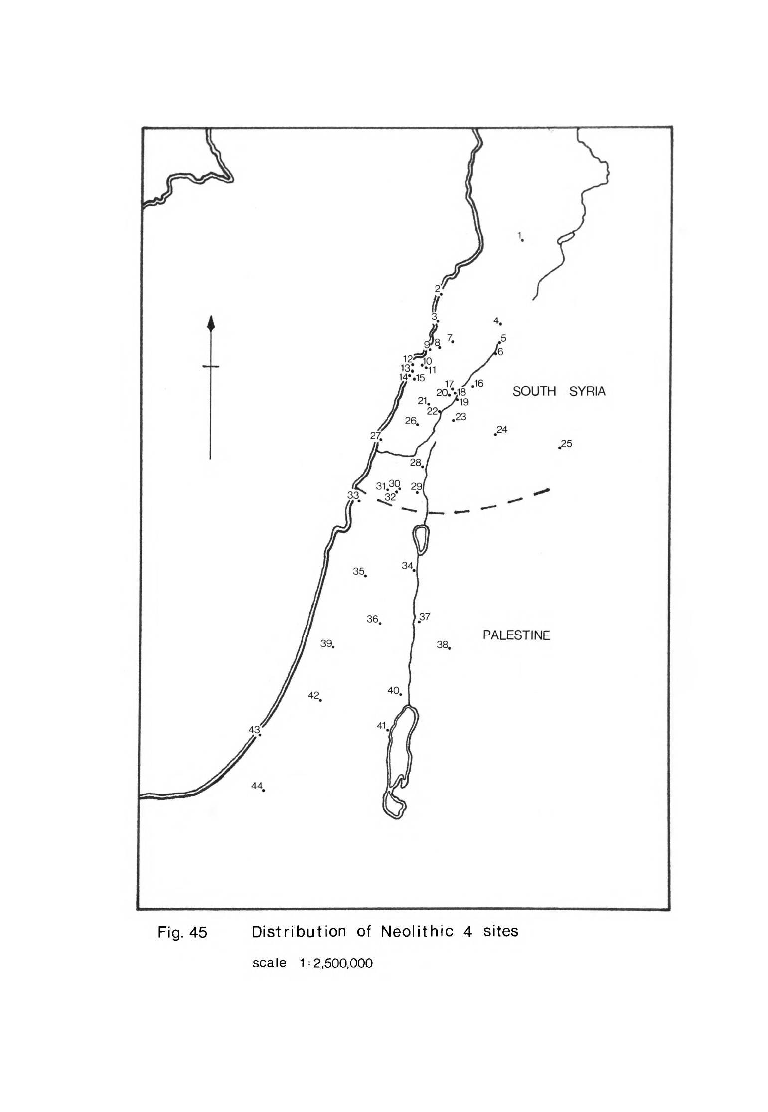
Fig.
45
Distribution
of
Neolithic
4
sites
scale
1=2,500,000
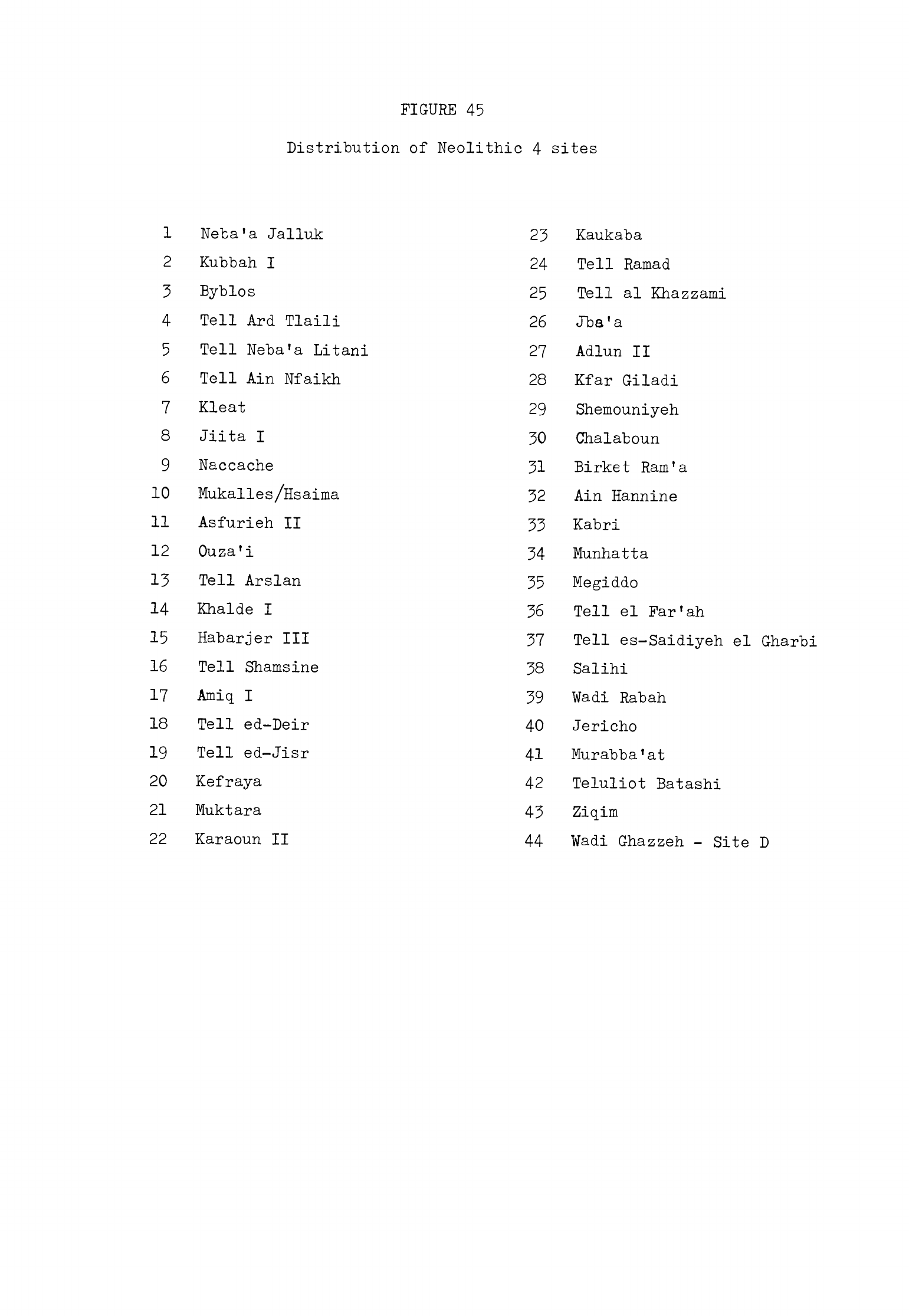
FIGURE
45
Distribution
of
Neolithic
4
sites
1
Neba'a
Jalluk
2
Kubbah
I
3
Byblos
4
Tell
Ard
Tlaili
5
Tell
Neba'a
Litani
6
Tell
Ain
Nfaikh
7
Kleat
8
Jiita
I
9
Naccache
10
Mukalles/Hsaima
11
Asfurieh
II
12
Ouza'i
13
Tell
Arslan
14
Khalde
I
15
Habarjer
III
16
Tell
Shamsine
17
Amiq
I
18 Tell
ed-Deir
19
Tell
ed-Jisr
20
Kefraya
21
Muktara
22
Karaoun
II
23
Kaukaba
24
Tell
Ramad
25
Tell
al
Khazzami
26
Jbs'a
27
Adlun
II
28
Kfar
Giladi
29
Shemouniyeh
30
Chalaboun
31
Birket
Ram'a
32
Ain
Hannine
33
Kabri
34
Munhatta
35
Megiddo
36
Tell
el
Far'ah
37
Tell
es-Saidiyeh
el
Gharbi
38
Salihi
39
Wadi
Rabah
40
Jericho
41
Murabba'at
42
Teluliot
Batashi
43
Ziqim
44
Wadi
Ghazzeh
-
Site
D
-
U13
-
even
the
modest
village
of
Ne*olithique
Ancien.
The
remains
of
the
Ne"o-
lithique
Moyen
settlement
today
end
abruptly
at
the
edge
of
the
cliff
on
the
seaward
side
so
the
site
would
have
"been
somewhat
larger
originally.
In
Ne"olithique
Re*cent
the
focus
of
the
settlement
lay
further north
along
the
ridge
nearer
the
spring
(Dunand,
1973,
127).
Here
houses
were
built
on
the
side
of
the
ridge
sloping
down
to
the
spring
and
on
the
flat
floor
of
the
little
valley
itself.
It
seems
that
the
part
of
the
settlement
covered
by
the
houses
was
not
very
extensive
but
the
total
area
occupied
in
Ne"olithique
Re"cent
was
1.5
ha
(Dunand,
1973,
pi.
G)
so
the
settlement
was
much larger
than
that
of
Ne"olithique
Moyen
and
bigger
even
than
in
Ne*olithique
Ancien.
The
houses
at
the
core
of
the
village
were
surrounded by
working
areas
and
"silos"
(Dunand,
1973,
168)
representing
a
division
of
activities
within
the
confines
of
the
settlement. The
traces
of
these
features
probably
account
for
much
of
the
extent of
the
village.
The
houses
of
the
Neolithique
Moyen settlement
were
similar
in
shape
to
those
of
Neolithique
Ancien,
differing
only
in
certain
details.
The
core
of
each
house
was
a
single
rectangular
room
with
stone
walls
(Dunand,
1973,
95ff)«
Usually
these
houses
had
another
room
at
one
end
separated by
an
internal
partition
wall
from
the
main
room.
Sometimes
this
second
room
might
be
built
on
to
the
exterior
of
the
house.
These houses
were
a
little
bigger
than
those
of
Neolithique
Ancien,
one
for
instance
being
7«10
m
long
and
U.35
m
wide
(Dunand,
1973,
97).
Their
floors
consisted
either
of
trampled
earth
or
chalk
spread
over
a
bed
of
stones. The
fine
plastered
floors
of
Neolithique
Ancien
ceased
to
be made
during
this
phase.
In
N^olithique
Recent the
houses
were
built
in
much
the
same
way
as
before
but
their
plans
were
usually
different.
A
few
were
single-roomed
dwellings
of
similar
dimensions
to
those
in
earlier
phases
(Dunand,
1973,
130)
but
most
while
still
rectangular were
much
longer,
at
least
12
m
in
one
instance
and
17.8
m
in
another
(Dunand,
1973,
128,
132).
These
large
buildings
had
two
or
three
rooms.
The floors
of
two
structures
were
made
of
a
layer
of
clay
-
kih
-
(Dunand,
1973,
127)
but
all
the
others
were
of
trodden
earth.
Several
houses
had
a
low
bench
made of
stones
along
the
outside
of
one
of
the
walls
(Dunand,
1973,
130,
133),
another
indication
of
the
increasing
elaboration
of
these
structures.
That
these
buildings,
both
the
smaller
single-roomed
ones
and
the
long
multi-roomed
structures,
were
houses
still
seems
to
me
to be
their
most
probable
function
although there
is
an
obvious
difference
in
the
size
of
the
families
which
could
have
occupied
these
two
types
of
dwelling.
Several
other
buildings
constructed
in
a
similar
manner
to
the
houses
have
been
identified
by
Dunand
as
religious
structures
(1973,
13^ff).
These
were
on
the
side
of
the
little
hill
near
the
spring.
The
only
difference
between
them
and
the
other
buildings
was
that
they
each
had
a
low
plinth
set
on
the
floor
of
the
principal
room.
They
were
also
the
first
structures
to
be
built
in
places
where
a
series
of temples
was
constructed
in
the
Chalcolithic and
during
the
Bronze
Age.
One
cannot
be certain
that
these
buildings
had
a
religious
function
as
their
shape
and contents
differed
so
little
from
the
houses.
The
argument
concerning
their
position
under
a
series of
later
temples
carries
some
weight
so
it
remains
possible
that
they
were
simple
chapels
as
Dunand
has
suggested.
Two
other
kinds
of
structure
were
common
in
the
Ne"olithicjue
Recent
settlement.
These
were
areas
of
stone
paving
and
"silos".
The
paved
areas
were
often
circular
and
grinding
stones
were
found
in
association
with
several
of
them
(Dunand,
1973,
137,
138).
This
evidence
suggests
that
some
of
them
were
used
for
preparing
cereals
while
others
may
have
been
working
surfaces
for
other
activities.
The
"silos"
were
either
shallow
basins
lined
with
stone
slabs
or
hollows
dug
out
of
the
subsoil
and
lined
with
clay.
Both
could have
been used
for
storing
food.
Ne"olithique
Moyen
burial
practices
had
much
in
common
with
those
of
Ne*olithique
Ancien.
Most
corpses
continued
to
be laid
in a
crouched
position
in
simple
earth
graves
(Dunand,
1973,
99).
Dead
children
were usually
buried
in
jars,
a
mode
of
burial reserved
exclusively
for
them
(Dunand,
1973,
100),
although
a
few
were
also
buried
in
earth
graves.
Three
graves
only
were
found
in
which
skeletal
remains lay
on
beds
of stones
and
all
were
atypical.
They
were
not graves
of
people
of
demonstrably
high
social
status
in
the
community.
Grave
goods
were
placed
in
some
of
the
earth
graves
but
not,
apparently,
in
all.
It
may
be
that
those
of
higher
social
status
were
buried
in
the
same
kind
of grave
as
other
inhabitants
of
the
village
but
that
more
objects
were
deposited
with
them.
There
was
a
revival
of
the
custom
of
secondary
burial
in
Neolithique
Moyen
Byblos.
A
number of
burials
were
found
in
which
the
skeletons
were
incomplete
(Dunand,
1973,
99).
Care
had
been
taken
to
conserve
the
skull
in
several
instances,
an
echo
of
the
widespread
practices
of
Neolithic
2.
One
house
in
particular
was
used
for
secondary
burials
(Dunand,
1973,
97)
though
the
building
itself
need
not
have
had
a
religious
function
as
Dunand
was
inclined
to
believe.
Burial
practices
in
Ne"olithique
Re*cent
followed
those
of
the
earlier
phases
quite
closely
although
there
were
no
more
secondary
burials.
Earth
graves
were
the
usual
mode of
burial while
the
remains
of
children
continued
to
be
placed
in
jars (Dunand,
1973,
136).
Several
graves
were
found
in
which
the
body
had
been
placed
on
a
bed
of
stones
or
was
surrounded
by
stones
recall-
ing
the
mode
of
burial used
for
persons
of
higher
status
in
Ne"olithique
Ancien.
The
chipped
stone
assemblage
of
Ne*olithique
Moyen
comprised
h9^
pieces
only
(Cauvin,
1968,
97)
so
the relative
proportions
of
different
types of
tools
are
of
less
diagnostic
value
than
in
the
other
phases.
Sickle
blades
were
the
most
abundant
type
(Cauvin,
1968, 100ff).
Most
of
these
were
seg-
mented
but
their
retouch
varied
considerably.
Some
has
coarse,
others
fine
denticulation
along
the
cutting
edge;
some
were
backed,
others
not.
Several
sickle
blades
were
retouched
by
pressure
flaking
in
this
phase.
Axes
and
chisels
formed
18%
of the
assemblage
in
Neolithique
Moyen
(Cauvin,
1968,
105,
113),
a
far
greater
proportion
than
in
Neolithique
Ancien.
They
were
made of
flint,
limestone
or
sandstone
and
tended
to
be
thicker
and
-
U16
-
longer
than
in
the
preceding
phase.
Those
with
straight
cutting
edges
pre-
dominated.
These
were
of two
principal
shapes, short
and
trapezoidal
or
long
and
rectangular
(fig.
h6)
.
The
others
had
a
curved
cutting
edge
and
almost
all
of
them
were
relatively
long
with
parallel
sides.
The
almond-
shaped
ones
of
Ne*olithique
Ancien
were
no
longer
made.
A
few
of
these
tools
were
asymmetrical
and
so
were
probably
used
as
adzes.
All
were
flaked
first
and
some
were
partially
polished.
The
chisels
were made
in
the
same
way
and,
like
the
axes,
had
straight
or
curved
cutting
edges.
The
latter
are
charac-
teristic
of
this
phase only
at
Byblos
(Cauvin,
1968,
113).
Three small
axes
made
of
greenstone,
a
black
rock
and
amphibolite
were
also
found
in
the
Ne"olithique
Moyen
settlement
(Cauvin,
1968,
113;
Dunand,
1973,
12U).
Flint
borers were
much more
common
than
in Ne*olithique
Ancien
(Cauvin,
1968,
115).
Some
were
quite
delicate
but
others,
though
small,
were
robust
and
could
have
been
used
for
drilling
wood.
The
presence
of these
and
numerous
axes
and
chisels
suggest
that
the
cutting
and
working
of
timber
grew
in
importance
in
this
phase.
Burins
were
present
in
about
the
same
proportions
as
before
and
the
types
were
similar
(Cauvin,
1968,
119).
End-scrapers
on
blades
and
flakes
were
more
common
(Cauvin,
1968,
121)
as
were
side-scrapers
though there
were
relatively
few
of
the
latter.
The
remaining
flint
tools
consisted
of arrowheads
and
denticulated
blades
and
flakes.
Arrowheads
were
less
common
than
in
Ne"olithique
Ancien,
forming
only
6%
of
the
total
assemblage.
Three
types
of
arrowhead
were
found,
Byblos
points,
Amuq
1
points
and
oval
arrowheads
(Cauvin,
1968,
97,
98).
The
marked
reduction
in
the
proportion
of
arrowheads
is
probably
an
indicator
of
a
decline
in
hunting
which
may
also
be
seen
at
other
sites
in
Neolithic
h.
The
Ne*olithique
Recent assemblage
was
more abundant
than
that
of
Ne"olithique
Moyen.
Sickle blades
while
still
quite
numerous made
up
a
smaller
proportion,
13%,
of
the
total
assemblage
than
before
(Cauvin,
1968,
128).
Most
were
segmented
with
finely-denticulated
cutting
edges;
coarse
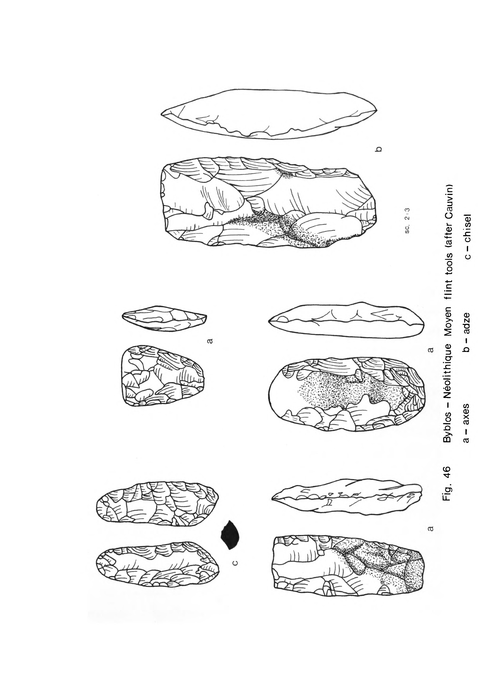
Fig.
46
SC.
23
a
Byblos
-
Neolithique
Moyen
flint
tools
(after
Cauvin)
a-axes
b
-
adze
c-chisel
-
1*17
-
denticulation
was
not
used
in
this
phase.
Some
of the
sickle
"blades
had
little
or
no
edge
retouch.
The use
of
pressure-flaking
for
edge
and
back
retouch
fell
out of
use
in
Ne"olithique
Re"cent,
most
"backed
sickle
"blades
being
retouched
abruptly.
The
proportion
of
axes
and
chisels
in
the
assemblage
remained
about
the
same
in
Ne*olithique
Recent
as
in
Ne*olithique
Moyen
at
^9%
(Cauvin,
1968,
135
5
150).
Most
were
made
of
flint
but
a
few
were
struck
from
limestone and
two
from
basalt
(Cauvin,
1968,
1^5).
All
the
axes
and
chisels
had
straight
cutting
edges
(Fig.
^7).
The
axes
were
relatively
longer
and
narrower
than
those
of
the
preceding
phase
although
their
shapes
were
similar.
Some
had
sliced
sides.
From
the
asymmetrical
profiles
of
many
of
these
tools
it
would
seem
that
they were used
as
adzes
rather
than
axes.
Most
of
these tools
were
flaked
but
a
few
were
shaped
by
hammering;
their
cutting
edges
were then
usually
polished
(Cauvin,
1968,
lUo).
A
number
of
small,
polished
greenstone
axes
and
chisels
were
also
found
in
Ne"olithique
Recent
levels
(Dunand,
1973,
165)
which
were
probably
functionally
associated
with
the
heavier
cutting
tools.
The
proportion
of borers
made
in
this
phase,
17%
9
"was
greater
even
than
in
Ne*olithique
Moyen
(Cauvin,
1968,
153).
Most
were
small
drills
while
the
remainder
consisted
of
borers
on
flakes
and
blades
with
fine
or
coarse points.
The
drills
were
probably
used
for
drilling
wood
and
bone
(Cauvin,
1968,
l6lff)
while
the
other
borers
could
have
had
a
variety
of
uses.
End-scrapers
on
flakes
and
blades were
used
more
in
this
phase
than
before
(Cauvin,
1968,
163).
Sidescrapers
continued
to
be
used
in
modest
quantities
and
some
of
these tools
were
made
on
tabular
flint
(Cauvin,
1968,
167).
Burins,
on
the
other
hand,
were
less
common
than
in
the
preceding
phases.
The
remaining
tools
consisted
of
notched
and
denticulated
pieces
and
arrowheads.
Tanged
arrowheads
and
Amuq
points
were
no
longer
made
in
this
stage
(Cauvin,
1968,
127).
The
only
arrowheads
were
tranchets and
these
were
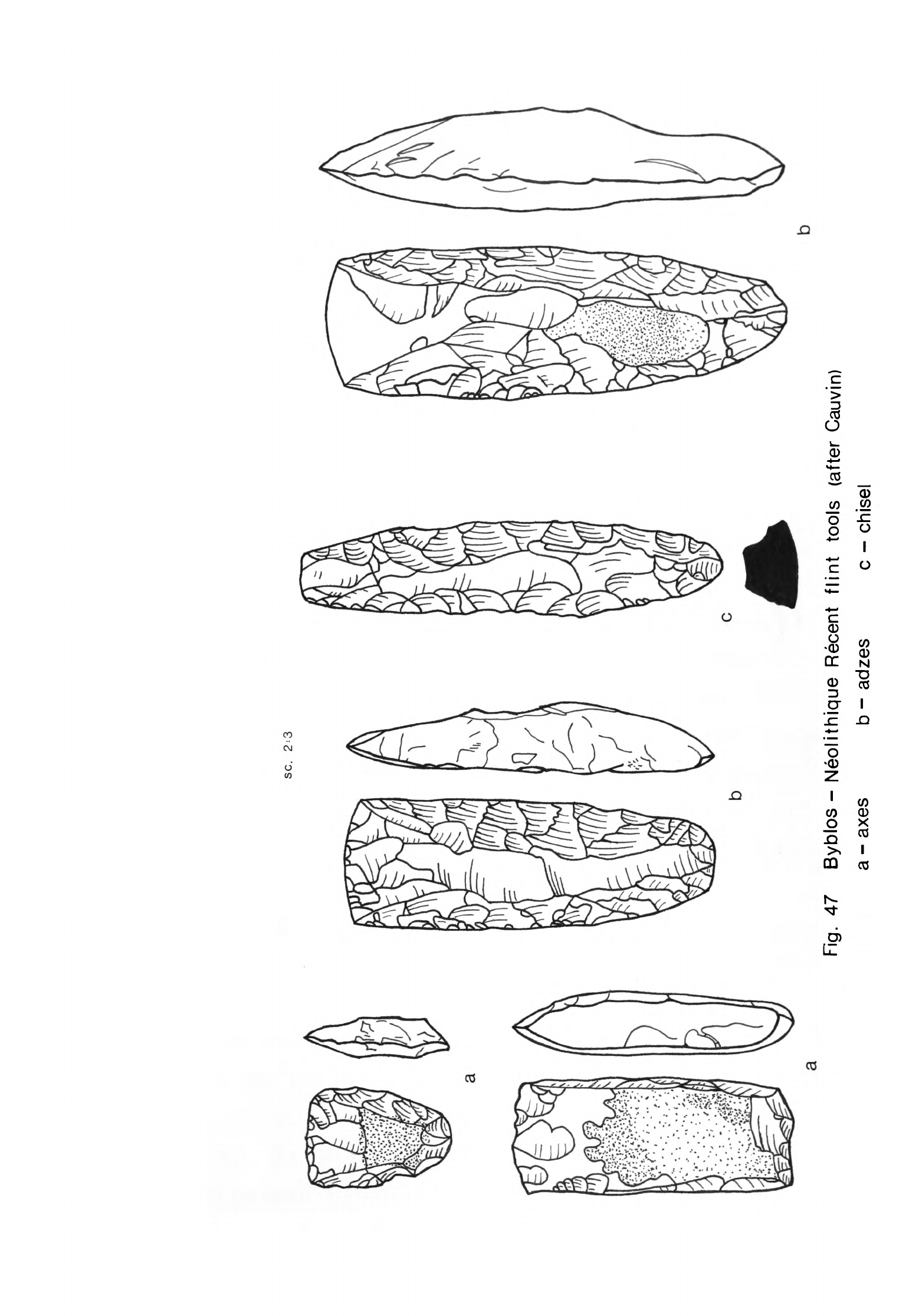
SC.
2
=
3
~l
\
IQ
f
Rg.
47
Byblos
-
Neolithique
Recent
flint
tools
(after
Cauvin)
a
-
axes
b
-
adzes
c
-
chisel
\
- in 8 -
probably
used
for
hunting
in
a
different
manner
than
the
arrowheads
of
earlier
phases.
Similar
tranchet
arrowheads have
been
found
on
coastal
sites
in
Palestine
in
both
Neolithic
3
and
Neolithic
k.
A
few
pieces
of
obsidian
were
found
in
Neolithique
Moyen
levels
and
hk
more
in
the
Ne"olithique
Recent
settlement
(Cauvin,
1968,
172).
Both
of
the
Neolithique
Moyen
pieces
which
have
been
analysed
came
from
the
Van
region,
one
from
the
1g
source
and
the
other
from
3a
(Renfrew
et al.,
1966,
63,
66).
Each
of
the three
Neolithique
Recent
pieces
analysed
came
from
a
different
region,
one
from
1g
near
Lake
Van,
another
from
Nemrut
Dag
(he)
and
the
third
from
Ciftlik
(Renfrew
et
al.,
1966,
63, 65,
68).
Querns,
rubbers,
mortars
and
pestles
were
of
the
same
types
in
Ne"olithique
Moyen
and
Re"cent
as
in
Ne*olithique
Ancien
and
equally
abundant
(Dunand,
1973,
101,
137).
Stone
vessels
continued
to
be made
in
small
quantities
during
N olithique
Moyen.
The
principal
forms
were
cups,
bowls
and
dishes
made of
limestones
and
basalt
(Dunand,
1973,
102,
103).
Two
of
the
basalt
dishes
were
each
supported
on a stem.
Stone
dishes
were
no
longer
made
in
Ne"olithique
Recent
but
stone
cups
and
bowls
were
relatively
abundant
(Dunand,
1973,
139).
The
shapes
of the
vessels
were
quite
similar
but
more
seem
to
have
been
decora-
ted
with
lines
incised
around
the
rim.
In
addition
to
the
range
of
limestone
and
basalt
vessels
there
were
two
small
steatite
pots.
Other
stone
tools
found
in
both
phases
were
maceheads,
weights
and
polishing
stones
(Dunand,
1973,
119ff,
158ff).
The
pottery
of
Neolithique
Moyen
was
a
little
more
developed
than
that
of
N^olithique
Ancien.
The
fabrics
of
the
vessels
were similar
but
now
were
almost
always
fired
buff
or
brown,
occasionally
dark
brown.
The
vessels
were
hand-made
but
sometimes
finished
on
a
turntable.
Their
surfaces
were smoothed
by
hand
and
then
burnished
as
before.
Small
hemispherical
bowls
and
cups
continued
to
be
made
in
this
phase
(Dunand,
1973,
fig.
58)
and
many
of
these
were
decorated
with
deeply
incised
or
excised
designs.
Flat-based
dishes
or
plates
were
made
for
the
first
time
(Dunand,
1973,
10U)
as
were
bowls
with
straight
flared
sides
and
flat
"bases.
Globular
hole-mouth
pots
and
jars
were
still
used
but
most
of
the
larger
vessels
now
had
collar
necks
(Fig.
hQ)
with
either
round
or
flat
bases
(Dunand,
1973,
figs.
62-65).
They
often
had
loop
handles
at
the
junction
of
collar
and
body
or
pierced
lugs
at
the
widest
point of
the
body.
Another
new
shape
was
a
tall
jar
with
a
narrow,
flat
base
and
relatively
small
mouth
(Dunand,
1973,
108).
It
had
loop
handles
on
the
upper
part
of
the
body
or
long
vertical
lugs
pierced
horizontally.
Many
of
these
vessels
were
decorated
with
incised
patterns,
coloured
slip
or
paint
or
burnish.
The
incised patterns
included
those
common
in
Ne"olithique
Ancien
but
there
was
a
greater
variety
of
stabbed
patterns
and
zig-zag
lines
(Dunand,
1973,
pis.
LXVTI-LXIX).
Red
or
brown
paint
or
slip
was
used
to
colour
half
or
all
of
the
surface
of
certain
vessels
and
was
then
usually
burnished.
Sometimes
this
kind
of
decoration
was
combined
with
areas
of
stab
marks.
Paint
was
also
applied
in
bands
or
in
criss-cross
lines
(Dunand,
1973,
10^).
Some
vessels
were
decorated
with
pattern
burnish
(Dunand,
1973,
103).
One
small
bowl
with
a
flat
base
made
of
white
plaster
ware
was
found
in
a
Neolithique
Moyen
level
(Dunand,
1973,
103).
No
other
white
plaster
vessels
were
found
in
this
or
subsequent
phases.
The
pottery
of
Ne*olithique Recent
was
simply
a
development
of
that
of
Neolithique
Moyen.
Fabrics
were
similar
though
many
of
the
vessels
were
harder
fired.
The
rims
of
more
bowls
and
other
vessels
were
finished
on
a
turntable.
A
few
vessels
were
decorated
with
incised
lines
(Dunand,
1973,
1^2)
but
this
was
rare.
Most
were
covered
with
red
paint
or
slip
and
bur
nished.
A
few
were
painted
in
fine
criss-cross
or
parallel
lines
(Dunand,
1973,
pi.
LXXXI).
Some
other
vessels
were
decorated
with
pattern
burnish
(Dunand,
1973,
1^1).
Hemispherical
and
flat-bottomed
cups
and
bowls
were
still
common
but
bowls
with
straight
splayed
sides
and
a
flat
base
were
used
more
than
before
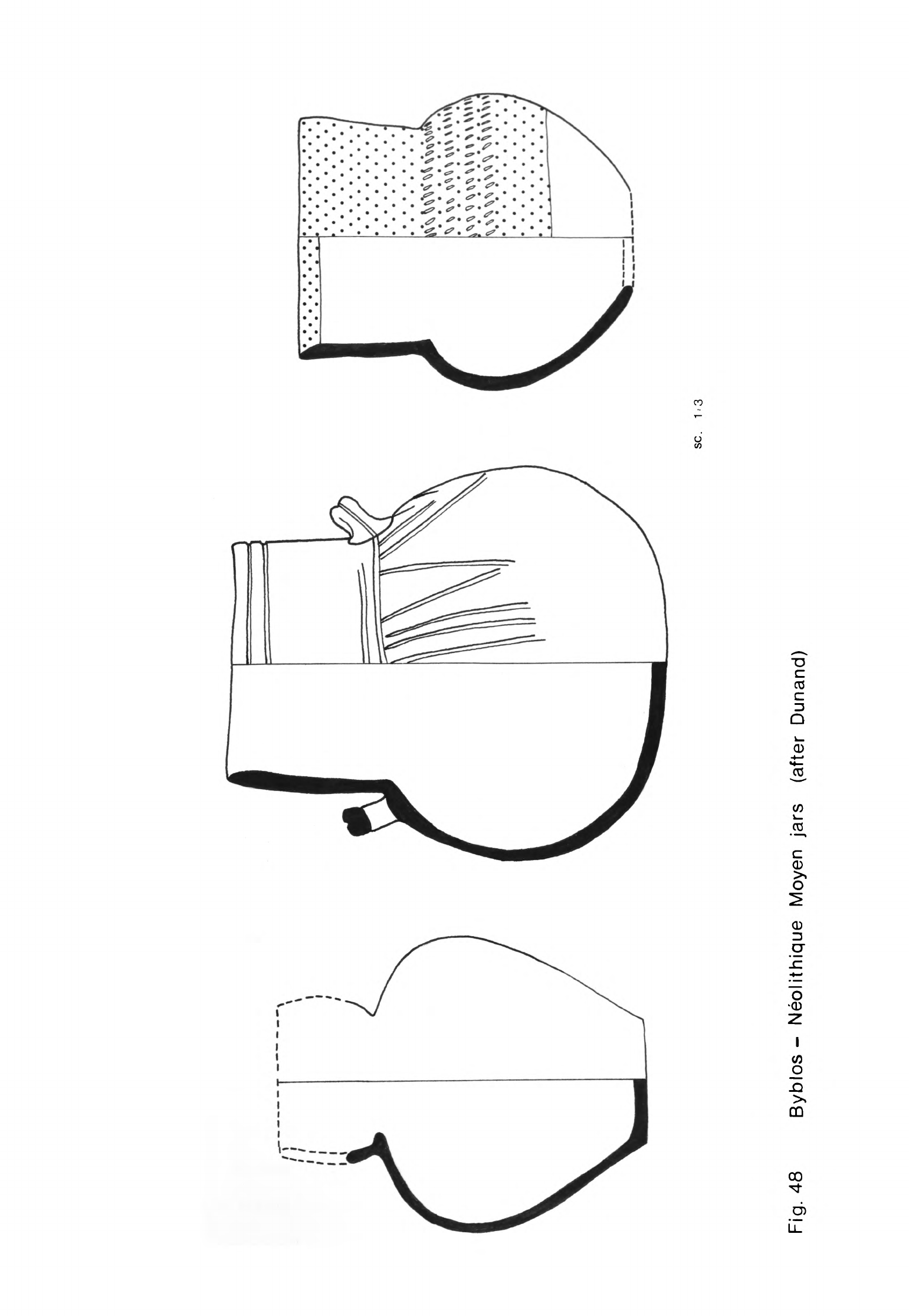
sc.
1
.•
3
Fig.
48
Byblos-
Neolithique
Moyen
jars
(after
Dunand)
-
1*20
-
(Fig.
1*9).
Hole-mouth
pots
and
jars
usually
with
a
flat
base
but
sometimes
curved
were
another
common
type.
Globular
jars
were
rarely
made
in
this
phase
and
the
collared
jars
of
Ne"olithique
Moyen
were
also
unusual.
The
most
common
large
containers
were tall
jars
with
narrow
flat
bases
(Dunand,
1973,
1U8).
Their
necks
were
collared
or
flared
and
they
often
had
handles
on
the
sides
(Fig.
U9).
This
type
was
first
made
in
the
preceding
phase
but
became
the
standard
large
vessel
in
Ne*olithique
Recent.
The
bone
tools
of
Ne"olithique
Moyen
were
similar
to
those
of
Ne"olithique
Ancien
(Dunand,
1973, 121).
There
were
borers
in
several
different
sizes,
some
with
quite
delicate
points
and
others that
were
more
robust.
Spatulae
were
another
common
type
while
among
the
more
unusual
tools
were
fish-hooks
and
hafts.
Bone borers
were
particularly
abundant
in
Ne"olithique
Re*cent
(Dunand,
1973, 161).
A
number
were
found
in
close
proximity
as
if
they
had
been used
together
in
some
craft
activity.
The
other
bone
tools
included
spatulae,
a
fish-hook
and
a
needle.
There
were
also
a
number
of
hafts
and
two
fragments
of
animal
scapulae
with
rows
of
notches
similar
to
the
one
found
in
Ne"olithique
Ancien.
A
few
spindle
whorls
were
found
in
Ne"olithique
Moyen
and
many
more
in
Ne*olithique
Recent
(Dunand,
1973,
123,
163).
Most
were
made
of
baked
clay
but
a
few
were of
stone.
Pottery
and
stone
discs
which
may
have
had
a
related
function
were
also
found.
Stamp
seals
were
quite
rare
in
Ne*olithique
Moyen.
The
"pintaderas"
were
no
longer
made
but
there
were
several
seals
of
baked
clay
which
were
incised
with
the
same
simple
geometric
patterns
(Dunand,
1973,
125).
There
was also
at
least
one
stone
stamp
seal
which
was
similar
in
type.
Most
of
the
stamp
seals
in
Ne"olithique
Recent
showed
marked
evolution
from
those
of
the
preceding
phases
(Dunand,
1973,
l66ff).
There
were
still
a
few
baked
clay
ones
with
simple line
patterns
but
more
were
made
of
stone.
They
often
had
steep
ridged
backs
and
were
pierced
for
suspension.
Some
had
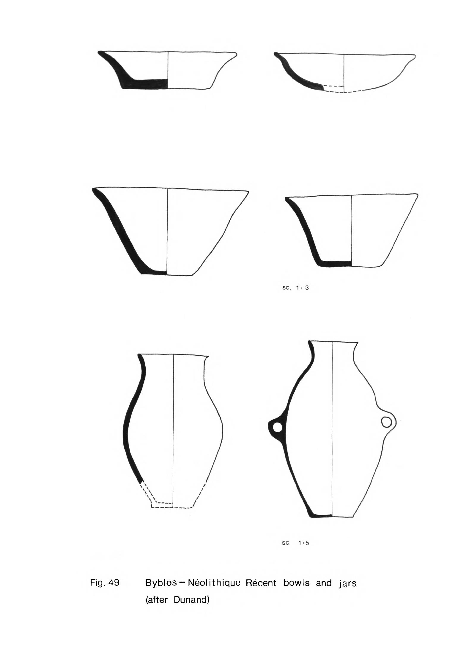
sc.
1
=
3
sc.
1-5
Fig.
49
Byblos-Neolithique
Recent
bowls
and
jars
(after
Dunand)
-
1*21
-
patterns
of
incised
lines
as
before
but
others
had
new
motifs
formed by
a
series
of
drilled
holes.
Jewellery
and
other
objects
of
adornment
were
quite
rare
in
Ne"olithique
Moyen
but
there
were
a
few
stone,
bone
and
shell
beads.
There
were
also
several
stone
and
baked
clay
objects
similar
to
those
found
in
Ne"olithique
Ancien
which
I
have
suggested
may
have
been
nose
adornments
or
labrets.
These
objects
were
rare
in
the
Ne"olithique
Recent settlement
while
beads
and
pendants
were
also
scarce
(Dunand,
1973,
165,
166).
The
only
figurines
found
in
the
Ne"olithique
Moyen
settlement
were
two
pebbles
with
a
few
lines
scratched
on
them
to
indicate
human
beings
(Dunand,
1973,
123).
These
were
of
the
same
type
as
those
found
in
Ne"olithique
Ancien.
These
pebble
figurines
were
absent
in
Ne"olithique
Recent,
the
only
figurine
found
on
those
levels
being
a
baked
clay
quadruped
(Dunand,
1973,
165).
No carbon
1U
determinations have
been
made
on
samples
from
the
Ne*olithique
Moyen
and
Recent
settlements
at
Byblos
so in
order
to
estimate
their
duration
one
has to
rely
on
typological
parallels
with
other
dated
sites.
Unfortunately
very
few
samples
from
contemporary
sites
have
been
dated
so
far
so
that
any
estimate
must
be
imprecise.
I
have already
suggested
that
Ne"olithique
Ancien
Byblos
continued
to
be
inhabited
until
about
5000
or
U800
B.C.
when
the
transi-
tion
to
Ne"olithique
Moyen
took
place,
The
material
remains
of
the
Ne"olithique
Moyen
settlement
were
relatively
slight
suggesting
that
the
phase did
not
last
long.
This
is
borne
out
by
the
dating
evidence
obtained
by
Kirkbride
at
the
site
of
Ard
Tlaili
in
the
Beka'a.
The site
is
a
small
tell
which
has
yielded
some
Halaf
pottery
and
remains
of
a
rectangular
building
(Kirkbride,
1969,
53ff).
Accompanying
the
Halaf
painted
wares
were
many
plain
burnished
and
pattern
burnished
sherds
as
well
as
deeply-incised
fragments
which
closely
resembled
Ne*olithique
Moyen pottery
at
Byblos.
In
the
upper
levels
of
the
site
were
sherds of
red
washed
vessels
more
akin
to
the
pottery
of
Ne*olithique
Recent
at
Byblos.
Three
carbon
lk
determinations
were
obtained
from
samples
taken
from
the
lower
levels
giving
dates
of ^920
±
130
B.C.
K-1^32,
U900
±
130
-
1+22
-
B.C.
K-1l*33
and
kQhO
±
130
B.C.
K-1U3
1
!
(Kirkbride,
1969,
55;
Mellaart,
1975,
287).
The
date
from
one
sample
from
the
upper
level
at
Ard
Tlaili
was
UT10
±
130
B.C.
K-1U31.
Following
these
dates
I
would
suggest
that
Ne"olithique
Moyen
at
Byblos
lasted
until about
1*700
B.C.
or
a
little
before.
Thus
the
maximum
duration
of
the
phase
would
be
300
years
and
the
minimum
about
one
century.
There
was
no
apparent
break
in
the
sequence
of
occupation
at
Byblos
between
Ne"olithique
Moyen
and
Ne"olithique
Re*cent
even
though
the
settlement
altered
so
markedly.
It
follows,
therefore,
that
Ne"olithique
Recent
may
have
begun
about
U700
B.C.
The
abundant
remains
of
this
settlement
indicate
that
the
phase
lasted
a
long
time
but
its
terminal
date
can
be
little
more
than
a
guess.
Ne"olithique
Recent
at
Byblos
has
many
similar
cultural
remains
to
level
IIIC
at
Ras
Shamra
which
is
dated
by
a
lk
C
determination
of U18U
±
173
B.C.
P-389
(de
Contenson,
196U,
^7;
Radiocarbon
5
5
1963,
83).
From
this
it
would
appear
that
Ne"olithique
Recent
lasted
at
least
until
the
end
of
the
5th
millennium.
The
succeeding
phases
at
Byblos,
Ene*olithique
Ancien
and
Ene"olithique
Recent
followed
Ne"olithique
Recent
directly.
The
material
remains
of
these
phases
shared
many
traits
with
the
Ghassulian
in
Palestine
with
which
they
were
probably
approximately
contemporary.
The
transition
to
the
latter
began
about
3750
B.C.
and
was
complete
by
3500
B.C.
(Moore,
1973,
63).
Thus
N^olithique
Recent
at
Byblos
may
have
lasted
until
the
earlier
centuries
of
the
Uth
millennium,
perhaps
3900
or
3800 B.C.
A
number
of
other
Neolithic
k
sites
have
been
found
on
the
seaward
side
of
the
Mountains
of
Lebanon.
Almost
all are
known
only
from
surface
finds
but
these
can
be
dated
by
typological
comparisons
with
Byblos
Ne"olithique
Moyen
and
Re*cent.
Many
other
probable
Neolithic
sites
have
been
identified
in
this
region
and
elsewhere
in
Lebanon
(see
especially
Copeland,
Wescombe,
1965;
1966)
but
insufficient
material
has
been
found
on
them
for
us
to
know
during
which
phases
of
the
Neolithic
they were
occupied.
It
is
likely
that
most
of
these
other
sites
were
inhabited
during
Neolithic
3
or
k
and
therefore
that
the
number
of
sites
discovered which
were
inhabited
in
these
phases
is
significantly
greater
than
those
I
am
describing.
Several
sites
contemporary
with
Byblos
Ne"olithique
Moyen
have
been
found
on
the
hill
slopes
near
the
sea
south of
the
Nahr
el
Kelb
(Fig. 50).
The
most
northerly
of
these
is
Dbaye
I
on
top
of
the
promontory
at
the
mouth
of
the
Nahr
el
Kelb
itself
and
about
1
km
north
of
the
village
of
Dbaye (Copeland,
Wescombe,
1965,
81).
Dbaye
I
The
site
was
discovered
long
ago
by
Zumoffen
and
others
have
picked
up
material
there
since.
Much of
this
has
been
deposited
in
the
University
Saint-
Joseph
and
at
the
Museum
of
the
American
University
in
Beirut
where
I
have
ex-
amined
it.
The
finds
from
the
site
consisted
entirely
of
flint
artifacts and of
these
the
heavy
tools,
axes,
chisels
and
picks
were
the
most
prominent.
The
axes
were of
a
variety
of
shapes
and
some
were
unusually
large.
Those
with
rounded
cutting
edges
were either
oval
or
almond-shaped
while
the
straight-
edged
axes
were
triangular
or
trapezoidal.
The
chisels
were
usually
quite
small
and
narrow
with rounded
or
straight
cutting
edges.
Most
of
the
picks
were
small
with rounded
butts;
these
tools
were
probably
for
woodworking
like
the
axes
and
chisels.
In
addition
there
were
a
number
of
heavy
spherical
flint
hammers
which
may
have
been
used
to
make the
other
large
tools.
The
assemblages
from
Dbaye
I
included
a
number
of
tanged
arrowheads
and
a
variety
of
segmented
sickle
blades,
mostly
with
fine
edge
retouch
but
a
few
with
coarse
denticulation.
There
were
also
a
range
of
borers,
some
knives,
burins
and end and
side-scrapers.
Cauvin
has
published
much
of
the
available
material
and
has
concluded
that the
site
was
inhabited
at
the
same
time
as
the
Ne"olithique
Moyen
settle-
ment
at
Byblos
(1968,
2^0ff)
principally
because
the
typology
of
the
axes,
chisels,
sickle
blades and
arrowheads was
the
same
at
both
sites.
The
site
was
visited
in
other
periods, however,
on
the
evidence
of
a
few
other
finds
(Copeland,
Wescombe,
1966,
162).
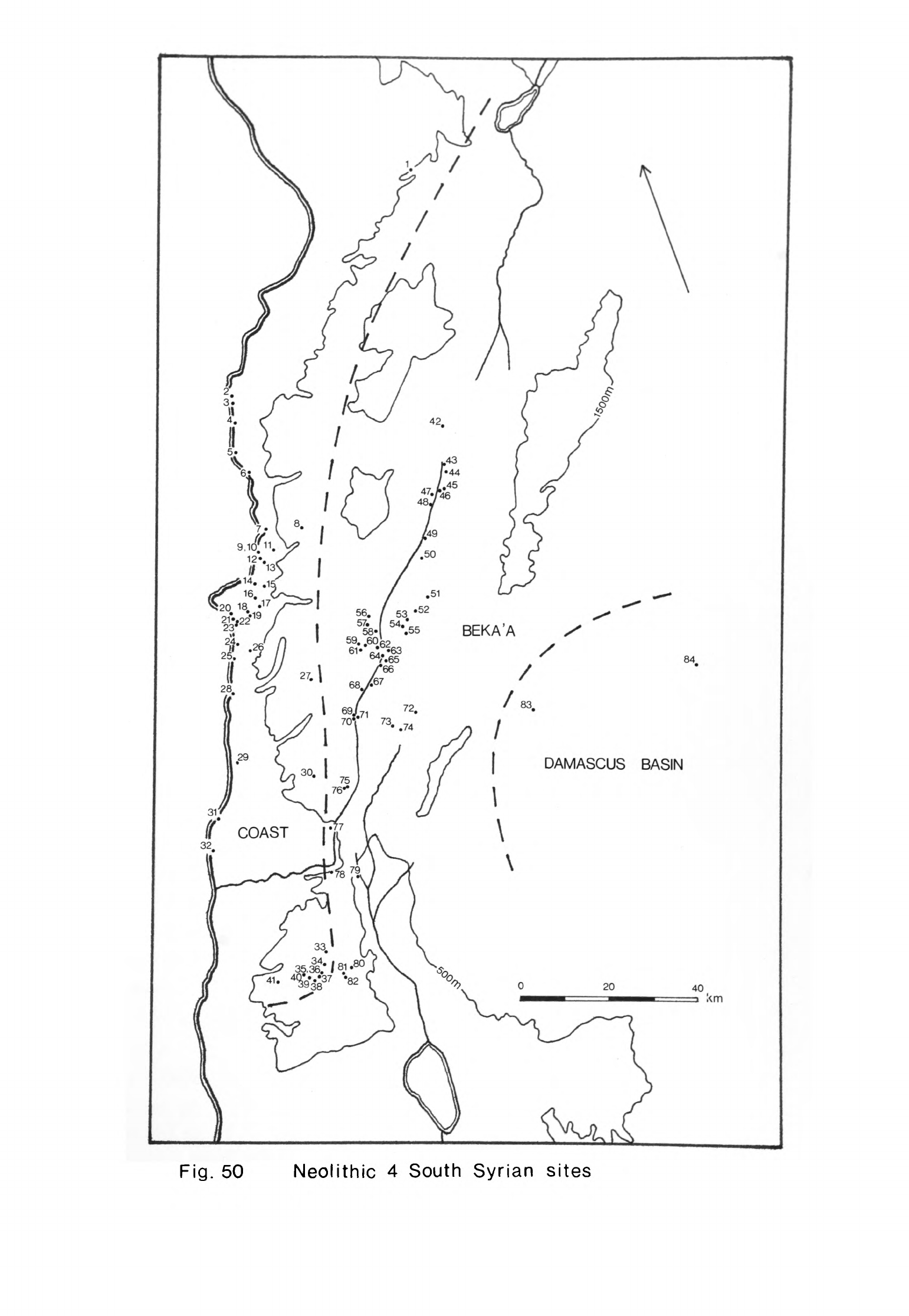
DAMASCUS
BASIN
f
COAST
I
o
I
Fig.
50
Neolithic
4
South
Syrian
sites
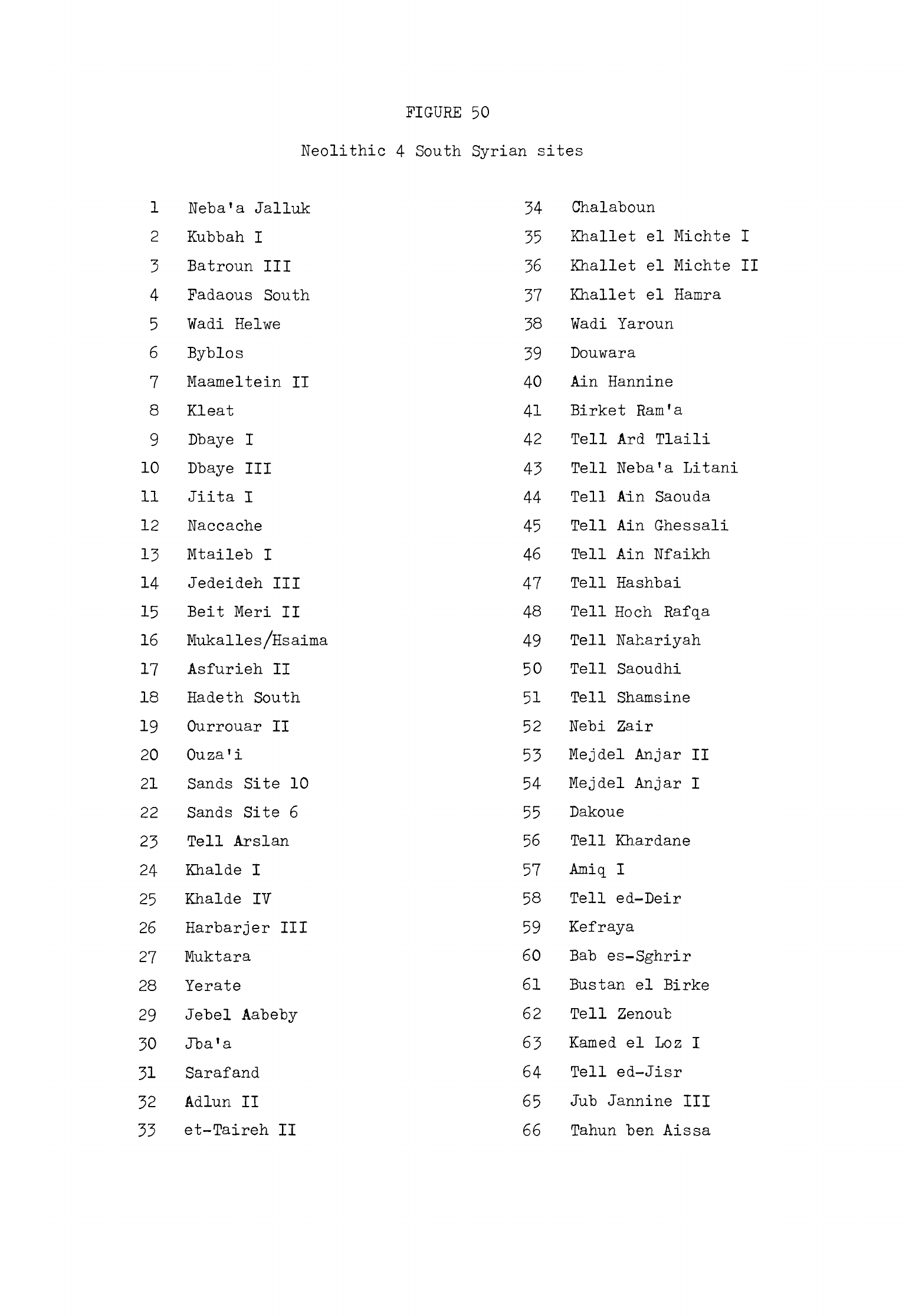
FIGURE
50
Neolithic
4
South
Syrian
sites
1
Neba'a
Jalluk
2
Kubbah
I
3
Batroun
III
4
Fadaous
South
5
Wadi
Helwe
6
Byblos
7
Maameltein
II
8
Kleat
9
Dbaye
I
10
Dbaye
III
11
Jiita
I
12
Naccache
13
Mtaileb
I
14
Jedeideh
III
15
Beit
Meri
II
16
Mukalles/Hsaima
17
Asfurieh
II
18
Hadeth
South
19
Ourrouar
II
20
Ouza'i
21
Sands
Site
10
22
Sands
Site
6
23
Tell
Arslan
24
Khalde
I
25
Khalde
IV
26
Harbarjer
III
27
Muktara
28
Yerate
29
Jebel
Aabeby
30
Jba'a
31
Sarafand
32
Adlun
II
33
et-Taireh
II
34
35
36
37
38
39
40
41
42
43
44
45
46
47
48
49
50
51
52
53
54
55
56
57
58
59
60
61
62
63
64
65
66
Chalaboun
Khallet
el
Michte
I
Khallet
el
Michte
II
Khallet
el
Hamra
Wadi
Yaroun
Douwara
Ain
Hannine
Birket Ram
'a
Tell
Ard
Tlaili
Tell
Neba'a
Litani
Tell
Ain
Saouda
Tell
Ain
Ghessali
Tell
Ain
Nfaikh
Tell
Hashbai
Tell
Hoch
Rafqa
Tell
Nahariyah
Tell
Saoudhi
Tell
Shamsine
Nebi
Zair
Mejdel
Anjar
II
Mejdel
Anjar
I
Dakoue
Tell
Khardane
Tell
ed-Deir
Kefraya
Bab
es-Sghrir
Bustan
el
Birke
Tell
Zenoub
Kamed
el
Loz
I
Tell
ed-Jisr
Ju.b
Jannine
III
Tahun
ben
Aissa

67
Amlaq
el
Qatih
68
Ain
Jaouze
69
Karaoun
II
70
Beidar
Chamout
71
Karaoun
I
72
Dahr
el
Ahmar
73
Kaukaba
74
Ard
Saouda
75
Khallet
el
Khazen
III
76
Khallet
el
Khazen
IV
77
Kafr
Tibnit
78
et-Tayibe
79
Kfar
Giladi
80
Shemouniyeh
81
Wadi
Salhah
82
Wadi
Farah
83
Tell
Ramad
84
Tell
al
Khazzami
There
is
another
site
in
the
vicinity
of
Dbaye
which
has
yielded
a
little
more
material
of
the same
kind
which
Copeland
and
Wescombe
called
Dbaye
III
(1965,
82)
and
Cauvin,
apparently
in
error,
Dbaye
II
(1968,
2^0).
Here again
there
were
a
number
of
axes
and
other
heavy
tools
but
relatively
few
sickle
blades,
arrowheads and
scrapers.
The
assemblages
from
these
two
sites
may
resemble
that
from
Byblos
typologically
but
it
is
clear
that
the
way
of
life
of
the
inhabitants
of
Dbaye
I
and
Dbaye
III
was
different.
The
presence
of
a
number
of arrowheads
suggests
that
hunting
contributed
significantly
to
the
diet,
supplementing
the
fruits
of
agriculture
presumably,
but
the
heavy
tools
indicate
that
the
inhabitants
spent
much
time
in
clearing
the
surrounding
woodland
and
shaping
timber.
Naccache
The
village
of
Naccache
lies
between
Dbaye
and
Antelias,
just
south
of
the
monastery
of
Mar
Jorgis.
The
surface
station,
or
rather
stations since
it
seems
that
there
were
several,
of
Naccache
or
Mar
Jorgis
lie
principally
to
the
north
and
east
of
the
village
(Copeland,
Wescombe,
1965,
110;
Cauvin,
1968,
232).
They
were
first
visited by
Bergy
in 1933
and
subsequently
by
several
other
workers
who
collected
much
material,
some
of
which
is
in
the
University
Saint-Joseph
in
Beirut.
The site
or
sites
consisted
of
several
concentrations
of
flint
tools
and
waste
over
a
wide
area.
Cauvin
collected
much
material
from
one
concentration
which
he
believed
had
been
missed by
earlier
workers.
The
most
numerous
tools
from
Cauvin
1
s
station
were
arrow-
heads,
sickle
blades,
borers,
burins and
notched
pieces.
The
arrowheads
were
tanged
and
pressure-flaked
Byblos
points.
The
sickle
blades
were
segmented
and
retouched
in
a
variety
of
ways
with
fine
or
coarse
denticulation, sometimes
by
pressure-flaking
and
either
with
or
without
backing
(Cauvin,
1968,
233).
The
borers
included both
small points
on
flakes
or
blades and
also
heavier
flaked
tools
which
one
might
classify
as
"picks".
The
latter
bore
clear
traces
of
wear
on
the
intersections
of
the
flake
scars
which showed
that
they
-
1*25
-
had
been
used
as
borers
or
reamers
(Cauvin,
1968,
237)-
In
addition
to
these
tools
there
were
a
number
of
axes
with
either
round
or
straight
cutting
edges
and
also
some
chisels.
The
other
artifacts
were
end-scrapers,
side-
scrapers
and
denticulated
blades
and
flakes.
Cauvin
believed
that
his
station
at
Naccache
was
occupied
during
Byblos
Ne*olithique
Moyen
on
the
basis
of
the
typology
of
the
arrowheads,
sickle
blades,
axes
and
chisels
and
also
because
end-scrapers
were
present.
These
observations
seem
valid
for
his
station
and
also
apply
to
the
material
which
I
have
seen
from
the
other
stations
in
the vicinity.
These
sites
appear
to
represent
the
settlements
of
one
or
more
groups
who lived
here
during
part
of
Neolithic
h.
The
settlements may
in
fact
have
been
more
long-lived
than
that
since
some
of
the
tools
could
equally
well
have
been
used
later
in
Neolithic
h
or even
in
Neolithic
3.
Such
stations
in
areas
where
flint
was
abundant
were
used
by
other
groups
in
other
phases
and
the
surface
collections
usually
include
at
least
a
few
tools
made
by
such
visitors.
Tell
Arslan
Tell
Arslan
lay
in
the
dunes or
Sands
8.5
km
south
of
Beirut
and
about
800
m
east
of
the
present shoreline
(Copeland,
Wescombe,
1965,
131;
Cauvin,
1968,
fig.
121).
The
site
was
a
mound
covering
about
1
ha
and
was
situated
on
a
low
rise
just
north
of
the
Nahr
el
Ghedir.
Bergy
found
the
site
in
1930
and collected
much material
from
it.
Fleisch
gathered
a
great
deal
more
in
19^8
when
the
site
was
levelled
during
the
construction
cf
Beirut
Airport.
All
this
material
is
now
in
the
University
Saint-Joseph.
The
site
seems
to
have
been
a
Neolithic
village
which
was
also
occupied
in
Roman
times.
The
extant
Neolithic material
from
the
site
consists
of
flints
and
pottery.
About
25%
of
the
flint
tools
were
axes
and
chisels
(Cauvin,
1968,
260,
269).
The
axes
were
particularly
varied,
a
majority
having
straight
and
the
remainder
round
cutting
edges.
Those
with
straight
edges
were
usually
trapezoidal
although
a
few
were
rectangular. Most
were
relatively
small
but
there
were
a
few
large
ones.
The
axes
with
rounded
edges
were
-
U26
-
either
oval
or
almond-shaped.
A
number
of the
trapezoidal
and
rectangular
ones
were
asymmetrical
in
cross-section
and
thus
adzes
rather
than
axes.
A
series
of
other
asymmetrical
ones,
both
trapezoidal
and
oval
in
outline,
had
heavily worn
cutting
edges.
Cauvin
has
concluded
that
these
tools
were used
as
hoes
(1968,
268),
an
interpretation with
which
I
agree.
Similarly
shaped
tools
have
been
found
on
the
other
Neolithic
U
sites
I
have
described
but
none
have
such
clear
traces
of
heavy
wear;
in
fact
few
of these
heavy
tools
show
any
signs
of
wear
at
all
to
the
naked
eye. It
would
seem
probable
that
some
of
these
asymmetrical
axes
were
used
as
hoes
on
the
other
sites
but not
long
enough
for
the
traces
of
wear
to
be
so
readily
visible.
The
chisels
from
Tell
Arslan
were
narrow
and
usually
oval
in
cross-section.
They
had
round
or
straight
cutting
edges.
These
tools
were
probably
for
wood-
working
as
were many
of
the
axes
and
adzes.
Borers
and
picks
which
might
also
have
been
used
in
carpentry
were
less
abundant
in
the
collections
from
Tell
Arslan
than
on
some
other
contemporary
sites
(Cauvin,
1968,
270).
The
two
other
main
classes
of
tools
were
arrowheads
and
sickle
blades.
The
arrowheads,
like
the
axes,
were
particularly
varied
since
they
included
both
kinds
of
Amuq.
point,
tanged
arrowheads of
the
Byblos
type
and
even
a
few
notched
examples.
Most,
though not
all,
the
sickle
blades
were
segmented
and
many
were
backed. They
had
either
finely-serrated
or
coarsely-denticulated
cutting
edges.
The
other
tools
consisted
of
a
few
burins,
end and
side-scrapers,
knives
and
notched
and
denticulated
pieces.
The
few
probable
Neolithic
sherds
from
Tell
Arslan
had
a
quite
hard,
evenly
fired
fabric
with
some
grit
and
straw
filler.
There
were
fragments
of
flat
bases
and
a
strap
handle
as
well
as
a
few
sherds
with
incised
decoration
consisting
of
parallel
lines
and
stab
marks.
In
his
study
of
the
Tell
Arslan
material
Cauvin
concluded
that
the
flints
and
sherds
were
all
sufficiently
similar
to
Ne*olithique
Moyen
artifacts
at
Byblos
for the
two
sites
to
have
been inhabited
contemporaneously
(1968,
27^,
275).
I
would
accept
that
for
many
of
the
flint
tools
and
perhaps
the
sherds
-
1*27
-
this
may
be
so
but
both
the
heavy
tools
and
the
arrowheads include
several
types
that
were
more
common
in
the
Neolithique Ancien
phase
at
Byblos. This
is
especially
so
of
the
short
trapezoidal
axes
and
Amuq
arrowheads.
The
few
notched
arrowheads
would
appear
to
come
from
a
Neolithic
2
context
contemporary
with
Tell aux
Scies
which
was also
in
the
Sands.
There
are
other
flint
tools
in
the
collections
from
Tell
Arslan
which
are
more
archaic
still,
perhaps
even
Upper
Palaeolithic
in
date,
which
suggest
that
groups
visited
the
site
in
much
earlier
times.
The
history
of
the
site
probably began with
such
temporary
camps
and
then
a
small
settlement
may
have
been established
here
in
Neolithic
3.
This
grew
and
became
much
more
extensive
in
the
earlier
centuries
of
Neolithic
U
at
a
time
contemporary
with
Neolithique
Moyen
at
Byblos,
after
which
the
site
was
probably
abandoned.
Muktara
The
village
of
Muktara
is
about
5
km
south-east
of
Beit
ed-Din
and
overlooks
the
valley
of
the
Nahr
el
Baruk
high
in
the
Mountains
of
Lebanon
below
Jebel
Baruk.
The
site
lies
on
a
series
of
terraces
below
the
village
at
an
elevation
of
about
900
m.
Cauvin
excavated
it
in
1961
and
has
presented
the
results
in
two
publications
(1963,
^89ff;
1968,
277ff)
The
site
had
been
cultivated
for
a
long
time
and
consequently
nothing
remained
undisturbed.
The
excavations
yielded
a
collection
of
flint
tools,
waste,
some
bone
tools,
a
few
badly-weathered
potsherds,
one
of
which
was
incised,
and
a
basalt
hoe
as
well
as
a
few
other
stone
tools.
"\k.Q%
of
the
ho6
retouched
tools
were
arrowheads.
Most
of
these
were
tanged
Byblos points
but
there
were
also
Amuq
points
and
a
notched
arrowhead
with
pressure-flaked
retouch.
Cauvin
included
two large
bifacially
retouched
oval
points
in
this
category
but
called
them
daggers
(1968,
278);
they
may
have
been used
to
arm
arrows
or
spears
but
might
have
been
used
as
knives
instead.
A
further
11$
of
the
retouched
tools
consisted
of
sickle
blades
(Cauvin,
1968,
281).
These
were
all
segmented
and
some
were
retouched
by
pressure-flaking.
The
cutting
edges
had
fine
or coarse
denticulation
and
most
were
backed.
Burins
-
U28
-
were
almost
as
numerous
as
the
sickle
blades
(10.8$)
while
much
of
the
remainder
of
the
tools
consisted
of
notched
or
denticulated
pieces
(Cauvin,
1968,
287,
289).
The
heavy
tools
such
as
axes
and
chisels
were
present
in
small
quantities
at
Muktara,
the
two
categories
comprising
6%
of
the
retouched
pieces
(Cauvin,
1968,
282,
286).
The
axes
were
quite
varied
nonetheless
since
the
assemblage
included
almond-shaped,
oval,
round
and
trapezoidal
ones.
In
addition
to
these
tools
there
were
a
few
"borers,
end
and
side-scrapers
and
knives.
The
typology
of
the
main
classes
of
flint
tools
at
Muktara
resembles
that
of
the
Byblos
Ne'olithique
Moyen assemblage
quite
closely
so
the
two
sites
were
occupied
contemporaneously
(Cauvin,
1968,
277).
The
proportions
of
the
tools
in
the
Muktara
assemblage
differ
quite
markedly from
those
of
Byblos and
other
Ne'olithique
Moyen
sites
discussed
so
far.
Perhaps
the most
surprising
aspect
is
the
low
percentage
of
woodworking
tools
at
Muktata
since
the
neighbourhood
of
this site
would
have
been
quite
as
heavily
forested
as
that
of
the
sites
at
lower
elevations
near
the
coast.
The
high
percentage
of
arrowheads found
in
the
excavations
may
indicate
that
hunting
contributed
more
to
the
food
supply
than
on
other
sites.
The
presence
of
a
hoe,
a
stone
spindle
whorl
(Cauvin,
1963,
fig.
9)
and perhaps the
sickle
blades
suggest
that
the
economy
of
the
site
was
based
upon
agriculture
and
herding,
both
of
which
could
have
been
practised
in
the
environs
of
the
site
despite
its
elevation.
The
valley
slopes
in
this
region
are
quite
steep
so
that
herding
may
have
played
a
larger
part
in
the
economy
than
on
the
coastal
sites.
Indeed
it
is
likely
that
Muktara
was
a
seasonal
settlement
occupied
only
during
the
summer
when
flocks
and
herds
were
pastured
here
and
a
few
crops
grown
in
the
vicinity.
Much
less
is
known
about
Hie
other
surface
stations
kiown
to
have
been
occupied
contemporaneously
with
Ne'olithique
Moyen
Byblos
so
that
I
shall
discuss
these
only
briefly.
Neba'a
Jalluk
is
situated
in
the
hills
at
the
extreme
northern
end
of
the
Mountains
of
Lebanon
about
8
km
south
of
Tell
Kalakh
(Copeland,
Wescombe,
1966,
kQ).
The
site
was
occupied
in
the
Neolithic
as
well
as
in
later
periods.
The
Neolithic
material consisted
of
flint
tools,
obsidian
blades
and
a
few
sherds,
one
of
which
had
an
applied,
decorated
band
and
was
burnished.
Among
the flints
were
tanged
arrowheads, finely
and
coarsely-
denticulated
segmented
sickle
blades,
axes
and
adzes.
This
material
is
thought
principally
to
resemble
finds
from
Byblos
Ne*olithique
Moyen
although
the site
may
have
been
inhabited
both
in
Neolithic
3
and
later
in
Neolithic
h.
Kubbah
I
north
of
Batrun
was
occupied
in
Neolithic
3
as
we
have
seen
but
continued
to
be
inhabited
in
Neolithic
k
(Copeland,
Wescombe,
19&5»
101).
The
collections
from
the
site
in
the
University Saint-Joseph
include
segmented
sickle
blades
with
both
fine
and
coarse
denticulation
as
well
as
long,
narrow
trapezoidal
axes
and
adzes
which
are
more
typical
of
Ne"olithique
Moyen
than
Ne"olithique
Ancien
at
Byblos.
A
basalt
hoe
was
also
found
here
like
the one
from
Muktara
though
we
do
not
know
it
if
came
from
the
Neolithic
3
or
Neo-
lithic
h
levels
at
the
site.
An
assemblage
similar
to
the
Neolithic
k
material
from
Kubbah
I
has
been
found
on
the
beach
south
of
Batrun
and
this
station
has
been
designated
Batrun
III
(Copeland,
Wescombe,
1965,
72).
Another
site
lying
beside
the
sea
has
been
found
on
the south
side
of
the
mouth
of
the
Wadi
Helwe
6.5
km
north
of
Byblos
(Copeland,
Wescombe,
1965,
139).
The
site
is
said
to
have
yielded
tanged
arrowheads,
sickle
blades,
axes,
scrapers,
borers
and
fragments
of
stone
bowls
resembling
Ne"olithique
Moyen
material
from
Byblos.
Further
south
Maameltein
II
overlooks
the
bay
of
Jounieh
at
an
elevation
of
between
15
and
20
m.
Some
material
was
collected
here
by
Bergy which
resembles
N^olithique
Moyen
finds
from
Byblos
(Copeland,
Wescombe,
1965,
103).
The
site of
Kleat
is
about
8
km
east-south-east
of
Jounieh
at
an
elevation
of
1000
m
(Copeland,
Wescombe,
1965
9
100).
Material
said
to
be
comparable
to
Byblos
Ne"olithique
Moyen
was
found
here
by
Nasrallah.
Jiita
I
is
also
a
little
distance
inland
in
the
Nahr
el
Kelb
but
at
a
lower
elevation
of
TO
m
(Copeland,
Wescombe,
1965,
90).
The
site
is
a
deep
cave
which
was
partly
excavated
by
Zumoffen
and
in
which
other
workers
have
also
found
flints
and
pottery.
Some
of
the
flints
and
pottery
are
believed
to resemble
Ne"olithique
Moyen
material
-
430
-
at
Byblos
so
the
site
was
probably
occupied
then
as
well
as
in
other
periods.
Mukalles/Hsaima
is
on
the
valley
floor of
the
Nahr
Beirut
6.5
km
south-east
of
the
city
(Copeland,
Wescombe,
1965,
109).
The
Neolithic
material
found
on
this
site
consisted
of
flint
axes
and
adzes,
denticulated
segmented
sickle
blades,
arrowheads
and
end-scrapers,
all
of
which
are
thought
to
belong
to
a
Ne"olithique
Moyen
assemblage.
The
other
sites
are
near
the
coast
south of
Beirut.
One,
Site
6, is
in
the
Sands
area
8
km
south
of
Beirut
near
the
Airport
Terminal
building
(Copeland,
Wescombe,
1965,
132).
Some
flints
of
Byblos
Ne*olithique
Moyen
type
have
been
found
here
as
well
as
Palaeolithic
material.
Another
site,
Habarjer
III,
is
3
km
east-south-east
of
Khalde
among
open
hills
(Copeland,
Wescombe,
1965,
88).
The
Neolithic
flints
collected
here
consisted
of
small
and
medium-sized
trapezoidal
axes
and
adzes,
oval
axes,
some
longer
adzes,
picks
and
choppers,
tanged
Byblos
points,
both
finely and
coarsely-denticulated
segmented
sickle
blades,
end and
side-scrapers
on
flakes,
burins,
borers
and
knives.
The
arrowheads,
sickle
blades
and
some
of
the
axes
and
other
tools
would
fit
both
a
Byblos
Ne"olithique
Ancien
and
Moyen
context. The
likelihood
is
that
the
site
was
first
used
in
Neolithic
3
and
then
continued
to
be
inhabited
well
into
Neolithic
k.
The
next
site
to
the
south
is
Yerate
on
the
left
bank
of
the
mouth
of
the
Nahr
Damur
(Copeland,
Wescombe,
1965,
1^0).
An
arrowhead,
axe,
adze,
several
segmented
sickle
blades
and
scrapers
were
found
here
with
much
waste
flint.
The
site
is
certainly
Neolithic
and
may
have
been occupied
in
this
phase.
The
next most
southerly
site
of
this
group
is
Chalaboun
which
lies
among
the
hills
which
are
part
of
the
Galilee
uplands near
the
present
frontier
with
Israel.
The
site
is
2
km
north-east
of
Ain
Ebel
beside
the
road
to
Bint
Jbail
(Copeland,
Wescombe,
1966,
28).
The
material
from
here
consisted
of
several
types
of
axes,
chisels,
borers,
burins
and
segmented
sickle
blades
(Qauvin,
Cauvin,
1968,
113).
The
Cauvins
have
attributed
this
site
to
the
early
part
of
Neolithic
H
contemporary
with
Ne'olithique
Moyen
Byblos.
-
U31
-
Neolithique
Moyen
at
Byblos was
a
short-lived
phase,
especially
when
compared
with
Ne"olithique
Re"cent.
One
might
be
surprised,
therefore,
that
at
least
17
other
sites
have
"been
found
on
the
western
side
of
the
Mountains
of
Lebanon
which
can
be
attributed
to
the
same
phase.
It
should
be
remembered,
however,
that
all
have
to
be
dated
on
typological
grounds
and
that
many
of
the
flint
types
used
were
current
in
at
least
one
other phase
of
the
Byblos
sequence.
These
sites
were
not
necessarily
occupied
or
visited
only
during
the
centuries
the
Ne"olithique
Moyen
settlement
at
Byblos
was
inhabited
but
later
in
Neolithic
k
also
and
perhaps
in
Neolithic
3.
In
contrast
with
the
relative
abundance
of
Ne"olithique
Moyen
sites
few
stations
with
material
similar
to
that of
Ne"olithique
Recent
have
been
dis-
covered.
Nearly
all
those
that
are
known
are
in
the
vicinity
of
Beirut
which
suggests
at
once
that
this
is
more
the
result
of
the
concentration
of
archaeo-
logical
activity
in
this
area
than
any
certain
reduction
in
the
number
of
sites
occupied
in
the
rest
of
western
Lebanon.
More
is
known
about
Asfurieh
II
than
other
sites
since
Cauvin
has
published
the
collection
Bergy
made
here
(Copeland,
Wescombe,
1965,
69;
Cauvin,
1968,
297).
This
station
lies
about
8
km
south-east
of
Beirut
beside
the
road to
Damascus
at
an
altitude
of
about
280
m;
it is
probably
now
buried
by
the
village
of
Fayadiyeh.
The flints
from
this site
consisted
of
a
series
of
trapezoidal
axes
and
adzes
with
straight
cutting
edges,
a
few
chisels,
borers, burins,
end-scrapers,
side-scrapers and
a
fan-scraper
on
tabular
flint.
Cauvin points
out
that
the
typology
of
these
tools
closely matches
that of
the
Byblos
Ne"olithique
Recent
assemblage
(
1968,
298).
From
the
types
represented
it
would
seem
that
the
inhabitants
of
the
site
engaged
in
much
woodworking.
Two
sites
thought
to
be of
this
phase
have
been
found
in
the
Sands.
One,
Ouza'i,
is
5
km
south
of
Beirut
to
the
east
of
the
Sidon
road
(Copeland,
Wescombe,
1965
5
130).
Flints
were collected
over
a
wide
area
by
several
workers.
They
included
long,
narrow
adzes,
finely-denticulated
segmented
sickle
blades
and
borers
which
Cauvin
believed
matched
the
Neolithique
Recent
-
1*32
-
assemblage
from
Byblos.
The
other,
Sands
site
10,
is
about
7
km
south
of
Beirut
also
just
to
the
east
of
the
Sidon
road
(Copeland,
Wescombe,
1965,
133).
Flints
of
several periods
were
found
over
a
wide
area
here.
Some
of
them,
including
a
number
of
axes,
were said
to
be like
Neolithique
Recent
material
from
Byblos.
Two
more
sites
are
situated
near
the
Sidon
road
further
south.
The
first,
Khalde
I,
is
12
km
south
of
Beirut
on
a
hill
above
the
road
to
the
east
(Copeland,
Wescombe,
1965,
98).
Once
again
the
flints
were
spread
over
a
wide
area
but
they
formed
a
homogeneous
assemblage.
The
tools
consisted
of
finely-denticulated
segmented
sickle
blades,
end-scrapers,
steep
scrapers,
several
adzes,
borers
and
a
tanged
arrowhead.
From
the
typology
of
these
pieces
it
appeared
that
the
site
was
contemporary
with
Neolithique
Recent
at
Byblos
although
it
may
have
been
used
in
the
preceding
phase
also.
Khalde
IV
is 17
km
south
of Beirut
and
11
m
above
sea
level
(Copeland,
Wescombe,
1965
5
99).
The
flints
found
here
were
finely-denticulated
sickle
blades
and
various
scrapers
which
are
thought
to
be
similar
to
Khalde
I
and
thus
contemporary
with
Byblos
Ne"olithique
Recent.
Two
more
sites
of
this
phase
were
found
long
ago
by
Bovier-Lapierre
in
southern
Lebanon.
One,
Ain
Hannine
is
2
km
west
of
Ain
Ebel
(Copeland,
Wescombe,
1966,
19).
A
great
many
flint
tools
and
waste
were
found
near
the
spring
which
are
now
in
the
Universite
Saint-Joseph. The
most
abundant
tools
were
a
series
of
axes,
adzes
and
chisels,
not
all
of
which
were
finished.
There
were
also
some
end
and
side-scrapers
as
well
as
a
few
awls,
knives and
a
tanged
arrowhead.
The few
sickle
blades
were
segmented
and
backed
with
nibbled
edge
retouch
or
plain
cutting
edges.
The
material
also
included
cores
and
hammers.
The
abundance
of
the
axes
and
the
unfinished
condition
of
some
of
them
have
led
to
suggestions
that
this
was
a
factory
site.
This
is
probably
correct
but
the
wide
range
of the
other
tools
that
I
have
seen
indicate
that
this was
also
a
settlement.
The
typology
of
the
axes
and
sickle
blades
is
similar
to
that
of
Byblos
Neolithique
Recent
placing
it
in
Neolithic
U
but
Palestinian
parallels
for
this
material
would
indicate
that
the
site
was
-
U33
-
occupied
late
in
this phase.
Birket
Ram'a
is
19
km
clue
east
of
Nakura
on
the
coast
and
west of
Ain
Hannine
(Copeland,
Wescombe,
1966,
27).
This
site
is
also
near
a
spring.
The flints
which included
many
axes
as
well
as
long
chisels
and
picks
are
also
said
to
resemble
Ne"olithique
Recent
material
from
Byblos.
One
other
site
in
this
group,
the
last,
is
the
most
southerly
of
all.
This
station,
Wadi
Yaroun,
lies
2
km
south
of
Ain
Ebel
near
the
frontier
between
Lebanon
and
Israel
(Copeland,
Wescombe,
1966,
89).
The
site
consisted
of
a
dense
scatter
of
flint
flakes
among
which
were
axes,
scrapers
and
other
tools.
Some
were
sufficiently
diagnostic
for
the
site
to
be
assigned
to
a
late
stage
of
Neolithic
U.
This
station
may
have
been
a
factory
site
although
the
finished
state of
some
of
the
artifacts
indicates
it
was
also
inhabited
as
a
settlement.
I
will
now
discuss
the
Neolithic
h
sites
which
have
been
discovered
in
the
Beka'a.
These
differ
sufficiently
from
the
sites
on
the
coast
to
be
classed
as
a
second
sub-group
within
the
South
Syrian group
of
Neolithic
k
sites.
Beka'a
I
will
describe
first
those
sites
that
were inhabited
early
in
Neolithic
h
and
which
were
contemporary
with
Ne*olithique
Moyen
Byblos.
More
is
known
about
Tell
Ard
Tlaili
than
other
sites
since
this
is
the only
Neolithic
U
settlement
in
the
Beka'a
to
have
been
excavated.
Tell
Ard
Tlaili
Tell
Ard
Tlaili
lies
11
km
north-west
of
Baalbek
on
the
other
side
of
the
Beka'a
near
the
foot
of
the
Mountains
of
Lebanon
(Kirkbride,
1969
9
53).
The
site
is
a
low
mound
on
the
plain
in
an
area
which
at
present
has
a
high
water
table.
The
mound
was
slightly
larger
originally
since
its
perimeter
is
now
buried
beneath
1
m
of
soil.
The
occupation
sequence
was
divided
into
a
lower
and
upper
phase.
The
buildings
in
both
phases
were
rectilinear;
their
walls
were
of
pise"
with,
in
the
lower
phase
pebble
footings
and
in
the
upper
foundations
of
large
stones.
The
floors of
these
buildings
were
made of
trodden
clay
of
white plaster
while
the
walls
of
some
structures
were
plastered
also
and
even
burnished
(Kirkbride,
no
date).
In
the
yards
between
these
structures
were hearths
and
areas
made
of
plaster
or
clay.
31
The
finds
consisted
for
the
most part
of
chipped
stone
tools
and
pottery
though
there
were
also
basalt
bowls,
hammers
and
many
baked
clay
sling
bullets.
Among
the
flints
were
segmented,
finely-denticulated
blades,
some
axes
and
borers.
There
was
a
variety
of
scrapers,
including
end and
side-scrapers
on
flakes,
steep
scrapers
and
fan
scrapers.
Several
obsidian
blades
were
also
found.
The
pottery
comprised
four
principal
groups.
Painted
sherds
of
Halaf
type
made
up the first group
(Kirkbride,
1969,
pi.
III).
The
patterns
included
rows
of
horizontal
or
vertical
lines,
sometimes
with
dots
between,
zig-zag
and
wavy
lines
and
delicate
mesh
designs.
In
the
upper
phase
jars
with
bow
rims
and
vessels
coloured
with
a
red
wash were used
with
the
painted
Halaf
wares.
The
second
pottery
group
consisted
of
burnished
vessels
with
surface
colours
ranging
from
red
and orange
to
brown
and
black.
Some
of
these
vessels
were
pattern
burnished.
The
third
group was somewhat
coarser
and
decorated with
varied
incised
patterns
which
included
parallel
lines,
zig-zags,
filled
triangles and
stab
marks (Kirkbride,
19&9,
pl»
IV).
The
fourth
kind
of
pottery-
was
a
coarse
ware with
much
straw
and
some
grit
badly
fired
at
a
relatively
low
temperature.
The
surface
of
the
pots
was
usually
buff
or
brown
and
smoothed
by
hand
or
wiped
with
straw.
The
affinities
of
the
painted
pottery
are
clearly
with
Halaf
sites
to
the
north.
Indeed
this
is
the
most
southerly
site
at
which
pottery
painted
in
the
Halaf
style
has
been
found.
The
burnished
wares,
while
also
common
enough
on
Halaf
sites,
resemble
pottery
from
Byblos
Ne*olithique
Moyen
as
does
the
incised
group
of
sherds.
The
flints,
too,
show
affinities
with
Byblos. This
little
farming
village
shares
the
material
culture
of
the
early
Neolithic
U
South
Syrian
sites
and
their
Halaf
counterparts
to
the
north.
The
carbon
1^i
determinations
from
Ard
Tlail
which
I
have
already
discussed
when
considering
Byblos,
are
important
since
they
are the
only
ones
that
we
have
for
any
Neolithic
k
site
in
the
South
Syrian
group
(Kirkbride,
1969,
55;
Mellaart,
1975,
287).
They
suggest
that
the
site
was
inhabited
from
about
5000
B.C.
until
U700
or
U600
B.C.
Tell
Ain
Nfaikh
Tell
Ain
Nfaikh
is
on
the
west
side
of
the
Beka'a midway
between
Rayak
and
Baalbek and
300
m
east
of
the
Litani
river
(Copeland,
Wescombe,
1966,
56).
The
site
is
now
ploughed
flat
and the
remains
of
the
prehistoric
occupation
are
concentrated
in
an
area
of no
more than
100
sq
m.
The
site
was
also
used
in
Bronze
Age
and
Classical
times
and
material
from
these phases
has
been
found
over
a
wide
area.
The
chipped
stone
tools
collected
from
the
surface
and
now
in
the
University
Saint-Joseph
included
many
segmented
sickle blades.
These
were
usually
short
but
relatively
wide
with
nibbled
or
finely-denticulated
cutting
edges
(Copeland,
Wescombe,
1966,
fig.
XXXVIII:
1-7).
Few
other
flint
tools
were
found
but
among
them
were
tanged
arrowheads,
axes
and
chisels,
borers,
end-scrapers
and side-scrapers,
some
of
which
were
on
tabular
flint,
and
burins
(Copeland,
Wescombe,
1966,
57;
Copeland,
1969,
95).
Obsidian
was
used
at
the
site
and
there
was
one
small
axe
made
of
imported
greenstone.
Pottery
was
quite
abundant
and
included
some fine
wares
as
well
as
many
coarse
sherds.
The
fabrics
were
buff,
grey
or
black
tempered
with
straw
and
some
grit.
The
vessels
were
quite
hard-fired
though
unevenly
finished
by
smoothing
with
a
hand
or
wiped
with
straw.
The
jars
had
flat
bases
with
collared
necks,
some
of
which
were
flared
(Copeland,
Wescombe,
1966,
figs.
XXXIX,
XL);
there
were
also
jars
with
bow
rims.
Some
of
the
coarse
ware
jars
were
globular
with
hole-mouth
rims.
Bowls
were
hemispherical
or
flat-based
with
flared
sides.
The
fine
wares
were
frequently
decorated
with
red
or
-
U36
-
sometimes
"black
wash
or
slip
which
was
often
burnished.
Other
vessels
were
not
coloured
but
burnished
all
the
same.
There
was
at
least
one
sherd with
a
painted
lattice
pattern
which
had
also
been
burnished.
Some
vessels,
both
coloured
and
plain,
were
decorated
with
incised
designs
of
lines
and
stab
marks
and
finger
impressions
in
the
rims.
The
affinities
of
the
flints
are
with
Byblos
Ne"olithique
Moyen
and Recent
although
the
precise
shape
of
the
sickle
blades
is
different.
The
shapes
of
the
pots
and
their
decoration
resemble
Byblos
Ne"olithique
Moyen
more
than
Recent
though
again
such
frequent
use
of
surface
colour
is
more
typical
of
Ain
Nfaikh,
Ard
Tlaili
and
other
Beka'a
sites.
Thus
Tell
Ain
Nkaikh
seems
to
have
been occupied
first
when
Ne"olithique
Moyen
Byblos and
Tell
Ard
Tlaili
were flourishing
settlements
but
probably
continued
to
be
inhabited
until
later
in
Neolithic
h.
The
remaining
Beka'a
sites
thought
to
be
contemporary
with
Neolithique
Moyen
Byblos
and
Tell
Ard
Tlaili
merit
only
a
brief
description.
Tell
Neba'a
Litani
is
about
9
km
west
of
Baalbek
at
the
source
of
the
Litani
river
(Copeland,
Wescombe,
1966,
80).
The
only
flint
tools
found
here
were
some
steep
scrapers
and
a
segmented
sickle
blade.
The
pottery
was
quite
varied
since
it
included
burnished
and
incised
sherds
as
well
as
others
with
red
slip.
There
were
also
a
few
painted
sherds
with
a
lattice
pattern
(Copeland,
1969,
fig*
7:^)
All
this
material
is
believed
to
resemble
Neolithique
Moyen
Byblos
and
Tell
Ard
Tlaili
so
dating
the
site
to
Neolithic
h
though
it
was
also
occupied
in
the
Bronze
Age.
Tell
Ain
Saouda
lies
2
km
south
of
Tell
Neba'a
Litani
beside
two
springs
and
near
the
Litani
river
(Copeland,
Wescombe,
1966,
58).
The
flints
from
this
site
consisted
of
a
number
of
nibbled
or
finely-denticulated
segmented
sickle
blades,
flake
scrapers,
tanged
arrowheads
and
an
axe
with
sliced
sides
(Copeland,
Wescombe,
1966,
fig.
XLIV).
Fragments
of
obsidian
were
also
found
here.
The
sherds
came
from
flat-bottomed
jars
with
collared
necks
or
flared
rims,
globular
hole-mouth
jars
and
bowls
either
with
flared
sides
or
hemi-
spherical
in
shape.
Many
of
these
vessels
were
burnished
and
some
had
incised
-
U3T
-
decoration. Others
had
a
red
slip
or
were
painted.
This
material
resembles
that
from
Tell
Ain
Nfaikh and
other
neighbouring
Beka'a
sites
which
I
have
mentioned
indicating
that
the
site
was
occupied
during
Neolithic
h.
It
was
also
inhabited
during
the
Bronze
Age
and
as
late
as
Classical
times.
Tell
Ain
Ghessali
is
just
to
the
east
of
Tell
Ain
Nfaikh
halfway
between
Rayak
and Baalbek
(Copeland,
Wescombe,
1966,
55).
A
surface
collection
from
here
included
several
flint
scrapers,
an
axe
and
a
segmented
sickle
blade
as
well
as
sherds
of
burnished
pottery.
This
material
was
thought
to
possibly
indicate
Neolithic
h
occupation
and
Copeland
has
since
linked
the
site
with
neighbouring
tells
which
were contemporary
with
Ne"olithique
Moyen
Byblos
(1969
5
9*0«
The
tell
was
also
occupied
during
the
Bronze
Age.
The
earliest
Neolithic
occupation
at
Tell
Hashbai
not
far
from
Tell
Ain
Nfaikh
was
during
Neolithic
3
as
we
saw
in
the
last
chapter.
Some
of
the
flint
tools
and
pottery,
particularly
some
of
the
incised,
red-slipped
and
burnished
pottery,
resembled
that
of Byblos
Ne"olithique
Moyen
and
neighbouring
contemporary
sites
in
the
Beka'a
(Copeland,
Wescombe,
1966,
65)
so
the
settlement
continued
to
be
occupied
well
into
Neolithic
k.
A
little
south
of
Tell
Hashbai
and
9
km
north-north-east
of
Rayak
lies
Tell
Hoch
Rafga
(Copeland,
Wescombe,
1966,
67)
This
site
is
also
near
the
Litani
river
and
belongs
to
this
large group
of
sites
in
the
central
Beka'a.
The
flints
collected
from
the
surface of
the
site
consisted
of
scrapers
and
segmented
sickle
blades
while
some
scrapers
of obsidian
were
also
found.
The
potsherds
included
several
rims
which
had
been
coloured
black
or
red
and
burnished.
These
finds
match
those
from
the
nearby
sites
I
have
already
mentioned
so
it
is
thought
that Tell
Hoch
Rafqa
was
also
inhabited
for
much
of Neolithic
h
as
well
as
in
later
periods.
Tell
Nahariyah
is
2.7
km
north-north-east
of
Rayak
on
the
left
bank
of
the
Litani
(Copeland,
Wescombe,
1966,
77)-
The
bulk
of
the
tell consists
of
the
remains
of
the
Neolithic
settlement although
the
site
was
probably
also
occupied
in
the
Bronze
Age.
A
surface
collection
from
the
site
consisted
-
U38
-
of
flint tools,
obsidian
fragments,
basalt
tools
and
pottery.
Among
the
flints
were
finely-denticulated segmented
sickle
blades
and
many
steep
scrapers.
At
least
two
wares
were
represented
among
the
Neolithic
potsherds.
One was
a
plain
coarse
ware
and
the
surface
of these
sherds
had
been
wiped
with
grass
or
cloth.
The
other consisted
for the
most part of
thinner
walled
vessels
with
a
burnished
surface;
some
of
these
were
coloured
with
a
red
slip.
The
affinities
of
these
flints
and
sherds
are
once
again
with
Ard
Tlaili and
the
other
Beka'a
sites
I
have mentioned,
indicating
that
the
site
was
occupied
for
much of
Neolithic
U.
Tell
Sha.msine
on
the
other
side
of
the
Beka'a
near
An
jar was
probably
first
settled
in
Neolithic
3
as
we
have
already
seen.
Some
of
the
burnished
pottery
and
flints
from
here
were
more akin to
those
of
neighbouring
Neolithic
h
sites
so
it
would
appear
that
the
site
continued
to
be
inhabited
well
into
the
next
phase
(Copeland,
1969>
fig.
3).
Another
site
in
this
group
of
settlements
in
Mejdel
Anjar
II.
The
site
is
2
km
north
of
the
village
of
Mejdel
Anjar
near
the
road from
Beirut
to
Damascus
(Copeland,
Wescombe,
1966,
hh)
.
There
is
a
considerable
accumulation
of
deposit
here,
most of
which
appears
to
be
Neolithic
since
only
the
uppermost
levels
seem
to
date
from
later
periods.
The
Neolithic
surface
finds
from
this
site
consisted
of
flints,
potsherds
and
part
of
a
hemispherical
stone
bowl.
The
flints
were
more
numerous
and
varied
than
on
other
sites
,
partly
because
the
tell
was disturbed.
Among
the
tools
were
nibbled
and
finely-denticulated
segmented
sickle
blades,
end-scrapers,
burins,
borers,
picks
and
trapezoidal
axes.
Both
fine
and
coarse
pottery
was
found
and
the
fine
ware
included
sherds
with red
slip
and
burnish
as
well
as
an
incised
sherd.
The
flints
and
pottery
resemble
both
the
material
from
Ard
Tlaili
and
Byblos
Ne"olithique
Moyen
and
Re"cent
(Copeland,
Wescombe,
1966,
1*5)
so
Mejdel
Anjar
II
was
occupied
for
much
of Neolithic
U.
The
last
tell of
this
group
in
the
central
Beka'a
is
Tell
ed-Deir
about
halfway
between
Chtaura
and
Jub
Jannine
(Copeland,
Wescombe,
1966,
62).
Many
-
^39
-
Neolithic
flint
tools
were
found
here,
the
most
numerous
of
which
were
large
scrapers,
knives,
picks,
axes
and
adzes.
There
were
also
some
denticulated
segmented
sickle
blades
and
burins.
The
only
diagnostic
Neolithic
potsherds
were
finished
with
red
slip
and
burnish.
Both
the
flint
tools
and
these
potsherds
resemble
Neolithic
k
material
from
the
tells
in
the
same
area
so
the
site
was
certainly
occupied
in
this
phase
as
well
as
later
in
the
Bronze
Age.
Sites
of
this
phase
in
the
south
Beka'a
were
smaller
with
little
depth
of
deposit,
probably
because
the
broken
country
in
this
region
was
less
suitable
for
long-lived
villages
deriving
their
subsistence
from
agriculture.
Bab
es-Sghrir
3
km
south-east
of
Kefraya
near
the
road
to
Jub
Jannine
is
one
such
small
surface
station
(Copeland,
Wescombe,
1966,
25).
Only
flints
were
found
on
the
surface
here.
These
consisted
of
several
oval,
cordiform
and
other
axes,
chisels,
scrapers
and
borers
which
are
believed
to
be
similar
typologically
to
material
from
Ne"olithique
Moyen
Byblos.
It
would
thus
appear
that
the
site
was
used
early
in
Neolithic
U.
Tahun
ben
Aissa
is
3.5
km
west-south-west
of
Jub
Jannine
on
the
left
bank
of
the
Litani
(Copeland,
Wescombe,
1966,
53).
Some
flints
were
found
here
which
consisted
for
the
most
part
of
large
cutting
tools
such
as
rectangular,
trapezoidal
and
oval
axes
(Cauvin,
Cauvin,
1968,
112,
fig.
6).
A
few
scrapers,
finely-denticulated
segmented
sickle
blades
and
a
pressure-flaked
oval
arrow
head
were
also
found
here.
The
Cauvins
believe
that
the
site
was
contemporary
with
Ne'olithique
Moyen
Byblos.
Similar
flints
have
been
found
at
Dahr
el
Ahmar
500
m
north
of
the
village
of
the
same
name
and
3
km
north
of
Rakaya
among
hills
on
the
east
side
of
the
Beka'a
(Copeland,
Wescombe,
1966,
28).
West
of
Rakaya
Kaukaba
too
has
yielded
enough
material
of
this
phase
to
show
that
it
was
inhabited
for
at
least
part
of
Neolithic
h
as
well
as
in
Neolithic
3
(Copeland,
Wescombe,
1966,
39).
Among
the
more
interesting
finds
from
this
site
attributed
to
Neolithic
U
was
a
series
of
flint
picks.
The
points
of
these
were
very
heavily
worn
as
if
used
for
particularly
heavy
work.
Two
fragments
of
basalt
hoes
were
also
-
440
-
found
at
Kaukaba
and Cauvin
thinks
that
the
picks
were
used
to
drill
a
hole
through
each hoe
for
a
handle
(1969,
125ff).
Khallet
el
Khazen
III
is
13
km
south
of
Jezzine
on
a
ridge
west
of
the
hamlet
of
Khallet
el
Khazen
(Copeland,
Wescombe,
1966,
41).
This
locality
is
in
hilly
country
west
of
the
Litani
before
it
makes
its
turn
west
to
the
Mediterranean.
A
number
of
flints
have
been
found
on this
station,
among
them
segmented
sickle
blades,
an axe,
chisels
and
scrapers.
These
have
been
likened
to
Ne'olithique
Moyen
material
from
Byblos
with
which
it
seems
the
site was
contemporary.
Khallet
el
Khazen
IV
is
several
hundred
metres
west
of
site
III
at
a
higher
elevation
(Copeland,
Wescombe,
1966,
41).
A
greater
variety
of
tools
has
been
found
here
which
include
a
tanged
arrowhead,
almond-
shaped
and
other
axes,
an
adze,
choppers
and
burins.
Several
of
these
tools
are
similar
to
those
from
Muktara
indicating
that
this
station
also
was
used
early
in
Neolithic
4.
All
the
Beka'a
sites
I
have
discussed
so
far,
both
the
tell
settlements
and
small
open
stations,
were
probably
occupied
early
in
Neolithic
4
while
some of
them
continued
to
be
occupied
into
the
later
centuries of
this
phase.
There
are
some
other
Beka'a
sites
whose
material
remains
may
best
be
compared
with
Byblos
Ne'olithique
Recent
which seem
to
have
been
occupied
only late
in
Neolithic
4,
One
site,
Tell
ed-Jisr,
is
better
known
than
the
others
so
I
shall
describe
it
first.
The
mound
lies
1.5
km
north-west
of
Jub
Jannine
on
the
right
bank
of
the
Litani
at
a
probable
ancient
river
crossing
(Copeland,
Wescombe,
1966,
68).
Much
pottery
and
flint,
now
in
the
University Saint-
Joseph,
was
collected
from
a
section
cut
by
the
road
which
passes
the
mound.
Many of
the
flint
tools
were
large,
particularly
several
choppers,
long
trapezoidal
axes
and
adzes
and
some
end
and
side-scrapers.
The
other
scrapers
were
quite
small
while
the
segmented
sickle
blades
had
nibbled
or
finely-
denticulated
cutting
edges.
Some
pieces
of
obsidian
were
found
in
the
section
and
also
fragments
of
a
basalt
bowl
and
other
stone
vessels.
The
pottery
consisted
of
fine
and
coarse
wares. The
fabrics
were
tempered
with
straw
and
grit
which
was
often
white
and
quite
coarse.
All
were
finished
by
hand
while
the
surface
of
some
coarse sherds
was
wiped
with
straw.
Some
coarse
vessels
were
burnished,
others
not.
Hole-mouth
jars,
globular
ones
with
upright
rims,
collared
jars
and
others
with
bow
rims
were
all
made
while
some
of
the
finer
sherds
came
from
bowls
with
incised
designs,
red
wash
or
slip
and
a
few
even
with
cream
slip.
This
material
has
much
in
common
with
Ne"olithique
Recent
at
Byblos and
even,
as
we shall
see,
with
later
Neolithic
1*
in
Palestine.
The
settlement
certainly
flourished
in
this
phase and
was
also
occupied
during
the
Bronze
Age.
The
most
northerly
Beka'a
site
which
was
probably
first
occupied
in
this
later
stage
of
Neolithic
U
is
Tell
Saoudhi.
This
small
tell
lies
about
2
km
south-west
of
Rayak
(Copeland,
Wescombe,
1966,
83).
A
little
burnished
pottery
and
some
flints
were
found
here
which
have
been
compared
with
Neolithique
Re'cent
Byblos.
Amiq
I
lies
"\k
km
south-west
of
Chtaura
on
rocky
slopes
at
the
west
side
of
the
Beka'a
below
Jebel
Baruk
(Copeland,
Wescombe,
1966,
21).
Flint
tools,
basalt
querns
and
other
fragments
were
found
here
but
no
pottery.
The
flints
consisted
of
segmented
sickle
blades,
an
arrowhead
and
numerous
axes,
adzes
and
chisels
as
well
as
blunted
picks
(Cauvin,
1969,
121).
Two of
the
basalt
fragments
had
been
bored
through
and
the
picks
are
thought
to
have
been
used
to
drill
holes
in
these
and
other
basalt
artifacts.
All
this
material
is
thought
on
typological
grounds
to
date
from
late
in
Neolithic
1*.
Further
south-west
along
the
foot
of
Jebel
Baruk
is
Ain
Jaouze.
The
site
is
on
the
west
side
of
the
road from
Chtaura
to
Machgara
and
Jezzine
overlooking
the
new
Karaoun
lake
(Copeland,
Wescombe,
1966,
20).
Bergy
collected
flints
from
the
surface
of
this
station
which
are
said to
be
similar
to
those
of
Byblos
Neolithique
Re'cent.
Ard
Saouda
is
among
the
hills
on
the
east
side
of
the
Beka'a
6
km
west
of
Rakaya
(Copeland,
Wescombe,
1966, 23).
The
site
is
situated
on
a
basalt
flow
and
near
a
flint
source
which
has
been used
since
the
Lower
Palaeolithic.
The
Neolithic
material from
this
site
consisted
entirely
of
flints.
Tools
were
quite
numerous
while
cores
and
waste
were
relatively
scarce
suggesting
that
the
site
was
a
settlement
rather
than
purely
a
factory
site.
Axes
and
adzes
were plentiful
and
chisels
were
also
present.
Heavily-worn
picks
were
particularly
numerous
(Cauvin,
19^9,
119)
while
scrapers,
burins,
borers
and
segmented
sickle
blades
were
relatively
rare.
Cauvin
believes
that
the
picks
found
at
Ard
Saouda
were
used
to
drill
holes
in
basalt
artifacts
although
no
worked
basalt
pieces of
this
kind
have
been
found
on
the
site
(1969,
125).
On
the
evidence
of
the
typology
of
the
flints
the
site
is
thought
to
have
been
occupied
late
in
Neolithic
h.
Beidar
Chamout
is
just
below
the
Karaoun
dam
on
the
right
bank of
the
Litani
river
(Copeland,
Wescombe,
1966,
26).
Flints
of
several
periods
have
been
found
here
some
of
which
were
Neolithic.
These
tools
were
predominantly
adzes
although
there
were
also
chisels,
scrapers
and
other
artifacts;
some
were
particularly
robust
pieces.
The
Neolithic
flints
are
believed
to
date
from
the
latter
part
of
Neolithic
k.
Kfar
Giladi
at
the
head
of
the
upper
Jordan
valley
was
probably
also
occupied
in
Neolithic
h.
Stratified
above
the
two
"Neolithic"
layers
which
I
have
ascribed
to
Neolithic
3
"was
another
deposit
which
Kaplan
designated
"Chalcolithic"
(1966,
273).
This
mixed
deposit
contained
some
pottery
akin
to
that
which
he
found
at
Wadi
Rabah
as
well
as
other
sherds
of
Ghassulian
type.
Much
of
Kaplan
f
s
Wadi
Rabah
pottery
was
covered
with
red
wash
or slip
and
then
burnished
so
was
therefore
quite
similar
to
that
found
on
some
Beka'a
sites
late
in
Neolithic
U.
Thus
it
seems
that
Kfar
Giladi
was
also
occupied
briefly
in
this
phase.
The
distribution
of
settlements
in
the
Beka'a
during
the
last
centuries
of
Neolithic
k
was
similar
to
that of
the
earlier
part
of
this phase.
The
two
tells,
Tell
ed-Jisr
and
Tell
Saoudhi,
were both
in
the
central
Beka'a
while
all
sites
further
south
were
surface
stations
inhabited
by
quite
small
groups.
I
have
now
described
all the
Neolithic
k
settlements
known
to
have
been
inhabited
in
Lebanon.
There
is
one
other
kind
of
site to be
considered
which
occurs
in
this
region.
These
are
surface
stations
situated
for
the
most
part
in
southern
Lebanon
both
on
the
seaward
side
of
the
mountains
and
in
the
Beka'a.
They
are
always
near
sources
of
flint
and
the
material found
on
them
consists
almost
entirely
of
flint
tools
and
waste. The
waste
flint
is
usually
abundant
and
comprises
flakes,
thick
blades,
crested
blades
and
"orange
slices"
The
cores
may
be
pyramidal,
discoid
or
cylindrical
while
prepared
cores
of
Levallois
type
are
also
found.
Some
of
the
tools
on
these
sites
are
fully
finished, others only
roughed
out.
Particularly
common
are
axes,
adzes,
chisels
and
picks
while
flake
scrapers
are
also
found.
Arrowheads
and
sickle
blades
are
rare
or
absent.
Both
the
tools
and
waste
are
relatively
large
and
coarse
which
is
why
the
sites
have
been
described
as
"Heavy
Neolithic"
or
"Campignian"
(Copeland,
Wescombe,
1965,
^3;
Cauvin, Cauvin,
1968,
103).
These
stations
were
factory
sites
on
which
flint
tools,
principally
axes
and
others
used
in
cutting
and
working
timber,
were
roughed
out
(Cauvin,
Cauvin,
1968,
113).
The
type-site
for
the
Heavy
Neolithic
is
Karaoun
II
in
the
southern
Beka'a.
I
shall
describe
this
site
first
and
then
the
others
which
have
been
found
elsewhere
in
the
Beka'a,
on
the
western
slopes
of
the
mountains
and
in
Galilee.
Karaoun
II
Karaoun
II
is
immediately
south
of
the
Karaoun
dam
across
the
Litani
(Copeland,
Wescombe,
1966,
38).
It
is
on
the
lip
of
the
gorge
on
the
right
side
of
the
river.
This
site
is
now
largely
obliterated
but
several
workers
32
have
collected
much
material
from
it
in the
past.
Roughed-out
rectangular,
oval
and
almond-shaped
axes
and
rectangular
and
trapezoidal
chisels
were
abundant.
Scrapers
were
also
quite
numerous
consisting
of
thick
discoids,
side-scrapers
on
flakes
and
end-scrapers
on
flakes
or
massive
blades.
There
were
also
some
picks
and
a
few
burins
as
well
as
numerous
retouched
flakes
and
blades.
Waste
material
was
abundant
at
Karaoun
II
and
included
the
full
-
1*1*1*
-
range
of
cores
and
other
pieces
found
on
Heavy
Neolithic
sites.
The
Cauvins
believe
that
the
typology
of
the
axes
and
other
tools
found
at
Karaoun
II
and
elsewhere
is
similar
to that of
the
assemblage
from
Ne*olithique
Moyen
Byblos
(Cauvin,
Cauvin,
1968,
108).
They
have
accordingly
dated
all
the
Heavy Neolithic
sites
to
the
earlier
part of
Neolithic
U.
The
types
of
axes,
adzes,
chisels,
picks,
scrapers
and
other
tools
encountered
on
Heavy
Neolithic
sites
may
have
been
found
at
Ne"olithique
Moyen
Byblos,
Muktara
and
other
contemporary
sites
but
they also
occur
on
later
Neolithic
h
sites
and
even
on
some
in
Neolithic
3.
It
may
be
true
that
many
Heavy
Neolithic
stations
were
used
early
in
Neolithic
h
but
I
believe they
were
also
visited
later
in
this
stage
and
possibly
earlier
as
well.
There
is
one
other
Heavy
Neolithic
site
in
the
immediate
vicinity
of
Karaoun
II
and
that
is
Karaoun
I.
It
is
on
the
left
bank
of
the
Litani
a
little
further
downstream
from
the
dam
(Copeland,
Wescombe,
1966,
37)-
Like
Karaoun
II
it
is
on
open
ground
at
the
top of the
cliffs
above
the
river.
The
flints
found
here
resembled
those
from
Karaoun
I
and
included
roughed-out
axes,
picks
and
scrapers
as
well
as
many
waste
flakes,
blades
and
cores,
some
of
them
of
Levallois
type.
I
will
now
describe
the
other
Heavy
Neolithic
sites
in
the
Beka'a
pro-
ceeding
from north
to
south.
There
are
several
uncertain
occurrences
in
the
northern
and
central
Beka'a
but
the
first
certain
one
is
Nebi
Zair.
This
is
on
the
left
side
of
the
road
from
Beirut
to
Damascus
1.5
km
north-west
of
Anjar
(Copeland,
Wescombe,
1966,
U9).
Bergy
found
a
great
many
Heavy
Neolithic
flints
distributed
over
a
wide
area.
On
the
other
side
of
the
Beka'a
a
little
north-north-east
of
Amiq
beside
the
road
to
Chtaura
lies
Tell
Khardane
(Copeland,
Wescombe,
1966,
70).
Some
Heavy
Neolithic
flints
were
found
here
in
fields
beside
the
tell
which
included
picks
and
scrapers
as
well
as
blades
and
flakes.
Several
artifacts
had
been
made
by
the
Levallois
technique.
There
is
another
extensive
site on
the
eastern
side
of
the
Beka'a,
Me.idel
Anjar
I,
1.5
km
north-west
of
the
village
of
Me
j
del
Anjar
(Copeland,
Wescombe,
1966,
1*1*).
Bergy
found
very
many
flints
here
of
several
periods.
The
Heavy
Neolithic
assemblage
consisted
of
axes
and
chisels
with
cores
and
other
waste.
3
km
south-west
of
Mejdel
Anjar
is
the
site
of
Dakoue,
TOO
m
north-west
of
the
village
of
the
same
name
(Copeland,
Wescombe,
1966,
28).
Some
Heavy
Neolithic
axes,
adzes
and
much
waste
were
found
here
as
well
as
a
great
deal
of
Palaeolithic
material.
18
km
south-west
of
Chtaura
at
the
foot
of
the
Jebel
Baruk
is
the
site
of
Kefraya
(Copeland,
Wescombe,
1966,
39).
The
site
is
very
large,
extending
for
about
1
km
along
both
sides
of
the
road
to
Machgara.
The
flint
tools
collected
here
by
several
workers
consisted
of
adzes,
axes,
side-scrapers
and
end-scrapers
on
flakes,
knives
and
a
segmented
sickle
blade.
The
most
remark
able
feature
of
the
site,
however,
was
the
great
abundance
of
Levallois
cores
and
waste
flakes
all
over
the
surface.
Tell
Zenoub
is
h
km
north
of
Jub
Jannine
(Copeland,
Wescombe,
1966,
86).
The
tell
itself
was
occupied
in
later
periods
but
Heavy
Neolithic
flints
have
been
found
in
fields
to
the
south,
k.5
km
north-north-east
of
Jub
Jannine
and
2
km
north-east
of
the
village
of
Kamed
el
Loz
is
the
site
of
Kamed
el
Loz
I
(Copeland,
Wescombe,
1966,
36).
The
Heavy
Neolithic
flints
collected
here
consisted
of
axes,
picks,
scrapers
and
much
waste
mixed
with
Palaeolithic
material.
Bustan
el
Birke
is
in
the
same
part
of
the
Beka'a
2.5
km
south-east
of
Kefraya
(Copeland,
Wescombe,
1966,
27).
This
site
is
also
quite
extensive
and
has
yielded
disc
choppers,
picks
and
scrapers
as
well
as
cores,
flakes
and
other
waste.
Jub
Jannine
III
is
another
Heavy
Neolithic
site
in
this
area
1.5
km
south
of
the
village
of
Jub
Jannine
(Copeland,
Wescombe,
1966,
35).
Many
flake
scrapers
were
found
here
and
also
numerous
flakes,
blades
and
other
waste.
Amlaq
el
Qatih
is
2.5
km
north-west
of
Baaloul
near
the
east
bank
of
the
Litani
(Copeland,
Wescombe,
1966,
22).
Some
Heavy
Neolithic
flints
were
found
here
as
well
as
Palaeolithic
material.
Kafr
Tibnit
is
much
further
south
in the
Litani
bend
(Copeland,
Wescombe,
1966,
35).
Some
Heavy
Neolithic
flints
were
found
here
as
well
as
other
-
1*1*6
-
material.
Et-Tayibe
is
2
km
south
of
the
Litani
bend
and
this
site
also
has
yielded
Heavy
Neolithic material
(Copeland,
Wescombe,
1966,
53).
Et-Taireh
II
is
2
km
north-east
of
the
village
of
the
same
name
a
little
to
the
south-west
of Bint
Jbail
(Copeland,
Wescombe,
1966,
53).
Flints
of
Heavy
Neolithic
type
were
found
on
the
site.
Khallet
el
Michte
I
and
II
are
1.5
and
1.2
km
north-east
of
Ain
Ebel
(Copeland,
Wescombe,
1966,
1*3).
Fleisch
found
Heavy
Neolithic
flints
at
both
sites
as
-well
as
Acheulian
material.
1.25
km
south
of
Ain
Ebel
is
Khallet
el
Hamra
found
by
Bovier
Lapierre
during
his
explorations
in
the
area
(Copeland,
Wescombe,
1966,
Uo).
A
considerable
number
of
Heavy
Neolithic
flints
was
collected
here
with
some
Acheulian
arti-
facts.
The
last
site
in
this
group
is
Douwara
2
km
south-west
of
Ain
Ebel
(Copeland,
Wescombe,
1966,
30).
Fleisch
found
the
site
which
was
covered
with
much
Heavy
Neolithic
waste
and large
tools
such
as
axes,
adzes
and
picks
together
with
some
Chalcolithic
material.
Before
considering
the
other
Lebanese
Heavy
Neolithic
sites
on
the
west
side
of
the
mountains
I
wish
to
discuss
several
sites
of
this
kind
found
long
ago
in
northern
Palestine.
They
lie
in
or
near
the
Wadi
Farah
in
Galilee.
This
wadi
cuts
eastward through rugged
country
to
meet
the
upper
Jordan valley
near
Lake
Huleh.
Turville-Petre
explored
the
wadi
in
1925
and
1926
finding
three
Heavy
Neolithic
sites.
The
first
was
Shemouniyeh
on
a
plateau
above
the
north
side
of
the
Wadi
Farah
a
little
north-west
of
Deishun
(Turville-
Petre,
1927»
110).
The
second
was
the
Wadi
Farah
site
itself
which
was
on a
high
terrace
at
the
point
where
the
Wadi
Salhah
joined
the
main wadi
(Turville-
Petre,
1927,
109).
A
large
number of
big
flint
tools
and
much
waste
were
33
found
on
both
these
sites. The
tools
included
adzes,
picks, flake
scrapers
and
borers.
The
third
site
was
a
small
cave
in
the
Wadi
Salhah
itself
(Turville-Petre,
1927,
11
Iff).
Turville-Petre
excavated
most
of
it
and
found
that
his
levels
II
and
III
consisted
of
occupation
deposits
with
flints
and
potsherds.
Some
of
the
pottery
was
later
in
date
but
the
flints
included
many
of
the
large
flake
scrapers,
thick
blades
and
denticulated
pieces
found
on
the
other
two
sites.
There
were
also
several
pressure-flaked
leaf-shaped
and
tanged
arrow
heads,
one
of
Amuq.
2
type.
These
flints
are
like
those
found
on
Heavy
Neolithic
sites
in
Lebanon
so
that
the
three
Wadi
Farah
sites
may
be
ascribed to
the
same
group.
Wadi
Salhah
was
an
occupation
site
rather
than
a
factory
station.
The
typology
of
the
flints
indicates
that
all
three
sites
were
occupied
in
Neolithic
h.
Wadi
Salhah
was
probably
occupied
quite
early
in
the
phase
on
the
evidence
of
the
arrowheads,
Turning
now
to
sites
on
the
coast
of
Lebanon,
the
most
northerly
of
these
is
Fadaous
South.
This
site
is
12
km
north
of
Byblos
beside
the
sea
just
south
of
Fadaous
village
(Copeland,
Wescombe,
1966,
158).
Many
large
side-scrapers
and
end-scrapers,
cores
and
other
waste
were
found
here
indicating
that
this
was
a
Heavy
Neolithic
factory
site.
The
next
site,
Mtaileb
I
or
Rabiya,
is
much
further
south,
1.5
km
east-
north-east
of
Antelias in
broken
country
about
300
m
above
sea
level
(Copeland,
Wescombe,
1965,
109).
The
site
itself
was
covered
with
cores
and
waste
pieces
though
only
a
few
tools
were
found
among
them.
These were
roughed
out
axes,
chisels,
picks
and
scrapers
(Cauvin,
1968,
2^7)«
Jedeideh
III
is
not
far
from
Mtaileb
I
since
it
is
about
7 km
almost
due
east
of
Beirut
(Copeland,
Wescombe,
1965s
95).
The
surface
collection
from
here
consisted
of
large
flake
scrapers,
choppers
and
picks.
Beit
Meri
II
is
a
little
to
the
south-east
overlooking
the
Nahr
Jamani
(Copeland,
Wescombe,
1965»
75)
and
Heavy
Neolithic
flints
were
also
found
here.
Hadeth
South
is
7
km
south-south-east
of
Beirut
in the
low
hills
over
looking
the
Sands
(Copeland,
Wescombe,
1965
s
88).
This
site
yielded
coarse
picks
and
choppers
as
well
as
cores
and
large
flakes.
Ourrouar
II
is
just
beyond
Hadeth
South
on
the north
side
of
the
Nahr
Ghedir
8.5
km
south-south
east
of
Beirut
(Copeland,
Wescombe,
1965»
11*0.
Some
coarse
picks,
a
chopping
tool,
axe,
burins,
and
scrapers
were
found
here
as
well
as
a
few
segmented
sickle
blades
and
some
waste.
The
station
appears
to
have
been
another
Heavy
Neolithic
factory
site.
-
UU8
-
Jebel
Aabeby
is
in
southern
Lebanon
1
km
east-south-east
of
Sidon
(Copeland,
Wescombe,
1965,
93).
A
variety
of
flake
scrapers
as
well
as
/
large
cores
and
other
waste
were
collected
on
this
site.
Jba'a
is
well
inland
about
8
km
south-west
of
Jezzine
(Copeland,
Wescombe,
1965»
93).
A
number
of
big
flake
scrapers
as
well
as
many
cores
and
much
waste
were
found
here
(Copeland,
Wescombe,
1966,
163).
A
few
finished
tools
were
also
picked
up,
among
them
polished
axes,
adzes,
a
chisel
and
a
pick.
These
other
tools
may
indicate
that
the
station
served
as
a
habitation
site
as
well
as
a
factory,
Sarafand
on
the
coast
is
1U
km
south-west
of
Sidon.
Some
Heavy
Neolithic
material
was
collected
from
a
site
here
which
comprised
an
adze,
chisel,
some
bifaces,
flakes
and
blades
(Copeland,
Wescombe,
1965,
135).
Adlun
II
or
Bezez cave
is
19
km
south-west
of
Sidon
beside
the
coast
road.
Zumoffen
sounded
the
site
in
1898
then
the
excavations
were
re-opened
in
1963
by
the
Department
of
Antiquities
of
Lebanon,
Garrod
and
Kirkbride
(Copeland,
Wescombe,
1965
S
6U).
A
level
above
Upper
Palaeolithic
and
earlier
deposits
and
below
more
recent
habitation
debris
contained
an
assemblage
of
Heavy
Neolithic
flints.
A
collection
made
at
the
site
by
Copeland
in
1966
consisted
of
large,
long
trapezoidal
axes
and
chisels,
a
chopper,
a
pick,
points
and
a
number
of
coarse
flake
scrapers.
There
were
also
flakes,
blades,
some
cores
and
hammerstones.
Most
of
this
material
is
similar
to
Heavy
Neo
lithic
assemblages
elsewhere
thus
Bezez
cave
was
used
as
a
factory
site
but
was
also
inhabited
for
part
of
Neolithic
k.
I
have
now
reviewed
all
the
known
sites
that
can
reasonably
be
ascribed
to
the
Lebanese
coast
and
Beka'a
sub-groups
of
the
South
Syrian
group
of
Neolithic
h
sites.
The
third
sub-group
comprises
sites
in
the
Damascus
basin.
Damascus
basin
There
are
two
Neolithic
k
sites
near
Damascus,
Tell
al
Khazzami
and
Tell
Ramad.
Tell
al
Khazzami
Tell
al
Khazzami
is
25
km
south-east
of
Damascus
where
the
new
Inter-
national
Airport
now
stands
(de
Contenson,
1968,
55).
This
tell
was
in
the
semi-arid
region
at
the
edge
of
the
Ghuta
near
the
Hijjane
lake
and
Tell
Aswad.
When discovered
it
was
150
m
in
diameter
and
2
m
high.
De
Contenson
excavated
the
tell
in 1967
before
it
was
levelled
to
make
way
for the
new
airport.
Four
soundings
were
made
in
the
site
which
had
a
single
phase
of
buildings
(de
Contenson,
1968,
58).
These
consisted
of
rectilinear
structures
with
doorways
made
of
baked
bricks
which
were
all
35
by
25
by
10
cm
in
size.
These
structures
had
small
cell-like
chambers
as
well
as
larger
rectangular
rooms
so
were
not
like
the
houses found
on
other
sites.
Some
white
lime
floors
were
found
in
the
lower
levels.
The
sounding
in
the
middle
of
the
site
was
excavated
through
a
series of
shallow
hearths
full
of
ashes
in
what
was
probably
a
courtyard
area
(de
Contenson,
1968,
58).
Few
flints
were
found
in
the
soundings
themselves
but
these
were
augmented
by
a
surface
collection.
The
proportion
of
tools
to
waste
was
low
(de
Contenson,
1968,
58).
The
most
numerous
type
was
a
segmented
sickle
blade
on
a
thick
blade
with
a
nibbled
or
finely-denticulated
cutting
edge.
Backed
blades
which
may
have
been
knives
or
unfinished
sickle
blades
were
also
relatively
common.
The
other
types
consisted
of
borers
and scrapers,
some
of
which
were
made
from
tabular
flint.
Tanged
arrowheads
and
axes
were both
rare.
The
paucity
of
axes
reflects
the
absence
of
woodland
in
the
environs
of
the
site.
Two
obsidian bladelets were
found
on
the
surface
but
none
in
the
soundings.
De
Contenson
points
out
that
the
numerous
sickle
blades may
indicate
that
agri-
culture
was
important
at
the
site
while
the
borers
and
scrapers might
have
been used
for
leather
working
(1968,
60).
The
few
arrowheads
found suggest
that
hunting
did
not
contribute
much
to
the
food
supply,
in
contrast
with
earlier
sites
in
the
same
area.
Some
basalt
mortars
and
a
palette
were found
on
the
site
(de
Contenson,
-
1*50
-
1968,
60).
There
was
also
a
fenestrated basalt
stand
or
base
like
some
found
on
Chalcolithic
sites
in
Palestine.
Stone
sling
bullets
and
beads
were
present
but
the
only
bone
tools
found
were
two
bone
spatulae.
In
contrast
with
the
other
finds
pottery
was
plentiful
(de
Contenson,
1968,
61).
The
wares
were
quite
standardised
though
still
hand
finished.
The
principal
shapes
of
vessels
were
deep
bowls,
dishes
with
flat
bases
and
jars. The
latter
included
simple
hole-mouths
and
also
vessels
with
collared
necks or
splayed
rims.
Some
of
these
pots
had
knobs
or strap
handles
with
splayed
attachments
for
lifting.
There
were
also
some
fragments
of
strainers.
These
vessels
were
coated
with
a
thin
red
wash
or
slip.
Some
had
relief
decoration
of
a
cordon
with
indentations.
The
closest
parallels
for
the
flint
tools
and
pottery
are
with
Byblos
Ne*olithique
Recent and
Tell
ed-Jisr.
The
uniformity
of
the
pottery,
the
extensive
use
of
red
wash
and
the
specific
type of
strap
handles
are
Damascene
features.
The
proportions
of
the flint
tools
in
the
assemblage
are
also
somewhat
different
from
those
on
Lebanese
sites.
Arrowheads
were
scarce
as
on
sites
further
west
but
so
were
axes,
pick
drills
and other
woodworking
tools
while
sickle
blades
were
more
common.
These differences
suggest
that
woodworking
was not
much
practised,
no
doubt
because
there
were
few
trees
in
the
vicinity,
but
that
reaping,
probably
of
cereals,
was
important.
Comparable
cultural
material
though
with
interesting
local variations
has
been
found
at
Tell
Ramad.
Some
artifacts
were collected
from
the
surface
of
the
western
part
of
the
site
which
differed
from
those
found
in
the
excavations
(de
Contenson,
van
Liere,
196U,
119).
The
potsherds
had
a
light
coloured
fabric
with
coarse
grits
and
their
surface
had
been
polished
with
a
red
wash
or
slip.
The
vessels
were
bowls
with
lugs,
some
of
which were
pierced,
A
few
had
some
incised
decoration
also.
The
accompanying
flint
tools
included
numerous
axes,
many
of
which
were made
of
hard
stone
other
than
flint
and
completely
polished
(de
Contenson,
1971»
285).
At
first
this
occurrence
was
thought
to
be
a
development
of
Level
III
and
so
was
designated
IIIC.
Then
it
was
recognised
as
a
later
deposit
which
had
been
entirely
eroded
away
leaving
only
some
flints
and
potsherds
on
the
surface
of
the
mound
(de
Contenson,
1969a,
26).
The
affinities
of
the
flints
and
pottery
are
with
Tell
al
Khazzami
and,
more
distantly
Byblos
Ne"olithique
Recent.
The
abundance
of
the
axes
suggests
that
woodworking
was
important
here
as
on
so
many
sites
in
the
Beka'a
and
on
the
Lebanese
coast.
The
axes
themselves,
however,
were
somewhat
different
both
in
raw
material
and
the extent
to
which
some
of
them
had
been
polished.
This
surface
occupation
like
that
of
Tell
al
Khazzami
probably
dates
from
late
in
Neolithic
k.
There
was
thus
a
substantial
gap
in
time
between
it
and
Level
III
at
Tell
Ramad.
I
have
now
concluded
my
description
of
the
South
Syrian
group
of
Neolithic
k
sites
and
will
turn
to
Palestine
(Fig.
51).
Palestine
The
Neolithic
h
sites
in
Palestine
are
those
which
I
classified
as
Late
Neolithic
phase
2
in
my
1973
article.
The
three
classes
of
material
remains
from
these
sites
are
their
structures,
flints
and
pottery.
The
flint
industry
of
Palestinian
sites
in
Neolithic
k
is
broadly
similar
to
that
in
Neolithic
3
as
far
as
we
know
from
the
little
information
available
so
I
shall
not
describe
it
here.
The
pottery
is
also
sufficiently
similar
on
all
Palestinian
sites
in
this
stage
to
show
that
they
fall
within
the
same
cultural
group
though
there
are
certain
local differences
in
style
that
enable
us
to
distinguish
three
regional
groups
in
southern,
northern and
western
Palestine.
South
Palestine
The
type-site
for
the
Palestine
group
as
a
whole
in
Neolithic
U
is
Jericho.
It
is
also
the
most
important
of
the
sites
in
southern
Palestine.
Jericho
Kenyon
has
called
the
Neolithic
k
or
Late
Neolithic
phase
2
settlement
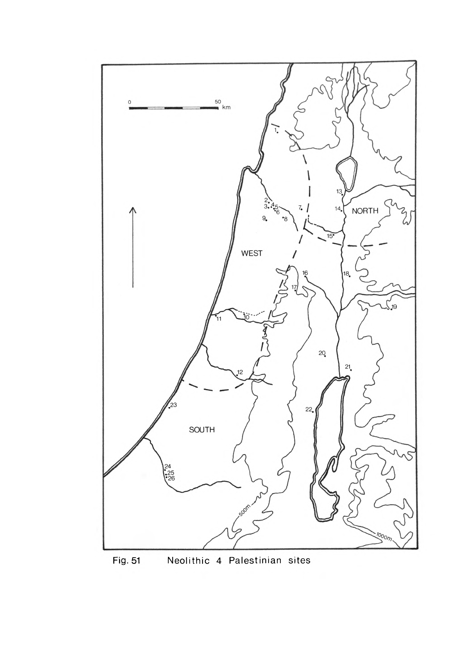
Fig.
51
Neolithic
4
Palestinian
sites
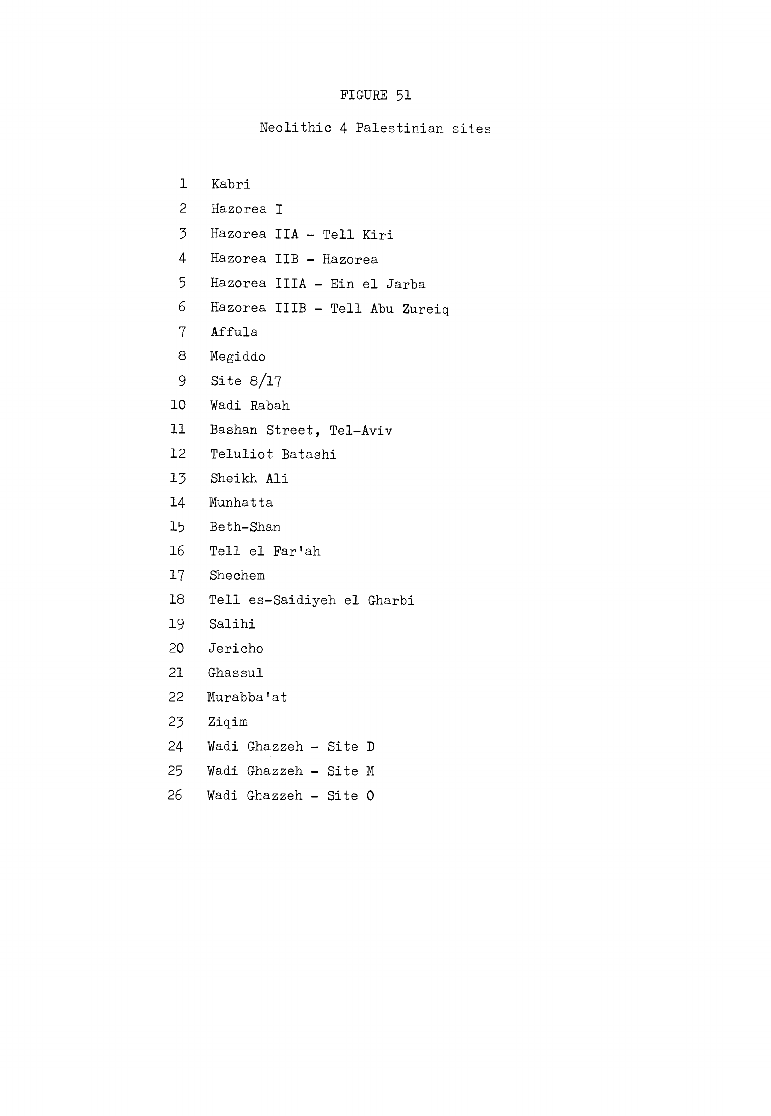
FIGURE
51
Neolithic
4
Palestinian
sites
1
Kabri
2
Hazorea
I
3
Hazorea
IIA
-
Tell
Kiri
4
Hazorea
IIB
-
Hazorea
5
Hazorea
IIIA
-
Bin
el
Jarba
6
Kazorea
IIIB
-
Tell
Abu Zureiq
7
Affula
8
Megiddo
9
Site
8/17
10
¥adi
Rabah
11
Bashan
Street,
Tel-Aviv
12
Teluliot
Batashi
13
Sheikh
Ali
14
Munhatta
15
Beth-Shan
16
Tell
el
Far'ah
17
Shechem
18
Tell
es-Saidiyeh
el
Gharbi
19
Salihi
20
Jericho
21
Ghassul
22
Murabba'at
23
Ziqim
24
Wadi
Ghazzeh
-
Site D
25
Wadi
Ghazzeh
-
Site
M
26
Wadi
Ghazzeh
-
Site
0
at
Jericho Pottery Neolithic
B
(1970,
63).
This
settlement
covered
the
whole
mound
and
so
was
as
extensive
as
that
of
Pottery
Neolithic
A.
The
first
structures
built
in
this
stage
were
circular
semi-subterranean
huts
set
in
pits like those
used
in
Pottery
Neolithic
A.
Their
walls
were made
of
plano-
convex
or
bun-shaped
bricks.
Later,
curved
walls
of
bun
bricks
with
stone
foundations
were
built
on
the
surface.
These
structures
may
have
been
circular
huts.
Other
rectilinear
buildings
with
the
same
walling
were
con-
structed
which
may
also
have
been
houses.
In
one
building
phase
there was
a
substantial
enclosure
wall.
Towards
the
end
of
Pottery
Neolithic
B
more
solid
rectilinear
structures
were
built
(Kenyon,
1970,
65).
The
coarse
pottery
of
this
stage
was
quite
similar
in
shape
to
that
of
Pottery
Neolithic
A
though
not
quite
so
crude.
The
fine
ware
was
much
better
made
since
the
clay
was
tempered
with sand
and
grit
but
less
straw
and
the
vessels
were
thinner
walled.
These
pots
were
hand-made but
many were
finished
by
turning
on
a mat.
The
common
shapes
were
hole-mouth
jars,
jars
wi.th
everted
rims
or
splayed
necks
and
bow
rim
jars
(Fig. 52).
Some
had
knob or
ledge
handles,
others
strap
handles
with
splayed
attachments.
There
were
some
simple
globular
bowls,
others
with
splayed
sides
and
some
carinated
ones.
Small
cups
were
also
made.
These
vessels
were
frequently
decorated
with
a
red
wash
or
slip
which
was
sometimes
carried
over
the
rim;
other
vessels
were
just
painted
at
the
rim.
Some
vessels
also
had
a
little
incised
decoration,
the
most
common
design
being
a
band
of
herringbones
just
below
the
rim.
Many
Pottery
Neo-
lithic
B
vessels
were
burnished
all
over
and
a
few
were
pattern burnished.
This
pottery developed
gradually
from
that
used
in
Pottery
Neolithic
A
while
the
dwellings
constructed
in
Pottery Neolithic
B
were
also
a
straightforward
development
of
those
made
in
the
previous
stage.
Pottery
Neolithic
B
thus
evolved
from
Pottery
Neolithic
A
without
a
break
(Moore,
1973,
57).
The
dwellings
used
at
Jericho
during
Pottery
Neolithic
B
were
Palestinian
in
type
without
parallels
on
South
Syrian
sites.
Only
when
rectilinear
houses
began
to
be
built
later
in
this
stage
did
the
appearance of
the
settlement
at
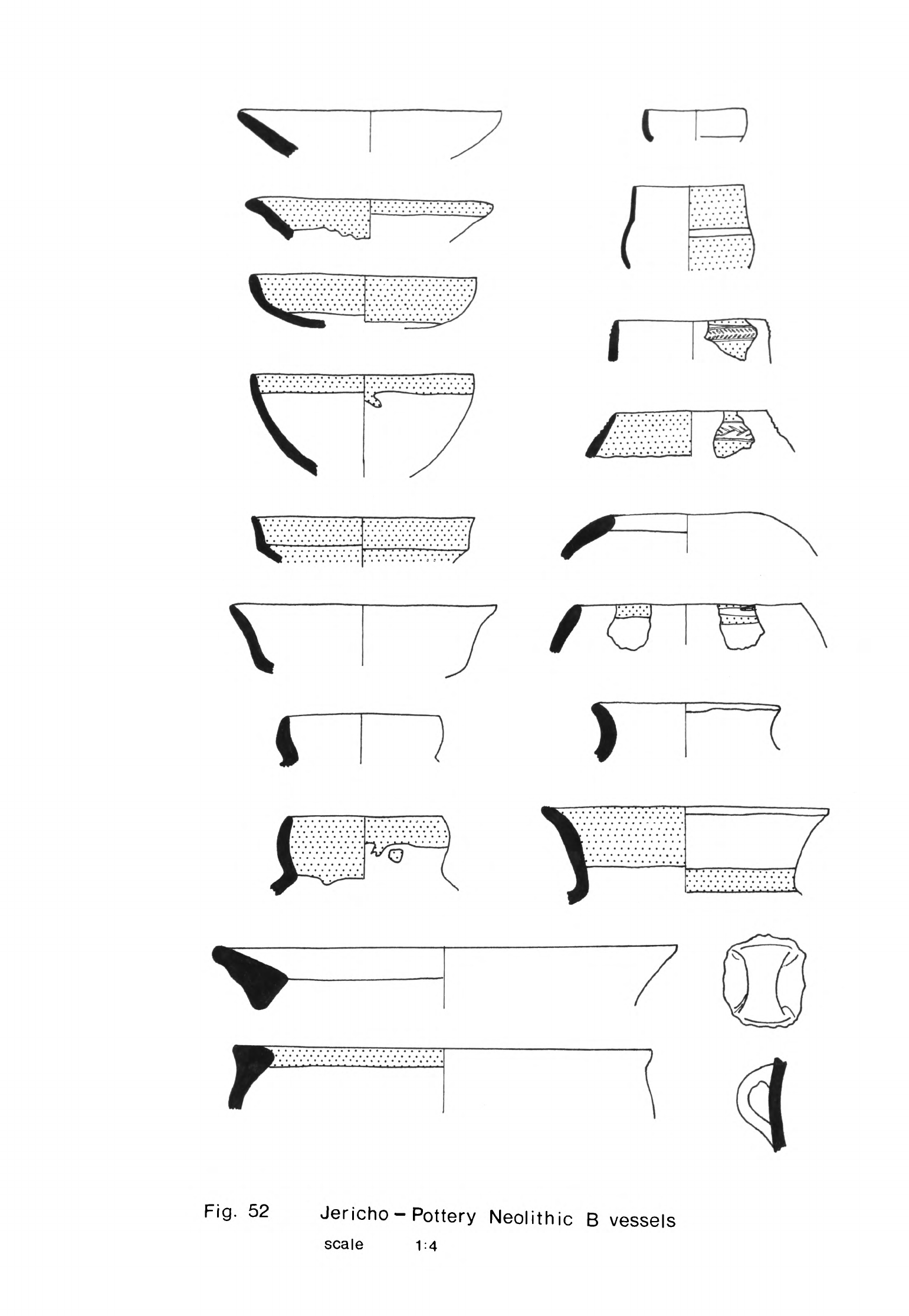
I
Fig.
52
Jericho-Pottery
Neolithic
B
vessels
scale
1:4
-
1*53
-
Jericho
resemble
that
of
sites
like
Byblos
or
Tell
Ard
Tlaili.
The
pottery,
however,
shared
certain
general
characteristics
with
sites
further north
throughout
this
stage.
There
were
the
same
vessel
shapes
as
at
Byblos
in
Ne*olithique
Moyen
and
Re*cent,
Tells
Ard
Tlaili,
Ain
Nfaikh and
Tell
ed-Jisr
while
the
use
of
red
colouring,
often
highly
burnished,
pattern
burnish
and
some
incised
decoration
is
also
typical
of
these
sites.
The
closest
parallels
are
with
the
Beka'a
and
Damascus
basin
sites
since
the
shapes of
Pottery
Neolithic
B
vessels
and
the
way
they
were
decorated
are
most
closely
matched
at
these
settlements. These
comparisons
confirm
that
Pottery
Neolithic
B
Jericho
was
occupied
in
Neolithic
h.
We
know
much
less
about
the
other
sites
in
this
South
Palestine
group
so
I
will
describe
them
briefly.
Some
Neolithic
h
pottery
and
flints
were
found
35
in
the
Murabba'at
cave in
a
wadi
between
Bethlehem
and
the
Dead
Sea.
This
cave
was
inhabited
in
both
Neolithic
h
and
the
Chalcolithic.
Among
the
Neo-
lithic
h
pots
were
several
globular
jars
with
hole-mouth
rims,
collared
or
splayed
necks
and
bow
rims
(Benoit
et
al.,
1961,
fig.
2:1,
3,
2U,
27,
31).
There
were
also
flat-based
bowls
with
flared
sides
and
a
carinated
bowl.
A
number
of
these
vessels
had
been
decorated
with
red
wash
or
slip
and incised
herringbone
designs.
Some
of
the
pots
were
burnished.
These
vessels
resemble
those found
at
Jericho
in
Pottery
Neolithic
B.
Similar
material
is
known
from
several
sites
in
the
southern
Jordan
valley.
A
little
pottery
like
that
from
Pottery Neolithic
B
Jericho
was
excavated
by
Hennessy
from
basal
layers
at
Ghassul
itself
(Moore,
1973,
67).
More was
found
at
Tell
es-Saidiyeh.
This
site
lies
2.5
km
west
of
Kureiyima
in
the
central
section
of
the
valley.
Neolithic
sherds
were
collected
in
the
vicinity
of
the
western
part
of
the
site,
Tell
es-Saidiyeh
el
Gharbi
(Glueck,
19^5~^9
9
293).
They were incised
with
herringbone
patterns
in
reserved
bands,
the
rest
of
the
sherds
being
painted
red
(Glueck,
19^5-^9,
59
1
*,
pi.
78:8,9).
These
sherds
are
also
similar
to
Pottery Neolithic
B
pots
from
Jericho indicating
that
the
site
was
occupied
during
Neolithic
k.
-
1*51*
-
Another
site
was
discovered
east
of
the
Jordan
valley
beside
the
old
road
from
Amman
to
Jerash
near
Salihi
(Kirkbride,
1959,
53).
Traces
of
an
occupation
layer
and
remains
of
house
walls
could
be
seen
in a
section
of
the
site
exposed
at
the
side
of
the
road.
Both
hand-made
sherds
and
flints
were
collected. Two
red
burnished
sherds
were
incised with reserved
chevrons
which
suggests that
the
site
may
have
been
inhabited
in
Neolithic
k.
Two
sites
north
of
Jericho
in
the
Judean
hills
have
yielded
material
similar
to
Pottery
Neolithic
B
Jericho.
One
is
Shechem
near
Nablus
where
there
was
a
Neolithic
deposit
at
the
bottom
of
the
site.
A
clay
lined
pit
ho
cm
deep
and
some
trodden
surfaces
were
excavated
here
(Toombs,
Wright,
1961,
36,
37).
Associated
with
these
features
were
much
charcoal,
animal
bones,
flints
and
pottery.
Many
of
the
pottery
jars
had bow
rims,
one
of
the
diag-
nostic
features
of
pots
of
this
phase.
The
other
site
is
Tell
el
Far'ah
a
little
further
north
which
was
first
occupied
in
Neolithic
2.
Neolithic
h
flints
and
pottery
were
found
here
with
pit
dwellings,
trodden
surfaces
and
hearths
(de
Vaux,
Ste"ve,
19^7»
397).
"3f^
Among
the
pots
were
a
number
of
hole-mouth
and
other
jars
some
of
which
had
bow
rims.
Several
of
these
vessels
bore
lugs
or
strap
handles
with
splayed
attachments.
There
were
also
many
hemispherical
cups
and
bowls
and others
with
splayed
sides.
Most
of
the
vessels
were
relatively
well
fired
with
fabrics
tempered
with
grit
but
little
straw.
Many
had
been
painted
red
or
coated
in
red
slip
and
burnished.
The
other
sites
in
the
South
Palestine
group
are
further
south.
One,
Ziciim,
is
8.5
km
south-west
of
Ashkelon
on
the
coast.
It
was
excavated
in
197^
when
remains
of
huts
and
pits
with
several
hearths
were
found
(Noy,
1976b,
1*9).
The
flints
associated
with
these
features
belonged
to
a
Late
Neolithic
assemblage.
The
potsherds
came
from globular
vessels
with
flat
bases
which
were
probably
jars
and
bowls.
These
had
knob
and
strap
handles.
The
vessels
were
decorated
with
red
wash
or
slip
and
burnished
which
suggests
that
the
site
was
occupied
in
Neolithic
U
rather
than
Neolithic
3.
Several
of
the
Wadi
Ghazzeh
sites
were
occupied
briefly
in
this
phase.
A
number
of
pits
-were
excavated
in
the
lower
levels of
sites
D,
M
and
0_
and
associated
with
these
were
Late
Neolithic
flints
and
pottery
(Macdonald
et
al.,
1932,
pis.
XVIII,
XX,
XXX).
There
was
some
coarse
pottery typical
of
this
phase
and
also
some
finer
vessels
painted
with
red
wash
and
burnished.
Among
these
vessels
were
globular
hole-mouth
jars
and
others
with
collar
necks.
These
had
knobs
or
strap
handles.
Bowls
with splayed
sides
and
other
more
rounded
ones
were
also
quite
common.
This
material
is
sufficiently
like that
from
Pottery
Neolithic
B
Jericho
to
indicate
that
these
sites
were
inhabited
in
Neolithic
h.
Their
main
phase of
occupation
was
in
the
Chalcolithic
from
which
most
of
the
other
material
found
on
them
was
derived.
North
Palestine
The
sites
in
the
North
Palestine
sub-group
are
situated
in
the
northern
Jordan
valley
and
valleys
to
the
west.
The
site
with
the
most
complete
record
is
Munhatta.
Munhatta
Level
2A
or
the
Wadi
Rabah phase
falls
within
Neolithic
h
(Perrot,
1968,
col.
U16).
In
this
level
rectangular
houses
with
two
or
three
small
rooms
were
built
for
the
first
time.
The
walls
were
set
on
stone
foundations and
the floors
were
of
trodden
earth
laid
on
beds
of
stones.
The
pottery
of
this
phase was
also
different
from
that
of
level
2B.
The
pots
were
made
from
a
clay
tempered
with
grits
and
almost
no
straw,
much
less
than
on the
southern
sites,
and
were
quite
hard
fired
to
a
buff
or
grey
colour.
The
vessels
had
thin
walls
with
the
exception
of
some
of
the
coarse
ware.
The
principal
kinds
of
pots
were
jars,
bowls
and
cups
(Perrot,
1968,
fig.
8U6).
Some
of
the
jars
were
globular,
others
quite
deep
with
curved
sides.
These
jars
had
simple
hole
mouths,
collared
necks,
or
flared
or
bow
rims.
Some
of
the
bowls
were
quite
deep
with
hole
mouths
while
others
were
carinated.
A
few
stood
on
pedestal
bases,
a
feature
found
on
some
other
Neolithic
h
sites,
-
1*56
-
but
most
had
flat
bases.
The
cups
were
deep
with
straight
sides.
Some
of
the
jars
had
lugs,
ledge
or
strap
handles.
Many of
these
vessels
were
coloured
red,
orange,
brown
or
black
and then
burnished,
often
to
a
high
polish.
The
darker
highly
polished
vessels
were
more
common
here
than
on
sites
further
south.
A
few
pots
were
painted
with
linear
designs.
Others
were
decorated
with
incised
patterns
of
criss-cross
lines,
chevrons
and
groups
of
stab
marks.
This
type
of
decoration
was
also
more
common
here
than
on
sites
in
southern
Palestine.
Some
pots
even
had
applied
designs
of
coiled
snakes
or
human
figures,
a
feature
found
on
pottery
of
several
sites
in
western
Palestine
but
not
in
the
south.
Sheikh
All
The two
upper
levels
at
Sheikh
Ali
were
called
strata
I
and
II,
stratum
I
being
subdivided
into
three
phases,
a,
b
and
c
(Prausnitz,
19TOa, 98).
Strata
Ib,
Ic
and
II
were
inhabited
in
this
stage.
The
buildings
in
these
strata
were
rectilinear
with
several
rooms
and
their walls
had
stone
founda-
tions
(Prausnitz,
19TOa,
100).
The
floors
of
the
rooms
were
made
of
crushed
chalk
while
the
yards
outside
were
roughly
paved.
In
these
open
spaces
between
the
buildings
were
small
pits,
some
of
which
were
lined
with
stones
like
those
in
the
Ne*olithique
Re"cent
settlement
at
Byblos.
Associated
with
these
buildings
were
a
flint
assemblage
and
potsherds
characteristic of
other
Neolithic
h
Palestinian
sites.
The
pots
consisted
of
globular
jars,
small
bowls
and
cups
(Prausnitz,
1957»
252).
These
were
coloured
red,
brown
or
black
and
often
burnished,
sometimes
to
a
lustrous
finish.
Some
vessels
were
decorated
with
incised
designs
usually
combined
with
painted
and
burnished
bands
(Prausnitz,
1960,
120).
These
incised
patterns
consisted
of
both
stab
marks
and
combing.
The
pottery
was
similar
in
shape
and
finish
to
that
from
Munhatta
2A.
The
la
phase
of
occupation
at
Sheikh
Ali
falls
within
the
Chalcolithic
since
both
the
pottery
and
flints
are
more
like
those
of
Ghassul
than
Neolithic
h
sites.
Some
evidence
of
Neolithic
k
occupation
was
found
at
Beth-Shan.
Bun
brick
structures
were
excavated
in
level
XVIII
above
the
basal layer
with
pits.
Red
painted
pottery
and
strap
handles
with
splayed
attachments
were
found
in
both
levels
and
some
ledge
handles
with
finger
impressed
edges
known
also
from
Munhatta
2A
and
Pottery
Neolithic
B
Jericho
(Fitzgerald,
1935,
7,
8,
pi.
II:
5,
8,
16,
21, 23,
2*0.
The
other
material
from
level
XVIII
was
Chalcolithic
(Moore,
1973,
66).
West
Palestine
The
Neolithic
k
sites
in
western
Palestine
are
situated
in
the
central
coastal
plain, Mount Carmel,
the
Plain
of
Esdraelon
and
the
Galilee
hills.
Wadi
Rabah
The
latest
structure
here,
building
A,
was
Chalcolithic
but
below
that
were
two
more
structures,
B
and
C,
occupied
in
Neolithic
h
(Kaplan,
1958b,
153).
Both
were rectilinear with
stone
foundations
and
B
was
probably
a
room
of
a
house.
Flints,
pottery
and
a
few
other
artifacts.were
found
in
and
around
these
buildings.
The
flints
were
similar
to
those
from
Jericho
and
other
sites.
The
pottery
consisted
of
jars,
bowls
and
cups
made
of
clay
tempered
with
sand,
grit
and
occasionally
straw.
These
were
fired
to
a
brown
or
buff
colour
while
a
few
were
pink.
Some
of
the
jars
were
globular
and
had
hole
mouths or
thickened
rims
while
many
others
had
bow
rims
(Kaplan,
1958b,
15*0
>
They
were
usually
made
with
strap handles
with
splayed
attachments,
knobs,
lugs
or ledge
handles.
Many of
the
bowls
were
carinated
or
had
splayed
sides
and
a
few
had
pedestal
bases.
These
vessels
were
often
painted
red around
the
rim
or
all
over.
Some
vessels
were
coloured
brown
or
black.
Many
were
burnished,
often
to
a
high
gloss.
This
kind
of
decoration
was
more
common
at
Wadi
Rabah
and
on
other
West
Palestine
sites
than
elsewhere.
Some
other
pots
at
Wadi
Rabah
were
incised
with
stab
marks,
criss-cross
lines,
herringbones
and
wavy
lines.
-
1*58
-
Teluliot
Batashi
Batashi
like
Wadi
Rabah
was
first
settled
in
Neolithic
3
"but
was
also
inhabited
in
Neolithic
h
and
during
the
Chalcolithic.
Level
III
was
stratified
under
the
Chalcolithic
settlement
and
above
level
IV
which
had
been
inhabited
during
Neolithic
3.
The
material from
this
level
was
typical
of
Neolithic
k
(Kaplan,
1958c,
83*).
The
pottery
from
level
III
closely
resembled
that
from
Wadi
Rabah.
There
were
the
same
hole-mouth
and
bow
rim
jars,
bowls
with
flared
sides
and
carinated
bowls.
Many were
coloured
red,
brown
or
black
and
burnished,
some
to
a
high
lustre.
There
was
a
similar
range
of
incised decoration
comprising
wavy
lines,
combing,
stab
marks,
herringbones
and
zig-zags.
This
combination
of
traits,
so
similar
to
Wadi
Rabah,
links
Batashi
with
other
sites
in
western
Palestine.
Bashan
Street,
Tel-Aviv
When
the
Bashan
Street
site
was
excavated
several
pits
were
discovered
(Kaplan,
1959a,
n.
5)
in
one
of
which
was
a
burial.
A
clay
figurine was
found
in
the
excavations
(Kaplan,
1959b,
pi.
I)
which
bore
some
resemblance
to
others
found
in
Tell
Ramad
III,
Munhatta
2B,
Shaar
Hagolan
and
Kfar
Giladi
in
Neo-
lithic
3.
The
pottery
from
the
site
on
display
in
the
Jaffa
Museum
includes
sherds
which were
painted
red and
burnished
as
well
as
other
incised
sherds.
The
pottery
is
like
much
of
that
from Wadi
Rabah
so
it
is
probable
that
the
site
was
occupied
in
Neolithic
h.
Site
8/17
Flints
and
pottery similar
to
material
from
other
western
Palestine
sites
have
been
found
at
site
8/17
near
Gal-Ed
in
the hills
west
of
Megiddo
(Meyer,
1970,
21).
The
pottery consisted
of
hole-mouth
jars
and others
with
splayed
sides
and
thickened
rims
(Meyer,
1970,
fig.
7).
There
were
also
jars
with
splayed
necks
or
bow
rims.
The
other
vessels
were carinated
bowls
and
bowls
with
gently
curved
sides.
Some
of
the
vessels
were
coloured
red
or
black
and
burnished.
Incised
decoration
was
also
common
and
consisted
of
stab
marks,
wavy
lines,
herringbones
and
rocker
patterns.
Hazorea
Five
Neolithic
h
sites
have
been
found
spaced
at
intervals
along
a
terrace
below
Mount
Carmel
near
Hazorea.
They
are
Site
I,
HA
or
Tell
Kiri,
HE
or
Hazorea,
IIIA
or
Ein
el
Jarba
and
HIE
or
Tell
Abu
Zureiq
(Kaplan,
1969,
fig.
1)
The
terrace
overlooks
the
Plain
of
Esdraelon
and
is
cut
by
several
streams.
There
is
also
a
line
of
springs
at
its
foot
so
since
the
soil
is
fertile
the
place
was
most
favourable
for
farming
settlements.
These
sites
were
occupied
in
Neolithic
k
but
probably
not
at
exactly
the
same
time
since
they
are
so
close
together
(Moore,
1973,
61).
Several
were
also
inhabited
in
later
periods.
Their
material
remains,
known
through
surface
collection
and excavation,
are
similar
to
those
from
other
sites
in
western
Palestine
with
the
exception
of
certain
local
idiosyncracies
in
the
pottery.
These
probably
reflect
the
geographical
separation
of
these
sites
from
those
on
the
coastal
plain
(Moore,
1973»
62).
Tell
Kiri
was
sounded
by
Perrot
while
he
and
Anati
have
excavated
Tell
Abu
Zureiq,
(Perrot,
1963,
559;
Anati,
1972,
1^9).
Both
found
a
range
of
painted,
burnished
and
incised
pottery
quite
similar
to
that
from
Wadi
Rabah
and
Batashi
as
well
as
typical
Neolithic
k
assemblages
of
flint
tools.
Anati
!
s
collection
of
pottery
was
unusually
varied
in
decoration although
the
shapes
of
the
vessels
were
similar
to
those
found
on
other
sites.
This
was
partly
because
he
found
much
more
material
than
excavators
of other
sites
in
western
Palestine.
Three
pieces of
obsidian
have
been
analysed
from
one
of
the
Hazorea
sites.
One
piece
came
from
Ciftlik
(2b)
and
the
other
two
from Nemrut
Dag
(Uc)
and
source
1g
in
eastern
Turkey
(Wright,
Gordus,
1969,
81).
The
material
from
the
earliest
phase
of
Ein
el
Jarba,
phase
IV,
resembled
that
of
the
other
Neolithic
k
sites
at
Hazorea
and
elsewhere
in
western
Palestine.
The
later
phases
of
occupation
fell
within
the Chalcolithic.
The
only
building
remains
found
in
phase
IV
were
several
straight
stone
walls
-
U60
-
(Kaplan,
1969,
5).
These
had
probably
belonged
to
rectangular
houses
of
the
type
found
in
phases
II
and
III
which
had
been
destroyed
when
these
later
structures
were
built.
There
were
also
traces
of
a
plaster
floor,
a
hearth
and
seven small
pits
dug
into
the
subsoil.
Most
of
the
finds
from
Ein
el
Jarba
were
more
typical
of
the
Chalcolithic
in
Palestine
than
Neolithic
h
although
the
flints
also
resembled
those
of
Ne"olithique
Recent
Byblos
and
some
of
the
pottery
was
characteristic of
a
late
stage of
Neolithic
k.
Several
of
the
jars
had
bow
rims
or
flared
necks
while
a
number
of the
bowls
were
carinated;
there
were
also
several
dishes
with
flared
sides (Kaplan,
1969,
figs.
U:
1-U,
10, 11,
13,
1
1
*;
5:5,
6:7).
These
vessels
were
decorated
with
red
paint
or
wash
which
was
often
burnished.
Some
of
the
small
bowls
and
other
vessels
were
coloured
black
or
brown
and
burnished
to a
high
polish.
Incised
decoration
was
also
common.
The
motifs
included
combing,
wavy
lines,
herringbones,
nail
impressions
and
stab
marks
(Kaplan,
1969,
fig.
8).
All
these
features
were
characteristic
of
pottery
from
other
Neolithic
U
sites
in
western
Palestine.
Several
pots
had
applied
designs
while
one
in
particular
was
decorated
with
two
anthropomorphic
figures
(Kaplan,
1969,
fig.
7:1).
Two
samples,
one
of
charcoal
and
the
other
of
bone,
have
been
dated
by
carbon
1U.
The
result
of
the
charcoal
determination
was
37^-0
±
11*0
B.C.
and
the
bone
one
2970
±
2^0
B.C.
(Kaplan,
1969,
27).
The
bone
determination
was
obtained
from
a
very
small amount
of
collagen
which
may
account
for
the
date
being
so
recent.
The
charcoal
date
would
fit
the
context
very
well,
reinforcing
the
evidence
from
the
material
remains
that
the
site
was
occupied
late
in
Neolithic
U.
Some
Neolithic
k
pottery
was
found
in
Stratum
XX
at
Megiddo
mixed
with
Neolithic
3
and
Chalcolithic
material.
The
succeeding
phase
Stratum
XIX
contained
much
Chalcolithic
pottery
and
flints.
Among
the
Neolithic
U
pots
were
bowls
with
splayed
sides,
hemispherical
bowls
and
others
with
a
carination
as
well
as
some
dishes.
These
had
been
painted
red and
some
also
carried
-
1*61
-
incised
decoration.
Several
had
been
burnished
to
a
high
lustre
like
the
pottery
from
Wadi
Rabah
and
other
western
sites
(Moore,
1973,
62).
One
other
site
in
the
Plain
of
Esdraelon,
Affula,
was
probably
first
settled
towards
the
end
of
Neolithic
k
since
denticulated
segmented
sickle
blades
were
found
in
the
deposits
(Payne,
19^8b,
72).
There
was
also
a
tanged
and
winged
arrowhead
(Payne,
19^8b,
73)
but
this
may
be
a
stray
find
dating
from
an
earlier
period
since
it
has
relatively
little
retouch
and
resembles
Neolithic
2
types.
These
flints
were
found
in
levels
that
other-
wise
contained
Chalcolithic
and
Bronze
Age
pottery
(Sukenik,
19^8,
16,
17)
though
it
is
possible
that
some
of
the
pottery
thought
to
have
been
Chalco-
lithic
was
in
fact
Neolithic
k
in
type.
However
that
may
be, the
site
would
appear
to
have
been
first
occupied
at
the
end
of
Neolithic
h
and
then
in
the
Chalcolithic.
The
settlement
of
layer
II
at
Kabri
in
western
Galilee
was
also
occupied
in
Neolithic
k.
This
layer
was
stratified
above
layer
III
inhabited
in
Neolithic
3
and
below
the
Chalcolithic
layer
I
(Prausnitz,
1:969,
137)-
Remains
of
rectilinear
walls
and
floors
of
buildings
were
found
in
layer
II.
Several
burials were
associated
with
the
buildings.
The
flints
included
denticulated,
segmented
sickle
blades
and
trapezoidal
axes
and
adzes,
types
found
in
Neolithic
k
sites
in
Palestine
and
in
the
South Syrian
group.
There
was
also
a
little
pottery
in
layer
III.
One
other
find
of
interested
should
be mentioned,
a
unique
stone
jar
with
a
bow
rim.
This
was
among
the
group
of
fine
obsidian
and
stone
objects
found
during
agricultural
work
which
led
to
the
discovery
of
the
site. It
was
thought
to
have
come
from
the
surface
Chalcolithic
layer
but
its
shape
is
most
like
many pottery
jars
found
on
Neolithic
h
sites
in
Palestine.
Kabri
is
one
of
the most
northerly
of
Palestinian
Neolithic
h
sites.
The
material from
it
while
resembling
that
of
other
Palestinian
sites
may
also
be
compared
to
that
of
Neolithic
k
sites
in
southern
Lebanon
which
I
have
placed
in
the
South
Syrian
group.
The
country
to
the
south
of
the
site
opens
-
U62
-
out
towards
the
Acre
plain
and
the
Plain
of
Esdraelon
while
to
the
north
and
east
are
broken
hills.
Geographically
Kabri
has
better
communications
with
sites
further
south and
south-east
which
is
why
I
prefer
to
place
it
within
the
West Palestine
group
of
sites.
I
have
now
concluded
my
description
of
Neolithic
h
sites
in
Palestine.
As
I
mentioned
in
the
last
chapter
there
is
a
series
of
other
sites
in
Palestine
that
we
know
were
occupied
during
the
Late
Neolithic
but
which
cannot
with
certainty
be
ascribed
to
either
Neolithic
3
or
U
(Fig.
53).
I
wish
now
to
briefly
describe
the
location
of these
sites
and
their
material
remains
since
they
augment
our
knowledge
of
the distribution
of
each
type
of
site
in
the
6th
and
5th
millennia.
Abu
Usba
is
a
cave
high
up
in
the
south
side
of
the
Wadi
Fallah
not
far
from
the
site
of
Nahal
Oren.
Two
of
the
upper
layers
here,
B1
and
B2,
con-
tained
material
from
several
periods.
Lunates
with
Helwan
retouch,
segmented
denticulated
arrowheads,
tanged
arrowheads
and
Neolithic
pottery
were
all
mixed
together.
Stekelis
who
excavated
the
site
thought
that
the
material
was
associated
and
called
this
heterogeneous
culture
"Usbian"
(Stekelis,
Haas,
1952,
18).
Albright
who
added
his
comments
to
the
original
report
pointed
out
that
the layers
must
have
been
mixed
and
that
the
cave
had
been
occupied
in
several
periods.
Some
of
the
sickle
blades
and
pottery,
particularly
some
of
the sherds
with
red
wash
and
incised
decoration,
are
Late
Neolithic
but
we
do
not
know
in
which
stage
the site
was
inhabited.
Rakafet
cave
on
the
other
side
of
Mount
Carmel
from
Abu
Usba
was
also
occupied
during
the
late
Neolithic
(Noy,
Higgs,
1971,
226)
though
we
do
not
yet
know
when.
Sahl
el
Khoussin
is
west
of
the
road
to
Jenin
opposite
Samaria
(Neuville,
1929,
120).
A
collection
of
flints
was
made
from
this
site
which
included
axes
and
adzes,
some
of
them
with
polished
edges,
picks,
flake
scrapers,
borers
and
segmented
sickle blades.
From
the
sickle
blades
and
adzes
I
have seen
in
the
Hebrew
University
in
Jerusalem
where
part
of the
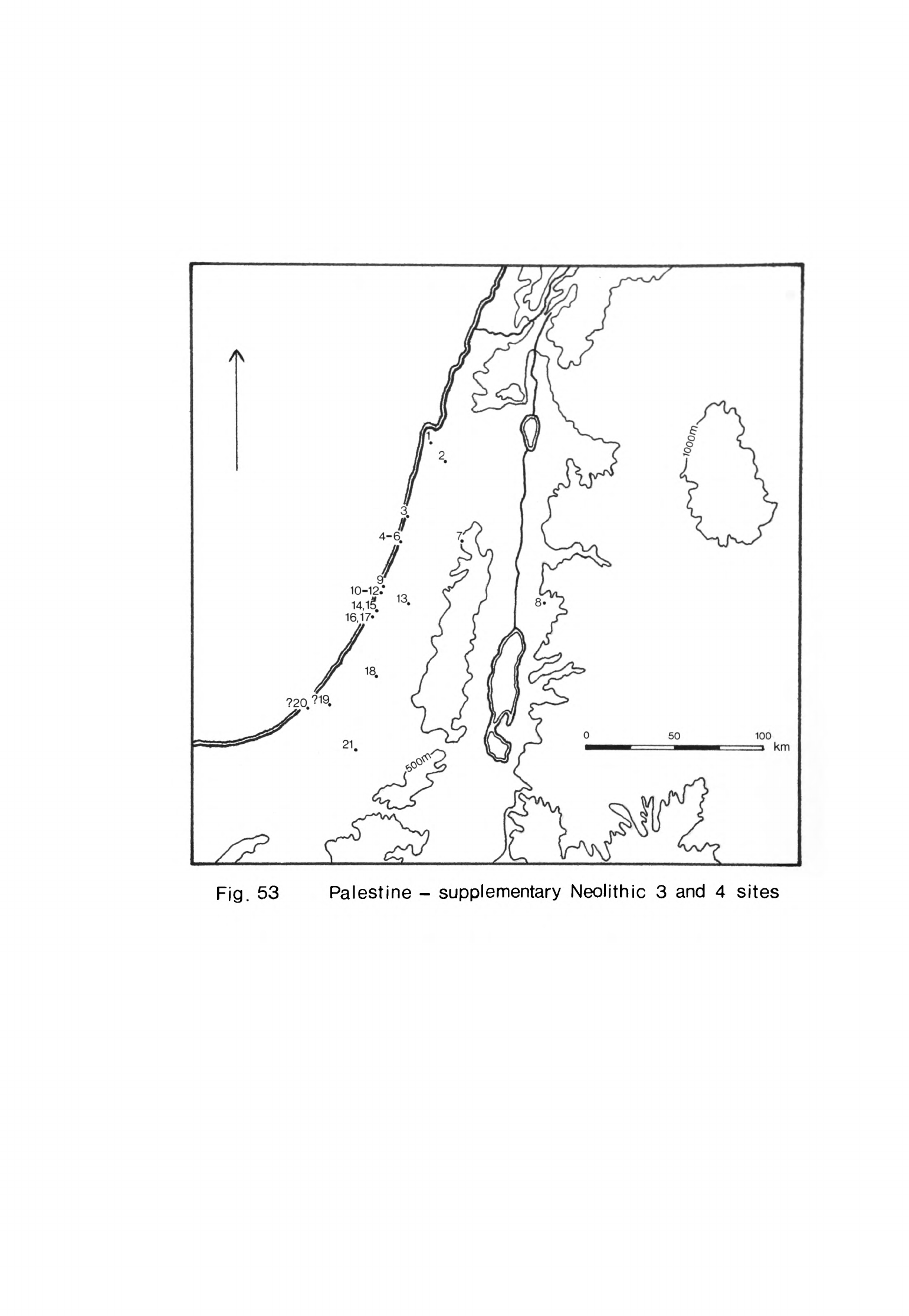
?20
.
Fig.
53
Palestine
-
supplementary
Neolithic
3
and
4
sites
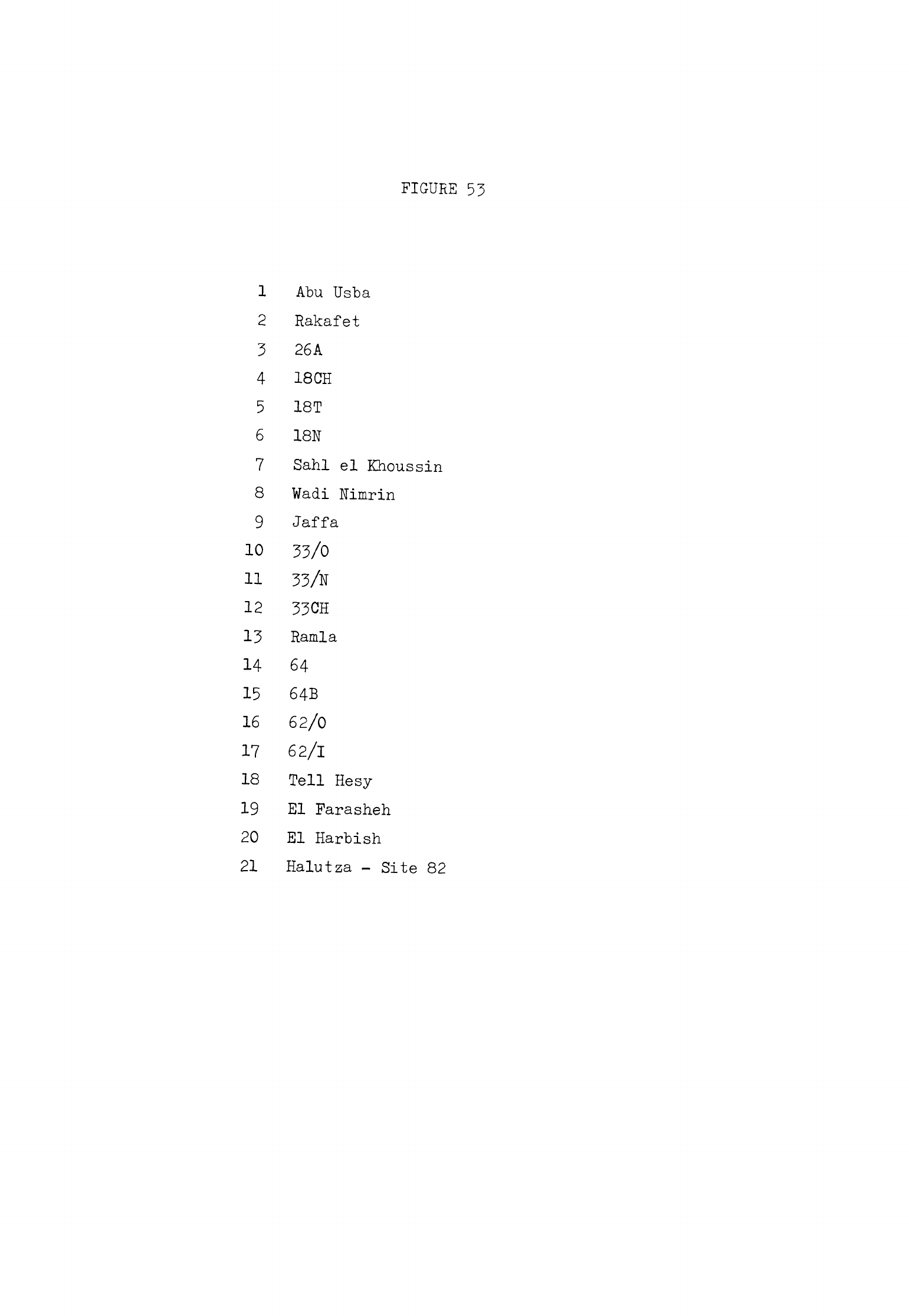
FIGURE
53
1
Abu
Usba
2
Rakafet
3
26A
4
18 CH
5
1ST
6
18N
7
Sahl
el
Khoussin
8
Wadi
Nimrin
9
Jaffa
10 33/0
11
33/N
12
33CH
13
Ramla
14
64
15
64B
16
62/0
17
62/1
18
Tell
Hesy
19
El
Farasheh
20
El
Harbish
21
Halutza
-
Site
82
-
U63
-
collection
is
deposited
it
is
clear
that
the
site was
occupied
in
the
Late
Neolithic
but
in
the
absence of
pottery
one
cannot
say
during
which
stage.
Neuville
likened
some
of
the
material
to
the
Campignian
which
suggests
that
the
site
was
similar
to
many
of
the
surface
stations
in
southern
Lebanon.
The
wide
range
of
tools
found
suggest
that
this
was
a
settlement
like
Tahun
ben
Aissa
and
Amiq.
I
rather
than
simply
a
factory
site.
Neuville
noted
another
site
in
the
Wadi
Nimrin
in
the
hills
east
of
the
Jordan
valley
on
the
road
to
Amman
(1929,
119).
A
collection
of flints
from
here
included
small
tanged
arrowheads
like
those
from
et-Tauamin,
a
site
which
I
have
ascribed
to
Neolithic
3.
Wadi
Nimrin
may
have
been occupied
in
Neo-
lithic
3
also
or
possibly
in
Neolithic
h.
Many
Late
Neolithic
surface
sites
have
been
discovered
on
or
near
the
coast
of Palestine.
Mallon
reported
that
he
found
many
flints
over
a
consider-
able
area
extending
12
km
north
along
the coast
from
Jaffa
(1925,
201).
His
collection
included
flint tools
made
in
several
periods
which
must
have
come
from
a
number
of
stations
given
the
extent
of
the
survey.
He
found
some
denticulated,
segmented
sickle
blades
as
well
as
tanged
arrowheads
and
axes
and
adzes
with
polished
cutting
edges,
some
of
which
were
probably
Late
Neolithic
also.
Neuville
surveyed
north
of
Jaffa
and
as
far
as
10
km
south
of
the
town
(1929»
116).
He
found
more
flint
artifacts
of
several
periods
some
of
which
were
Late
Neolithic.
The
most
diagnostic
tools
were
denticulated,
segmented
sickle
blades
but
he,
like
Mallon,
also
collected
axes
and
chisels,
some
with
polished
cutting
edges,
picks
and
small
tanged
arrowheads
many
of
which
were
probably
made
in
the
Late
Neolithic.
Mallon
collected
more
flints
from
another
large
surface
scatter
h
km
south of
Kamia
(1925,
200).
Once
again
he
found
flints
of
different
periods
which
probably
came
from
several
locations.
Among
them
were
segmented,
denticulated
sickle
blades
of
Late
Neolithic
type.
Burian
and
Friedmann
have
found numerous
Late
Neolithic
surface
stations
in
the
coastal
dunes
between
Hadera
and Ashdod.
They
collected
small
pressure-
flaked
tanged
and
winged
arrowheads
of
Late
Neolithic
type
from
site
26A
just
north
of
the
Nahal
Alexander
(1963-6U,
6),
a
station
which
had
been used
in
Neolithic
2.
Site
18CH
just
north
of
the
Nahal
Poleg
near
its
mouth
yielded
denticulated,
segmented
sickle
blades
as
did
1ST
immediately
to
the
south-west
beside
the
river
(1963-6U,
13,
15).
More
denticulated,
segmented
sickle
blades
and
small
tanged
and
winged
arrowheads
were
collected
at
18N
on
the
south
bank
of
the
river
at
its
mouth
(1963-6*+,
1U).
Burian
and
Friedmann
located
three more
Late
Neolithic
stations
between
Rishon
le
Zion
and
the
sea
in
an
area
which
may
overlap
with
Neuville's
Jaffa
explorations.
Denticulated,
segmented
sickle
blades
and
small
tanged
and
winged
arrowheads
were
collected
from
33/0
near
the
sea
and
similar
tools
from
33/N
further
east
(1963-6U,
17, 18).
More
tools
of
the
same
kind
were
found
at
33CH
immediately
south-west
of
33/0
(1963-6**,
19).
Fout
more
stations
were
discovered
between
the
Nahal
Sorek
and
Nahal
Lachish.
They
were
from
north
to
south
6*1,
6*+B,
62/0
and
62/1
(Burian,
Friedmann,
1963-6*1,
27,
29,
30,
31).
Denticulated,
segmented
sickle
blades
were
found
on
all
of
them
and
sherds
of
coarse
pottery
at
6U
and
6*+B.
Several
trapezoidal
flint
axes
were
picked
up
at
62/0.
This
site,
62/1
and
6U
had
previously
been
inhabited
in
Neolithic
2.
Four
other
sites
in
southern
Palestine
were
probably occupied
during
the
Late
Neolithic.
Tell
Hesy
is
one,
the
evidence
for
which
being
some
segmented,
37
coarsely
denticulated
sickle
blades
which
Bliss
found
when
he
excavated
at
the
site
(189*+,
12*+).
Another
is
El
Farasheh
on
the
south
bank
of the
Wadi
Ghazzeh,
the
exact
location
of
which
is
no
longer
known.
Stekelis
found
some
denticulated,
segmented
sickle
blades
and
small
flake
awls
here
in
19*+3
which
were
deposited
in
the
Palestine
Archaeological
Museum.
The
same
museum
holds
a
collection
of
flints
from
El
Harbish
which
was
probably
situated
near
Khan
Yunis. This
site
may
have
been
discovered
by
Harding
who
explored
the
region
before
and
during
the
Second
World
War.
Among
the flints
were denticulated,
segmented
sickle
blades,
tanged
arrowheads,
a
pick
and
some
flake
scrapers
-
1*65
-
that
were probably
made
in
the
Late
Neolithic.
Tanged
and
winged
arrowheads
of
Late
Neolithic
type
as
well
as
flints
of
other
periods
were
found
at
site
82
in
the
Halutza
dunes
(Burian,
Friedmann,
19T3j
28).
The
only
evidence
of
Late
Neolithic
activity
further
south
known
to
me
is
the
find
by
Rothenberg
of
a
single
characteristic
tanged
arrowhead
at
site
k6l
in
Sinai
(Moore,
1973,
Distribution
of
sites
Neolithic
k
sites
were
located
in
every
geographical
zone
except
the
high
mountains
from
the
Levant
coast
as
far
east
as
the edge
of
the
steppe
plateau,
that
is
up
to
1
10
km
inland. Thus
there
were
sites
all
along
the
coast
of
Lebanon
(Kubbah
I,
Byblos
,
Adlun
II)
and more
have
been
found
on
the
seaward
slopes
of
the
mountains
up
to
an
altitude
of
1000
m
(Kleat,
Mtaileb
I,
Muktara)
.
Almost
the
whole
length
of
the
Beka'a
was
occupied
from
Baalbek
to
the
headwaters
of
the
Jordan
(Tell
Ard
Tlaili
,
Tell
ed-Jisr,
Ard
Saouda,
Kfar
Giladi).
No
Neolithic
k
sites
are
known
in
the
Anti-Lebanon
but
two
in
the
Damascus
basin
were
inhabited
(Tell
al
Khazzami,
Tell
Ramad)
.
The
pattern
was
similar
in
Palestine
where
sites
have
been
discovered
all
along
the
coast
and
on
the
coastal
plain
(Kabri,
Wadi
Rabah,
Ziqim)
.
The
Plain
of
Esdraelon
was
settled
(Hazorea)
and
the
way
east
to
the
Jordan
valley
(Beth-Shan)
.
Several
Neolithic
k
sites
have
been
excavated
in
the
Judean
hills
(Tell
el
Far
'ah,
Shechem,
Murabba'at)
while
others
are
known along
the
Jordan valley
(
Sheikh
Ali,
Munhatta,
Tell
es-Saidiyeh
el
Gharbi
,
Jericho).
Only
one
site,
Salihi,
has
been
discovered
in
the
hills
east
of the
Jordan
valley
and
none
on
the
Trans
Jordan
plateau.
The
southern
limit
of
known
Neolithic
h
settlement
was
the
Wadi
Ghazzeh
(sites
D,
M,
0)
.
No
trace
of
settlement
or
camp
sites
has
been
found
in
Sinai
in
any
of
the
recent
surveys
which
have
been
carried
out
so
the
area
was
apparently
unoccupied
though
perhaps
occasionally
visited
in
Neolithic
U.
This
is
despite
the
fact
that
there
is
evidence
of
contact
between
Palestine
and
Egypt
in
this
stage
(Moore,
-
k66
-
1973,
57);
presumably
travellers
followed
the
coast
leaving
no
trace
of
their
journeys.
This
distribution
of
settlements
was
generally
similar
to
that
of
Neolithic
3.
The
only
difference
was the
greater
number
of
sites
situated
on
the
slopes
of
the
Mountains
of
Lebanon,
in
the
Galilee hills
and
the
Judean
uplands. Sites
in
the
Mountains
of
Lebanon
were
also
to
be
found
at a
higher
elevation
than
in
earlier
Neolithic
stages.
Other
sites
were
in
areas
of
fertile
land,
that
is
on
valley
terraces
or
plains,
and
usually
near
a
permanent
source
of
water
such
as
springs,
streams
or
rivers. The
catchments
of
these
sites
consisted
for
the
most
part
of
arable
land with
some
grazing
implying
that
agriculture
was
the
economic
basis
of
these
settlements.
They
needed
not
only
a
permanent
source
of
water
for
drinking
and
watering
flocks
but
also
adequate
rainfall
for
their
crops.
This
is
the
reason
for
the
confined
distribution
of
sites
in
this
period
and
the
abrupt
limit
of
settle-
ment
to
the
south
towards
Sinai
and
to
the
east
at
the
edge
of
the
Syrian
and
Transjordan
plateaux.
During
this
period
the
rainfall
decreased.
The
temperature
approached
its
postglacial
maximum
during
the 5th
and
kth
millennia
and may
have
been higher
than
it
is
today
toward
the
end
of
Neolithic
h.
Thus
the
amount
of
effective
moisture
available
was
also
reduced.
The
effect
of
these
two
factors,
the
drop
in
rainfall
and
rise
in
temperature
with
its
consequences,
was
that
Sinai
and
the
plateaux
to
the
east
were
even
drier
than
they
had
been
in
Neolithic
3.
The
forest
zones
shrank
still
more
because
of
the
reduction
in
rainfall
and
man's
activities
so
that
Sinai
and
the
inland
plateaux
were
now
open
steppe.
Rainfall
was
still
sufficient
to
support
agricultural
settlements
in
and
near
the
coastal
hills
and
mountains
but
not
beyond.
Settlement
types
were
almost
the
same
in
Neolithic
U
as
in
Neolithic
3.
Most
sites
were
hamlets
or
villages
with
houses,
other
structures
and
a
full
artifact
inventory. The
Palestinian
villages
came
to
resemble
their
counter-
parts
further
north
during
Neolithic
h
since
rectangular
houses were
adopted
-
1*67
-
as
the
usual
form
of
dwelling.
Traces
of dwellings
have been
found
at
Shechem
and
Tell
el
Far'ah
but
the
sites
in
the
hills
and
on
the
slopes
of
the
mountains
seem
to
have
been
less
substantial
than
those
on
the plains
and
in
the
valleys.
Nevertheless,
the
range
of
material
found
at
Muktara,
Kfar
Giladi
and
Khaliet
el
Khazen
III
and
IV
was
sufficiently
varied
to
suggest
that
these
sites
had
been
inhabited
as
settlements
even
if for
relatively
short
periods.
These
small
upland
settlements
and
some
on
lower ground
were
near
Heavy
Neolithic
stations such
as
Karaoun
II,
Douwara
and
Wadi
Farah.
The
Heavy
Neolithic
sites
were
factory
stations
at
which
flint
artifacts,
particularly
axes,
adzes,
picks
and
other
bulky
tools,
were
roughed
out.
They
were
probably
complementary
sites
to
the
settlements
in
the
hills
while
their
products
occasionally
found
their
way
to
other
settlements
on
the
plains
(Cauvin,
Cauvin,
1968,
110).
These
Heavy
Neolithic
factory
stations
were
a
Neolithic
k
pheno-
menon
since
factory
sites
of
any
kind
in
the
hill
country
were
rare
in
earlier
stages.
Nearly
all
Neolithic
U
settlements
were
open
sites.
The
few
inhabited
caves
such
as
Adlun
II,
Jiita
I
and
Murabba'at
were
as
exceptional
as
those
occupied
in
Neolithic
3.
Hunting
stations
were
equally
rare;
the
only
group
of
these
were
those
surface
sites
along
the
coast
of
Palestine
which
may
have
been inhabited
in
this
stage.
There
is
very
little
accurate
information
about
the
size
of
Neolithic
k
sites.
Some
of
the
smaller
settlements
and
many
of
the
surface stations
probably
ranged
from
several
hundred
to
several
thousand
square metres
in
area.
Tell
Arslan
was
about
1
ha
while
Byblos
covered
1.5
ha
for
much
of
Neolithic
U.
Tell
al
Khazzami
was
of
similar
size
extending
over
1.76
ha.
Wadi
Rabah
was
larger
than
these
sites
since
it
covered
about
2.^3
ha
(Kaplan,
1958b,
151)
but
we
do
not
know
if
the
whole area
was
occupied
in
Neolithic
h.
Jericho
was
much
bigger
again
since
it
spread
over
k
ha;
it
is
the
only
known
Neo-
lithic
U
site
that
was
large
enough
to
be
called
a
town.
No
other
very
large
-
1*68
-
sites
have been
discovered though
there
may
be
a
few
hidden
at
the
heart
of
some
of
the
great
tells.
It
would
seem
that
there
was
a
little
less
variation
in
the
size
of
Neolithic
k
settlements
than
in
Neolithic
3
and
much
less
than
in
Neolithic
2
though
this
can
only
be
a
provisional conclusion
until
we
have
further
evidence.
Was
the
population of
the
central
and
southern
Levant
the
same
in
Neolithic
U
as
in
Neolithic
3?
Neolithic
h
lasted
for
approximately
the
same
length
of
time
as
Neolithic
3.
The
settlements
were
quite
similar
in
size
so
far
as
we
know.
Some
Neolithic
k
sites
were
occupied
only
briefly
but
others
like
Byblosj
Jericho
and
Munhatta
were
inhabited
for
much
or
all
of
this
stage.
Thus
the
sites
of
each
stage
are
broadly
comparable
and
it
is
likely
that
an
approximately
equal
proportion
of
those
that
once
existed
has
been
discovered.
I
have
listed
110
Neolithic
k
sites
but
32
of
these
were
Heavy
Neolithic
factory
sites
which
must be
discounted
in
any
comparison
of
density
of
settlements.
That
leaves
78
sites
which
were
occupied
for
part
or
all
of
Neolithic
U.
The
total
for
Neolithic
3
was
81
but
38
of
these
were
north
of
the
latitude
of
Horns
and
so
should
be
excluded.
Only
h3
Neolithic
sites
are
known
from
Lebanon,
the
Damascus
basin
and Palestine
compared
with
the
78
settlements
I
have
listed
for
Neolithic
k.
Even
when
full
allowance
is
made
for all
the
errors that
can
arise
when
sites
are
compared
in
this
way
the
difference
is
striking.
It
appears that
there
was
another
marked
increase
in
population
in
Neolithic
U.
This
increase
in
population
is
probably
the
reason
for the
only
signifi-
cant
difference
in
settlement
distribution
between
Neolithic
3
and
h
9
the
considerable
increase
in
the
number
of
sites
to
be
found
in
the
hills
and
on
the
mountain
slopes.
As
the
population
increased
it
was
unable
to
expand
south
and
east
since
the
environment
of
these
regions was
unsuitable
for
settlements
based
on
simple
agriculture.
A
greater
population
had
to
be
supported
on
the
available
land
on the
plains
and
in
the
valleys
while other
settlements
could
only be
established
at
higher
altitudes
in
the
Mediterranean
forests.
Thus
we
find
new
settlements
in
the
Mountains
of
Lebanon,
the
broken
hill
country
of
the
southern
Beka'a
and
Galilee uplands
as
well
as
in
the
Judean
hills.
Accompanying
these
new
settlements
were
the
Heavy
Neolithic factory
sites
where
the
large
cutting
tools
needed
to
clear
the
forests
were
roughed
out.
Economy
There
is
even less
evidence
for
the
economy
of
Neolithic
h
sites
than
there was
for
Neolithic
3.
Few
sites
have
been
excavated
and
several
of
these
were
dug
long
ago
when
economic evidence
was
considered
of
little
importance.
In
some
excavated
more
recently
such
as
Jericho
little
organic
material
was
found
to
have
survived
in
the
Neolithic
h
levels.
For
these
reasons
it
is
possible
to
reconstruct
the
economy
of
Neolithic
k
sites
in
outline
only.
I
have
already
mentioned
that
the
catchments
of
most
lowland
sites
consisted
of
land
suitable
for
arable
and
grazing.
This
implies
that
the
economy
of
these
sites
was
based
upon
mixed
farming
as
in
Neolithic
3.
Some
of
the
Beka'a
tells
such
as
Tell
Ard
Tlaili, Tell
Ain
Nfaikh
and
Tell
ed-Jisr
were
surrounded
entirely
by
potential
arable
land.
The
catchments
of
most
other
Neolithic
U
sites
such
as
Beth-Shan,
Munhatta
in
the
Jordan
valley
and
Wadi
Rabah
on
the
coastal
plain
of
Palestine
included
some
land
of
more
varied
quality
which
was
probably
better
suited
for
grazing.
Other
sites
like
Kubbah
I
on
the
Lebanese
coast,
Tell
Hashbai
and
Kaukaba
in
the
Beka'a,
Megiddo
and
the
Hazorea
sites
in
the
Plain
of
Esdraelon
had
almost
as
much
grazing
as
arable
land
in
their
catchments.
We
should
remember,
however,
that
the
often
bare
limestone
slopes
to
be
found
near
these
sites
now
which
we
class
as
grazing
land
probably carried
a
thin
soil
cover
then
that
the
inhabitants
of
these
settlements
may
have
found
quite
easy
to
cultivate.
Jericho
is
the
only
Neolithic
h
site
from
which
plant
remains
have
been
recovered.
Grains
of
hulled
two-rowed
barley,
emmer
and
einkorn
were
found
as
well
as
several
field
weed
see.ds
(Hopf,
1969,
356).
We
know
that
these
cereals
had
become
the
staples
of
most
agricultural
settlements
through-
out
the
Levant
by
the
end
of
Neolithic
3.
The
Jericho
evidence
reinforces
the
probability
that this
pattern
was
maintained
during
Neolithic
k.
We
do
not
know
for
certain what
legumes
were
grown during
Neolithic
h
but
it is
likely
that
lentils
and
vetch
were
planted
most
frequently
although
others
would
also
have
been
regularly
grown.
The
animal
bones
from
several Neolithic
k
sites
have
been
studied
so
we
have
a
general
idea
of
the
prevailing
patterns
of
animal
husbandry.
The
fullest
account
is
the
report
by
Jarman
on
the
animal
bones
from
Sheikh
Ali.
He
found
that
the
main food
animals
were
sheep,
goat,
pigs,
cattle
and
gazelle
(197^»
50).
A
few
deer,
onager,
fish
and
a
canid
were
also
present
in
the
sample.
The
number
of cattle
and
gazelle
killed
at
Sheikh
Ali
remained
relatively
stable
throughout
Neolithic
k.
Cattle
made
up
about
20%
of
the bones
and
gazelle
about
12%
although
these
declined
towards
5%
at
the
end
of
the
stage
(Jarman,
197^
5
fig.
1).
The
pigs
increased from
about
32%
to
k$%
while
the
ovicaprines
fell
from
about
35%
to
under
30%,
a
continuation
of
a
trend
that
was
more
marked
during
the
Neolithic
2
occupation
of
the
site.
The
increase
in
the
proportion
of
pigs
balanced
that
of
the
decline
in
the
numbers
of
both
ovicaprines
and
gazelle
killed.
The
age
at
which
each
species
of
animal
was
slaughtered
remained
fairly
constant
throughout
the
occupation
sequence
at
Sheikh
Ali.
Jarman believes
that
the
ovicaprines,
pigs
and
cattle
were
all
subject
to
control
by
man
(197^5
57)
and
it
is
probable
that
the
gazelle
were
also.
He
suggests
that
as
in
Neolithic
2
the
ovicaprines
here
were
exploited
for
wool
and
dairy
products
as
well
as
meat
since
most
were
not
killed
off
until
they
were
at
least
two
years
old
(197^-j
56).
Milk
may
also have
been
an
important
by-
product
of
the
cattle.
Nearly
all
the
pigs
were
killed
young
for
their
meat.
Jarman
has
offered
an
interesting
explanation
for the
increase
in
importance
of
pigs
and
the
relative
decline
of
the ovicaprines
and
gazelle.
He
has
pointed
out
that
there
is
good reason
to
suppose
that
the
population
of
the
region
in
which
Sheikh
Ali
is
situated
would
have
risen
during
the
period
when
the site
was
occupied
(197^,
58).
We
have
seen
that
there
is
evidence
for
this
in
both
Neolithic
2
and
Neolithic
k
though
in
Neolithic
3
-
1*71
-
Sheikh
All
was
deserted
and
the
population
of
the
region
vas
temporarily
reduced.
The
growing
population
of
Neolithic
2
and
k
could
have
been
fed
by
increasing
the
quantity
of
cereals
that
was produced.
This
might
have
reduced
the
amount
of
land
available
on
which
the
ovicaprines
and
gazelle
would
have
grazed
so
threatening
the
meat
supply.
Any
forced
reduction
in
the
numbers
of
sheep,
goat
and
gazelle
that
were
kept
could
have
been
compensated
for
by
increasing
the
herd
of
pigs.
These
animals
do
not
need
to
graze
on
potential
arable
land
and
can
feed
off
foods
not
consumed
by
the
ruminants.
The
fauna
of
Munhatta
2A
has not
been
published
separately
from
that
of
2B
so
we
do
not
know
if
there
was
any
difference
in
the
exploitation
of
animals
between
Neolithic
3
and
Neolithic
k.
The
main
food
animals
killed
in
phase
2
were
gazelle,
cattle,
ovicaprines
and
pigs
as
we
saw
in
the
last
chapter
(Ducos,
1969,
267).
Ducos
believes
that
both
the
pigs
and
ovicaprines
were
domesticated
(1969,
273).
Cattle
were
killed
in
about
equal
proportions
at
Munhatta
and
Sheikh
Ali.
Pigs
were
less
numerous
at
Munhatta
while
ovi-
caprines
and
gazelle
were
more
abundant
than
at
Sheikh
Ali
but
there
were
no
striking
differences
between
the
proportions
of
the
animals
killed
at
each
site.
Thus
animals
were
probably
exploited
in a
similar
manner
at
both
these
sites.
Very
few
bones
were
found
in
the
Pottery
Neolithic
at
Jericho
and
no
separation
was
made
between
those
from
phases
A
and
B,
that
is
Neolithic
3
and
Neolithic
U.
The
most
numerous
species
in
Neolithic
k
as
in
Neolithic
3
were
probably
sheep
and
goat
while
gazelle
and
cattle
were
also
present
(Glutton-
Brock,
1971,
^6,
5U).
No
pigs
were
found
(Glutton-Brock,
1971,
^1).
The
pattern
of
exploitation
at
Jericho
would
thus
appear
to
differ
in
certain
details
from
that
at
Sheikh
Ali
and
Munhatta
further
north
in
the
Jordan
valley
but
we
cannot
be
sure
since
the faunal sample
was
so
small.
Animal
exploitation
at
the
Neolithic
h
sites
for
which
we
have
evidence
was
principally
based
on
herds
of
domesticated
animals.
The
most
important
species
were
usually
sheep
and
goats.
Cattle
also
provided
a
significant
amount
of
meat
while
pigs
were
particularly
important
at
some
sites.
There
is
little
other
evidence
for the
economies
of
the
remaining
lowland
Neolithic
h
sites
though
they were
probably organized
along
the
same
general
lines
I
have already
indicated.
Bones
of
gazelle
were
found
at
Ziqim
(Noy,
I9?6b,
U9)
adding
to
the
evidence
that
this
animal
was
still
commonly
exploited
in
Neolithic
h.
Fishing
contributed
some
food
to the
diet
of
the
inhabitants
of
this
and
other
coastal
sites
such
as
Byblos
(Dunand,
1973,
161).
Such
supplements
were
probably
still of
some
importance
in the
economy
of
many
Neolithic
h
sites.
Hunting
in
general, though,
seems
to
have
declined
even
further
than
in
Neolithic
3.
Arrowheads
comprised
a
smaller
percentage
of
the
chipped
stone
assemblage
on
Neolithic
h
sites
than
in
preceding
phases.
The
few
arrowheads
found
at
Byblos
were
of
the
tranchet
type
found
also
on
some
coastal
Palestinian
sites.
These
were
probably
used
to
shoot
birds
and
small
game
rather
than
the
larger
ruminants.
It
is
interesting
in
this
connection
to
note
that
bird
bones
were
also
found
at
Ziqim
(Noy,
19?6b,
^9).
The
economies
of
the
sites
in
the
uplands
could
not
have
been
based
upon
mixed
agriculture and
herding
like
the
sites
in
the
lowlands.
The catchments
of
sites
such
as
Kleat,
Asfurieh
II,
Muktara,
Ain
Hannine
and
Wadi
Salhah
con-
sisted
for
the
most
part
of
steep
hill
slopes
with
relatively
thin
soil
covered
by
Mediterranean
forest.
The
only
land
which
could have
been
cultivated
without
extensive
terracing
was
the
flat
hilltops,
gentler
slopes
and
narrow
valley
bottoms
of
adjacent
wadis.
All
except
the
steepest
hillsides
could,
once
cleared,
have made
excellent
pasture
for
sheep
and
goats.
Niches
would
always
have
been
available
for
pasturing
a
few
cattle.
Thus
the
economies
of
these
sites
would
from
their
very
positions
have
been
better
suited
to
pastoralism
than
to
agriculture.
The
material
remains
from
these
sites
are
always
scanty
since
no
structures
and
few
organic
remains
have
been
found
on them.
In
itself
the
absence
of
buildings
suggests
that
these
sites
were
occupied
relatively
briefly.
The
flint
assemblages
from
most
of
these
sites
included
numerous
axes,
adzes,
-
1*73
-
chisels
and
large
flake
scrapers.
Most
of these
cutting
tools
were
probably
used
to
open
up
the
forest
for
grazing
and
to
work
the
timber
that
was
cut
down.
Many
arrowheads
were
found
at
Muktara
which may
indicate
that
hunting
was
a
significant
aspect
of
the
economy
but
this
is
the
only
one
of
the
upland
sites
for
which
we have
such
evidence.
What
these
sites
appear
to
represent
is
a
major
penetration
of
the
upland
zone
often
to
a
high
elevation
and
in
areas
not
settled
earlier
in
the
Neo-
lithic.
The
evidence
suggests
that
their
economies
depended
upon pastoralism.
This
expansion
is
almost
certainly
connected
as
we
have
seen
with
the
rise
in
population
that
took
place
in
Neolithic
U.
Would
such
sites
have
been
per-
manently
viable
on
a
mainly
pastoral
basis?
I
think
that
this
would
have
been
unlikely.
Some
of
them
are
situated
in
areas
that
would
have
been
inhospitable
during
the
winter
months.
I
suggest
that
many
of
these
sites
were
settlements
inhabited
during
the
late
spring
and
summer
by
groups
which
brought
flocks
and
herds
up
from
the
lowland
sites. In
this
way
larger
flocks
and
herds
could
have
been
maintained
than
would
have
been
possible
on
the
lowlands
alone,
especially
as
some
of
the
grazing
land
near
many
settlements
may
have
been
taken
into
cultivation. We
have
seen
that
transhumance
was
probably
a
feature
of
earlier
stages
of
the
Neolithic
and
that
it
may
have
been practised
on
a
modest
scale
in
Neolithic
3.
Its
great
expansion
in
this
phase
was
a
corollary
of
the
growth
of population
that
took
place.
Some
of
these
upland
sites
may
have
been
inhabited
on a
semi-permanent
basis
and
their
inhabitants
may
have
practised
some
agriculture
as
seems
to
have
been
the
case
at
Muktara.
There
were
other settlements
in
the
foothills
and
in
the
broken
country
of
the
southern
Beka'a
such
as
Naccache,
Amiq.
I,
Tahun
ben
Aissa
and
Beidar
Chamout
which
may
have depended
upon
their
flocks
and
herds
to
a
greater
extent
than
the
lowland
settlements
but whose
inhabitants
did not
practise,
long-distance
transhumance.
These
settlements,
probably
including
Sahl
el
Khoussin
in
Samaria,
may
have
been
established
by
breakaway
groups
from
sites
in
the
lowlands
who
sought
new
land
in
areas
that
were
previously
thinly
populated
if
at
all.
These
groups
were
relatively
small
judging
by
the
size
of
the sites
and
they
did
not
remain
long
enough
to
leave
much
material.
The
evidence
suggests
that some
groups
penetrated
the
hilly,
forested
regions
and
settled
in
small
villages
while
others,
probably
based
at
lowland
sites
such
as
Byblos,
Tell
Arslan
and
Munhatta
exploited
the
uplands
at
higher
elevations
by
taking
their
flocks
and
herds
up
to
temporary
camps
each
year.
The
Heavy
Neolithic
stations
were
yet
another
type
of
site
connected with
this
expansion.
I
suggest
that
the
inhabitants
of
the
upland
settlements
and
seasonal
camps
themselves
roughed
out
the
tools
they
needed
to
clear
the
forest
on
the
Heavy
Neolithic
factory
sites.
Thus
all
these
sites
were
part
of
a
pattern
of
intensive
exploitation
of
the
upland
zone
which
took
place
in
Neolithic
U.
The
agriculture
of
Neolithic
h
settlements
in
the
lowlands
was
probably
based
on
a
short
fallow
system
as
I
have
suggested
for
Neolithic
3.
This
would
have
been
further
intensified
so
that
sufficient
food
was
produced
to
feed
the
growing
population.
The
same
system
was
probably adopted
in
Palestine
as
a
result
of
population
growth
in
preference
to
the
less
intensive
bush
fallow
system
practised
there
in
Neolithic
3.
The
system
was
obviously
a
stable
one
since
many
sites
in
Lebanon
and
Palestine
were
occupied
for
much
or
all
of
Neolithic
h
and
on
into
the
Chalcolithic.
This
was
so
at
Byblos
and
several
of
the
Beka'a
tells
such
as
Tell
Ain
Saouda,
Mejdel
Anjar
II
and
Tell
ed-Jisr.
The
Neolithic
h
settlements
in
the
Jordan valley
such
as
Jericho
and
Sheikh All
were
equally
long-lived
as
were
Wadi
Rabah,
Beth-Shan,
Megiddo
and
several
of
the
Hazorea
sites
on
the
Plain
of
Esdraelon.
We
know
little
more
about
how
the
Neolithic
U
farmers
worked
their
fields
than
we
did
for
Neolithic
3.
The
discovery
of basalt
hoes
at
Kubbah
I,
Muktara
and
Kaukaba
and
flint
ones
at
Tell
Arslan
is
particularly
interesting
since
they
are
the
earliest
good
evidence we
have
that
heavy
digging
tools
were
being
made
to
till
the
soil.
These
were
needed
to
increase
the
productivity
of
the
soil
to
feed
the
growing Neolithic
U
population.
We
can
only
presume
-
1+75
-
otherwise
that
these
farmers
used
wooden
spades
and
perhaps
ards
as
I
postulated
for
Neolithic
3.
Community
organization
and
trade
The
inhabitants
of
most
excavated
Neolithic
h
settlements
lived
in
separate
rectangular
houses
sometimes
with
one
but
usually
with
two
or
more
rooms.
This
arrangement
was
broadly
similar
to
that
of
Neolithic
3
even
if
at
certain
settlements
such
as
Byblos
the
size
of
the
houses
was
different
in
succeeding
phases.
These
houses
were
probably
still
inhabited
by
nuclear
families
which
continued
to
form
the
basic
units
of
village
society.
The
large
houses
of
Neolithique
Recent Byblos
could
have
housed
quite
extended
families
including
perhaps
members
from
several
generations.
These
families
would
have
been
linked
to
the
other
households
in
the
village
by
complex
social
relationships.
They
were
probably
still
the
fundamental
economic
unit
as
in
preceding
stages.
This
pattern
was
characteristic
not
only of
settlements
in
the
South
Syrian
group
but
also
in
Palestine,
at
least
in
the
latter
part
of
Neolithic
k.
There
is
good
evidence
from
Jericho,
Munhatta
and
other
sites
that
recti-
linear
houses
were
adopted
once
more
by
the
inhabitants
of
settlements
in
Palestine
superseding
the
pit
dwellings
of
Neolithic
3.
Thus
the
social
organization
of
Neolithic
h
villages
was
similar
to
that
of
settlements
in
the
central
and
northern
Levant
in
Neolithic
3.
On
the
few
settlements
in
which
several
buildings
have
been
excavated
none
differed
markedly
from
the
others
in
its
basic
plan.
Thus
none
stands
out
as
having
possibly
served
a
communal
function
with
the
exception,
perhaps,
of
those
buildings
in
Ne*olithique
Re*cent
Byblos
which
Dunand
suggested
may
have
been
chapels.
Even
these
looked
no
different
from
the
others
which
I
have
interpreted
as
houses.
It
is
possible
that
communal
buildings
with
a
different
plan
may
yet be
found
on
other
sites
if
they
are
more
extensively
excavated
but
for
the
moment
we
have
no
certain
evidence
that
they
were
built.
The
inhabitants
of
Byblos
and
other
relatively
large
Neolithic
h
villages
may
simply
have
used
a
structure
built
like
one
of
their
houses
for
communal
purposes
should
they have
felt
the
need.
This
is
the
custom
in
modern
peasant
villages
throughout
the
Levant
in
which
a
house built
like
the
others
may
be
reserved
as
a
meeting
place
and
for the
use
of
guests.
There
would
have
been
the
same
strong
social
ties
between
the
inhabitants
of
Neolithic
h
villages
in
each
region
as
I
have
suggested
for
Neolithic
3.
These
communities
were probably grouped
in
tribes.
The
cultural
groups
and
sub-groups
that
I
have
identified
corresponded
quite
closely
with
the
different
regions
of
the
central
and
southern
Levant.
It
is
likely
that
the
sites
of
each
cultural
sub-group
were
inhabited
by
members
of
each
tribe.
Thus
one
tribe
may
have
occupied
the
central
and
northern
coastal
strip
of
Palestine,
another
the
Beka'a,
a
third
the
Damascus
basin,
a
fourth
the
southern
Jordan
valley and
hills
to
the
west
and
a
fifth
the
northern
Jordan
valley.
Byblos
is
the
only
site
at
which
more
than
a
few
human
burials
were
found.
Even
here
there
is
reason
to
suspect
that
the
dead
were
usually
buried
beyond
the
limits
of
the
settlement.
This
may
also
have
been
so
at
other
sites
in
which
few
or no
burials
were
found,
unless the
dead
were disposed
of
by
other
means,
as
I
have
postulated
for
Neolithic
3.
Some
of
the
burials
at
Byblos
were
in
simple
earth
graves
but
there
were
other
collective,
secondary
burials.
This
revival
of
a
custom
common
in
Neolithic
2
was
also
followed
at
Ein
el
Jarba
where
a
secondary
burial
was
found
(Kaplan,
1969,
5).
Prominent
in
this
interment was
a
group
of
skulls
and
skulls
were
given
special
attention
in
some
burials
at
Byblos.
Burials
were
found
in
and
under
buildings
at
Kabri
but
elsewhere
the
custom
of
burying
the
dead
within
the
settlement
seems
to
have
been
rarely
practised.
There was
little
evidence
of
any
differences
in
social
status
among
the
burials
at
Byblos.
The
information
from
other
sites
is
too
meagre
for
any
conclusions
to be
drawn.
Most
of
the
buildings
at
Byblos
were
of
a
similar
type
and
no
house
stands
out
as
having
been
larger
or more
elaborately
finished
than
the
others.
Objects
of
adornment
and artifacts
made
of
rare
materials
from
exotic
sources
are
no
more
numerous
here
or
on
other
sites
than
in
the
previous
stage.
Thus
there
seem
to
have
been
no
marked
differences
in
wealth
or
status
between
families
either
at
Byblos
or
on
other
sites
in
Neolithic
k.
Society
was
still
broadly
egalitarian.
There
is
evidence
that
the
same crafts
were
practised
as
in
Neolithic
3.
The
pottery
was
better
made
everywhere
and
more
durable.
Probably
as
a
result
of
this
stone
bowls
were
made
less
frequently
on
most
sites;
at
Byblos
they
ceased
to
be
used
during
Neolithic
k.
Other
crafts and
daily
activities
seem
to have
continued
with
little
change
from
the
preceding
stage.
It
is
as
if
a
plateau
had
been
reached
in
the
development
of
material
culture.
Not
until
the
next
stage,
the
Chalcolithic,
was
there
any
further
elaboration
when,
with
the
coming
of
the use
of
metal,
new
crafts
developed
and
new
kinds
of
arti-
facts
became
available.
The
villages
of
Neolithic
k
continued
to
obtain
raw
materials
from
sources
a
short distance
away.
Limestones
and
basalt
were
frequently
used
for
stone
tools.
Flint
was
also
exchanged
in
small
quantities.
These
were
materials which
were
freely
available
and
in
everyday
use.
A
little
obsidian
continued
to
reach
sites
in
the
central
and
southern
Levant.
Of
the
five
pieces
analysed
from
Byblos
four
came
from
Van and
only
one
from
Ciftlik.
Two
of
the
three
pieces
analysed
from
Hazorea
also
came
from
Van
and
the
other
from
Ciftlik.
Renfrew
has
visually
examined
several
pieces
found
on
the
surface
of
the
Beka'a
tells
and
has
concluded
that
they
came
from
sources
in
the Van
region
and
Cappadocia
(Copeland,
1969,
103).
If
these
results
accurately
reflected
the
pattern
of
exchange
then
more
obsidian
was
apparently
being
obtained
from
Van
than
from
Cappadocia,
a
reversal
of
the
trend
in
Neolithic
3.
The
number
of
samples
analysed
is
too
few
to
be
certain;
we
can
only be
sure
that
obsidian
from
both
Cappadocia
and
eastern
Turkey
was
being
obtained.
The
exchange
of
other
materials
from
distant
sources
diminished
further
in
both
quantity
and
variety
during
Neolithic
k.
Greenstones
continued
to
-
U78
-
be
used
for
small
axes
and
chisels.
These
have
been
found
at
Byblos
and
other
sites
in
the
South
Syrian
group,
then
as
far
south
as
Ein
el
Jarba
if
the
axes
from
there
really
came
from
the
basal
layer
(Kaplan,
1969,
20).
The
raw
material
for
these
objects
originated
either
in
north-west
Syria
or
the
Taurus.
A
few
steatite
objects
were
found
at
Byblos
but
no
other
artifacts
made
of
exotic
materials
nor
minerals
have
been
reported
from
any
Neolithic
k
site.
Nothing
seems
to
have
been
obtained
from
Sinai,
probably
because
it
was
still
uninhabited,
and
regular
exchange
with
regions
far
to
the
north-wsst
ceased.
We
see
here
one
result
of
the
coming
of
Halaf.
For
the
time
being
contacts
between
the
Levant
and
other
regions
sensibly
diminished.
Chapter
7
CONCLUSION
The
Neolithic
of
the
Levant
"began
about
8500
B.C.,
I
have
equated
this
stage
with
the
development
of
a
sedentary
agricultural society
but
it
will
be
evident
now
that
it
came
about
because
of
earlier
changes
that
had
taken
place
in
Mesolithic
2.
The
most
important
stimulus
was
the
growth
in
population
that
happened
early
in
Mesolithic
2
at
or
soon
after
10,000
B.C..
This
expansion
of
the
population
occurred
at
a
time of
environmental
affluence.
Mesolithic
1
had
coincided
with
a
long
phase
of cold,
dry
climate
during
which
the
steppe
had
expanded
at
the
expense
of the
Mediterranean
forest.
Then
towards
the
end
of
Mesolithic
1
about
12,000
B.C.
a
major
change
took
place.
The
climate
became
warmer
and
moister
which
brought
about
a
considerable
expansion
of
the
Mediterranean
and
intermediate
forest
zones.
This
amelioration
of
the
climate
and
consequent
change
in
the
vegetation
preceded
the
Mesolithic
2
growth
in
population
on
the
chronology
I
have
proposed.
It
appears
to
have
created
the
favourable
circumstances
in
which
the
first
expansion
of
population
took
place.
Why
should
the
population
have
expanded
then?
Part
of
the
answer
must
be
that
a
much
larger
population
could
be
supported
on
the
increased
resources
that
became
available
in
the
greatly
extended
forest
zones.
The
edible
wild
food
plants
would
have
been much
more
abundant
while
the
game
population
would
have
grown
since
the
new environment could
support
a
much
higher
biomass.
Human
populations
tend
to
expand
when
the
supply
of
food
increases
as
appears
to
have
happened
in this
instance.
The
growth
of
population
in
Neolithic
2
led
to
the
formation
of
human
groups
larger
than
the
composite
bands
of
Mesolithic
1
and
before. These
groups
inhabited relatively
large
settlements
on
a
semi-permanent
basis.
They
were
thus
more
sedentary
than
their
ancestors
had
been.
The
simple
hunter-
-
1*80
-
gatherer
economy
of
earlier
stages
while
still
adequate
for
many
smaller
Neolithic
2
groups
had
to
be
modified
in
order
to
sustain
the
inhabitants
of
the
larger
semi-sedentary
settlements.
It
was
in
these
circumstances
that
the
exploitation
of
plants
and
animals
became
more
systematic.
The
larger
human
groups
probably
wished
to
maintain
their
size for
as
long
as
possible
because
this
permitted
them
richer
and
more
frequent
social
contacts
than
had
been
possible
hitherto;
certainly
once
these
larger
groups
began
to
be
formed
in
Mesolithic
2
the
tendency
was for
the size
of
groups
to
increase
throughout
the
Neolithic.
The
formation
of
such
large
groups
under
exceptionally
favourable
environmental
conditions
thus
created
a
need
for
novel
adaptations
of
traditional
economic
activities
and
the
development
of
new
ones.
I
have
been
able
to
document
the
growth
of
population
and group
size
which
occurred
in
Mesolithic
2
from
the
archaeological
evidence
available.
I
have
also
been
able
to
indicate
how
some
traditional
hunter-gatherer
economic
practices
were
refined
and
have
pointed
to
evidence
indicating
that
man
may
already
have
begun
to
control
the
reproduction
of
the
plants
upon
which
he
depended
for
food.
All
this
appears
to
be
so
novel
partly
because
of
the
scarcity
of
economic
evidence
for
Mesolithic
1
and
the
Aurignacian.
Such
evidence
as
has
become
available
recently
for
the
economy
of
human
groups
in
these
earlier
stages
indicates
that
these
novel
practices
were
but
the
culmination
of
broad-based
patterns
of
exploitation
that
were
current
far
back
in
the
Palaeolithic.
I
have
isolated
two
factors
which
I
believe
to
have
been
of
crucial
importance
in
forming
the
conditions
in
which
the
development
of
the
Neolithic
took
place:
the
improvement
in
the
environment,
particularly
climate
and
vegetation,
and
increase
in
population.
Other
factors,
for
instance
changes
in
economy
and
social
organization,
were
also
critical.
For
the
moment
given
the
evidence
we
have
it is
only
possible
to
single
out
the
major
factors
and
to
see
which,
if
any,
had
a
preponderant
influence.
We
must
always
remember

-
1*81
-
that
changes
in
each
factor
influenced
the
others
continually
so
that
the
crystallizing
of
the
Neolithic
was
a
most
complex
process.
I
have
divided
the
Neolithic
of
the
Levant
into
four
stages.
If
one
takes
a
"broad
view
of
the
developments
in
economy,
population
levels
and
social
organization
it
can
be
seen
that
these
fall
into
two
major
phases.
The
first
or
archaic
phase
comprised
Neolithic
1
and
2
and
the
second
or
developed
phase
Neolithic
3
and
4.
In
the
first
phase
the
embryo simple
agricultural
economy
combined
with
hunting
and
gathering
was
developed
as
far
as
was
possible
under
the
environmental
conditions
of the
Levant;
this
permitted
a
substantial growth
in
population.
In
the
second
phase
this
pattern
was
substantially
modified;
a
more
developed
form
of
agriculture
was
adopted
by
the
inhabitants
of
most
settlements
which
has
continued
to
be
the
basis
of
existence
in
the
Levant
down
to
modern
times.
Considerable
adjustments
in
the
settlement
pattern
accompanied
this
development
while
the
population
subsequently
grew
still
more.
Seen
in this
way
the
change
from
Mesolithic
2
to
Neolithic
1
was
less
abrupt
than
that
from
Neolithic
2
to
Neolithic
3.
The
developments
in
social
organization,
settlement
patterns
and
economy
which
had
been
initiated
in
Mesolithic
2
were
simply
taken
further
in
Neolithic
1.
Sites
grew
larger
and
the
groups
inhabiting
them
more
numerous.
A
few
sites,
notably
Jericho
but
also Tell
Aswad,
were
very
large
indeed.
These
larger
sites
were
also
inhabited
for
longer.
The
types
and
sizes
of
sites
were
more
varied
than
in
Mesolithic
2.
The
inhabitants
of
the
larger
sites
now
depended
for
food
upon
the
deliberate
planting
and
harvesting
of
cereals
as
well
as
the
collection
of
numerous
species
of
wild
plants.
Herds
of
certain animals
were
selectively
exploited
but
much
other
game
was
still
hunted.
The
economy
of
the
larger
sites
was
thus
based
upon
simple
agriculture
and
the
continued
exploitation
of
wild
resources.
The
economy
of
the
smaller
sites
was
still
probably
little
different
from
the
broadly-based
hunting
and
gathering
of
many
Mesolithic
sites
-
1+82
-
In
favourable
circumstances
the
developed
agricultural/hurting
and
gathering
economy
permitted
the
formation
of
unprecedently
large
settlements
but
we
should
remember
that
there
is no
evidence
that
the
population
increased
further.
Neolithic
1
on
the
sites
of
medium
size
was
little
more
than
a
consolidation
of the
pattern
of
existence
that
began
in
the
previous
stage.
The
modifications
to
the
settlement
pattern
and
economy
in
Neolithic
1
took
place
against
a
relatively
stable
environmental
background.
Conditions
were
still
particularly
favourable
for
a
way
of
life
partly
dependent
upon
wild
food
resources.
About
8000
B.C.,
that
is
during
Neolithic
1,
the
temperature
rose
a
little
and
rainfall noticeably
decreased
but
this
did
not
have
a
marked
effect
on
the
new
pattern
of
life.
The
new
agricultural
techniques
were
not
widely
adopted until
Neolithic
2.
During
this
stage
a
range
of
cereals
and
legumes
came
to
be
regularly
planted,
and
harvested
on
most
settlements.
Animals
were
also
exploited
more
systematically
ths.n
in
Neolithic
1.
The
inhabitants
of
these
settlements
still
relied
on
wild
plants
and
animals
for
part
of
their
subsistence
but
to a
lesser
extent
than
before.
Thus
the
economy
of
most
settlements
was
still
a
mixed
one,
combining
a
range
of
agricultural
practices
and
also
continued
hunting
and.
gathering.
It
was not
until
this
stage
that
the
full
potential
of
this
simple
agricultural
system
was
realised.
Only
now
did the
population greatly
increase
as
a
result
of
the
larger
amounts
of
food
that
could
be
produced.
It
is
probable
that
fully
sedentary
settlements
were
first
established
in this
phase
as
a
corollary
of
these
developments
in
economy
arid
population.
The
greater
degree
of
control
now
exercised
over
herds
of
animals
also
permitted
the
population
to
expand
much
further
into
the
steppe
by
following
a
pastoral
way
of
life.
This
was
the
only
stage
during
the
Neolithic
in
which
the
steppic
interior
of
the
Levant
was
systematically
exploited.
The
greatly
expanded
Neolithic
2
population
lived
in
settlements
which
were
-
U83
-
more
varied
in
size
than
ever
before.
A
few
like
Abu
Hureyra
and
Jericho
were
amongst
the
largest
of
all
Levantine
Neolithic
settlements.
At
the
other
extreme
were
some
which
were
still
only
small
hunting
stations.
The
great
growth
in
population
and
diversity
of
settlement
types
were
accompanied
by
considerable
technological
changes
in
and
elaboration
of
material
culture.
The
developments
in
chipped
stone
industries
and
other
stone
tools
were
closely
linked
with
changes
in
exploitation
practices.
The
growth
of
crafts
and
the
greater
richness
of
objects
of
adornment,
stone
bowls and
other
personal
possessions
were
the
result
of
the
concentration
of
relatively
large
numbers
of
people
in
permanent
settlements.
The
economy
of
these
settle-
ments
now
allowed
many
inhabitants
extended
periods
of
leisure
in
which
to
pursue
these
crafts;
greater
sedentism
made
it
possible
for
them
to
accumulate
personal
possessions.
Neolithic
2
coincided
approximately
with
another
period
of
environmental
change.
The
temperature
continued
to
rise,
rainfall
became
more
seasonal
and
probably
slightly
diminished.
Thus
the
Mediterranean
and
intermediate
forest
zones
retreated
while
the
steppe
expanded.
This
apparent
worsening
of
conditions
probably
did not
adversely
affect
the
Neolithic
2
pattern
of
existence
until
quite
late
in
the
stage.
The
opening
up
of
the
forest
zones
was
a
process
that
man
himself
was
hastening
through
clearance.
His
farming methods
were
better
suited
to
the
lighter
soils
and
more
open
conditions
of
the
intermediate
forest
which
was
not
densely
populated
at
this
stage.
The
second
or
developed
phase
of
the
Neolithic
comprising
Neolithic
*5
and
4
saw
the
rapid
emergence
of
a
way
of
life
that was
recognisably
modern.
This
only
happened
after
an
agricultural
economy
had
already
been
practised
for
two
and
a
half
millennia
in
the
archaic
Neolithic
and
probably
in
a
very
simple
form
for
at
least
another
millennium
and
a
half
before
that,
as
far
back
as
10,000
B.C..
The
people
of
the
Levant
came
to
depend
on
a
fully
agricultural
economy
in
Neolithic
3.
This
was
based
upon
the
cultivation
of
wheat,
barley,
lentils
and
vetch
although
some
other
cereals
and
legumes
were also grown.
The
principal
domesticated
animals
were
sheep,
goat,
cattle
and
pigs.
Ga:;elle,
hares,
birds
and
other
game
continued
to
be
eaten
in
small
quantities
as
they
have
been down
to
the
present
but
they were
no
more
than
a
modest
supplement
on
the
settlement
sites.
I
explained
in
Chapter
5
that
I
believe
this
pattern
might
have
come
about
in
time
simply
because
of
man's
pressure
on
the
land and
the
interaction
between
economy
and
population
growth
in
Neolithic
2.
In
fact
the
change was
precipitated
by
the
deterioration
in
the
environment
that
took
place
during
the
7th
millennium.
The
settlements
in
the
steppe
zone
could
not
continue
on
the
basis
of
the
Neolithic
2
economy
once
the
rainfall
diminished
since
this
undermined
both
simple
farming
and
grazing
land
for
herded
animals.
Man
had contributed
to
this
by
clearing
the
vegetation
around
his
settlements
and
damaging
the
soil
cover.
The
Neolithic
3
settlement
pattern
differed
markedly
from
that
of
the
preceding
stages.
Sites
were
confined
to
the
forest
zones
and
were
situated
mostly
near cultivated
land.
They
were
in
general
larger
than
many
Neolithic
2
settlements
but
also
more
uniform
in
both
size
and
type.
These
major
adjustments
in
the
way
of
life
of
the
people
of the
Levant
did
not
lead
immediately
to
any
major
change
in
population
levels.
The
next
phase
of
population
growth
came
in
Neolithic
4 as
a
result
of
the
new
adaptation
worked
out
in
Neolithic
3.
A fully
agricultural
economy
based
almost
exclusively
on
sedentary
settlements
situated
in
areas
with
the
most
fertile
land
could
support
a
greater
population
than
even
that
of
Neolithic
2
and
3.
This
could
only
happen,
of
course,
if
the
agricultural
system
was
more
intensive
than
anything practised
earlier.
The
increase
in
population
during
Neolithic
4
took
place
at
a
time
when
the
forest
zones
were
contracting
as
the
environment
deteriorated
still
further.
The
new
economic
system
allowed
communities
in
each
region
of
the
Levant
to
increase
and
prosper
in
spite
of
adverse
environmental
circumstances
although
they
lacked
the
means
to
adapt their
system
so
that they
could
once
more
inhabit
the
steppe.
This
review
of the
main
variables
which
contributed
to
the
formation
and
development
of
the
Neolithic
of
the
Levant
will
have
emphasised
that
the
stages
of
economic
and
cultural
change
that
I
have
defined
coincided
approximately
with
periods
of
environmental
change.
Mesolithic
1
was
coeval
with
the
last
severe
cold
phase
of
the
Pleistocene
while
Mesolithic
2
coincided
with
a
period
of
greatly
improved
environment.
A
slight
deterioration
in
conditions
occurred
during
Neolithic
1
which
grew more
marked
in
Neolithic
2.
Both
Neolithic
3
and
Neolithic
4
corresponded
with
phases
of
accentuated
environmental
pressure.
The
coincidence
was
never
exact,
the
improvement
of
conditions
in
Mesolithic
2
for
example
began
late
in
Mesolithic
1
while
the
deterioration
in
climate
in
Neolithic
2
began
well
after
that
phase
was
underway.
The
correspondence
is
important
nevertheless
since
it
suggests
at
once
that
changes
in
environment
were
intimately
connected
with
the
succession
of
cultural
and
economic
stages.
I
have
explored
this
relationship
in
detail
in
the
thesis
but
the
important
general
point
to
note
here
is
that
there
was
no
general
cause-and-effect
relationship
between
the
two.
I
have
suggested
that
the
environmental
improvement
which
began
late
in
Mesolithic
1
was
the
principal
cause
of
the
rise
in
population
in
Mesolithic
2
and
subsequent
developments
in economy.
The
environmental
deterioration
which
began
in
Neolithic
2
was
also
partly
responsible
for
the
changes
in
settlement
pattern
and
economic
strategy
in
Neolithic
3
though
even
here several
other
factors
played
an
important
part.
The
human
response
to
the
great
growth
in
population
that
took
place
in
Neolithic
2
and man's own
impact
of
the
environment
were
both
of
crucial
significance.
The
worsening
of
conditions
during
Neolithic
4
had
no
further
-
1^86
-
deleterious
effect
on
man's
way
of
life
since
the
evolved Neolithic
economy
was
able
to
support
the
greatly
enlarged population
even
under
circumstances
of
environmental
stress.
The
changes
in
environment
during
the
8th
and
7th
millennia
brought
about
by more
seasonal
rainfall
and
a
reduction
in the
total
amount
which
fell
had
no
immediate
damaging
effect
on the
pattern
of
settlement
or
economy,
perhaps
the
reverse
since
at
first
it
opened
up
the
vegetation
as
man
himself
was
trying
to do.
Similarly
the
changes
in
environment
were
not
always
responsible
for
the
growth
in
population.
I
have
explained
that
I
believe
the
improvement
in
conditions
at
the
end
of
the
Pleistocene
was
principally
responsible
for
the
rise in
population
during
Mesolithic
2.
Quite
different
factors
were
responsible
for
the
growth
of
population
in
Neolithic
2
and
Neolithic
4
since
both
coincided
with
phases
of
environmental
deterioration.
Here
population
growth
was
a
consequence
of
the
economic
changes
which
took
place
in
preceding
stages.
Alterations
in
environment
however
caused
were
one
of
the
most
important
variables
involved
in
the
origins
and
development
of
the
Neolithic
but
their effect
depended
upon
the
interaction
of
the
other
three
principal
variables
I
have
considered,
economy,
social
organization
and
population
growth.
The
transition
from
one
Neolithic
cultural
and
economic
stage
to
the
next
occurred
rapidly.
Each
of
the
four
stages
I
have
identified
began
almost
simultaneously
throughout
the
Levant
with
the
exception
only
of
Neolithic
3
and
4
in
Palestine.
The
main
cultural
changes
also
took
place
very
rapidly.
To
take
two
of
the
most
striking
examples:
the
change
from
the
Neolithic
1-to
Neolithic
2
chipped
stone
industry
took
place
over
a
few
centuries
at
most
while
the
making
of
pottery
spread
quite
as
swiftly
through-
out
the
central
and
northern
Levant
at
the
beginning
of
Neolithic
3.
The
rapidity
of
the
change
from
one
stage
to
the
next
throughout
the
Levant
-
1*87
-
emphasises
the
cultural
and
geographical unity
of this
region
during
the
Neolithic.
Each
swift
progression
from
one
stage
to
the
next was
followed
by
many
centuries
of
adjustment
and
consolidation,
at
least
so
far
as
the
development
of
cultural
material
was
concerned.
The
principal
changes
in
the
shape
of
houses,
chipped
stone
industries,
craft
products
and
other
artifacts
occurred
in
the
transition
from
one
stage
to
another.
Thus
the
development
of
the
Neolithic
appears
to
have
taken
place
in
a
series
of
sharp
advances
followed
by long
pauses.
There
is
evidence
that
the
changes
in
economy followed
the
same
pattern.
The
general
adoption
of
simple
agriculture
and
herding
in
Neolithic
2
and
the
coming
of
developed
agriculture
in
Neolithic
3
both
occurred
in
this way.
Yet
the
reality
was
probably
much
more
complex
than
this
as
I
have
suggested
at
several
points
in
the
thesis.
Each
period
of
apparent
adjustment
to
the
principal
economic
changes
would
have
been
a
time
of
continued
interaction
between
all
the
factors
influencing
the
development
of the
Neolithic.
The
marked
increases
in
population
in
Neolithic
2
and
Neolithic
4
for
example
would
each have
taken place
over
several
centuries.
They
would
have
caused
major
changes
in
settlement
patterns
as
they
took
place.
Part
of
the
difficulty
in
understanding
what
was
happening
at
particular
moments
lies
in
our
insubstantial
chronological
framework.
For
the
moment
we
have
barely
enough chronological
information
from
carbon
14
determinations,
stratigraphical
sequences
and
comparative
typology
to
date the
main
stages
of
the
Neolithic.
There
is
all
too
little
dating
evidence
to
pinpoint
other
changes
within
each
stage.
Even
when
more
information
becomes
available
I
believe
the
principal
economic
and
cultural
innovations
will
be
seen
to
have
been
adopted
almost
simultaneously
throughout
the
Levant
but
many
other
important
changes
might
appear
to
have
come
about
at
various
times
within
each
of
the
four
main
stages.
-
1+88
-
One
further
point
should
be
made
about
the
pace
of
development
of
the
Neolithic
in
the
Levant
and
that
is
that
it
took
place
over
a
long
period
of
time.
The
developed
agricultural
economy
based
on
the
growing
of
cereals
and
legumes
and
herding
of
sheep,
goat
and
cattle
was
only
generally
adopted
after
6000
B.C..
It
was
evolved
after
a
long
period
of
development
from
Mesolithic
2
to
Neolithic
2.
Even
then
many
of
the
important
constituents
of
the
new
way
of
life
had
their
origin
in
practices
current
in
Mesolithic
1.
It
is
particularly
important
to
remember
the
length
of
time
it
took
for
the
developed
Neolithic way
of
life
to
evolve
in
the
Levant
when
the
speed
of
its
spread
into
Europe
and
Egypt
is
considered,
a
process
which
was
of
course
quite
different
from
the
indigenous
evolution
we
have
been
considering.
The
long
period
of
development
of the
Neolithic
in
the
Levant
does
not
detract
from
the
revolutionary
nature
of
the
change;
nor
does
the
very long
period
in
which
some
of
the
essential preconditions
of
population
growth
and
economic
adaptation
took
place,
stretching
far
back
through
the
Upper
Palaeolithic
and
beyond
as
we
can
now
begin
to
discern.
The
new
way
of
life
permitted
far
higher
levels
of
population
than
ever before
and
consequently
much
more
complex
patterns
of
social
organization.
It
was
the
essential
precondition
of
the
development
of
civilization.
These
changes
were
so
far-
reaching
in
their
implications
that
they
still
constituted
a
revolution
as
Childe
vividly
described
them
(1941,
66).
Now
that
I
have
considered
the
origins
and
development
of
the
Neolithic
in
the
Levant
in
detail and
isolated
several
variables
which
seem
to
me
to
have
played
a
preponderant
part
in
what
took place
I
will
return
to
the
questions
of
theory
that
I
proposed
in
the
Introduction.
Firstly,
is
there
any single
model
which
may
be
applied
to
explain
what
happened
and
which
could
be
used
to
predict
the
outcome?
I
think
there
is
not.
We
have
seen
that
the
processes
at
work
were
complex
and
that
much
depended
upon
the
interaction
of
each
-
U89
-
variable,
none
of
which
exerted
the
same
influence
throughout.
Changes
in
one
stage
made
possible
developments
in
the
next
but
even
if
one
considers
the
principle variables
alone
it
would
not
be
possible
to
predict
developments
in
succeeding
stages.
If
we cannot
establish
that
the
development
of
the
Neolithic
followed
a
general
model
or
Grand
Design
can
we
discern
any
regularities
in
the
principal
variables
and
especially
in
the
human
response
to
changing
circumstances?
Here
I
think
we can
isolate
certain
general
influences
which
partly
determined
what
happened.
The
Neolithic
of
the
Levant
took
shape
as
the
world
emerged
from
the
last
glacial
epoch.
This
was
only
the
most
recent
of
many
previous
cold cycles
(Shackleton,
Opdyke,
1973,
fig.
9)
and
the
same
general
factors were
at
work
then
as
in
earlier
times.
The
principal
one
of
these
was
the
rise
in
temperature
while
consequent
upon
this
was
the
return
of
water
to
the
oceans.
The
rise
in
temperature
caused
the
environmental
change
which
precipitated
the
development
of
the
Neolithic.
It
continued
to
exert
an
important influence
on
man's
activities
thereafter.
The
particular
circumstances
of
the
environment
may
have
differed
somewhat
from
those
of
earlier
cycles
and
the
fluctuations
in
temperature
that
occurred
were
also
unique
but
the
general
effects
must
have
been
the
same.
Man
himself
had
confronted
the
end
of
a
glaciation
several
times
in
the
past
but
that
had
happened
in
different
circumstances
well
before
the
evolution
of
Homo
sapiens.
The
human
response
to
the
postglacial
rise in
temperature
and
its
environmental
effects
was
conditioned
by
one
principal
regularity.
That
was
the
tendency
of
human
populations
to
increase
towards
the
maximum
which
could
be
supported
by
the
available
food
supply.
The
amount
of
food
which
could
be
obtained
from
the
environment
depended upon
the
techniques
used.
Man's
technological
capacity
was
thus
a
powerful
constraint
upon
the
level
to
which
the
population
could
rise.
-
1*90
-
We
have
seen
that
population
growth
was
the
principal
human
cause
of
the
development
of
the
Neolithic
so
this
regularity
was
of
great
importance.
When
the
population
rose
during
Mesolithic
2
and
Neolithic
2
man
intensified
his
means
of
obtaining
food
so
that
the
population
could
be
maintained
at the
new higher
level.
This
in
turn
led
to
further
population
growth.
These
two
regularities,
the
one
environmental
and
the
other
human,
had
together
a
determining
influence
on
the
origins
and
development
of
the
Neolithic.
They
were
the
principal
factors
responsible
for
what
took
place
but
the
development
of
the
Neolithic
did not
depend
upon
them
alone.
The
other
main
variables
I
have
discussed,
particularly
economy
and social
structure,
also
played
an
important
part.
The
human
response
to
environmental
change
was
complex
so
that
I
do
not
think
that
the
Neolithic
was
necessarily
an
inevitable
outcome
of
the
influence
of
the
two
regularities
I
have
described.
This
far-reaching
change
in man's
way
of
life
arose
from
the
interaction
of
all
the
variables
I
have
mentioned.
The
pattern
of
human
settlement
and
social
organization altered
quite
as
markedly
as
the
economy
during
the
Neolithic.
I
have
considered
the
great
growth
of
population
in
detail
but
wish
to
emphasise
here
how
the
distribution
of
human
groups across
the
landscape
was
modified.
During
Mesolithic
2
and
Neolithic
1
the
population
was
spaced
out
through
the
Mediterranean
and
intermediate
forest
zones
as
far
as
the
edge
of
the
steppe.
The
Neolithic
2
economy
permitted
a
considerable
expansion
of
settlement
outward
so
that
the
steppe
was
occupied
as
well
as
the
forest
zones. This
was
reversed
in
Neolithic
3
and
4
when
the
area
of
settlement
became
restricted
to
the
forest
zones
once
more
although
it
did
extend
up
the
mountains
to
higher
elevations
than
before.
By
Neolithic
4
when
the
population
was
greatest
the
people
of
the
Levant
were
concentrated
in
a
smaller
area
of
the
region than
in
any
previous
period.
This
greatly
increased
social
intercourse
between
communities

-
U91
-
and
was
one
of
the
reasons
why
there
were
such
fundamental
changes
in
social
organization.
Another
feature
of
the
changes
in
social
organization
was
the
complete
alteration
in
settlement
pattern
during
and
after
Mesolithic
2.
The
population
began
to
be
concentrated
in
relatively
large
settlements
which
provided
a
semi-permanent
home.
Then
in
time
the
size
of
the
villages
increased
and
hence
the
number
of
inhabitants.
By
Neolithic
2
many
of
these
villages
were
permanently
occupied
and
this
became
the
general
rule
in
Neolithic
3
and
4.
The
change
in
settlement pattern
was
one
result
of
the
transition
from
a
band
to
tribal
system
of
social
organization.
I
have
pointed
out
that
I
believe
the
inhabitants
of
the
Levant
in
Mesolithic
1
and
at
least
as
far
back
as
the
Aurignacian
had
lived
together
in
composite
bands.
During
Mesolithic
2
this
pattern
began
to
change
as
some of
the
composite
bands
coalesced
to
form
larger
groups
based
on
semi-permanent
settlements.
The
evidence suggests
to
me
that
these
larger
groups
rapidly began
to
be
linked together
in
tribes.
This
new
tribal
system,
once
formed,
remained
the
characteristic
pattern
of
social
organization
throughout
the
Neolithic.
It
did
not,
however,
replace
the
composite
band
system
completely
for
several
millennia
since these
continued
to
exist
throughout
Neolithic
1.
The
most
common
type
of
building
on
village
sites
from
Mesolithic
2
on
was
a
small,
discrete
dwelling,
at
first
circular
and
later
rectangular.
I
believe
that
these
were
inhabited
by
individual
families,
quite
small
nuclear
families
at
first
but
probably
extended
families
later.
If
one
accepts
this
correspondence
then
it
will
be
clear
that
from
the
beginning
of
the
transforma-
tion
of
the
social
system,
that
is
in
Mesolithic
2,
the
nuclear
family
became
the
basic
social
unit.
I
have
also
suggested
that
such
households
were
the
basic
economic
unit,
at
least
in
the
later
stages
of
the
Neolithic.
It
also
follows
that
the
transition
from
a
composite
band
to
tribal
system
-
1+92
-
was
a
direct
one;
society
was not
organized
in
some
other
way
during
a
lengthy
transition
period.
The
evidence
we
have
from
"burials
and
other
sources
indicates
that
society
was
egalitarian
throughout
the
Neolithic.
At
first
there was
little enough
in
the
way
of
desirable
material
possessions
or
economic
surpluses
to
be
differentially
acquired
by
individuals.
Later during
the
developed Neolithic
when
the
decorative
products
of
several
crafts
were
available
on
most
sites
there
is
still
little
indication
that
a
few
individuals
were
acquiring
these
objects
in
preference
to
other
inhabitants
of
the
community.
The
slight
differences
in
burial
customs
that
I
have
noted
are
hardly
sufficient
to
suggest
that
a
group
of
higher
status
was
a
regular
component
of
every
community.
In
the
developed Neolithic
most
villages
seem
to
have
been
inhabited
by
peasant
farmers
of
approximately
equal
status.
The
growth
in
population,
its
concentration
in
a
relatively
small
area
of
the
Levant
and
the
grouping
of
families
in
permanent
villages,
themselves
linked
together
in
a
tribal
system
represent
a
complete
transformation
of
society
as it
existed
at
the
beginning
of
Mesolithic
2.
Yet
the
new
social
system
which
was
established
in
Neolithic
2
remained
apparently
stable
even
under
the
impact
of
further
population
growth
in
Neolithic
4.
The
potential
for
further
development
in
the
direction
of
civilization
was
there
but
that
had
to
await
a
still
greater
population,
its
concentration
in
even
larger
settlements
and
the
emergence
of
groups
of
higher
status
with
preferential
access
to
the
resources
of the
community.
One
of
the
consequences
of
the
concentration
of
large
groups
in
sedentary
settlements
was
the
possibilities
this
afforded
for
the
development
of
crafts.
We
have seen
that
this
process
began
as
early
as
Mesolithic
2.
By
Neolithic
2
stone
vessels,
stone
and
bone
jewellery,
baskets,
mats,
textiles
and
even clay
objects were
all
being
made
in
quantity.
The
preparation
of
lime
plaster
and
perhaps
mud-brick
making
were
organized
on
quite
a
large
scale.
These
crafts
were
developed
further
in
subsequent
stages,
the
principal
addition
being
the
making
of
pottery
in
Neolithic
3.
I
have
indicated
that
the
practice
of
these
crafts
was
accompanied
by
a
degree
of
specialisation.
Certain
individuals
were
probably
making
some
of
these
objects
for
the
rest
of
the
community.
In
most
instances,
however,
these
crafts
probably
remained
part-time
activities
practised
by
individual
households.
The
emergence
of
the
full-time craftsman
practising
his craft
in
a
workshop
with
the
help
of
assistants
came
later,
probably
during
the
Chalcolithic.
The
Neolithic
communities
of
the
Levant
formed
an
open
society
which
was
ready
to
adopt
new
techniques
at
once
should
they
appear
advantageous.
The
most
striking
example
of
this
is
the
speed
with
which
the
cultural
innovations
of
succeeding
stages
spread
almost
simultaneously
throughout
the
Levant.
Innovations
in
economic practices
were
generally
adopted
more
slowly
but
the
spread
of
sheep
and
goat
herding
in
Neolithic
2
seems
to
have
been
quite
rapid
as
was
the
adoption
of
a
fully
agricultural
economy
on
settlements
throughout
the
Levant
at
the
beginning
of
Neolithic
3.
These
communities were
also in
contact
with
neighbouring
regions
through
the
medium
of
exchange.
The
Neolithic
was
the
first stage
in
the
Levant
in
which
exotic raw
materials
were
regularly
exchanged
over
great
distances.
The
traffic
in
obsidian
is
the
best
illustration
of
this;
the
exchange
of
this
material
began
in
Neolithic
1.
Obsidian
was
also
the
only
material
which
continued
to
be
exchanged
throughout
the
Neolithic. Other
raw
materials
were
obtained
from distant
regions
during
the
archaic
Neolithic
but
there
was
a
noticeable
diminution
in
these
long-distance
exchanges
in
the
developed
Neolithic.
By
then
full
agriculture
formed
the
basis
of
the
economy
and
most
of
the
population
was
firmly
settled
in
villages.
A
consequence
of
this
was
that
cultural
differences
from
one
part
of
the
Levant
to
another
became
more
marked.
These
trends
may
have
caused
a
lessening
in
long-distance
movements
of
individuals
and
thus of
the
exchange
of
exotic
raw
materials
from distant
sources.
The
cultural
changes
of
Neolithic
4
when
north
Syria
moved
into
the
Halaf
sphere
also
contributed
to
this
since
from
that time
on
contact
with
regions
to
the
north-east
of
the
Levant
almost
ceased.
The
evidence
suggests
to
me
that
the
development
of
the
Neolithic
of
the
Levant
was
almost
entirely
a
regional
process.
The
growth
in
population,
the
development
of
the
new
economy
and
the
associated
change
from
a
band
to
a
tribal
society
based
on
permanent
villages
all
took
place
in
the
Levant
and
were
little
affected
by
influences
from
other
regions.
The
bringing
into
cultivation
of
the
principal
cereal
crops
and
the
increasing
control
over
gazelle,
sheep,
goat
and
cattle
also
seem
to
have
taken
place
in
the
Levant and
not
to
have
been
introduced
from
other
regions.
The
same
was
true
of
almost
all
the
cultural
innovations;
the
modifications
of
the
chipped
stone
industry
in
successive
stages and
the
introduction
of
new
kinds
of
houses
for
example,
were
of
local
inspiration.
The
only
apparent
exception
to
this
rule
is
the
introduction
of
pottery possibly
from
Anatolia
but
even
this
is
far
from
certain
on
present
evidence.
An
essential
part
of
the
local
development
of
the
new
economy
and
culture
was
the
absence
of
large-scale
immigration
from other
regions.
At
no
stage
was
the
long process
of
local
cultural
and
economic
development
interrupted
by
elements
introduced
abruptly
from
elsewhere.
At
times
there
were
considerable
movements
of
population
within
the
region,
notably
early
in
Neolithic
3,
but
these
phenomena
occurred
within
the
region
as
a
result
of
changes
that
took
place
there.
The
Levant,
then,
was
one
of
the
centres
in
which
the
Neolithic
way
of
life
was
formed.
The
same
regularities
that
played
such
a
large
part
in
its
development
there,
postglacial
environmental
change
and
population
growth,
affected
other
regions
of
the
Near
East
also
but
in
different
ways.
Anatolia
and
eastern
Mesopotamia
rising
into
the
Zagros
were
two
other
centres
in
which
a
Neolithic
way
of
life
developed
apparently
independently
but
it
seems
to
me

that
innovations
in
these
regions
had
little
impact
upon
the
evolution
of
the
Neolithic
of
the
Levant
in
spite
of
the
evidence
of
contacts
between
them.
APPENDIX
Carbon
1*4-
dating
Radiocarbon
dating
is
the
only
scientific technique
which
has
been
applied
to
obtain
estimates
of
the
approximate
absolute
age
of
material
from
Mesolithic
and
Neolithic
sites
in
the
Levant.
All
the
problems
associated
with
this
technique
thus
have
a
direct
bearing
upon
the
chronology
of
these
periods.
Two
difficulties
in
particular
affect
the
dating
of
the
phenomena
I
discuss
in
this thesis.
The
first
is
that
many
of
the
ll
*C
determinations
made
when
the
method
was
being
developed
have
since
proved
to
be
inaccurate.
Jericho
was
one
of
the
first
sites
in
the
Near
East
from
which
ll
*C
dates
were
obtained
but
determinations
were
also made
not
long
after
on
material
from
Byblos
,
Ras
Shamra
and
other
sites.
At
the
time
these
dates,
particularly
those
from Jericho,
seemed
to
be
remarkably
early
which
led
to
a
revision
of
our
thinking
on
the
dating
of
the
origins
of
the Neolithic.
These
dates
are
now
seen
to
have
been
too
recent.
This
underestimation
of
the
true
lif
C
age
of
samples
tested
many
years
ago has
to
be
borne
in
mind
when
the
chronology
of the
sites
concerned
is
considered.
The
second
difficulty
is
more
serious since
it
affects
all
the
14
C
deter-
minations
that
have
been obtained
from
Levantine
sites.
This
is
the
question
of
calibration.
The
amount
of
lif
C
in
the
atmosphere,
once
thought
to
be
constant,
is
now
known
to
have
fluctuated
in
the
past.
One
result
of
this
is
that
carbon
1*1
determinations
may
differ
quite
markedly
from
the
absolute
age
of
the
sample
being
dated.
Samples
of
bristlecone
pine
of
known
age
have
been
dated
by
1!
*C
in
order
to
find
out
by
how
much
a
14
C
determination
may
differ
from
the
true
age
of
a
sample.
The
difference
between
the
14
C
and
the
dendrcchronological
dates
gives
a
correction factor
which
may
be
applied
to
other
samples
dated
by
the
carbon
1U
method.
Several
calibration
curves
have
been
published
based
on
these
studies
of
the
bristlecone
pine,
for
example
those
of
Suess
(1970,
pi.
I),
Ralph
et
al.
(1973,
figs.
1-6)
and
Clark
(1975,
fig.
1).
These
calibration
curves
illustrate
just
how
great
the
difference
between
a
ll+
C
date
and
the
true
age
of
a
sample
can
be.
This
figure
may
be
TOO
years
or
more
for
samples
whose
true
age
would
be
^500
B.C.
when
the
variation
was
most
extreme.
The
calibration
curves
give
a
general
idea
of
the
variation
between
true
ages
and
carbon
1^
determinations.
None
has
been
accepted
unreservedly
for
correcting
14C
dates
since
each
is
based
on
differing
assumptions about
the
variation
in
14
C
in
the
atmosphere
in
the
past
and
the
statistical
procedures
to be
applied
to
the
bristlecone
pine
dates.
A
more
serious
drawback
which
concerns
my
thesis
is
that
none of
the
correction
curves
extends
further
back
in
time
than
5^00
B.C.
Thus
using
these
curves
it
would
be possible
to
calibrate
only
about
1UOO
years
of
the
six
millennia which
I
consider
in
the
thesis,
that
is
the
second
half
of
Neolithic
3
and
Neolithic
h.
In
these
circumstances
I
have
decided
not
to
apply
calibration
to
the
lit
C
determinations
from
which
I
have
derived
the
chronology
of
the
stages
I
discuss.
All
the
dates
are
quoted
applying
the
Libby
half-life
since
this
is
still
the
recognised
standard
for
the
publication
of
all
carbon
1^
determinations.
I
recognise
that
by
using
uncorrected
14
C
determinations
the
chronology
I
propose
will
at
times
differ
substantially
from
the
true
dates
of
the
events
discussed.
The
uncorrected
ltf
C
determinations
are
consistent,
however,
when
compared
with
each
other
and
provide
a
sound
relative
sequence.
The
outline
relative
chronology
of
the
events
and
processes
I
describe
emerges
clearly enough
from
the
uncorrected
dates
even
if
one
wishes
always
that
more
determinations
were
available.
Detailed
chronological
problems
arise
but
rarely
in
the
thesis;
these
can
nearly
always
be
resolved
by
using
uncorrected
dates.
These
seem
to
me
to
be
sufficient
reasons
for
continuing
to
use
uncorrected
dates
in
this
case.
Once
correction
curves
are
available
for
the
earlier
millennia
with
which
I
am
concerned
it
will be
possible
to
work
with
corrected
dates.
Although
the
calibration
curves
themselves
do
not
extend
far
enough
back
in
time
to
be
applied
very
usefully
to
my
subject
it
is
interesting
to
consider
what
the
general
effects
would
be
if
the
chronology
I
propose
were
corrected.
-
U98
-
If
the
new
half
life
of
5720
±
30
years
were
applied
to
the
dates
I
use
they
would
all
be
a
little
older.
The
difference
would
be
180
years
at
^000
B.C.
increasing
to
360
years
at
10,000
B.C.
The
effects
of
calibration
are
more
complicated.
Several
of
the
published
calibration
curves
suggest
that
at
about
600
B.C.
the
14
C
date
and
absolute
date
are
the
same.
Thereafter
as
one
moves
back
in
time
the
true
age
of
a
sample
is
increasingly
older
than
the
ltf
C
determination.
This
trend
reaches
a
peak
at
about
1+500
B.C.
The
published
curves
do
continue
a
little
further
back
in
time
than
this
and
several
of
them
suggest
that
the
difference
between
the
absolute
dates
and
lt+
C
determinations
diminishes
once
the
peak
of
the
curve
is
passed
(Suess,
1973,
fig.
2;
Ralph
et
al.,
1973,
fig.
6).
The
behaviour
of
the
calibration
curve
before
5^00
B.C.
will
not
be
certainly
known
until
further
corrections
based
on
the
dendrochronological
dates
are
published.
The
shape
of
the
curve
would
depend
upon
what
caused
these
long-term
variations
in
14
C
in
the
atmosphere.
It
has
been
noted
that
the
calibration
curve
corresponds
to
the
sine
curve
of
variations
in
the
Earth's
magnetic
field
(Suess,
1973,
37;
Fleming,
1976,
70).
It
is
thought
that
there
is
a
direct
correlation
between
the
two
and
that
the
14
C
calibration
curve
follows
that
of
the
Earth's
geomagnetic
moment
after
a
lag
of
several
hundred
years.
It
is
thus
possible
to
estimate
the
behaviour
of
the
calibra
tion
curve
during
the
millennia
preceding
the
published
corrections
based
on
dendrochronological
dates
(Fig.
5^).
From
about
5000
B.C.
the
difference
between
the
calibration
curve
and
the
absolute
age
would
diminish
until
about
9000
B.C.
when
they
would
correspond
once
more.
I
have
applied
this
extended
calibration
curve
to
the
outline
chronology
1
propose
for
Mesolithic
2
and
the
Neolithic,
that
is
from
about
10,000
B.C.
to
UOOO
or
3750
B.C.,
in
Table
2.
These
figures
are
approximate
but
they
indicate
that
each
stage
lasted
for
a
shorter
period
than
the
uncorrected
ll
*C
dates
would
suggest
except
for
Neolithic
h
which
was
longer.
Mesolithic
2
was
perhaps
about
80
years
less,
Neolithic
1
280
years,
Neolithic
2
170
years
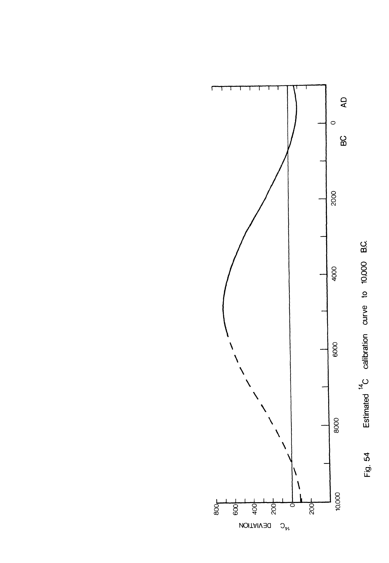
14
C
DEVIATION
jl
t'
m
</>
.—»•
a
8.
o
o
o'
g
CD
O
O
O
o
03
;o
o
o
o
o
CO
o
o
o
CD
o
o
o
ro
o
CD
O
>
O
o
o
o
ro
•&>
o>
oo
8
0
Q
o
o
Q_
^D
\
I~T
T
I
II
c
\
\
\
\
\
\
\
\
I
I I I I I
1 1
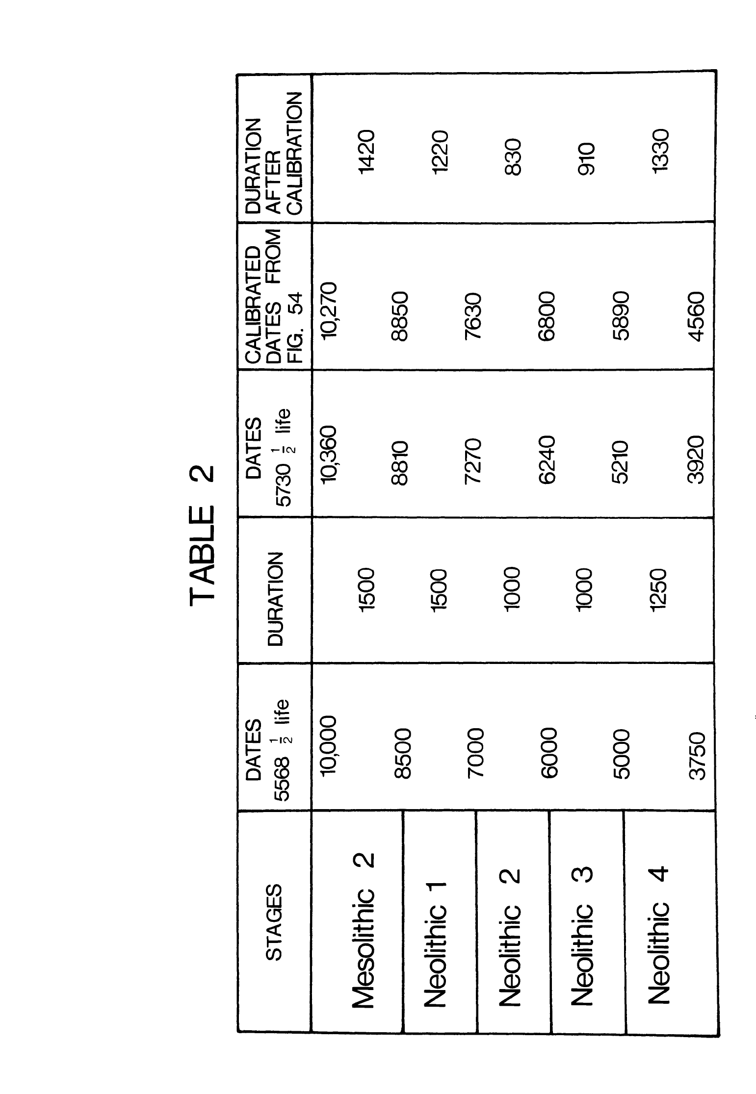
TABLE
2
STAGES
Mesolithic
2
Neolithic
1
Neolithic
2
Neolithic
3
Neolithic
4
DATES
5568
1
life
10,000
8500
7000
6000
5000
3750
DURATION
1500
1500
1000
1000
1250
DATES
5730
I
life
10,360
8810
7270
6240
5210
3920
CALIBRATED
DATES
FROM
FIG.
54
10,270
8850
7630
6800
5890
4560
DURATION
AFTER
CALIBRATION
1420
1220
830
910
1330

and
Neolithic
3
90
years
shorter
while
Neolithic
h
was
80
years
longer.
The
overall
effect
of
calibrating
these
dates
is
that
the
Neolithic
is
seen
to
have
begun
and
ended
earlier
than
the
uncorrected
14
C
dates
would
indicate.
The
earlier
stages
during
which
the
Neolithic
way
of life
was
formed,
that
is
Mesolithic
2,
Neolithic
1
and
Neolithic
2,
happened
more
quickly
while
Neolithic
3
and
Neolithic
h
together
lasted
about
the
same
length
of
time
as
the
uncorrected
dates
had
indicated.
-
500
-
NOTES
1 I
owe
this
information
to
P^re
F.
Hours
S.J.
2
I
am
indebted
to
Mrs.
L.
Copeland
for
this
data.
3
M.
J.
Cauvin
has
kindly
given
me
much
information
about
his
excavations
at
Mureybat.
4
This
was
suggested
to
me
in
1976
independently
by
Professors
F.
Hole,
A.E.
Marks
and
P.E.L.
Smith.
5
Description
based
on
an
examination
of
the
unpublished
flints
and
report
of
D.V.W.
Kirkbride
(l960a,
114ff).
6
I
owe
this
observation
to
A.J.
Legge.
7
See
also
Moore,
1975.
8
Description
of
material
derived
from
the
published
accounts
and
a
study
of
the
finds
in
the
Damascus
Museum.
9
Material
studied
at
the
Palmyra
Museum
and
Oriental
Institute,
University
of
Chicago.
10
Description
based
on
a
study
of
a
selection
of the
material
in
Damascus.
11
I
have
included
here
information
obtained
from
a
study
of
a
comprehensive
surface
collection
made
by
Gopeland
and
Wescombe
now
in
the
Universitl
Saint-Joseph,
Beirut.
12
I
have
studied
some of
this
material
in
the
Damascus
Museum
but
most
of
the
finds
from
the
soundings
have
been
lost.
13
Material
studied
at
the
Oriental
Institute,
University
of
Chicago.
14
Material
studied
at
the
French Archaeological
Mission,
Jerusalem
and
at
the
kibbutz
of
Mayan
Baruk.
15
Material
examined
at
the
French
Archaeological
Mission,
Jerusalem
and
the
Franciscan
Monastery
at
Abu
Gosh.
16
Many
of
which
are
now
in
the
Pontifical
Biblical
Institute,
Jerusalem
where
I
have
studied
them.
17
Material
from
several
of
these
studied
in
the
Pontifical
Biblical
Institute
and
Hebrew
University,
Jerusalem,
the
British
Museum
and
Royal
Ontario
Museum,
Toronto.
18
Material
studied
at
the
French
Archaeological
Mission,
Jerusalem.
19
Now
in the
collections
of
the
Institute
of
Archaeology,
University
of
London
where
I
have
examined
them.
20
Material
from
this
and
other
sites
discovered
by
Kirkbride
studied
in
the
Amman
Museum.
-
501
-
21
Collections deposited
in
the
Amman
Museum
where
I
have
studied
them.
22
Collections
in
the
Amman
Museum
labelled
"Jebel
Uweinid".
23
My
comments
are
based
on
my
study
of
the
finds
in the
collections
of
the
Oriental
Institute,
University
of
Chicago
as
well
as
the
published
accounts.
24
Material
studied
at
the
British
Institute
of
Archaeology
in
Ankara
and
the
Adana
Museum.
25
Material
studied
in
the
Adana
Museum,
at
Bryn
Mawr
College
and
the
Peabody
Museum,
Harvard
University.
26
Finds
collected
by
Copeland
and
Wescombe;
these
and
other
material
collected
in
the
Beka'a
by
Besancon,
Hours
and
Fleisch
have been
deposited
in
the
Universitl
Saint-Joseph,
Beirut
where
I
have
studied
them.
27
Information
from
the
excavator,
the
late
Miss
E.
Yeivin.
28
Material
examined
in
the
Palestine
Archaeological
Museum,
Jerusalem
and
the
Oriental
Institute,
University
of
Chicago.
29
Material
studied
at
the
Palestine
Archaeological
Museum,
Jerusalem
and
the
University
Museum,
University
of
Pennsylvania, Philadelphia,
30
Material
examined
at
the
Hebrew
University,
Jerusalem
and
the
Shaar
Hagolan
Museum.
31
The
excavated
material
was
deposited
in
the
National
Museum,
Beirut.
Some
surface
finds
are in
the
Universite*
Saint-Joseph.
32
Most
of
this
material
is
in
the
Universite
Saint-Joseph,
Beirut where
I
have
studied
it.
33
Some
of
this
material
was
deposited
in
the
British
Museum
where
I
have seen
it.
34
Material
deposited
in
the
Universitl
Saint-Joseph,
Beirut
where
I
have
studie
it.
35
The
pottery
is
in
the
Palestine
Archaeological
Museum,
Jerusalem
where
I
have
examined
it.
36
Material
in
the
Palestine Archaeological
Museum
and
the
Ecole
Biblique
Saint-
Etienne,
Jerusalem
where
I
have
studied
it.
37
I
wish
to
thank
the
Rev.
J.
Mathers
for
drawing
my
attention
to
these
flints
now
in
the
collections
of
the
Palestine
Exploration
Fund,
London.
-
502
-
BIBLIOGRAPHY
Akazawa,
T.,
1974.
Palaeolithic
assemblages
from
the
Douara
Cave
site.
Bull.
Tokyo Univ.
Mus.,
6,
1-167.
Allchin,
B.,
1966.
The
Stone-tipped
Arrow.
London,
Phoenix
House.
Alon,
D.,
Noy,
T.,
1974.
Beer
Faher,
a
Natufian
site.
Mitequfat
Haeven,
12,
7-9.
Anati,
E.,
1962.
Prehistoric
trade
and
the
puzzle
of
Jericho.
Bull.
Am.
Sen,
orient.
Res.,
167,
25-31.
Anati,
E.,
1972.
Stone
Age
site
excavated
in
Israel.
Archaeology,
25,
149-150.
Balfet,
H.,
Lafuma,
H.,
Longuet,
P.,
Terrier,
P.,
1969.
Une
invention
nlolithique
sans
lendemain.
Bull.
Soc.
prlhist.
fr«,
66,
188-192.
Balikci,
A.,
1968.
The
Netsilik
Eskimos:
adaptive
processes.
In
Man
the
Hunter,
R.B.
Lee,
I.
DeVore
(eds),
78-82.
Chicago,
Aldine.
Bar-Yosef,
0.,
1970a.
The
Epi-palaeolithic
Cultures
of
Palestine.
Doctoral
thesis,
Hebrew
University,
Jerusalem.
Bar-Yosef,
0.,
1970b.
Prehistoric
sites
near
Ashdod,
Israel.
Palest.
Ezp.
Q.,
52-64.
Bar-Yosef,
0.,
1975.
The
Epipalaeolithic
in
Palestine
and
Sinai.
In
Problems
in
Prehistory:
North
Africa
and
the
Levant,
F.
Wendorf,
A.E.
Marks
(eds),
363-378.
Southern
Methodist
University
Contributions
in
Anthropology,
13.
Bar-Yosef,
0.,
Burian,
F.,
Friedmann,
E.,
1974-
A
Harifian
site
in the
western
Negev.
Mitequfat
Haeven,
12,
10-14,
78.
Bar-Yosef,
0.,
Goldberg,
P.,
Leveson,
T.,
1974.
Late
Quaternary
stratigraphy
and
prehistory
in
Wadi
Fazael,
Jordan
valley.
Pallorient.
2,
415-428.
Bar-Yosef,
0.,
Goren,
N.,
1973.
Natufian
remains
in
Hayonim
cave.
Pale'orient,
1,
49-68.
Bar-Yosef,
0.,
Tchernov,
E.,
1966.
Archaeological
finds
and
the
fossil
faunas
of
the
Natufian
and
microlithic
industries
at
Hayonim
cave
(western
Galilee,
Israel).
Israel
J.
Zool.,
15,
104-140.
Bate,
D.M.A.,
1932.
A
note
on
the
fauna
of
the
Athlit
caves.
Jl
R.
anthrop.
Inst.,
62,
277-279.
Bate,
D.M.A.,
1938.
Vertebrate
remains
from Wadi
Dhobai,
1938.
J.
Palest.
orient.
Soc.,
18,
292-296.
Bate,
D.M.A.,
1942.
The
fossil
mammals
of
Shukbah.
Proc.
prehist.
Soc..
8,
15-20.
-
503
-
Bate,
D.M.A.,
1948.
Animal
remains from
strata
-XX
and
XX.
In
Megiddo
II,
seasons
of
1935-39,
by
G.
Loud,
139.
University
of
Chicago
Oriental
Institute
Publications,
62.
Bate,
D.M.A.,
Crowfoot,
G.M.,
1948.
Bone
tools
from
Cave
4067.
In
Megiddo
II,
seasons
of
1935-39,
by
G.
Loud,
140.
University
of
Chicago
Oriental
Institute
Publications,
62.
Begin,
Z.B.,
Ehrlich,
A.,
Nathan,
Y.,
1974.
Lake
Lisan
the
Pleistocene
precursor
of
the
Dead
Sea.
Bull, geol.
Surv.
Israel,
63,
1-30.
Ben-Arieh,
Y.,
1964.
A
tentative
water
balance
estimate
of
the
Lisan
Lake.
Israel
J.
Earth-Sc..
13,
42-47.
Benoit,
P.,
O.P.,
Milik,
J.T.,
de
Vaux,
R.,
O.P.,
1961.
Discoveries
in
the
Judaean
Desert
II.
Oxford,
Oxford
University
Press.
Besancon,
J.,
Hours,
F.,
S.J.,
1968.
Quelques
sites
prlhistoriques
nouveaux
dans
la
Blqaa.
Mllang.
Univ.
St-Joseph,
44,
75-84.
Bialor,
P.A.,
1962.
The
chipped
stone
industry
of
fatal
Htfyflk.
Anatolian
stud.,
12,
67-110.
Binford,
L.R.,
1968.
Post-Pleistocene
adaptations.
In
New
Perspectives
in
Archaeology,
S.R.
Binford,
L.R.
Binford
(eds),
313-341.
Chicago,
Aldine.
Birdsell,
J.B.,
1968.
Some
predictions
for
the
Pleistocene
based
on
equilibrium
systems
among
recent
hunter-gatherers.
In
Man
the
Hunter,
R.B.
Lee,
I.
DeVore
(eds),
229-240.
Chicago,
Aldine.
Bliss,
F.J.,
1894.
A
Mound
of
Many
Cities.
London,
A.P.
Watt
and
Son.
Bflkflnyi,
S.,
1969.
Archaeological
problems
and
methods
of
recognizing
animal
domestication.
In
The
Domestication
and
Exploitation
of
Plants
and
Animals,
P.J.
Ucko,
G.W.
Dimbleby
(eds),
219-229.
London,
Duckworth.
Bordes,
F.,
1969.
Traitement
thermique
du
silex
au
Solutrlen.
Bull.
Soc.
prlhist.
fr.,
66,
197.
Boserup,
E.,
1965.
The
Conditions
of
Agricultural
Growth.
London,
G.
Alien
and
Unwin.
Bostanci,
E.Y.,
1959.
Researches
on
the
Mediterranean
coast
of
Anatolia,
a
new
Palaeolithic
site
at
Beldibi
near
Antalya.
Preliminary
report.
Anatolia,
4,
129-178.
Bostanci,
E.Y.,
1962.
A
new
Upper
Palaeolithic
and
Mesolithic
facies
at
Belbaji
rock
shelter
on
the
Mediterranean
coast
of
Anatolia.
Belletin,
26,
252-292.
Bottema,
S.,
1967.
A
late
Quaternary
pollen
diagram
from
loannina,
north-
western
Greece.
In
The
climate,
environment
and
industries
of
Stone
Age
Greece:
part
III by
E.S.
Higgs,
C.
Vita-Finzi,
D.R.
Harris,
A.E.
Fagg,
26-29.
Proc.
prehist.
Soc.,
33,
1-29.
Bouchud,
J.,
1974.
Etude
prlliminaire
de
la
faune
provenant
de
la
grotte
du
Djebel
Qafzeh
pr^s
de
Nazareth
(Israel).
Pale'orient,
2,
87-102.
Braidwood,
L.S., 1958.
Stone
implements.
In
Soundings
at
Tell
Fakhariyah
by
C.W.
McEwan,
L.S.
Braidwood,
H.
Frankfort,
H.G.
Gflterbock,
R.C.
Haines,
H.J.
Kantor,
C.H.
Kraeling,
53-55.
University
of
Chicago
Oriental
Institute
Publications,
79.
Braidwood,
R.J.,
1937.
Mounds
in
the
Plain
of
Antioch.
University
of
Chicago
Oriental
Institute
Publications,
48.
Braidwood,
R.J.,
1940.
Report
of
two
sondages
on
the
coast
of
Syria,
south
of
Tartous.
Syria,
21,
183-226.
Braidwood,
R.J.,
1955-
The
earliest
village
materials
of
Syro-Cilicia.
Proc.
prehist.
Soc.,
21,
72-76.
Braidwood,
R.J.,
Braidwood,
L.S.,
I960.
Excavations
in
the
Plain
of
Antioch
I.
University
of
Chicago
Oriental
Institute
Publications,
61.
Braidwood,
R.J.,
Howe,
B.,
I960.
Prehistoric investigations
in
Iraqi
Kurdistan.
Studies
in
Ancient
Oriental
Civilization,
31.
Buccellati,
G.,
Buccellati,
M.K.,
1967.
Archaeological
survey
of
the
Palmyrene
and
the
Jebel
Bishri.
Archaeology,
20,
305-306.
Burian,
P.,
Friedmann,
E.,
I960.
Givat
Haparsa.
Mitequfat
Haeven,
2,
43-53.
Burian,
F.,
Friedmann,
E.,
1963-'64»
Prehistoric
survey
of
the
dunes
of
the
Mediterranean
coastline
of
Israel.
Mitequfat
Haeven,
6-7,
1-39.
Burian,
F.,
Friedmann,
E.,
1973.
Prehistoric
hunters
in
the
dunes
of
Halutza.
Mitequfat
Haeven.
11,
27-34.
Butzer,
K.W.,
1972.
Environment
and
Archaeology.
London,
Methuen.
Butzer,
K.W.,
1975.
Patterns
of
environmental
change
in
the
Near
East
during
late
Pleistocene
and
early
Holocene
times.
In
Problems
in
Prehistory:
North
Africa
and
the
Levant,
F.
Wendorf,
A.E.
Marks
(eds),
389-410.
Southern
Methodist
University
Contributions
in
Anthropology,
13.
Buzy,
D.,
1928,
Une
Industrie
me'solithique
en
Palestine.
Revue
Bibl.,
37,
558-578.
Cauvin,
J.,
1963.
Le
Nlolithique
de
Moukhtara
(Liban
Sud).
Anthropologie.
Paris,
67,
489-512.
Cauvin,
J.,
1968.
Fouilles
de
Byblos
IV.
Les
Outillages
Ne*olithiques
de
Byblos
et
du
Littoral
Libanais.
Paris,
Adrien
Maisonneuve.
Cauvin,
J.,
1969.
Meches
en
silex
et
travail
du
basalte
au IVe
mille'naire
en
Blka
(Liban).
Me^lang.
Univ.
St-Joseph,
45,
115-131.
-
505
-
Cauvin,
J.,
1970.
Mission
1969
en
Djezireh
(Syrie).
Bull.
Soc.
prlhist.
fr.,
67,
286-287.
Cauvin,
J.,
1972.
Nouvelles
fouilles
\
Tell
Mureybet
(Syrie)
1971-1972,
rapport prlliminaire.
Ann,
arch.
Ar.
Syr.,
22,
105-115.
Cauvin,
J.,
1974a.
Tell
Moureibet.
In
Antiquitls
de
1'Euphrate,
45-50.
Direction
Glnlrale
des
Antiquitls
et
des
Musles
de
la
Rlpublique
Arabe
Syrienne.
Cauvin,
J.,
1974b.
Les
debuts
de
la
clramique
sur
le
moyen-Euphrate:
nouveaux
documents.
Pallorient,
2,
199-205.
Cauvin,
J.,
Cauvin,
M.-C.,
1968.
Des
ateliers
"Campigniens"
au
Liban.
In
La
Prlhistoire,
Problemes
et
Tendances,
103-116.
Editions
du
Centre
National
de
la
Recherche
Scientifique.
Cauvin,
J,,
Cauvin,
M.-C.,
1972.
Sondage
\
Tell
Assouad
(Djezireh,
Syrie).
Ann,
arch.
Ar.
Syr.,
22,
85-103.
Cauvin,
M.-C.,
1973.
Problemes
d
f
emmanchement
des
faucilles
du
Proche-
Orient:
les
documents
de
Tell
Assouad
(Djezireh,
Syrie).
Pallorient,
1,
101-106.
Cauvin,
M.-C.,
1974a.
L'industrie natoufienne
de
Taibl
dans
le
Hauran
(Syrie).
Bull.
Soc.prehist.fr.,
71,
469-478.
Cauvin,
M.-C.,
1974b.
Fleches
&
encoches
de
Syrie:
essai
de
classification
et
d
1
interpretation
culturelle.
Pallorient,
2,
311-322.
Chavaillon,
J.,
Hours,
F.,
S.J.,
1970.
Jiita
II
(Dahr
el
Mghara)
campagne
1971,
rapport
prlliminaire.
Bull.
Mus.
Beyrouth,
23,
215-231.
Childe,
V.G.,
1941.
Man
Makes
Himself.
London,
Watts
and
Company.
Chisholm,
M.,
1968.
Rural
Settlement
and
Land
Use.
London,
Hutchinson.
Clark,
R.M.,
1975.
A
calibration
curve
for
radiocarbon
dates.
Antiquity,
49,
251-266.
Glutton-Brock,
J.,
1969.
Carnivore remains
from
the
excavations
of
the
Jericho
Tell.
In
The
Domestication
and
Exploitation
of
Plants
and
Animals,
P.J.
Ucko,
G.W.
Dimbleby
(eds),
337-345.London,
Duckworth.
Glutton-Brock,
J.,
1971.
The
primary
food
animals
of
the
Jericho
Tell
from
the
Proto-Neolithic
to
the
Byzantine
period. Levant,
3,
41-55.
Glutton-Brook,
J.,
Uerpmann,
H.-P.,
1974.
The
sheep
of
early
Jericho.
J.
arch,
sc.,
1,
261-274.
Cohen,
R.,
Noy,
T.,
1968.
A
Neolithic
site
near
Bin
Mor.
Mitequfat
Haeven.
9,
14.
de
Contenson,
H.,
1962.
Poursuite
des
recherches
dans
le
sondage
\
1'ouest
du
temple
de
Baal
(1955-1960)
(rapport
prlliminaire).
In
Ugaritica
IV,
by
C.F.A.
Schaeffer,
477-519.
Mission
de
Ras
Shamra,
15.
-
506
-
de
Contenson,
H.,
1963.
New
correlations
between
Ras
Shamra
and
Al-'Amuq.
Bull.
Am.
Sen,
orient.
Res.,
172,
35-40.
de
Contenson,
H.,
1964.
A
further
note
on
the
chronology
of
basal
Ras
Shamra.
Bull.
Am.
Sen,
orient.
Res.,
175,
47-48.
de
Contenson,
H.,
1966a.
La
station
prlhistorique
de
Qornet
Rharra,
pres
de
Seidnaya.
Ann,
arch.
Ar.
Syr.,
16,
197-200.
de
Contenson,
H.,
1966b.
Dlcouvertes
rlcentes
dans
le
domaine
du
Nlolithique
en
Syrie.
Syria,
43,
152-154.
de
Contenson,
H.,
1967.
Troisieme
campagne
\
Tell
Ramad,
1966,
rapport
prlliminaire.
Ann,
arch.
Ar.
Syr.,
17,
17-24.
de
Contenson,
H.,
1968.
Rapport
prlliminaire
sur
les
fouilles
&
Tell
al
Khazzami
en
1967.
Ann,
arch.
Ar.
Syr.,
18,
55-62.
de
Contenson,
H.,
1969a.
Quatrieme
et
cinquieme
campagnes
It
Tell
Ramad,
1967-1968,
rapport
prlliminaire.
Ann,
arch.
Ar.
Syr.,
19,
25-30.
de
Contenson,
H.,
1969b.
Sixieme
campagne
de
fouilles
&
Tell
Ramad
en
1969.
Rapport
prlliminaire.
Ann,
arch.
Ar.
Syr.,
19,
31-35.
de
Contenson,
H.,
1969c.
Contribution
£
1'ltude
du
Nlolithique
en
Syrie.
Mllang.
Univ.
St-Joseph,
45,
61-81.
de
Contenson,
H.,
1970.
Septieme campagne
de
fouilles
"a
Tell
Ramad
en
1970.
rapport prlliminaire.
Ann,
arch.
Ar.
Syr.,
20,
77-80.
de
Contenson,
H.,
1971.
Tell
Ramad,
a
village
of
Syria
of
the
7th and
6th
millennia
B.C.
Archaeology,
24,
278-285.
de
Contenson,
H.,
1972.
Tell
Aswad.
Fouilles
de
1971.
Ann,
arch.
Ar.
Syr.,
22,
75-84.
de
Contenson,
H.,
1973a.
Chronologie absolue
de
Tell
Aswad
(Damascene,
Syrie).
Bull.
Soc.
prlhist.
fr.,
70,
253-255.
de
Contenson,
H.,
1973b.
Le
niveau
Halafien
de
Ras
Shamra,
rapport
prlliminaire
sur
les
campagnes
1968-1972
dans
le
sondage
prlhistorique.
Syria,
50,
13-33.
de
Contenson,
H.,
1974.
Huitieme
campagne
de
fouilles
£
Tell
Ramad
en
1973,
rapport
prlliminaire.
Ann,
arch.
Ar.
Syr.,
24,
17-24.
de
Contenson,
H.,
1976.
Nouvelles
donnles
sur
le
Nlolithique
prlclramique
dans
la
region
de
Damas
(Syrie)
d'apres
les
fouilles
£
Ghoraifl
en
1974.
Bull.
Soc.
prlhist.
fr.,
73,
80-82.
de
Contenson,
H.,
van
Liere,
W.
J.,
1964.
Sondages
&
Tell
Ramad
en
1963,
rapport
prlliminaire.
Ann,
arch.
Syr.,
14,
109-124.
de
Contenson,
H.,
van
Liere,
W.J.,
1966.
Seconde
campagne
\
Tell
Ramad,
1965,
rapport
prlliminaire.
Ann,
arch.
Ar.
Syr.,
16,
167-174.
-
507
-
Cook,
S.F.,
Heizer,
R.F.,
1968.
Relationships among
houses,
settlement
areas,
and
population
in
aboriginal
California.
In
Settlement
Archaeology,
K.C.
Chang
(ed),
79-116.
Palo
Alto,
National
Press
Books.
Copeland,
L.,
1969.
Neolithic
village
sites
in the
South
Beqaa,
Lebanon.
Mllang.
Univ.
St-Joseph,
45,
83-114.
Copeland,
L.,
1975.
The
Middle
and
Upper
Palaeolithic
in
the
light
of
recent
research.
In
Problems
in
Prehistory:
North Africa
and
the
Levant,
F.
Wendorf,
A.E.
Marks
(eds),
317-350.
Southern
Methodist
University
Contributions
in
Anthropology,
13.
Copeland,
L.,
Hours,
F.,
S.J.,
1971.
A
microlithic
flint
site
in
the
Wadi
Rum,
Jordan,
and
a
review
of the
Epi-Palaeolithic
in
northern
Arabia.
Proc.
seminar
Arab, stud.,
7-21.
Copeland,
L.,
Wescombe,
P.J.,
1965.
Inventory
of
Stone-Age
sites
in
Lebanon,
part
1;
west
central
Lebanon.
Mllang.
Univ.
St-Joseph,
41,
29-175.
Copeland,
L.
Wescombe,
P.J.,
1966.
Inventory
of
Stone-Age
sites
in
Lebanon
part
2,
north,
south
and
east-central
Lebanon.
Mllang.
Univ.
St-Joseph,
42,
1-174.
Crabtree,
D.E.,
Butler,
B.R., 1964.
Notes
on
experiment
in
flint
knapping:
1.
Heat
treatment
of
silica
materials.
Tebiwa,
7,
1-6.
Crowfoot,
J.
See
Payne,
J.
Crowfoot.
Curray,
J.R.,
1961.
Late
Quaternary
sea level:
a
discussion.
Bull,
geol.
Soc.
Am.,
72,
1707-1712.
David,
N.,
1971.
The
Fulani
compound
and
the
archaeologist.
World
arch.»
3,
111-131.
Davidson,
T.E.,
McKerrell,
H.,
1976.
Pottery
analysis
and
Halaf
period
trade in
the
Khabur
headwaters
region.
Iraq,
38,
45-56.
Dayan,
Y.,
1969-
Tell
Turmus
in
the
Huleh
valley.
Israel
Explor.
J.,
19,
65-78.
Dennell,
R.W.,
1973.
The
phylogenesis
of
Triticum
dicoccum,
a
reconsideration.
Boon.
Bot.
t
27,
329-331.
Dewez,
M.C.,
1970.
Premieres
observations
sur
les
industries
lithiques
de
Qalaat-el-Moudiq.
Ann,
arch.
Ar.
Syr.,
20,
127-131.
Dollfus,
G.,
Lechevallier,
M.,
1969.
Les
deux
premieres
campagnes
de
fouilles
\
Abou
Gosh
(1967-1968).
Syria,
46,
277-292.
Dornemann,
R.H.,
1969.
An
early
village.
Archaeology,
22,
68-70.
Ducos,
P.,
1968.
L'origine
des
animaux
domestiques
en
Palestine.
Publications
de
1'Institut
de
Prehistoire
de
I'Universitl
de
Bordeaux.
Mlmoire
6.
-
508
-
Ducos,
P.,
1969.
Methodology
and
results
of
the
study
of
the
earliest
domesticated
animals
in
the
Near
East
(Palestine).
In
The
Domestication
and
Exploitation
of
Plants
and
Animals,
P.J.
Ucko,
G.W.
Dimbleby
(eds),
265-275.London,
Duckworth.
Ducos,
P.,
1970.
The
Oriental
Institute
excavations
at
Mureybit,
Syria:
preliminary
report
on
the
1965
campaign.
Part
IV:
les
restes
d'equides.
J.
Nr.
East.
St.,
29,
275-289.
Ducos,
P.,
1972.
The
Oriental
Institute excavations
at
Mureybit,
Syria:
preliminary
report
on
the
1965
campaign.
Part
V:
les
restes
de
bovidls.
J.
Nr.
East.
St.,
31,
295-301.
Ducos,
P.,
1975a.
The
Oriental
Institute
excavations
at
Mureybat,
Syria:
preliminary
report
on
the
1965
campaign.
Part
VI:
les
restes
de
petits ruminants
et
de
suide*s.
J.
Nr.
East.
St.,
34,
191-199.
Ducos,
P.,
1975b.
A new
find
of an
equid
metatarsal
bone
from
Tell
Mureibet
in
Syria
and
its
relevance
to
the
identification
of
equids
from
the
early
Holocene
of
the
Levant.
J.
arch,
sc.,
2,
71-73-
Dunand,
M.,
1973.
Fouilles
de
Byblos
V.
Paris,
Adrien
Maisonneuve.
Echegaray,
J.G.,
1964.
Excavaciones
en
la
terraza
de
"El
Khiam"
(Jordania).
I.
Bibliotheca
Praehistorica
Hispana
V.
Madrid.
Echegaray,
J.G.,
1966.
Excavaziones
en la
terraza
de
"El
Khiam"
(Jordania).
II.
Bibliotheca
Praehistorica
Hispana
V.
Madrid.
Ehrich,
A.M.H.,
1939.
Early
pottery
of
the
Jebeleh
region.
Mem.
Am.
phil.
Soc.,
13,
1-129.
Emiliani,
C.,
1955.
Pleistocene
temperature
variations
in
the
Mediterranean.
Quaternaria,
2,
87-98.
Emiliani,
C.,
1972.
Quaternary
paleotemperatures
and
the
duration
of
the
high-temperature
intervals.
Science,
N.Y.,
178,
398-401.
Emiliani,
C.,
Shackleton,
N.J.,
1974.
The
Brunhes
epoch:
isotopic
palaeotemperatures
and
geochronology.
Science,
N.Y.,
183,
511-514.
Fairbridge,
R.W.,
1961.
Eustatic
changes
in
sea
level.
Physics
Chem.
Earth,
4,
99-185.
Farrand,
W.R.,
1965a.
The
deglacial
hemicycle.
Geol.
Rdsch.,
54,
385-398.
Farrand,
W.R.,
1965b.
Geology,
climate
and
chronology
of
Yabrud
rockshelter
I.
Ann,
arch.
Syr.,
15,
35-50.
Farrand,
W.R.,
1971.
Late
Quaternary
paleoclimates
of the
eastern
Mediterranean
area. In
The
Late
Cenozoic
Glacial
Ages,
K.T.
Turekian
(ed),
529-564.
New
Haven,
Yale
University
Press.
-
509
-
Farrand,
W.R.,
1972.
Geological correlation
of
prehistoric
sites
in
the
Levant.
In The
origin
of
Homo
sapiens,
F.
Bordes
(ed),
227-235.
Ecology
and
Conservation,
3-
Ferembach,
D.,
1969.
Etude
anthropologique
des
ossements
humains
Nlolithiques
de
Tell
Ramad
(Syrie).
Ann,
arch.
Ar.
Syr.,
19,
49-70.
Ferembach,
D.,
Lechevallier,
M.,
1973.
Dlcouverte
de
deux
cranes
surmodells
dans
une
habitation
du
VH^eme
mille*naire
a
Beisamoun,
Israel.
Palgorient.
1,
223-230.
Field,
H.,
I960.
North
Arabian
desert
archaeological
survey,
1925-"50.
Papers
of
the
Peabody
Museum
of
Archaeology
and
Ethnology,
Harvard
University.
45,
1-224.
Fitzgerald,
G.M.,
1934.
Excavations
at
Beth
Shan
in
1933.
Palest.
Exp.
Fund
Q.
Statem.. 123-134.
Fitzgerald,
G.M.,
1935.
The
earliest
pottery
of
Beth-Shan.
Mus.
J.
Univ.
Perm.,
24,
5-32.
Flannery,
K.V.,
1972.
The
origins
of
the
village
as
a
settlement
type
in
Mesoamerica
and
the
Near
East:
a
comparative
study.
In
Man,
Settlement
and
Urbanism,
P.J.
Ucko,
R.
Tringham,
G.W.
Dimbleby
(eds),
23-53.London,
Duckworth.
Fleming,
S.,
1976.
Dating
in
Archaeology.
London,
J.M.
Dent
and
Sons.
France-Lanord,
A.,
de
Contenson,
H.,
1973.
Une
pendeloque
en
cuivre
natif
de
Ramad.
Pallorient,
1,
107-115.
French,
D.H.,
1966.
Excavations
at
Can
Hasan,
1965.
Fifth
preliminary
report.
Anatolian
stud.,
16,
113-123.
Frierman,
J.D.,
1971.
Lime
burning
as
the
precursor
of
fired
ceramics.
Israel
Explor.
J.,
21,
212-216.
Fugmann,
E.,
1958.
L
1
architecture
des
plriodes
pre-helllnistiques.
Hama
fouilles
et
recherches
1931-1938
II
part
1.
Nationalmuseets
Skrifter, St^rre
Beretninger,
IV.
Copenhagen,
Nationalmuseet.
Garrod,
D.A.E.,
1932.
A
new
Mesolithic
industry:
the
Natufian
of
Palestine.
Jl
R.
anthrop.
Inst.,
62,
257-269.
Garrod,
D.A.E.,
1942.
Excavations
at
the
cave of
Shukbah,
Palestine,
1928.
Proc.
prehist.
Soc.,
8,
1-20.
Garrod,
D.A.E.,
1954.
Excavations
at
the
Mugharet
Kebara,
Mount
Carmel,
1931:
the
Aurignacian
industries.
Proc.
prehist.
Soc.,
20,
155-192.
Garrod,
D.A.E.,
1957a.
The
Natufian
culture:
the
life
and
economy
of
a
Mesolithic
people
in
the
Near
East.
Proc.
Br.
Acad.,
43,
211-227.
Garrod,
D.A.E.,
1957b.
Notes
sur
le
Pallolithique
Suplrieur
du
Moyen
Orient.
Bull.
Soc.pre'hist.
fr..
54,
439-446.
-
510
-
Garrod,
D.A.E.,
I960.
The
flint
implements.
In
North
Arabian
desert
archaeological
survey,
1925-'50,
by
H.
Field.
Papers
of
the
Peabody
Museum
of
Archaeology
and
Ethnology,
Harvard
University,
45.
Garrod,
D.A.E.,
Bate,
D.M.A.,
1937. The
Stone
Age
of
Mt.
Carmel
I.
Oxford,
Clarendon
Press.
Garstang,
J.,
1935.
Jericho: city
and
necropolis
(fifth
report).
Lpool
ann.
arch,
anthrop.,
22,
143-184.
Garstang,
J.,
1953-
Prehistoric
Mersin.
Oxford,
Oxford
University
Press.
Garstang,
J.,
Phythian-Adams,
W.J.,
Seton
Williams,
V.,
1937.
Third
report
on
the
excavations
at
Sakje-Geuzi,
1908-1911.
Lpool
ann.
arch,
anthrop.,
24,
119-140.
Gifford,
E.W.,
1936.
Californian
balanophagy.
In
Essays
in
Anthropology
Presented
to
A.L.
Kroeber,
R.H.
Lowie
(ed),
87-98.
Berkeley,
University
of
California
Press.
Gilot,
E.,
Cauvin,
J.,
1973.
Datation
par
le
carbone
14
du
village
natoufien
et
pre'ce'ramique
de
Mureybet,
sur
1'Euphrate
(Syrie).
Bull.
Soc.
prlhist.
fr.,
70,
37-38.
Glueck,
N.,
1945-'49.
Explorations
in
eastern
Palestine,
IV.
A.
Am.
Sch.
orient.
Res.,
25-28, 1-424,
425-711.
Goldberg,
P.,
1969.
Analyses
of
sediments
of
Jerf
'Ajla
and
Yabrud
rockshelter.
Syria.
Etudes
sur
le
Quaternaire
dans
le
Monde,
2,
747-754.
Goldman,
H.,
1956.
Excavations
at
Gflzlfl
Kule,
Tarsus
II.
Princeton,
Princeton
University
Press.
Gould,
R.A.,
1969.
Subsistence
behaviour
among
the
Western
Desert
aborigines
of
Australia.
Oceania,
39,
253-274.
Gourdin, W.H.,
Kingery,
W.D.,
1975.
The
beginnings
of
pyrotechnology:
Neolithic
and
Egyptian
lime
plaster.
J.
field
arch.,
2,
133-150.
Harlan,
J.R.,
1967.
A
wild
wheat
harvest
in
Turkey.
Archaeology,
20,
197-201.
Harlan,
J.R.,
Zohary,
D.,
1966.
Distribution
of
wild
wheats
and
barley.
Science,
N.Y.,
153,
1074-1080.
Helbaek,
H.,
I960.
Cereals
and
weed
grasses
in
Phase
A.
In
Excavations
in
the
Plain
of
Antioch
I,
by
R.J.
Braidwood
and
L.S.
Braidwood,
540-543.
University
of
Chicago
Oriental
Institute
Publications,
61.
Helbaek,
H.,
1966.
Pre-Pottery
Neolithic
farming
at
Beidha,
a
preliminary
report.
In
Five
seasons
at
the
Pre-Pottery
Neolithic
village
of
Beidha
in
Jordan,
a
summary
by
D.V.W.
Kirkbride,
61-66.
Palest.
Bxp.
Q..
8-72.
Hennessy,
J.B.,
1969.
Preliminary
report
on
a
first
season
of
excavations
at
Teleilat
Ghassul.
Levant,
1,
1-24.
-
511
-
Henry,
D.O.,
1973a.
The
Natufian
of
Palestine;
its
Material
Culture
and
Ecology.
Doctoral
dissertation,
Southern
Methodist
University,
Dallas.
Henry,
D.O.,
1973b.
The
Natufian
site
of
Rosh
Zin:
a
preliminary
report.
Palest.
Exp.
Q.,
129-140.
Henry,
D.O.,
Servello,
A.F.,
1974.
Compendium
of
carbon-14
determinations
derived
from Near
Eastern
prehistoric
deposits.
Pale'orient,
2,
19-44.
Herman,
Y.,
1965.
Evidence
of
climatic
changes
in
Red
Sea
cores.
In
Means
of
Correlation
of
Quaternary
Successions,
R.B.
Morrison,
H.E.
Wright
(eds),
325-348.Salt
Lake
City,
University
of
Utah
Press.
Higgs,
E.S.,
Vita-Finzi,
C.,
Harris,
D.R.,
Fagg,
A.E.,
1967.
The
climate,
environment
and
industries
of
Stone
Age
Greece:
part
III.
Proc.
prehist.
Soc.,
33,
1-29.
Higgs,
E.S.,
Vita-Finzi,
C.,
1972.
Prehistoric
economies:
a
territorial
approach.
In
Papers
in
Economic Prehistory,
E.S.
Higgs
(ed),
27-36.
Cambridge,
Cambridge
University
Press.
Hillman,
G.C.,
1975.
The
plant
remains
from
Tell
Abu
Hureyra:
a
preliminary
report.
In
The
excavation
of
Tell
Abu
Hureyra
in
Syria:
a
preliminary
report
by
A.M.T. Moore,
70-73.
Proc.
prehist.
Soc.,
41,
50-77.
Hole,
F.,
1959.
A
reanalysis
of
basal
Tabbat
al-Hammam,
Syria.
Syria,
36,
149-183.
Hooijer,
D.A.
,
1961.
The
fossil
vertebrates
of
Ksa*r
'Akil,
a
Palaeolithic
rock
shelter
in
the
Lebanon.
Zool.
Verh.
Leiden,
49,
1-67.
Hooijer,
D.A.,
1966.
Preliminary
notes
on
the
animal remains
found
at
Bouqras
and
Ramad
in
1965.
Ann,
arch.
Ar.
Syr.,
16,
193-196.
Hopf,
Mo,
1969.
Plant
remains
and
early
farming
in
Jericho.
In
The
Domestication
and
Exploitation
of
Plants
and
Animals,
P.J.
Ucko,
G.¥.
Dimbleby
(eds),
355-359.London,
Duckworth.
Horowitz,
A.,
1971.
Climatic
and
vegetational
developments
in
northeastern
Israel
during
Upper
Pleistocene-Holocene
times.
Pollen
Spores,
13,
255-278.
Horowitz,
A.,
1975.
The
Pleistocene palaeoenvironments
in
Israel.
In
Problems
in
Prehistory:
North
Africa
and
the
Levant,
F.
Wendorf,
A.E.
Marks
(eds),
207-227.
Southern
Methodist
University
Contributions
in
Anthropology,
13.
Horowitz,
A.,
1976.
Late
Quaternary
paleoenvironments
of
prehistoric
settlements
in
the
Avdat/Aqev
area.
In
Prehistory
and
paleoenvironments
in
the
central
Negev,
Israel,
A.E.
Marks
(ed),
57-68.
Institute
for
the
Study
of
Earth
and
Man,
Reports
of
Investigations:
2.
Hours,
F.,
S.J.,
1969.
Saayideh
et
le
N^olithique
pre*-poterie
au
Liban.
MSlang.
Univ.
St-Joseph.
45,
29-41.
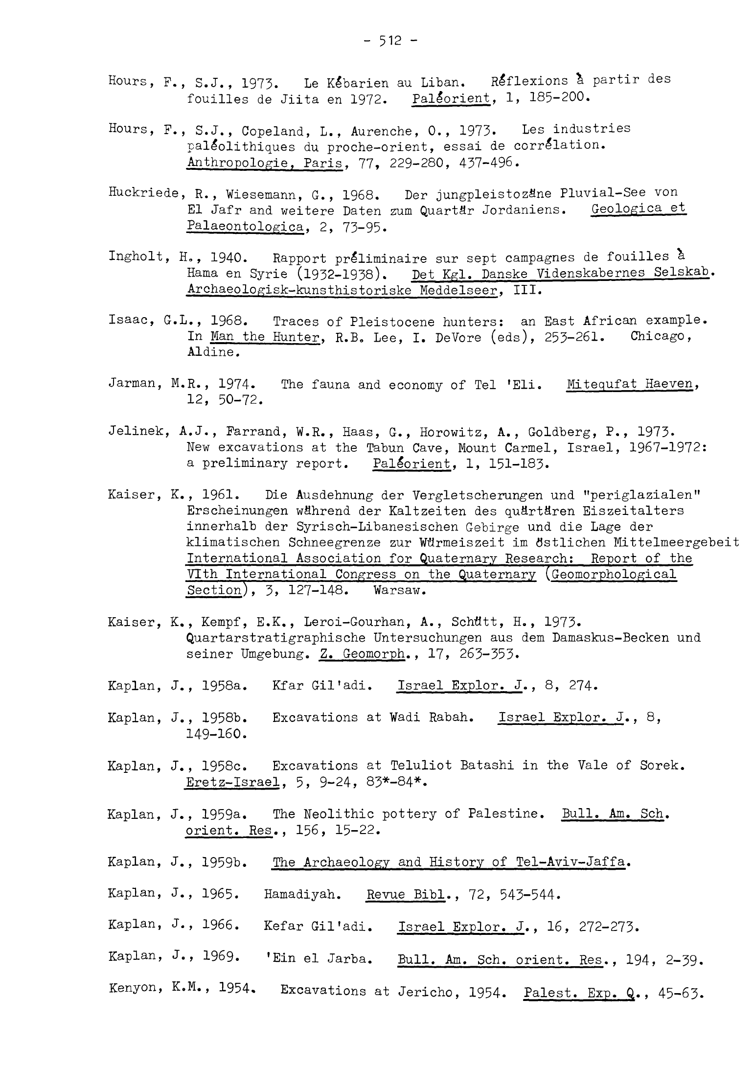
-
512
-
Hours,
F.,
S.J., 1973.
Le
Klbarien
au Liban.
Reflexions
a
partir
des
fouilles
de
Jiita
en
1972.
Pallorient,
1,
185-200.
Hours,
F.,
S.J.,
Copeland,
L.,
Aurenche,
0.,
1973.
Les
industries
pale*olithiques
du
proche-orient,
essai
de
correlation.
Anthropologie,
Paris,
77,
229-280,
437-496.
Huckriede,
R.,
Wiesemann,
G.,
1968.
Der
jungpleistozflne
Pluvial-See
von
El
Jafr
and
weitere
Daten
zum
Quarter
Jordaniens.
Geologica
et
Palaeontologica,
2,
73-95.
Ingholt,
Ho,
1940.
Rapport
prlliminaire
sur
sept
campagnes
de
fouilles
a
Kama
en Syrie
(1932-1938).
Pet Kgl.
Danske
Videnskabernes
Selskab.
Archaeologisk-kunsthistoriske
Meddelseer,
III.
Isaac,
G.L.,
1968.
Traces
of
Pleistocene
hunters:
an
East
African
example.
In
Man
the
Hunter,
R.B. Lee,
I.
DeVore
(eds),
253-261.
Chicago,
Aldine.
Jarman,
M,R.,
1974.
The
fauna
and
economy
of
Tel
'Eli.
Mitequfat
Haeven,
12,
50-72.
Jelinek,
A.J.,
Farrand,
W.R.,
Haas,
G.,
Horowitz,
A.,
Goldberg,
P.,
1973.
New
excavations
at
the
Tabun
Cave,
Mount
Carmel,
Israel,
1967-1972:
a
preliminary
report.
Pallorient,
1,
151-183.
Kaiser,
K.,
1961.
Die
Ausdehnung
der
Vergletscherungen
und
"periglazialen"
Erscheinungen
wflhrend
der
Kaltzeiten
des
quSrtSren
Eiszeitalters
innerhalb
der
Syrisch-Libanesischen
Gebirge
und
die
Lage
der
klimatischen
Schneegrenze
zur
Wftrmeiszeit
im
flstlichen
Mittelmeergebeit
International
Association
for
Quaternary
Research;
Report
of
the
Vlth
International
Congress
on
the
Quaternary
(Geomorphological
Section),
3>
127-148.
Warsaw.
Kaiser,
K.,
Kempf,
E.K.,
Leroi-Gourhan,
A.,
Schtltt,
H.,
1973.
Quartarstratigraphische
Untersuchungen
aus
dem
Damaskus-Becken
und
seiner
Umgebung.
Z.
Geomorph.,
17,
263-353.
Kaplan,
J.,
1958a.
Kfar
Gil'adi.
Israel
Explor.
J.,
8,
274-
Kaplan,
J.,
1958b.
Excavations
at
Wadi
Rabah.
Israel
Explor.
J.,
8,
149-160.
Kaplan,
J.,
1958c.
Excavations
at
Teluliot
Batashi
in
the
Vale
of
Sorek.
Eretz-Israel,
5,
9-24,
83*-84*.
Kaplan,
J.,
1959a.
The
Neolithic pottery
of
Palestine.
Bull.
Am.
Sch.
orient.
Res.,
156,
15-22.
Kaplan,
J.,
1959b.
The
Archaeology
and
History
of
Tel-Aviv-Jaffa.
Kaplan,
J.,
1965.
Hamadiyah.
Revue
Bibl.,
72,
543-544.
Kaplan,
J.,
1966.
Kefar
Gil'adi.
Israel
Explor.
J., 16,
272-273.
Kaplan,
J.,
1969.
'Ein
el
Jarba. Bull.
Am.
Sch.
orient.
Res.,
194,
2-39.
Kenyon,
K.M.,
1954.
Excavations
at
Jericho,
1954.
Palest.
Exp.
Q.,
45-63.
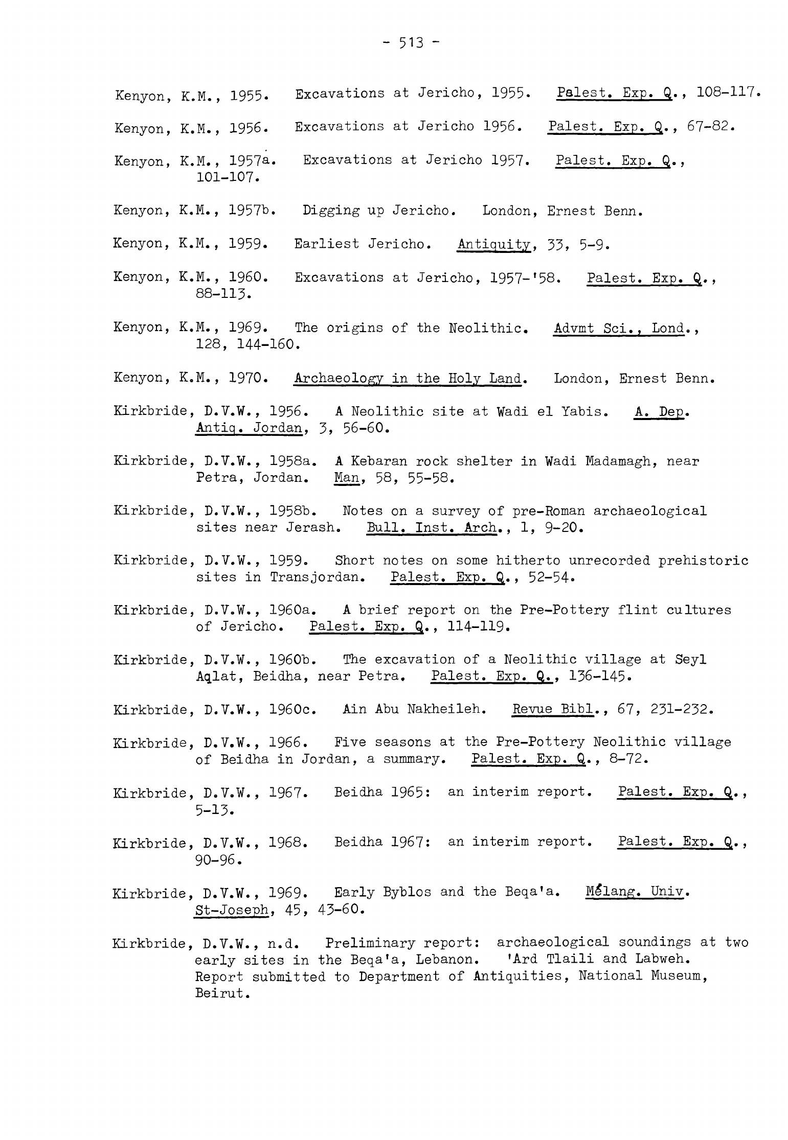
-
513
-
Kenyon,
K.M.,
1955.
Excavations
at
Jericho,
1955.
Palest.
Exp.
Q.,
108-117.
Kenyon,
K.M.,
1956.
Excavations
at
Jericho
1956.
Palest.
Exp.
Q«,
67-82.
Kenyon,
K.M.,
1957a.
Excavations
at
Jericho
1957.
Palest.
Exp.
Q.,
101-107.
Kenyon,
K.M.,
1957"b.
Digging
up
Jericho.
London,
Ernest
Benn.
Kenyon,
K.M.,
1959*
Earliest
Jericho.
Antiquity,
33,
5-9.
Kenyon,
K.M.,
I960.
Excavations
at
Jericho,
1957-
f
58.
Palest.
Exp.
Q.,
88-113.
Kenyon,
K.M.,
1969.
The
origins
of
the
Neolithic.
Advmt
Sci.,
Lond.,
128,
144-160.
Kenyon,
K.M.,
1970.
Archaeology
in the
Holy
Land.
London,
Ernest
Benn.
Kirkbride,
D.V.W.,
1956.
A
Neolithic
site
at
Wadi
el
Yabis.
A.
Pep.
Antiq.
Jordan,
3,
56-60.
Kirkbride,
D.V.W.,
1958a.
A
Kebaran
rock shelter
in
Wadi
Madamagh,
near
Petra,
Jordan.
Man,
58,
55-58.
Kirkbride,
D.V.W.,
1958b.
Notes
on
a
survey
of
pre-Roman
archaeological
sites
near
Jerash.
Bull. Inst.
Arch.,
1,
9-20.
Kirkbride,
D.V.W.,
1959.
Short
notes
on
some
hitherto
unrecorded
prehistoric
sites
in
TransJordan.
Palest.
Exp.
Q.,
52-54.
Kirkbride,
D.V.W.,
1960a.
A
brief
report
on
the
Pre-Pottery
flint
cultures
of
Jericho.
Palest.
Exp.
Q.,
114-119.
Kirkbride,
D.V.W.,
1960b.
The
excavation
of
a
Neolithic
village
at
Seyl
Aq.lat,
Beidha,
near
Petra.
Palest.
Exp.
Q.,
136-145.
Kirkbride,
D.V.W.,
1960c.
Ain Abu
Nakheileh.
Revue
Bibl.,
67,
231-232.
Kirkbride,
D.V.W.,
1966.
Five
seasons
at
the
Pre-Pottery
Neolithic
village
of
Beidha
in
Jordan,
a
summary.
Palest.
Exp.
Q.
,
8-72.
Kirkbride,
D.V.W.,
1967.
Beidha
1965:
an
interim
report.
Palest.
Exp.
Q.,
5-13.
Kirkbride,
D.V.W.,
1968.
Beidha
1967:
an
interim
report.
Palest.
Exp.
Q.,
90-96.
Kirkbride,
D.V.W.,
1969.
Early
Byblos
and
the
Beqa'a.
Me*lang.
Univ.
St-Joseph,
45,
43-60.
Kirkbride,
D.V.W.,
n.d.
Preliminary
report:
archaeological
soundings
at
two
early
sites
in
the
Beqa'a,
Lebanon.
'Ard
Tlaili
and
Labweh.
Report
submitted
to
Department
of
Antiquities,
National
Museum,
Beirut.
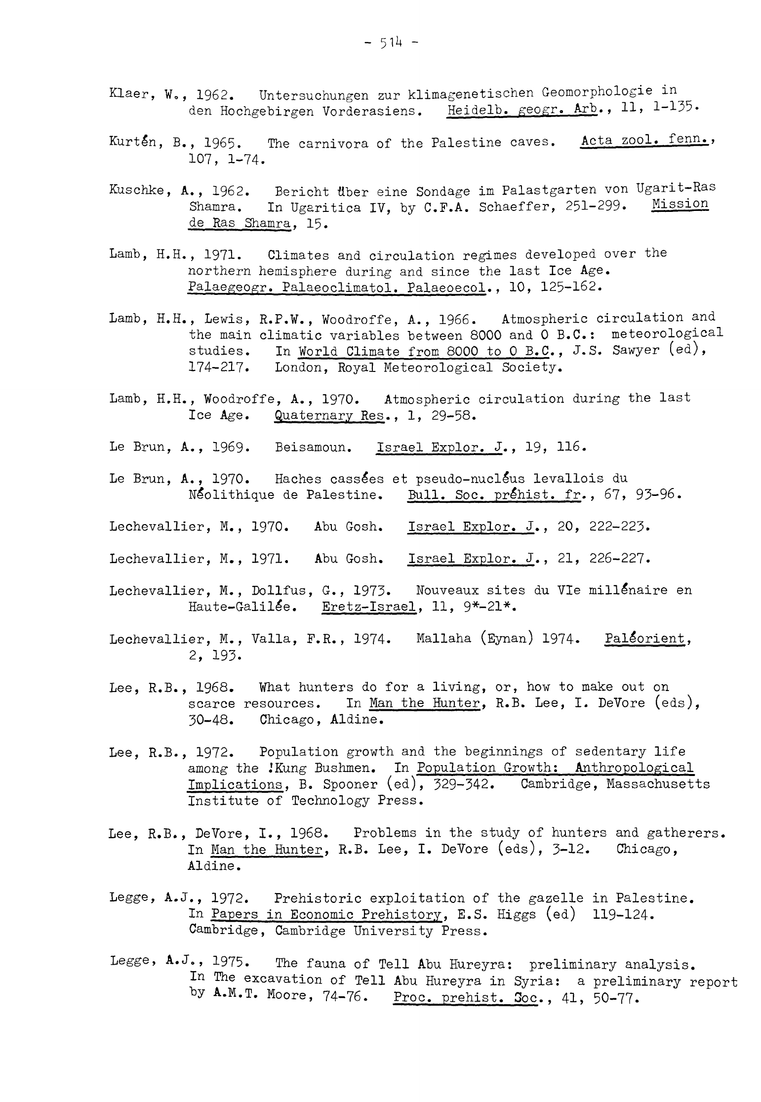
Klaer,
W.,
1962.
Untersuchungen
zur
klimagenetischen
Geomorphologie
in
den
Hochgebirgen
Vorderasiens.
Heidelb.
geogr.
Arb.,
11,
1-135-
Kurtln,
B.,
1965.
The
carnivora
of
the
Palestine
caves.
Acta
zool.
fenn.,
107,
1-74.
Kuschke,
A.,
1962.
Berieht
fiber
eine
Sondage
im
Palastgarten
von
Ugarit-Ras
Shamra.
In
Ugaritica
IV,
by
C.F.A.
Schaeffer,
251-299-
Mission
de
Ras
Shamra,
15.
Lamb,
H.H.,
1971.
Climates
and
circulation
regimes
developed
over
the
northern
hemisphere
during
and
since
the
last
Ice
Age.
Palaegeogr.
Palaeoclimatol.
Palaeoecol.,
10,
125-162.
Lamb, H.H., Lewis,
R.P.W.,
Woodroffe,
A.,
1966.
Atmospheric
circulation
and
the
main
climatic
variables
between
8000 and
0
B.C.:
meteorological
studies.
In
World
Climate
from 8000
to
0
B.C.,
J.S.
Sawyer
(ed),
174-217.
London,
Royal
Meteorological
Society.
Lamb, H.H.,
Woodroffe,
A.,
1970.
Atmospheric circulation
during
the
last
Ice
Age.
Quaternary
Res.,
1,
29-58.
Le
Brun,
A.,
1969.
Beisamoun. Israel
Explor.
J.,
19,
116.
Le
Brun,
A.,
1970.
Haches
cassles
et
pseudo-nucleus
levallois
du
Ne*olithique
de
Palestine.
Bull.
Soc.
prlhist.
fr.
,
67,
93-96.
Lechevallier,
M.,
1970.
Abu
Gosh.
Israel
Explor.
J.,
20,
222-223.
Lechevallier,
M.,
1971.
Abu
Gosh.
Israel
Explor.
J.,
21,
226-227.
Lechevallier,
M.
,
Dollfus,
G.,
1973.
Wouveaux
sites
du
Vie
millionaire
en
Haute-Galille.
Eretz-Israel,
11,
9*-21*.
Lechevallier,
M.,
Valla,
F.R.,
1974.
Mallaha
(Eynan) 1974.
Pal^orient,
2,
193.
Lee,
R.B.,
1968.
What
hunters
do
for
a
living,
or,
how
to
make
out
on
scarce
resources.
In
Man
the
Hunter,
R.B.
Lee,
I.
DeVore
(eds),
30-48.
Chicago,
Aldine.
Lee,
R.B.,
1972.
Population
growth
and
the
beginnings
of
sedentary
life
among
the
.'Kung
Bushmen.
In
Population
Growth:
Anthropological
Implications,
B.
Spooner
(ed),
329-342.
Cambridge,
Massachusetts
Institute
of
Technology
Press.
Lee,
R.B.,
DeVore,
I.,
1968.
Problems
in
the
study
of
hunters
and
gatherers.
In
Man
the
Hunter,
R.B.
Lee,
I.
DeVore
(eds),
3-12.
Chicago,
Aldine.
Legge,
A.J.,
1972.
Prehistoric exploitation
of
the
gazelle
in
Palestine.
In
Papers
in
Economic
Prehistory,
E.S.
Higgs
(ed)
119-124.
Cambridge,
Cambridge
University
Press.
Legge,
A.J.,
1975.
The
fauna
of
Tell
Abu
Hureyra:
preliminary
analysis.
In
The
excavation
of
Tell
Abu
Hureyra
in
Syria:
a
preliminary
report
A.M.T.
Moore,
74-76. Proc.
prehist.
3oc..
41,
50-77.
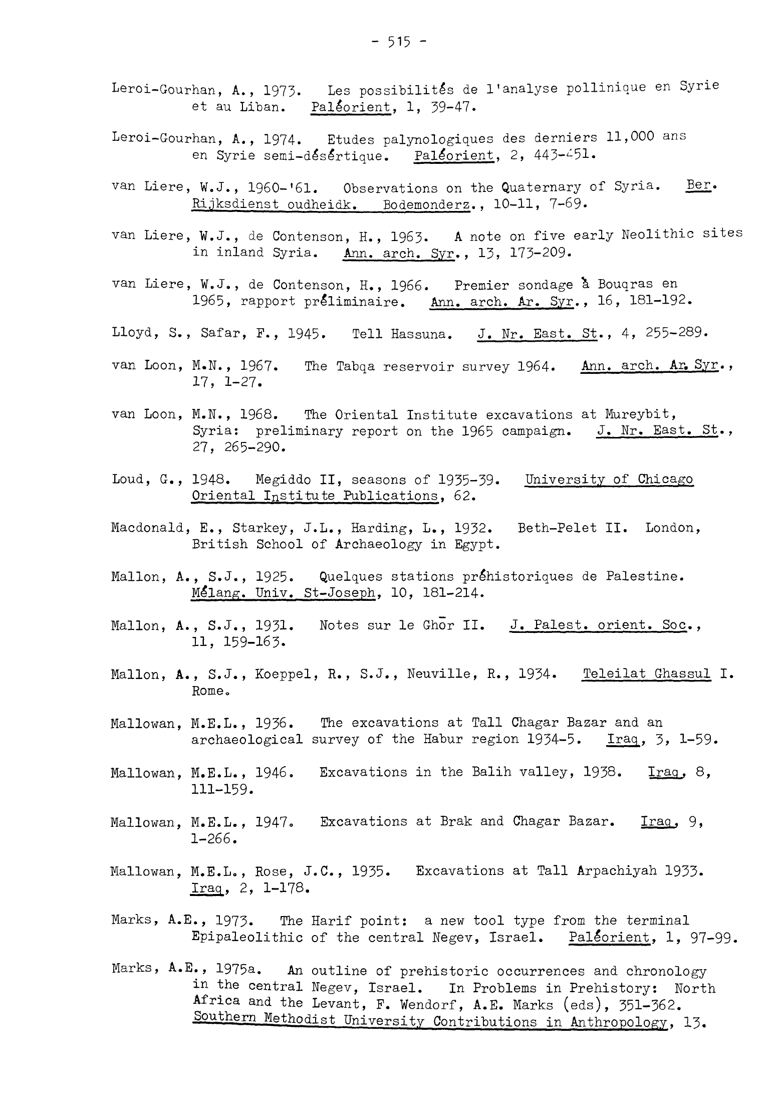
-
515
-
Leroi-Gourhan,
A.,
1973. Les
possibilite's
de
I
1
analyse
pollinique
en
Syrie
et
au
Liban.
Pallorient,
1,
39-47.
Leroi-Gourhan,
A.,
1974.
Etudes
palynologiques
des
derniers
11,000
ans
en
Syrie
semi-dlslrtique.
Pallorient,
2,
443-^51-
van
Liere, W.J.,
1960-'61.
Observations
on
the
Quaternary
of
Syria.
Ber.
Rijksdienst
oudheidk.
Bodemonderz.,
10-11,
7-69-
van
Liere,
W.J.,
de
Contenson,
H.,
1963.
A
note
on
five
early
Neolithic
sites
in
inland
Syria.
Ann,
arch. Syr.,
13,
173-209.
van
Liere, ¥.J.,
de
Contenson,
H.,
1966.
Premier sondage
\
Bouqras
en
1965,
rapport
pre'liminaire. Ann,
arch.
Ar.
Syr.,
16,
181-192.
Lloyd,
S.,
Safar,
F.,
1945.
Tell
Hassuna.
J.
Nr.
East.
St.,
4,
255-289.
van
Loon,
M.N.,
1967.
The
Tabqa
reservoir
survey
1964.
Ann,
arch.
Ar.
Syr.
,
17,
1-27.
van
Loon,
M.N.,
1968.
The
Oriental Institute
excavations
at
Mureybit,
Syria:
preliminary
report
on
the
1965
campaign.
J.
Nr.
East.
St.,
27,
265-290.
Loud,
G.,
1948.
Megiddo
II,
seasons
of
1935-39.
University
of
Chicago
Oriental
Institute
Publications,
62.
Macdonald,
E.,
Starkey,
J.L.,
Harding,
L.,
1932.
Beth-Pelet
II.
London,
British
School
of
Archaeology
in
Egypt.
Mallon,
A.,
S.J.,
1925.
Quelques
stations
pr&historiques
de
Palestine.
Mllang.
Univ.
St-Joseph,
10,
181-214.
Mallon,
A.,
S.J.,
1931.
Notes
sur
le
Ghor
II.
J.
Palest,
orient.
Soc.,
11,
159-163.
Mallon,
A.,
S.J.,
Koeppel,
R.,
S.J.,
Neuville,
R.,
1934.
Teleilat
Ghassul
I.
Rome»
Mallowan,
M.E.L.,
1936.
The
excavations
at
Tall
Chagar
Bazar
and
an
archaeological
survey
of
the
Habur
region
1934-5.
Iraq,
3»
1-59.
Mallowan,
M.E.L.,
1946.
Excavations
in
the
Balih
valley,
1938.
Iraq,
8,
111-159.
Mallowan,
M.E.L.,
1947o
Excavations
at
Brak
and
Chagar
Bazar.
Iraq,
9,
1-266.
Mallowan,
M.E.L.,
Rose,
J.C.,
1935.
Excavations
at
Tall
Arpachiyah
1933-
Iraq,
2,
1-178.
Marks,
A.E.,
1973.
The
Harif
point:
a
new
tool
type
from
the
terminal
Epipaleolithic
of
the
central
Negev,
Israel.
Pallorient,
1,
97-99.
Marks,
A.E.,
1975&.
An
outline
of
prehistoric
occurrences
and
chronology
in
the
central
Negev,
Israel.
In
Problems
in
Prehistory:
North
Africa
and
the
Levant,
F.
Wendorf,
A.E.
Marks
(eds),
351-362.
Southern
Methodist
University
Contributions
in
Anthropology,
13.
-
516
-
Marks,
A.E.,
1975b.
The
current
status
of
Upper
Palaeolithic
studies:
from
the
Maghreb
to
the
northern
Levant.
In
Problems
in
Prehistory:
North
Africa
and
the
Levant,
F.
Wendorf,
A.E.
Marks
(eds),
439-457.
Southern
Methodist
University
Contributions
in
Anthropology,
13.
Marks,
A.E.,
Crew,
H.,
Ferring,
R.,
Phillips,
J.,
1972.
Prehistoric
sites
near
Har
Harif.
Israel
Explor.
J.,
22,
73-85.
Marks,
A.E.,
Phillips,
J.,
Crew,
H.,
Ferring,
R.,
1971.
Prehistoric
sites
near
'En-'Avdat
in
the
Negev.
Israel
Explor.
J.,
21,
13-24.
Marks,
A.E.,
Scott,
T.R., 1976.
Abu
Salem:
type
site
of
the
Harifian
industry
of
the
southern
Levant.
J.
field
arch.,
3,
43-60.
Massoulard,
E.,
1949.
Prlhistoire
et
protohistoire
d'Egypte.
Travaux
et
Mlmoires
de
1'Institut
d'Ethnologie,
53.
Maxwell
Hyslop,
R.,
Taylor,
J.
du
Plat,
Seton
Williams,
M.V.
,
Waechter,
J.
d'A.
,
1942.
An
archaeological
survey
of the
Plain
of
Jabbul.
Palest.
Exp.
Q.,
8-40.
McDaniels,
J.B.,
1976.
An
Analytical
Study
of
Obsidian
from
Tell
Abu
Hureyra,
Syria.
M.A.
Thesis,
University
of
Bradford.
Mellaart,
J.,
1965.
Catal
Hflyflk
West.
Anatolian
stud.,
15,
135-156.
Mellaart,
J.
,
1967.
Catal
Hflyflk.
London, Thames
and
Hudson.
Mellaart,
J.,
1975.
The
Neolithic
of the
Near
Bast.
London,
Thames
and
Hudson.
Mellink,
M.J.,
1964.
Archaeology
in
Asia
Minor.
Am.
J.
arch.,
68,
149-166.
Messerli,
B.,
1966.
Las
problem
der
eiszeitlichen
Vergletscherung
am
Libanon
und
Hermon.
Z.
Geomorph.,
10,
37-68.
Messerli,
B.,
1967.
Die
eiszeitliche
und
die
gegenwSrtige
Vergletscherung
in
Mittelmeerraum.
Geographica
helv.,
22,
105-228.
Meyer,
M.,
1970.
Neolithic
site
8/17 near
Gal-Ed.
Mitequfat
Haeven,
10,
17-21.
Milliman,
J.D.,
Emery,
K.O.,
1968.
Sea
levels
during
the
past
35,000
years.
Science,
N.Y.,
162,
1121-1123.
l^oore,
A.M.T.,
1973.
The
Late
Neolithic
in
Palestine.
Levant,
5,
36-68.
Moore,
A.M.T.,
1975.
The
excavation
of
Tell
Abu
Hureyra
in
Syria:
a
preliminary
report.
Proc.
prehist.
Soc.,
41,
50-77.
Mortensen,
P.,
1970a.
A
preliminary
study
of
the
chipped
stone
industry
from
Beidha.
Acta
arch.,
41,
1-54.
Mortensen,
P.,
1970b.
Chipped
stone
industry.
In
Excavations
at
Hacilar
1,
by
J.
Mellaart,
153-157.
Edinburgh,
Edinburgh
University
Press.
Naroll,
R.,
1962.
Floor
area
and
settlement
population.
Am.
Antiq.,
27,
587-589.
-
517
-
Nasrallah,
J.,
1951.
Recherches
pr£historiques
dans
le
Qalamun
(Syrie
centrale).
Ann,
arch.
Syr.,
1,
80-106.
Nasrallah,
J.,
1965.
Notes
de
pre'histoire
Syrienne.
Ann,
arch.
Syr.
,
15,
51-64.
Neev,
D.,
Emery, K.O.,
1967.
The
Dead
Sea.
Bull,
geol.
Surv.
Israel,
41,
1-147.
Neuville,
R.
,
1929.
Additions
\
la
liste
des
stations
prlhistoriques
de
Palestine
et
Transjordanie.
J.
Palest,
orient.
Soc.,
9,
114-121.
Neuville,
R.,
1930.
Notes
de
pre'histoire
palestinienne.
J.
Palest,
orient.
Soc.,
10,
64-75.
Neuville,
R.
,
1934.
Le
prlhistorique
de
Palestine.
Revue
Bibl.,
43,
237-259.
Neuville,
R.,
1951.
Le
Paleolithique
et
le
Me"solithique
du
desert
de
Judle.
Archives
de
1'Institut
de
Pale*ontologie
Humaine,
Me'moire
24.
Paris.
Niklewski,
J.,
van
Zeist,
¥.,
1970.
A
late
Quaternary
pollen
diagram from
northwestern
Syria.
Acta
bot.
neerl.,
19,
737-754.
Noy,
T.,
I960.
Nizzana:
a
Neolithic
site
in
the
Negev.
Mitequfat
Haeven,
2,
35-41.
Noy,
T.,
1967.
Mesolithic
hunters'
industries
at
Ramat
Matred
(the
Wilderness
of
Zin).
Palest.
Exp.
Q.,
78-85.
Noy,
T.,
1970.
Survey
of
prehistoric
sites
in
the
Halutza
dunes.
Mitequfat
Haeven,
10,
1970,
1-10.
Noy,
T.,
1976a. Gilgal.
Israel
Explor.
J.,
26,
48.
Noy,
T.,
1976t>.
Ziqim.
Israel
Explor.
J.,
26,
49.
Noy,
T.,
n.d. In
the
footsteps
of
early
hunters.
Arrowheads
from
the
collection
of
F.
Burian
and
E.
Friedman.
Israel
Museum
Catalogue
151.
Jerusalem.
Noy,
T.,
Cohen,
R.,
1974.
Nahal
Boker:
an
early
Pre-Pottery
Neolithic
B
site.
Mitequfat
Haeven,
12,
15-25,
78-79.
Noy,
T.,
Higgs,
E.S.,
1971.
Raqefet
Cave.
Israel
Explor.
J.,
21,
225-226.
Noy,
T.,
Legge,
A.J.,
Higgs,
E.S., 1973.
Recent
excavations
at
Nahal
Oren,
Israel.
Proc.
prehist.
Soc.,
39,
75-99.
Noy,
T.,
Schick,
T.,
1973.
Kurnub,
a
desert
Natufian
site.
Mitequfat
Haeven.
11,
16-26.
O'Brien,
T.P.,
1933.
A
Chalcolithic
cave site
in
north
Syria.
Man,
33,
section
182,
173-178.
Olami,
Y.,
1973.
The
Epi-Palaeolithic
site
Haifa
1.
Mitequfat
Haeven,
11,
8-15.
-
518
-
Pabot,
H.
,
1957.
Rapport
au
gouvernement
de
Syrie
sur
l'£cologie
vlge'tale
et
ses
applications.
Food
and
Agriculture
Organization
Repo_rj
663. Rome.
Payne,
J.
Crowfoot,
1948a.
Flint
implements
and
three
limestone
tools.
In
Megiddo
II,
seasons
of
1935-39,
by
G.
Loud,
141-144.
University
o:
Chicago
Oriental
Institute
Publications,
62.
Payne,
J.
Crowfoot,
1948b.
Some
flint
implements
from
Affula.
In
Archaeological
investigations
at
Affula
by
E.L.
Sukenik,
72-78.
J.
Palest,
orient.
Soc.,
21,
1-78.
Payne,
J.
Crowfoot,
I960.
Flint
implements
from
Tell
al-Judaidah.
In
Excavations
in
the
Plain
of
Antioch
I,
by
R.J.
Braidwood
and
L.S.
Braidwood,
525-539.
University
of
Chicago
Oriental
Institute
Publications,
61.
Perkins,
D.,
Jr.,
1966.
The
fauna
from
Madamagh
and
Beidha,
a
preliminary
report.
In
Five seasons
at
the
Pre-Pottery
Neolithic
village
of
Beidha
in Jordan,
a
summary by
D.V.W.
Kirkbride,
66-67.
Palest.
Exp.
Q.,
8-72.
Perrot,
J.,
1951.
La
terrasse
d'El
Khiam.
In
Le
Pallolithique
et le
Me*solithique
du
desert
de
Jude*e
by
R.
Neuville,
134-178.
Archives
de
1'Institut
de
Pale*ontologie
Humaine,
Mlmoire
24.
Paris.
Perrot,
J.
,
1952a.
Te*tes
de
fleches
du
Natoufien
et
du
Tabounien
(Palestine).
Bull.
Soc.
pre*hist.
fr.,
49,
439-449.
Perrot,
J.
,
1952b.
Le
Nlolithique
d'Abou-Gosh.
Syria,
29,
119-145.
Perrot,
J.
,
1963.
Hazorea,
Tell
Turmus,
Ben
Shemen.
Revue
Bibl«,
70,
559-560.
Perrot,
J.,
1964.
Les
deux
premieres campagnes
de
fouilles
\
Munhatta
(1962-1963),
premiers
rlsultats.
Syria,
41,
323-345.
Perrot,
J.,
1965.
Munhata.
Israel
Explor.
J.,
15,
248-249.
Perrot,
J.,
1966a.
Le
gisement
Natoufien
de
Mallaha
(Eynan),
Israel.
Anthropologie,
Paris,
70,
437-484.
Perrot,
J.,
1966b.
La
troisilme
campagne
de
fouilles
\
Munhata
(1964).
Syria,
43,
49-63.
Perrot,
J.,
1966c.
Munhata
(Kb.
Minha).
Israel
Explor.
J., 16,
269-271.
Perrot,
J.,
1967.
Munhata
(H.
Minha).
Israel
Explor.
J.,
17,
267-268.
Perrot,
J.,
1968.
La
prlhistoire
Palestinienne.
In
Dictionnaire
de
la
Bible
8,
Letouzey,
Ane"
(eds), cole.
286-446.
Paris.
Perrot,
J.,
1969.
Le
"Nlolithique"
du
Liban
et
les
rlcentes
dlcouvertes
dans
la
haute
et
moyenne
vallle
du
Jourdain. Mllang.
Univ.
St-
Joseph,
45,
133-145-
Phillips,
A.,P.,
1971.
Attribute
analysis
and social
structure
of
Chassey-
Cortaillod-Lagozza
populations.
Man,
6,
341-352.
-
519
-
Phillips,
J.
,
Bar-Yosef,
0.,
1974a.
Prehistoric
sites
near
Nahal
Lavan,
Negev,
Israel.
Pal^orient,
2,
477-482.
Phillips,
J.
,
Bar-Yosef,
0.,
1974b.
Gebel
Meghara
-
northern
Sinai.
Pallorient.
2,
483-484.
Phillips,
J.L.,
Bar-Yosef,
0.,
Gilead,
I.,
Gissis,
I.,
n.d.
Prehistoric
sites
in
Gebel
Meghara,
northern
Sinai
(preliminary
report).
Manuscript.
Potut,
1937.
La
prlhistoire
dans
la
region
de
Damas.
Bull.
Soc.
prlhist.
fr.
,
34,
130-132.
Prausnitz,
M.¥.
,
1957.
Khirbet
Sheikh
'All.
Revue
Bibl.,
64,
252-253.
Prausnitz,
M.¥.
,
1959.
Kabri.
Israel
Explor.
J.
,
9,
268.
Prausnitz,
M.W.
,
I960.
Tell
'Eli
(Kh.
esh-Sheikh
«Ali).
Israel
Explor.
J.,
10,
119-120.
Prausnitz,
M.W.
,
1969.
The
excavations
at
Kabri.
Eretz-Israel,
9,
137.
Prausnitz,
M.W.
,
1970a.
From
Hunter
to
Farmer
and
Trader.
Jerusalem,
Sivan
Press.
Prausnitz,
M.W.
,
1970b.
A
Neolithic
hole-mouth
jar.
'Atiqot,
6,
9-
Prausnitz,
M.W.
,
Burian,
F.
,
Friedmann,
E.
,
Wreschner,
E.
,
1970.
Excavations
at
Herzliyah,
site
30/9.
Mitequfat
Haeven,
10,
11-16.
Raikes,
R.L.
,
1966.
Beidha,
prehistoric
climate
and
water
supply.
In
Five
seasons
at
the
Pre-Pottery
Neolithic
village
of
Beidha
in
Jordan,
a
summary
by
D.V.W.
Kirkbride,
68-72.
Palest.
Exp.
Q.
,
8-72.
Ralph,
E.K.
,
Michael,
H.N.
,
Han,
M.C.,
1973.
Radiocarbon
dates
and reality.
MASCA
Newsletter,
9,
1-20.
Renfrew,
C.
,
Dixon,
J.E.,
Cann, J.R.
,
1966.
Obsidian
and
early
cultural
contact
in
the
Near
East.
Proc.
prehist.
Soc.,
32,
30-72.
Renfrew,
C.
,
Dixon,
J.E.
,
Cann,
J.R.
,
1968.
Further
analysis
of
Near
Eastern
obsidians.
Proc.
prehist.
Soc.,
34,
319-331.
Renfrew,
J.M.
,
1973.
Palaeoethnobotany.
London,
Methuen.
Rhotert,
H.
,
1938.
Transjordanien
Vorgeschichtliche
Forschungen. Stuttgart,
Strecker
und
Schr6*der.
Riis,
P.J.
,
Thrane,
H.
,
1974.
Sukas
III.
Publications
of
the
Carlsberg
Expedition
to
Phoenicia,
3.
Copenhagen,
Munksgaard.
Ronen,
A.,
1973.
New
radiocarbon
dates
from
Mt.
Carmel.
Archaeology,
26,
60-62.
Roodenberg,
C.
,
forthcoming.
Une
Industrie
Ipipallolithique
sur
le
Nahr
el
Homr
(Syrie).
Ann,
arch.
Ar.
Syr.
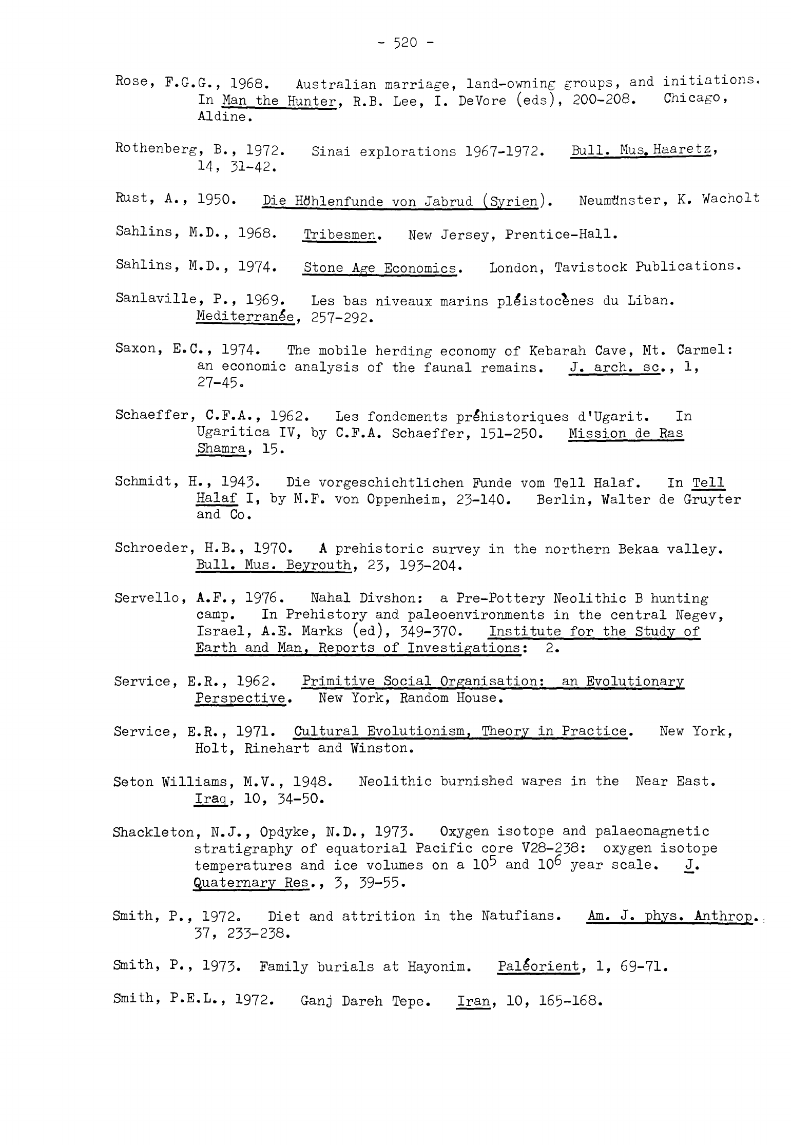
-
520
-
Rose,
P.G.G.,
1968.
Australian
marriage,
land-owning
groups,
and
initiations,
In
Man
the
Hunter,
R.B.
Lee,
I.
DeVore
(eds),
200-208.
Chicago,
Aldine.
Rothenberg,
B.,
1972.
Sinai
explorations
1967-1972.
Bull.
Mus.
Haaretz,
14,
31-42.
Rust,
A.,
1950.
Die
Hflhlenfunde
von
Jabrud
(Syrien).
Neumflnster,
K.
Wacholt
Sahlins,
M.D.,
1968.
Tribesmen.
New
Jersey,
Prentice-Hall.
Sahlins,
M.D.,
1974.
Stone
Age
Economics.
London,
Tavistock
Publications.
Sanlaville,
P.,
1969.
Les
bas
niveaux
marins
pleistocenes
du
Liban.
Mediterranle.
257-292.
Saxon, E.G.,
1974.
The
mobile
herding
economy
of
Kebarah
Cave,
Mt.
Carmel:
an
economic
analysis
of
the
faunal
remains.
J.
arch,
sc.,
1,
27-45.
Schaeffer,
C.F.A.,
1962.
Les
fondements
prdhistoriques
d'Ugarit.
In
Ugaritica
IV,
by
C.F.A.
Schaeffer,
151-250.
Mission
de
Ras
Shamra,
15.
Schmidt,
H.
,
1943.
Die
vorgeschichtlichen
Funde
vom
Tell Halaf. In
Tell
Halaf
I,
by
M.F.
von
Oppenheim,
23-140.
Berlin,
Walter
de
Gruyter
and
Co.
Schroeder,
H.B.,
1970.
A
prehistoric
survey
in
the
northern
Bekaa
valley.
Bull.
Mus.
Beyrouth,
23,
193-204.
Servello,
A.F.,
1976.
Nahal
Divshon:
a
Pre-Pottery Neolithic
B
hunting
camp.
In
Prehistory
and
paleoenvironments
in
the
central
Negev,
Israel,
A.E.
Marks
(ed),
349-370.
Institute
for
the
Study
of
Earth
and
Man,
Reports
of
Investigations;
2.
Service,
E.R.,
1962.
Primitive
Social Organisation:
an
Evolutionary
Perspective. New
York,
Random
House.
Service,
E.R.,
1971.
Cultural
Evolutionism,
Theory
in
Practice.
New
York,
Holt,
Rinehart
and
Winston.
Seton Williams,
M.V.,
1948.
Neolithic
burnished
wares
in
the
Near
East.
Iraq,
10,
34-50.
Shackleton,
N.J.,
Opdyke,
N.D.,
1973.
Oxygen
isotope
and
palaeomagnetic
stratigraphy
of
equatorial
Pacific
core
V28-238:
oxygen
isotope
temperatures
and
ice
volumes
on
a
10^
and
10"
year
scale.
_J.
Quaternary
Res.,
3,
39-55.
Smith,
P.,
1972.
Diet
and
attrition
in
the
Natufians.
Am.
J.
phys.
Anthrop.
37,
233-238.
Smith,
P.,
1973.
Family
burials
at
Hayonim.
Pale*orient,
1,
69-71.
Smith,
P.E.L.,
1972.
Ganj
Dareh
Tepe.
Iran,
10,
165-168.
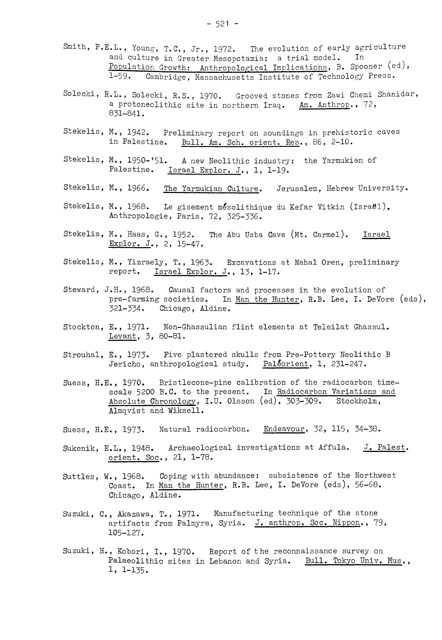
-
521
-
Smith,
P.E.L.,
Young,
T.C.,
Jr.,
1972.
The
evolution
of
early
agriculture
and
culture
in
Greater
Mesopotamia:
a
trial model.
In
Population
Growth;
Anthropological
Implications,
B.
Spooner
(ed),
1-59.
Cambridge,
Massachusetts
Institute
of
Technology
Press.
Solecki,
R.L.,
Solecki,
R.S.,
1970.
Grooved
stones
from
Zawi
Chemi
Shanidar,
a
protoneolithic
site in
northern
Iraq.
Am.
Anthrop.,
72,
831-841.
Stekelis,
M.,
1942.
Preliminary
report
on
soundings
in
prehistoric
caves
in
Palestine.
Bull.
Am.
Sch.
orient.
Res.,
86,
2-10.
Stekelis,
M.,
1950-
!
51.
A
new
Neolithic
industry:
the
Yarmukian
of
Palestine. Israel
Explor.
J.,
1,
1-19.
Stekelis,
M.,
1966.
The
Yarmukian
Culture.
Jerusalem,
Hebrew
University.
Stekelis,
M., 1968.
Le
gisement
mlsolithique
du
Kefar
Vitkin
(Israel).
Anthropologie,
Paris,
72,
325-336.
Stekelis,
M.,
Haas,
G.,
1952.
The
Abu Usba
Cave
(Mt.
Carmel).
Israel
Explor.
J.,
2,
15-47.
Stekelis,
M.,
Yizraely,
T.,
1963.
Excavations
at
Nahal
Oren,
preliminary
report.
Israel
Explor.
J., 13,
1-17.
Steward,
J.H.,
1968.
Causal
factors
and
processes
in
the
evolution
of
pre-farming
societies.
In
Man
the
Hunter,
R.B. Lee,
I.
DeVbre
(eds),
321-334.
Chicago, Aldine.
Stockton,
E.,
1971.
Non-Ghassulian
flint
elements
at
Teleilat
Ghassul.
Levant,
3,
80-81.
Strouhal,
E.,
1973-
Five
plastered
skulls
from
Pre-Pottery
Neolithic
B
Jericho,
anthropological
study.
Pallorient,
1,
231-247.
Suess,
H.E.,
1970.
Bristlecone-pine
calibration
of the
radiocarbon
time-
scale
5200
B.C.
to
the
present.
In
Radiocarbon
Variations
and
Absolute
Chronology,
I.U.
Olsson
(ed),
303-309.
Stockholm,
Almqvist
and Wiksell.
Suess,
H.E.,
1973.
Natural
radiocarbon. Endeavour,
32,
115,
34-38.
Sukenik,
E.L.,
1948.
Archaeological
investigations
at
Affula.
J.
Palest.
orient.
Soc.,
21,
1-78.
Suttles,
¥.,
1968.
Coping
with
abundance:
subsistence
of the
Northwest
Coast.
In
Man
the
Hunter,
R.B. Lee,
I.
DeVore
(eds),
56-68.
Chicago,
Aldine.
Suzuki,
C.,
Akazawa,
T.,
1971.
Manufacturing
technique
of
the
stone
artifacts
from
Palmyra,
Syria.
J.
anthrop.
Soc.
Nippon.,
79,
105-127.
Suzuki,
H.,
Kobori,
I.,
1970.
Report
of
the
reconnaissance
survey on
Palaeolithic
sites
in
Lebanon
and
Syria.
Bull.'Tokyo
Univ.
Mus.,
1,
1-135.
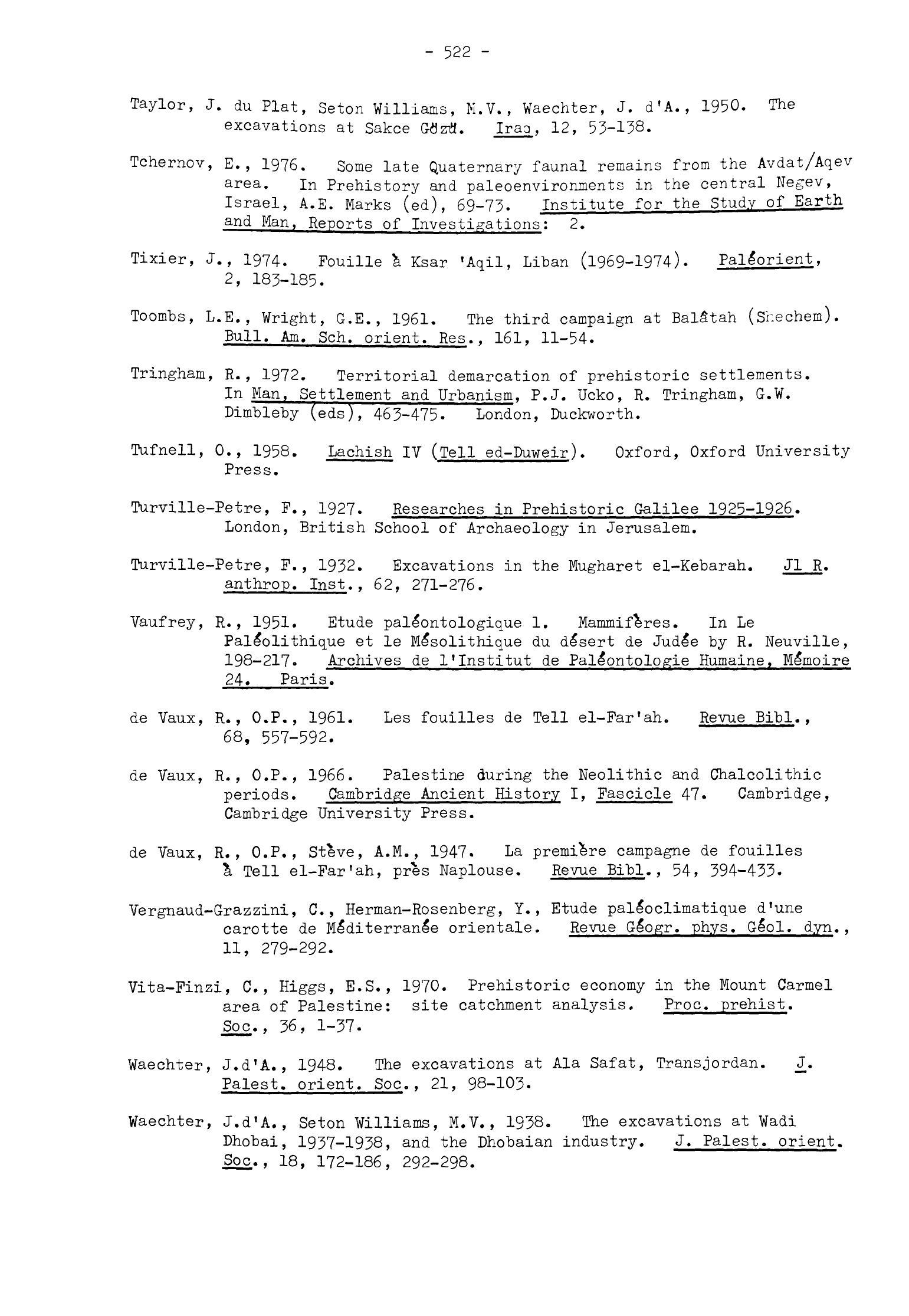
-
522
-
Taylor,
J.
du
Plat,
Seton
Williams,
M.V.,
Waechter,
J.
d'A.,
1950.
The
excavations
at
Sakce
Gflzfl.
Iraa,
12,
53-138.
Tchernov,
E.,
1976. Some
late
Quaternary
faunal
remains
from
the
Avdat/Aqev
area.
In
Prehistory
and
paleoenvironments
in
the
central
Negev,
Israel,
A.E.
Marks
(ed),
69-73.
Institute
for
the
Study
of
Earth
and
Man,
Reports
of
Investigations:
2.
Tixier,
J.,
1974.
Fouille
&
Ksar
'Aqil,
Liban
(1969-1974).
Pallorient,
2,
183-185.
Toombs,
L.E.,
Vright,
G.E.
,
1961. The
third
campaign
at
Bal£tah
(Sr.echem).
Bull.
Am.
Sch.
orient.
Res.,
161,
11-54.
Tringham,
R.,
1972.
Territorial
demarcation
of
prehistoric
settlements.
In
Man,
Settlement
and
Urbanism,
P.J.
Ucko,
R.
Tringham,
G.W.
Dimbleby
(eds),
463-475-London,
Duckworth.
Tufnell,
0.,
1958.
Lachish
IV
(Tell
ed-Duweir).
Oxford,
Oxford
University
Press.
Turville-Petre,
F.,
1927.
Researches
in
Prehistoric
Galilee
1925-1926.
London,
British
School
of
Archaeology
in
Jerusalem.
Turville-Petre,
F.,
1932.
Excavations
in
the
Mugharet
el-Kebarah.
Jl
R.
anthrop.
Inst.
t
62,
271-276.
Vaufrey,
R.,
1951.
Etude
pallontologique
1.
Mammiferes.
In
Le
Pal£olithique
et
le
Me*solithique
du
dlsert
de
Jude'e
by
R.
Neuville,
198-217.
Archives
de
1'Institut
de
Pale'ontologie
Humaine,
Me'moire
24.
Paris.
de
Vaux,
R.,
O.P.,
1961.
Les
fouilles
de
Tell
el-Far'ah. Revue
Bibl.
,
68,
557-592.
de
Vaux,
R.,
O.P.,
1966.
Palestine
during
the
Neolithic
and
Chalcolithic
periods.
Cambridge
Ancient
History
I,
Fascicle
47.
Cambridge,
Cambridge
University
Press.
de
Vaux,
R.,
O.P.,
Steve,
A.M.,
1947.
La
premiere
campagne
de
fouilles
a
Tell
el-Far'ah,
pres
Naplouse.
Revue Eibl.,
54,
394-433.
Vergnaud-Grazzini,
C.,
Herman-Rosenberg,
Y.,
Etude
palloclimatique
d'une
carotte
de
Me'diterrane'e
orientale.
Revue
Glogr.
phys. Glol.
dyn.
,
11,
279-292.
Vita-Finzi,
C.,
Higgs,
E.S.,
1970.
Prehistoric economy
in
the
Mount
Carmel
area
of
Palestine:
site
catchment
analysis.
Proc.
prehist.
Soc.,
36,
1-37.
Waechter,
J.d'A.,
1948.
The
excavations
at
Ala
Safat,
Transjordan.
_J.
Palest,
orient.
Soc.,
21,
98-103.
Waechter,
J.d'A.,
Seton
Williams,
M.V.,
1938.
The
excavations
at
Wadi
Dhobai,
1937-1938,
and
the
Dhobaian
industry.
J.
Palest,
orient.
Soc.,
18,
172-186,
292-298.
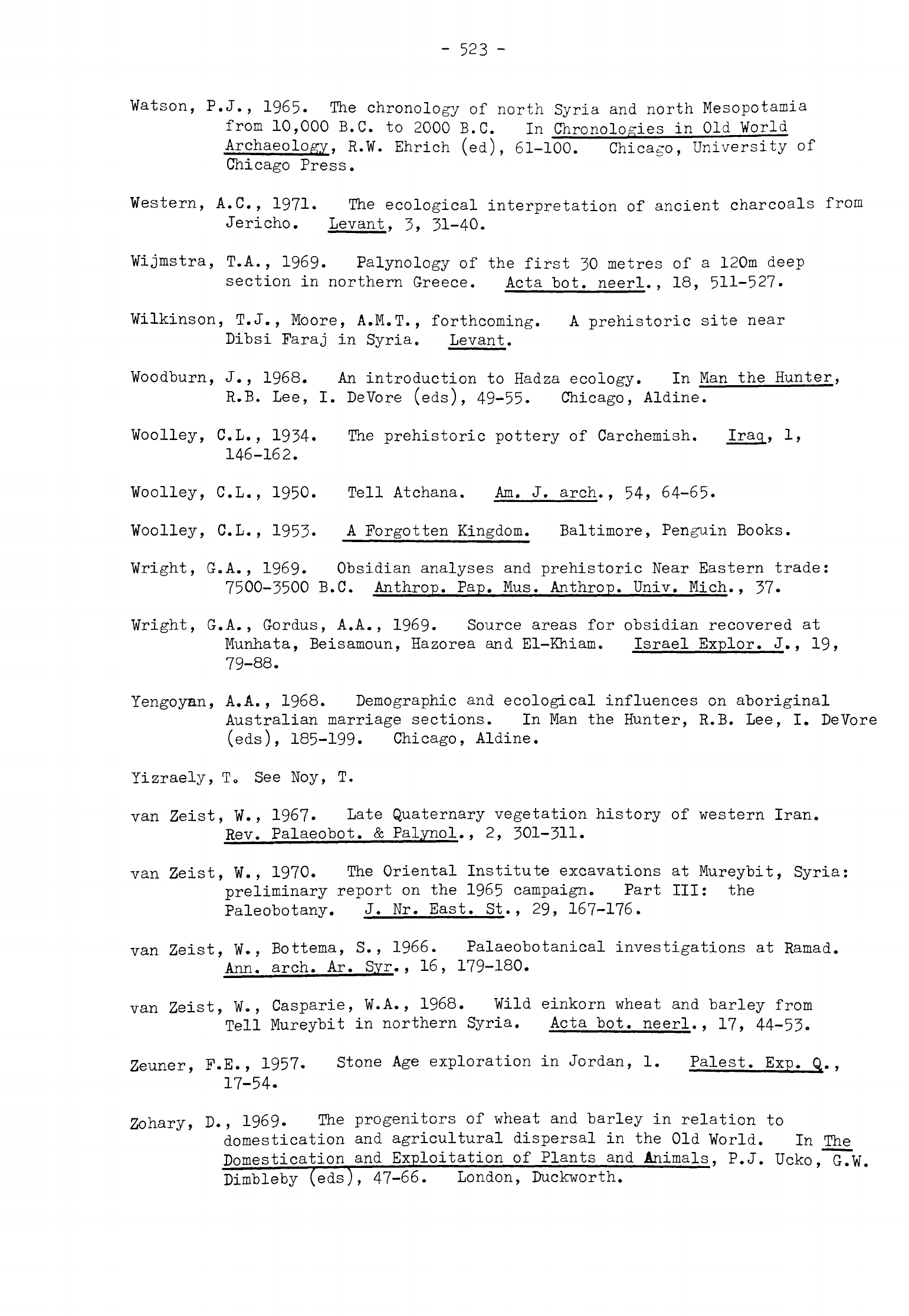
-
523
-
Watson,
P.J.,
1965.
The
chronology
of
north
Syria
and
north
Mesopotamia
from 10,000
B.C.
to
2000
B.C.
In
Chronologies
in
Old
World
Archaeology,
R.W.
Ehrich
(ed),
61-100.
Chicago,
University
of
Chicago
Press.
Western,
A.C.,
1971.
The
ecological
interpretation
of
ancient
charcoals
from
Jericho.
Levant,
3,
31-40.
Wijmstra,
T.A., 1969.
Palynology
of
the
first
30
metres
of
a
120m
deep
section
in
northern
Greece.
Acta
bot.
neerl.,
18,
511-527.
Wilkinson,
T.J.,
Moore,
A.M.T.,
forthcoming.
A
prehistoric
site
near
Dibsi
Faraj
in
Syria.
Levant.
Woodburn,
J.,
1968.
An
introduction
to
Hadza
ecology.
In
Man
the
Hunter,
R.B.
Lee,
I.
DeVore
(eds),
49-55.
Chicago,
Aldine.
Woolley,
C.L.,
1934.
The
prehistoric
pottery
of
Carchemish.
Iraq,
1,
146-162.
Woolley,
C.L., 1950.
Tell
Atchana.
Am.
J.
arch.,
54,
64-65.
Woolley,
C.L.,
1953.
A
Forgotten
Kingdom.
Baltimore,
Penguin
Books.
Wright,
G.A.,
1969.
Obsidian
analyses
and
prehistoric
Near
Eastern
trade:
7500-3500
B.C.
Anthrop.
Pap.
Mus.
Anthrop.
Univ.
Mich.,
37.
Wright,
G.A.,
Gordus,
A.A.,
1969.
Source areas
for
obsidian
recovered
at
Munhata,
Beisamoun,
Hazorea
and
El-Khiam.
Israel
Explor.
J.
,
19,
79-88.
Yengoyan,
A.A.,
1968.
Demographic
and
ecological
influences
on
aboriginal
Australian
marriage
sections.
In
Man
the
Hunter,
R.B.
Lee,
I.
DeVore
(eds),
185-199.
Chicago,
Aldine.
lizraely,
T
0
See
Noy,
T.
van
Zeist,
W.
,
1967.
Late
Quaternary
vegetation history
of
western
Iran.
Rev.
Palaeobot.
&
Palynol.,
2,
301-311.
van
Zeist,
W.,
1970.
The
Oriental
Institute
excavations
at
Mureybit,
Syria:
preliminary
report
on
the
1965 campaign.
Part
III:
the
Paleobotany.
J.
Nr.
East.
St.,
29,
167-176.
van
Zeist,
W.,
Bottema,
S.,
1966.
Palaeobotanical investigations
at
Ramad.
Ann,
arch.
Ar.
Syr.,
16,
179-180.
van
Zeist,
W.,
Casparie,
W.A.,
1968.
Wild
einkorn wheat
and
barley
from
Tell
Mureybit
in
northern
Syria.
Acta
bot.
neerl.,
17,
44-53.
Zeuner,
F.E.,
1957.
Stone
Age
exploration
in
Jordan,
1.
Palest.
Exp.
Q.,
17-54.
Zohary,
D.,
1969.
The
progenitors
of
wheat
and
barley
in
relation
to
domestication
and
agricultural
dispersal
in
the
Old
World.
In
The
Domestication
and
Exploitation
of
Plants
and
Animals,
P.J.
Ucko,
G.W.
Dimbleby
(eds),
47-66.London,
Duckworth.

Zohary,
K.,
1962.
Plant
life
of
Palestine.
Chronica
Botanica,
33-
New
York,
Ronald
Press.
Zohary,
M.,
1970.
Vegetation
of
Israel
and
the
Near
East.
In
Atlas
of
Israel,
D.H.K.
Amiran,
J.
Elster,
M.
Gilead,
II.
Rosenan,
N.
Kadmon,
U.
Paran
(eds),
Botany
VI/I.
Jerusalem,
Survey
of
Israel.
