|
Other Archaeological Sites / The Neolithic of the Levant (500 Page Book Online) Tell el-Retaba (Pithom) in Egypt ProofRead and Updated April 15th 2020
The Tell el-Retaba archaeological site is located in the middle part of Wadi Tumilat which extends along the north-eastern
margin of the Nile Delta. It contains fragments of fortified and domestic objects of the ancient fortress and other constructions built of mud bricks. The establishment and functioning of the fortress is dated at the times of the reign of two
great pharaohs -- Ramesses II and Ramesses III (13th and 12th centuries BC) ... The source of material used for brick production were the natural sediments located in the vicinity of the fortress -- i.e. the Holocene lake clay and the Pleistocene gravel and sand of the gezira formation. The fortress site was selected optimally in relation to the
landscape morphology and close vicinity of the source of basic material and water used for mud brick production. The
area around the fortress was substantially transformed by humans due to settlement (1) ... Previous excavations had already established the existence on this spot of an important fortress controlling the route between the Eastern Delta and the Sinai in the Ramesside period. The first regular large-scale excavations of the site were conducted more than 100 years ago but the gaps in our knowledge are still substantial -- virtually nothing is known about Tell el-Retaba before the Ramesside period and very little about its history after the New Kingdom. Even for the period of the 19th and 20th Dynasties, which is when the fortress existed, there is practically no information about its organization and functioning (2). 1. PREVIOUS EXCAVATIONS ON THE SITE The site was investigated scientifically for the first time by Edouard Naville in 1885. Twenty years later W.M.F. Petrie conducted large scale excavations and his publication remains practically the only source of information on Tell el-Retaba (ibid) ...
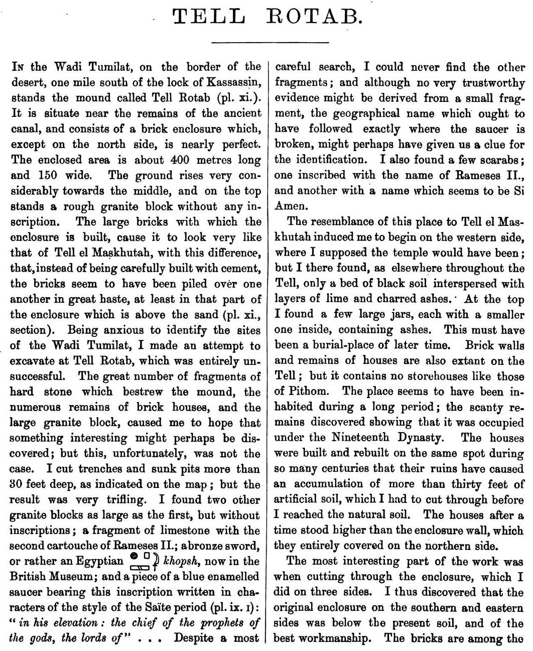
The shrine of Saft el Henneh and the land of Goshen by Edouard Naville (1885)
See Also in Google Books Pages 24-25 ...
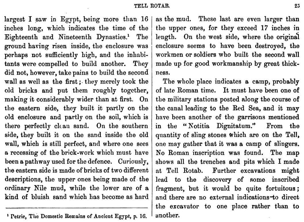
Hyksos and Israelite Cities by William Matthew Flinders Petrie (1906)
Chapter V --- Tell er Retabeh (Raamses)
36 The site and its results IN the middle of the length of the Wady Tumilat about twenty miles from Ismailiyeh on the east and rather farther from Zagazig (Bubastis) on the west stands a wide dusty mound of ruins knows as Tell er Retabeh. As in other ancient sites, so here,
the natives remove large quantities of earth to lay
upon the fields. But instead of this destructive
custom exposing the earlier remains, as is the case
on other sites, it makes the lower levels here even
more inaccessible. Any pit in this region is quickly
filled up with sand from the desert and the holes
made in one year are levelled up again in the next.
At first sight the mound looks untouched ; but a
large part of it is now a honeycomb of old pits filled
with sand. This makes work here unprofitable as it
is needful to dig through so much depth of running
sand in which nothing can be found. The soil itself
also is poor in objects in the untouched parts. The
mound is not an accumulation of house ruins as such
mounds usually are ; but large parts of it only contain
a few enclosing walls and the area seems to have been
largely left open and then gradually filled up with
ashes and blown dust. This filling indicates that the
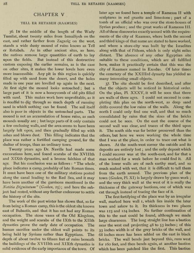
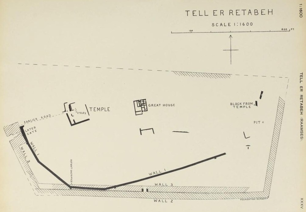
site was a fortified camping ground for the shelter of troops rather than an ordinary town. Twenty years ago Édouard Naville had made some excavations here and found scarabs of the XVIIIth and XlXth dynasties and a bronze falchion of that age. But his conclusion was as follows : " The whole place indicates a camp probably of late Roman times. It must have been one of the military stations posted along the canal leading to the Red Sea and it may have been another of the garrisons mentioned in the Notitia Dignitatem " (Goshen, 25); and here the subject had rested without any further endeavour to settle the history of the site. The work of the past winter has shown that, so far from being a Roman camp, this is the oldest site known east of Bubastis and that it has not had any Roman occupation. The stone vases of the Old Kingdom and the weight and scarabs of the IXth to the Xllth dynasties prove the early date of occupation. The human sacrifice under the oldest wall points to its being held by Syrians rather than Egyptians. The depth of about twelve to fifteen feet of ruins beneath the buildings of the XVIIIth and XlXth dynasties is solid evidence of the early importance of the town. Of later age we found here a temple of Ramessu II with sculptures in red granite and limestone; part of a tomb of an official who was over the store-houses of Syrian produce; and the great works of Ramessu III. All of these discoveries exactly accord with the requirements of the city of Raamses where both the second and third kings of that name are stated to have worked and where a store-city was built by the Israelites along with that of Pithom which is only eight miles distant. The absence of any other Egyptian site suitable to these conditions, which are all fulfilled here, makes it practically certain that this was the city of Raamses named in Exodus. Of later times the cemetery of the XXIIIrd dynasty has yielded us many interesting small objects. 37 The first city wall THE site should be first described and after that the objects will be noticed in historical order. On the plan, Plate XXXV, it will be seen that there are walls of three ages.
I could not succeed in completing
this plan on the north-west as deep sand
drifts covered the low ruins of the walls. Along the
north I could only find one wall and that so much
consolidated by rains that the sizes of the bricks
could not be seen. On the east the course of the
second wall was clear and traces of the third upon
it. The south side was far better preserved than the
others but here we were working the whole time
that I was at the place in order to trace out what is
shown. At the south-west corner the outside and its
deposits are entirely lost; and the only deposit which
I could recover was at the south-east and for that a
man worked for a week before he could find it. All
of the lower walls are of such earthy marl and so
much soaked with wet that it is difficult to tell them
from the earth around. The previous plan of the
town (Goshen, Plate XI) is largely drawn by guess work ;
and the very thick wall at the west of it is really the
thickness of the gateway bastions, one of which was
cut through instead of tracing the face of it.
(1) HOLOCENE LAKE SEDIMENTS AS A SOURCE OF BUILDING MATERIAL IN ANCIENT EGYPT; ARCHEOMETRIC EVIDENCE FROM WADI TUMILAT (NILE DELTA)
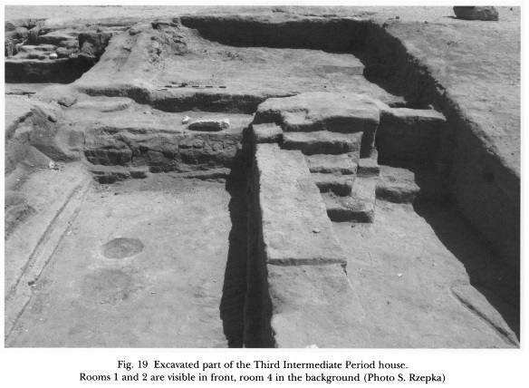
(2) TELL EL-RETABA 2007–2008 by Slawomir Rzepka -- Jozef Hudec -- Tomasz Herbich -- Anna Wodzinska in Egypt and the Levant 2009 Pages 241–280
New Kingdom and Third Intermediate Period in Tell el-Retaba by Anna Wodzinska (2012)
Egyptian Mission Rescue Excavations in Tell el-Retaba by Anna Wodzinska et al (2013) The History of the Ancient Near East Electronic Compendium |