|
Other Archaeological Sites / The Neolithic of the Levant (500 Page Book Online) A Report on the Soil and Water of the Wadi Tumilat Lands Under Reclamation by A. Lucas (1903)
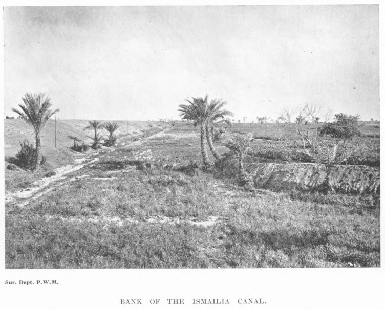
The Wadi Tumilat is a long narrow strip of land extending almost due east and west between the cultivation of the Nile delta near Abbassa and Lake Timsah at Ismailia. The valley is bounded on both the north and the south by desert. EARLY HISTORY
This description of the district was doubtless however from a shepherd’s point of view. In those days probably an overflow channel from the Nile inundated the valley annually during the flood and afterwards drained the lands into Lake Timsah on the waters subsiding. The flooded lands no doubt as soon as the waters retired grew green with fine pasturage and held in their lowest hollows lakes of sweet water for cattle to drink. So that for Jacob’s sons, who were shepherds, the valley was "the best of the land". The extensive deposits of Nile mud in the Wadi Tumilat prove the flow in ancient times of a considerable branch of the Nile eastward into the Red Sea. But a very slight elevation or silting up of the Red Sea would obstruct this arm of the Nile and impair the water communication and the fertility of the district. Of such results we have no evidence till the reign of Seti I, some time before the Exodus, when it became necessary to cut a canal through the Wadi Tumilat and this canal had to be reopened and extended to the southward by successive rulers down to the Roman Period as the difficulty of maintaining it increased. This ancient canal, beginning at Bubastis, watered the land of Goshen with its branches and, entering the Bitter Lakes, changed their character according to Strabo and connected them with the Red Sea. From the not inconsiderable remains of the old canal near Belbés it appears to have been about 50 yards (100 ells according to Strabo) in width and 16 to 174 feet in depth. The somewhat steep banks are still strengthened at places with solid masonry. According to Herodotus the canal was four days’ journey and according to Pliny 62 Roman miles in length. In ancient times the canal was primarily constructed for purposes of navigation. Some sections of this Pharaonic canal were utilized during the making of the Ismailia Canal of which they now form a part and one portion near Kassassin now serves as a section of the main drain. In 1899 three kilometres which had been in use for irrigation were replaced by new channels ... In 1901 a further length of "17 kilometres of the old stagnant reed-choked Wadi Canal" was suppressed ... In addition many dry and partly filled up portions exist and may still be traced. The History of the Ancient Near East Electronic Compendium |