|
Other Archaeological Sites / The Neolithic of the Levant (500 Page Book Online) Ancient Amrit (Greek Marathos or Marathus)
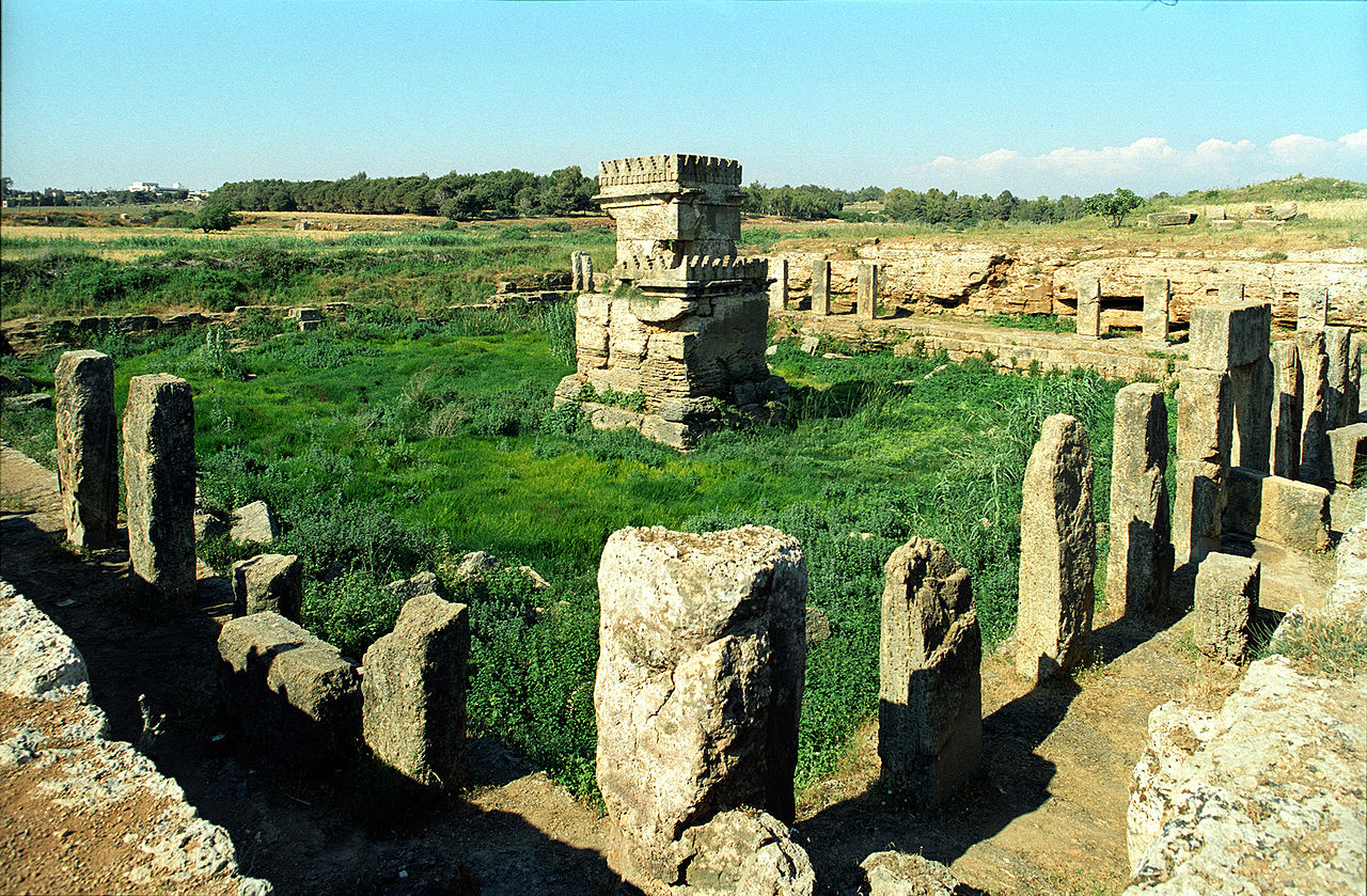
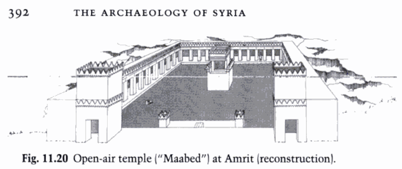
The site of Amrith is located on the Syrian coast 6 km south of the modern city of Tartous. Previous occupation from the end of the 3rd millennium B.C. has been identified on the tell (mound) but Amrith is first of all known as a typical site of the Phoenician period in Syria. The site is believed to be a continental suburb of the city of Aradus on the neighboring fortress island, which today is called Arwad. The great extent of the site and the variety of its archaeological structures clearly show that Amrith was a flourishing city and may have had an important commercial role. Amrit is known primarily for its temple from the 6th century B.C. and the necropolises surrounding the site (the population of Aradus was buried there as well), which would give an idea of the physical limits of the city. The city surrendered along with Arwad to Alexander the Great in 333 BC. During Seleucid times the town, then known as Marathus, was probably larger and more prosperous than Arwad. In 219 BC Amrit gained independence from Arwad and was later sacked by forces from the latter city in 148 BC (PDF) Excerpt: "Within the modern boundaries of Syria the major Phoenician power was the island city of Arwad. Although no archaeological evidence is available from Arwad itself, towns within its domain have yielded considerably more data than the more famous city-states in Lebanon like Sidon and Tyre. Preeminent among the sites in the Arwad vicinity is Amrit, noted for its impressive open-air temple ("Maabed”), the best-preserved monumental structure from the Phoenician homeland. Probably dedicated to the gods Melqart of Tyre and Eshmun, this extraordinary rock-cut structure consisted of a colonnaded portico enclosing a large rectangular basin. In the center of the basin was a naos, a stepped altar surmounted by merlons; stepped crenellations of a style employed frequently at the Achaemenid imperial capitals in Iran. These sculptural fragments display not only an encroaching Greek influence but an Egyptianizing tendency in Phoenician art" (***) ...
"PALESTINE AND SYRIA" Handbook for Travellers (1876) by Karl Baedeker
GOOGLE Books Online Pages 539-41 and Internet Archive and
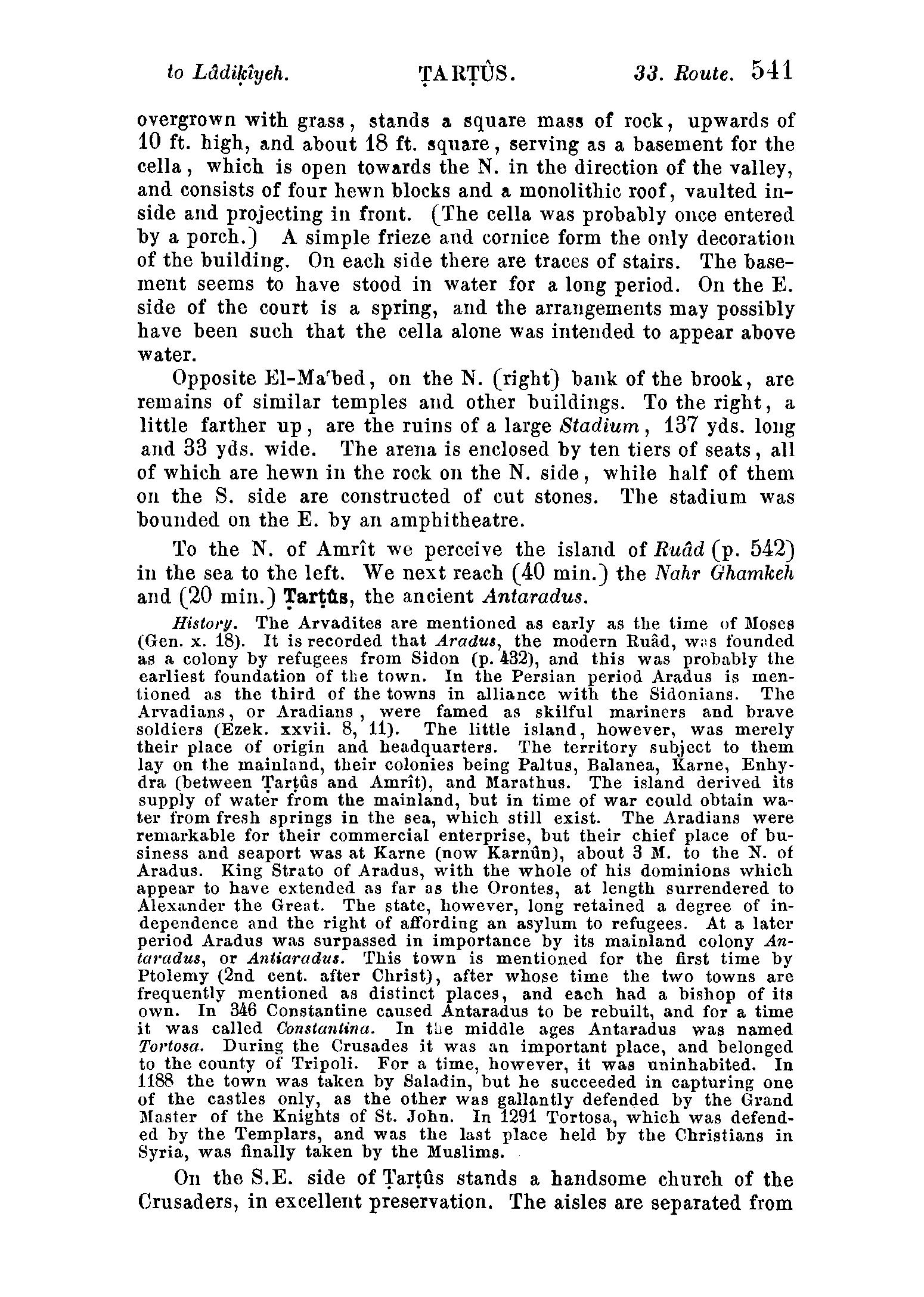
PDF (22.1 MB) NOTE: In late 1872 the [Karl Baedeker : Publisher] business moved from Coblence to Leipzig which had become the centre for German publishing. By 1878 the [travel guide] range had been expanded to the Near East with volumes on Palestine and Syria History --- The modern name of Amrit is probably a corruption of the ancient Marathus, as the town which formerly lay here was called. Marathus was founded by the Arvadites (p. 541) and was ruled over by the king of Aradus. When visited by Alexander the town was a large and prosperous place. In B.C. 219 Marathus became independent of Aradus and in 148 the Aradians attempted to destroy the town. At a later period Marathus is rarely mentioned and during the Roman period it had ceased to be a place of any importance. Renan [in his 1864 book] Mission De Phénicie is therefore probably right in supposing that the ruins of Marathus date from the Phoenician period. Marathus lay nearly opposite the islands of Hebles (to the S.W.) and Aradus (to the N.W.) on the banks of two brooks, the northern of which is called the Nahr Amrit and the southern the Nahr el-Kibleh ('southern brook'). Excerpt: ... "Off the coast are two islands, Hebles and north of it ancient Aradus, now Ruad, and between these comes out the Nahr el Kibleh which just before debouching into the sea receives the Nahr Amrit. The latter name is derived from Marathus, the extensive city which in the early times covered the surface all about the neighborhood of both rivers. To-day this region is little more than a wide expanse of tombs, rock-caves, shrines, pyramids and other remains of its spacious necropolis. The first king of Aradus founded the city in the dim past and the Aradians peopled it, entering into a league with the Phoenicians. It was still prosperous in the time of Alexander but had ceased to be of importance in the Roman days. There are remains of a large stadium and amphitheatre but the place has not been a human habitation for nearly two thousand years" (Pages 315-6 in Google and PDF 14.5 MB) ... When near the sea the latter ceases to run towards the W. and turns to the N., flowing parallel to the coast between thickets and swamps and emptying itself into the Nahr Amrit a little above the mouth of that river. Farther inland, between these streams, rises a range of hills which also run parallel with the coast. Between these hills and the lower part of the Nahr el-Kibleh runs the modern caravan-route. About 10 minutes before we cross the Nahr el-Kibleh we observe to the right of the road (opposite some bushes on the left) the first antiquities of Amrit. The first object of interest is a rock-tomb. About 150 paces to the N. of it is another and larger tomb called the Hajar el-Hubla ('stone of the pregnant woman') with remains of a pyramid near it.
A third monument of similar character but smaller is situated about 2 min. to the S.E. of these two. In this case the cube rests upon a basement of two steps. Above the cube is a hollow moulding and above the latter rises a second and smaller cubic block which once bore a pyramid. The entrance to the staircase which descends into the tomb-cavern below the monument is covered with a large well-hewn block of stone. About 5 min. to the N. of this necropolis stands a large house hewn in the rock. The W. facade is 33 yds. long; the walls are about 19 ft. in height and 2 1/2 ft. in thickness. The interior of the house was once divided by walls hewn out of the rock into three chambers. The N. side is bounded by a wall built of cut stones and so is part of the S. side also. The doors and windows are irregularly distributed. In the interior are seen the niches and holes once used for the insertion of beams. Near this house are several oil-presses in the rock and remains of mosaics. We now proceed from this house N.W. to the (5 min.) Nahr Amrit, before reaching which we perceive the shrine of El-Ma'bed on the left. This consists of a court, 52 yds. broad and 60 yds. long, hewn in the rock and artificially levelled. The S. wall of the court is now about 16 ft. high. The W. and E. walls descend towards the N. to the brook. The N. (front) side was probably once closed by a wall of hewn stones with gateways where a hedge now stands. Remains of pillars near the corners of the court appear to indicate that the walls were flanked by corridors. An opening in the W. wall leads to some quarries or grottoes. A small conduit skirting the E. and S. walls ends near some grottoes 8 1/2 yds. from the N.E. angle. In the middle of the quadrangle, which is now overgrown with grass, stands a square mass of rock upwards of 10 ft. high and about 18 ft. square serving as a basement for the cella which is open towards the N. in the direction of the valley and consists of four hewn blocks and a monolithic roof vaulted inside and projecting in front. (The cella was probably once entered by a porch). A simple frieze and cornice form the only decoration of the building. On each side there are traces of stairs. The basement seems to have stood in water for a long period. On the E. side of the court is a spring and the arrangements may possibly have been such that the cella alone was intended to appear above water. Opposite El-Ma'bed on the N. (right) bank of the brook are remains of similar temples and other buildings. To the right a little farther up are the ruins of a large Stadium 137 yds. long and 33 yds. wide. The arena is enclosed by ten tiers of seats all of which are hewn in the rock on the N. side while half of them on the S. side are constructed of cut stones. The stadium was bounded on the E. by an amphitheatre. To the N. of Amrit we perceive the island of Ruad (p. 542) in the sea to the left. We next reach (40 min.) the Nahr Qhamkeh and (20 min.) Tartus, the ancient Antaradus ... |
