|
Other Archaeological Sites / The Neolithic of the Levant (500 Page Book Online) Tell Jemmeh (Gemmeh) in Israel Updated December 9th 2019
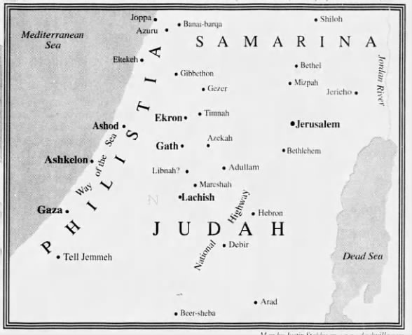
The site of Tell Jemmeh is located about 10 km south of Gaza on the southern bank of the Nahal Besor. Its position at the 300 mm isohyet places it at the border of arid and semi-arid land. This region of Israel's southern coastal plain can be characterized as a marginal agricultural area for both past and present (1). The proximity of Tell Jemmeh to Gaza (ancient Tell Ajjul) -- a major commercial center throughout much of antiquity -- insured its interaction in a broad sphere. Tell Jemmeh is located about eight km southeast of the trunk route ("The Way of the Land of the Philistines" or Via Maris: See Exodus 13:17) that connected Palestine and Egypt.
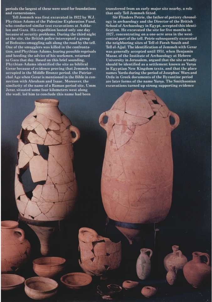
Sir Flinders Petrie conducted the first large-scale excavation of the mound in 1928, identifying it incorrectly as the Gerar of the Hebrew Bible (Genesis 20:1-2; 26:1-12).
The Smithsonian Institution Excavation at Tell Jemmeh Israel 1970–1990
The expedition had found evidence to support Mezer's identification and also identified the site with Arsa from Neo-Assyrian scripts[1] [WikiPedia]
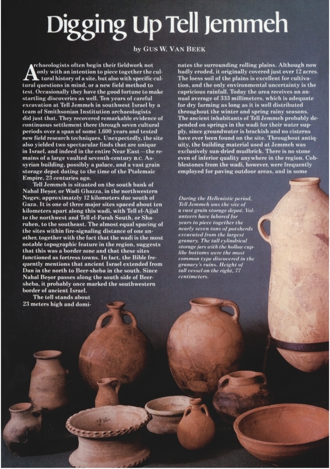
See: Digging Up Tell Jemmeh by Gus Van Beek in Archaeology (1983) Pages 12-19
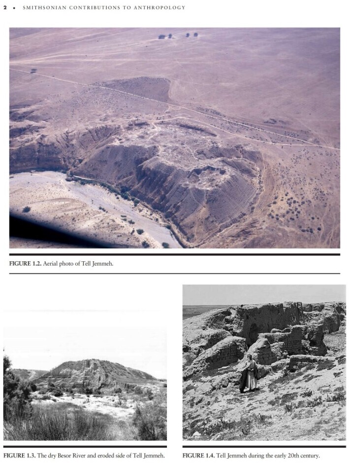
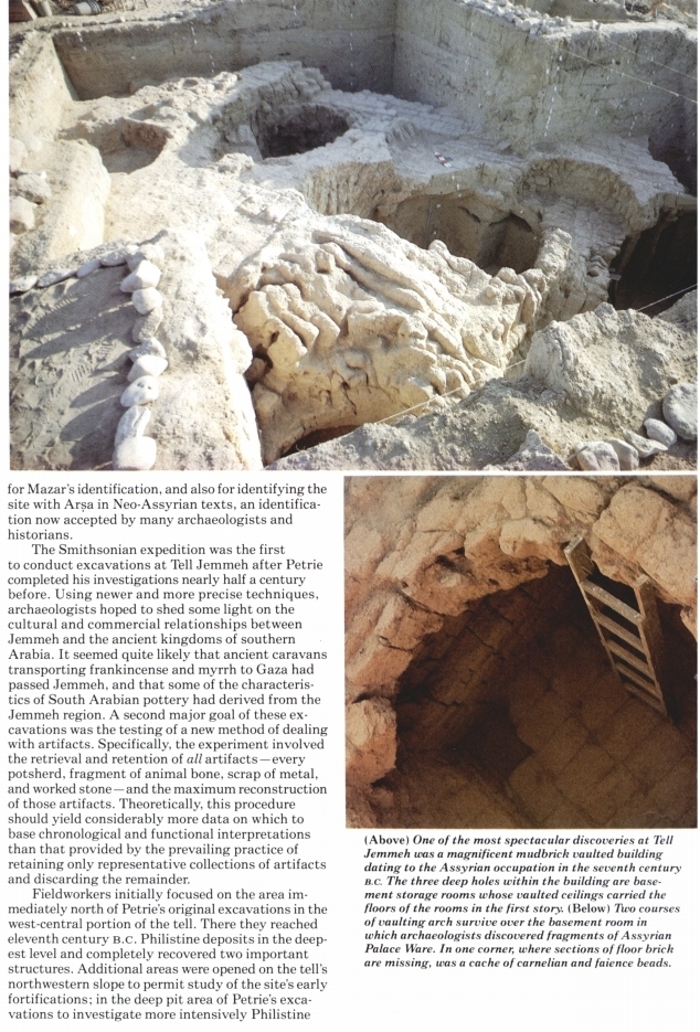
The archaeological site of Tell Jemmeh (Tel Re’im) is a
prominent mound located in the region of the northwestern
Negev and the southern coastal plain of Israel about 12 km
south of Gaza and 9 km west of the Mediterranean coast. The site is situated in a strategic location on
the southern fringe of a sedentary settlement close to the important
maritime gateway of Gaza and on the crossroads of
the major coastal highway connecting Egypt and Asia and the
route from Arabia to the main coastal gateways on the Mediterranean
coast. Even today it stands prominently overlooking
the modern roadway, giving the junction its modern name
(the Gemma Junction). Throughout the Bronze and Iron Ages
the sites of the western Negev presented a unique combination
of the material cultures of the regions surrounding it. A case
in point is the Iron Age II (10th–7th centuries BCE) when the
region witnessed the intensive political, military, cultural and
commercial activity of Egypt and Assyria as well as settlement
of Arabs, Phoenicians and perhaps also Greeks. This region
became pivotal in the administration of the spice trade network
that commenced at the Gaza, Ashkelon and Ruqeish headquarters.
In 1952 Benjamin Maisler (Mazar) argued that Tell Jemmeh
should be identified with Yurza (Yurtza), a Canaanite town
mentioned in the annals of Thutmose III in his cities list of the
southern Levant and in the Tell el Amarna correspondence
(Maisler 1952:48–51). Today most scholars accept this identification.
The association of Tell Jemmeh to Yurza is based on the
site’s prominence and strategic positing, controlling the coastal
route on the very southern edge of the Canaanite territory. This
identification is further substantiated by the petrographic provenancing
of two el Amarna letters written from Yurza’s governor
Pű-Ba’lu to the king of Egypt to Tell Jemmeh (Goren et al 2004:300).
Yurza: The Identification of Tell Jemmeh by Benjamin Maisler (1952)
https://ancientneareast.tripod.com/PDF/maisler1952.pdf
W. J. Pythian-Adams (1923:146), who was the first to excavate
the site, proposed to identify Tell Jemmeh with ancient
Gerar, a town mentioned in the Bible in passages primarily
dealing with the Patriarchs. The Byzantine site of Umm Gerar, some 3.6
km down the Nahal Besor from Tell Jemmeh, helped support
this claim, as according to Pythian-Adams, the name drifted
there from the biblical town of Gerar, which must have been nearby.
Report on Soundings at Tell Jemmeh by W. J. Phythian-Adams
Petrie (1928:2) followed Pythian-Adams in also identifying
Jemmeh with Gerar: “That the mound of Tell Gemmeh
is the site of the ancient Gerar is indicated by the name of the
district El Jura around it and by the name of a daughter town
Umm Jerar, entirely of Roman age, at a couple of miles downstream.”
This identification was accepted by virtually all scholars
and was assumed in most archeological publications from
1929 until 1952.
(1) Camel Caravans and Camel Pastoralists at Tell Jemmeh by Paula Wapnish https://ancientneareast.tripod.com/PDF/2299-camel-caravans-and-camel-pastoralists-at-tell-jemmeh.pdf
|