|
Other Archaeological Sites / The Neolithic of the Levant (500 Page Book Online) PAPYRUS ANASTASI VI 51-61 by Hans Goedicke in Studien zur Altägyptischen Kultur (1987) Pages 83-98 Updated August 1st 2019
Papyrus Anastasi VI 51-61 is frequently quoted as an illustration of how the forebearers of Israel might have entered the Pharaonic domain. Needless to say there is little justification for such an effort as long as the text is not approached with preconceived notions. There is no reference to Israel in the text nor is there any reason to draw parallels between the "Children of Israel" and the people mentioned there. They are clearly identified as "wanderers", i.e. shasu, a life style not typical of those whose experiences are taken as “guidance”, i.e. Torah. Their aim and outlook is principally sedentary which does not necessarily exclude times when this life style was more a desire than an accomplishment. For pondering the possible course of events the "Children of Israel" might have encountered the passage provides some significant insight although it is rather the opposite of what is frequently gleaned from it. The statement is contained in a compendium of model reports to guide minor administrators. It seems most likely to have been taken from an actual report which 1 Select Papyri in the Hieratic Character from the Collections of the British Museum London 1842 3 James H. Breasted Ancient Records III --- Pages 1122-23 (BAR) New York 1906
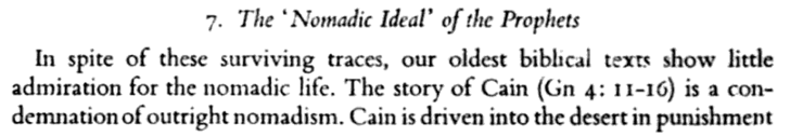
5 Although nomadic roots are widely claimed for what became Israel the biblical text displays no particular admiration for this life-style as Roland de Vaux, Ancient Israel I: Social Institutions New York 1965 13 following points out
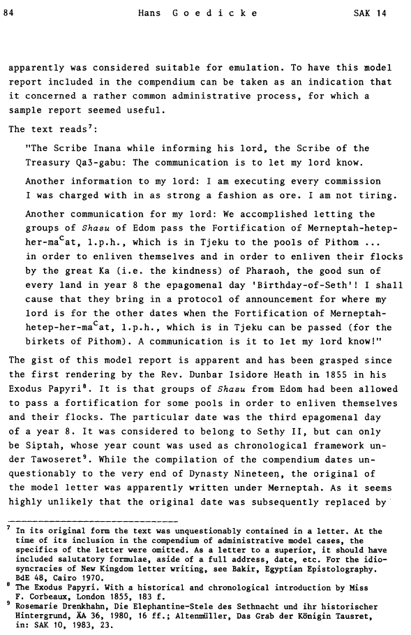
apparently was considered suitable for emulation. To have this model report included in the compendium can be taken as an indication that it concerned a rather common administrative process for which a sample report seemed useful. The text reads:
“The Scribe Inana while informing his lord, the Scribe of the Treasury Qa3-gabu: The communication is to let my lord know.
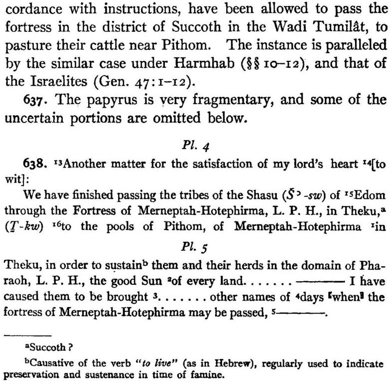
The gist of this model report is apparent and has been grasped since the first rendering by the Reverend Dunbar Isidore Heath in 1855 in his Exodus Papyri. It is that groups of Shasu from Edom had been allowed to pass a fortification for some pools in order to enliven themselves and their flocks. The particular date was the third epagomenal day of a year 8. It was considered to belong to Sethy II [Seti] but can only be Siptah whose year count was used as chronological framework under Tawoseret. While the compilation of the compendium dates unquestionably to the very end of Dynasty Nineteen the original of the model letter was apparently written under Merneptah. As it seems highly unlikely that the original date was subsequently replaced by
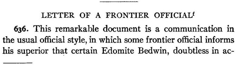
a date of the ruling king it is necessary to identify the “year 8" as belonging to Merneptah. As he ruled a maximum of 20 years such an attribution is secured. There are however some details where the understanding of the administrative communication can be improved. First the exact nature of the reported event; second the ensuing administrative measures; third the kind of people involved; fourth the geographical setting of the event. The purpose of the report has found differently shaded interpretations. Breasted saw it as a communication by a frontier official to his superior "that certain Edomite Bedwin, doubtless in accordance with instructions, have been allowed to pass the fortress ... to pasture their cattle near Pithom" ... Closer to the Egyptian wording is Grdseloff's trans- 10 The year indication is not identified but the papyrus was written under Sethy II (1200/1199-1194/93 BC) making an association with this Pharaoh tempting. Since however the texts gathered in the papyrus are copies the likelihood of reference to an earlier reign is marked. In this case an attribution of the original to the reign of Merneptah I (1213–1203 BC) would seem necessary. The mention of his name in the designation of the fortress which guarded the entry into Egypt would support such an interpretation, pointing to a date of 1216 B.C. (sic) for the original issue. Although Sethy II bears also the name Merenre, this is not sufficient reason to assign the original communication to his reign or to associate the name of the fortress with him as is frequently assumed. Inena, the writer of the model letter, is well known from other sources as well. His superior, the Scribe of the Treasury Qa3-gabu, is also mentioned in Papyrus Anastasi IV dated to a first year of an unknown Pharaoh whom Erman and Helck identify with Sethy II. Such a first year would well agree with an eighth year of Merneptah I. 11 BAR III §§ 636-38; he rendered the crucial passage “We have finished passing the tribes of the Shasu of Edom through the Fortress ... to the pools of Pithom ... in order to sustain them and their herds"
lation who sees in the passage an indication of changing times. While under Sethy I the Shasu were battled the text is for him an indication that "...” Wilson considered the text a model for an official on the eastern frontier to “report the passage of Asiatic tribes into the better pasturages of the Delta". Caminos provided a philological commentary but did not concern himself with a historical interpretation. In his discussion of the location of pr-'Itm and Tjeku Helck offered the rendering "..." His focal point is the geographical aspects and will concern us later. A somewhat different shade has Edel's rendering "..." A rather extensive commentary was provided by S. Herrmann who sees in the text the reflection of a routinely registered border-traffic in connection with the change of pastures by nomadic groups. The people concerned he identifies as nomads from the south Palestinian region who after crossing the northern Sinai Peninsula reached the eastern Delta and seek there pastures, temporarily or for longer, which they can use only with Pharaonic permission. Finally the rendering of Giveon has to be listed: "... 15 loco citato 259 " [We] have finished letting the Bedouin tribes of Edom pass the Fortress [of] Mer-ne-Tah ... which is in Tjeku, to the pools of Per-Atum (Pithom) ... to keep them alive and to keep their cattle alive ..."
This revue of renderings produced a remarkable range of views. The
majority sees the text as a report that the immigration by Shasau
Bedouins from southern Palestine was successfully completed so that
they could sustain themselves and their herds from the water supplies
inside the Pharaonic realm. Such a humanitarian attitude the Egyptian
official is credited with is surprising when compared with the usual
disdain the Egyptians display for foreigners, especially for nomads.
It might be particularly out of tune when one envisages a scarcity
of water supplies as surmised by Redford. The hydrographic situation
in the Wadi Tumilat, which will be discussed later, is however not as desperate as that of most of the region to its east.
The surprisingly “humane” attitude of the Egyptian authorities takes
on another perspective when the time element involved is considered.
It is not an unrestricted free access to the waters which is concerned here
but a privilege with temporal restraints. The possibility
to pass was restricted to a specific date; the one lending itself
to such a favor to "Asiatics" was the "birthday-of-Seth" -- i.e. the
third epagomenal day (which at the time the text was written fell in
the midst of summer). To grant the Shasu permission to proceed
to water their flocks seems a gesture more intended for Seth than for
the people concerned in order to win the god's grace on his “birthday".
Beyond this particular occasion the border was principally closed
to foreigners. Exemptions however could be made to meet emergencies.
In this case written application had to be made to the Egyptian
authorities. It was a matter beyond the power of the local frontier
administrator and required a decision by a superior. The second
part of Inana's letter states the procedures he intends to follow
for those who want to pass the frontier on other dates than the
"birthday-of-Seth".
The concern of Inana’s letter, used as a model for administrators, is thus twofold. This was apparently an annual event on the “birthday-day of Seth" -- the 3rd epagomenal day. It is not clearly specified whether this opening of the border was for one day only or if the people were allowed to remain inside the Pharaonic territory after crossing into it on a specific date. The fact that the completion of “letting the Shasu pass" is reported would seem to indicate that they were complemented out again when the day was over. In short the entire practice of allowing the nomads in was a religious custom rather than a humane concern. The second aspect of the letter, namely the emphasis on the strict execution of the established procedures, supports the view that the admission beyond the "Fortress of Merneptah" was a matter of one day only. Otherwise the border was closed and permission to cross on any other day had to be granted by the Treasury after a written application had been filed. Once the limited character of the border opening is recognized any attempts to draw comparisons with the sojourn of the "Children of Israel" to Egypt collapses. According to Genesis 47 they went to Egypt upon the invitation of Pharaoh and with the expectation to immigrate and remain there. The admission of the Shasu was a religiously motivated custom on the “birthday-of-Seth" and they had no prospects beyond this day. It would thus seem high time to abandon efforts to drag the Papyrus Anastasi VI into the Biblical discussion. This opens the question -- what kind of people were involved in the opening of the Pharaonic frontier. The text specifies them as "Shasu of Edom". In as much as this indication has received any comments they were considered nomads from southern Palestine who routinely changed their pastures to the eastern Delta. The notion would seen to conform with basic concepts of pasturizing peregrination -- a notion conjectured also as the habit of the forebearers of Israel. The convincing image has however some minor flaws when looked at critically. If one locates Edom in the Arabah -- i.e. between the Dead Sea and the Gulf of Aqaba -- it implies that those nomads had to move through, in part, extremely difficult terrains more than 300 kilometres 31 Redford, opus citatum, cautioned against excessive use of the text passage in discussing matters not directly related to it
Redford, Donald “Exodus I 11” in Vetus Testamentum Volume 13 #4 1963 Pages 401–418 32 Nelson Glueck, Exploration in Eastern Palestine II in AASOR 15, 1935, 138
as the crow flies or approximately 500 kilomeres actual distance. To cover it as routine migration seems difficult to imagine considering the fact that there are practically no water supplies in northern Sinai. The prospects of overcoming the hazards of such a journey are such that no herdsman would face them as a routine exercise for changing pastures. The improbability increases further when considering that those nomads were certainly not welcomed with open arms once they reached Pharaonic territory. As a matter of fact the text is quite explicit in stating that the nomads were admitted for one day only -- the "birthday-of-Seth". To assume that nomads travelled with their herds all the distance from the Arabah to Egypt's Delta to be allowed into the Pharaoh's domain for one day would seem too primitive even for unsophisticated herdsmen. In short the general assumption that those people came from south of the Dead Sea does not seem tenable. Shasu is widely considered as an ethnic designation. The fact that the term occurs for people in connection with Transjordan -- Syria -- Palestine -- the Nile Delta and here with Edom requires that it is rather socioanthropological than ethno-geographical. In his comprehensive study Giveon opted for deriving the term from the Semitic root “to plunder" rather than from “to wander". Certain is that they were not indigenous to one particular area but that their peregrinating life style was their distinguishing feature. They might best be envisaged as migrating pasturalizers; their designation is probably an update of the earlier “sand-farers". As "nomads" the Shasu were organized in “tribes” (mhwt) -- i.e. groups travelling together. Family bonds do not have to dominate although they are likely. The particular groups of Shasu permitted into the Pharaonic domain on the "birthday-of-Seth" are qualified as being from Edom. The equation of I-d-m with this recurrent Biblical geographical term is phonetically sound and has been universally accepted. Another possible occurrence in the geographical list of Sheshonq 34 Giveon's objections that Shasu has no "leg-determinative" and that it is found with a "country sign” is not really valid. There are numerous occurrences of “desert-dwellers" without people determinative or without “leg determinative” (e.g. Sinuhe B 73; 292). When taken as a generic term for nomads the seeming desparity of their appearance loses its impact.
is of limited significance for the discussion here. The area denoted as Edom in the Bible is assumed to have been located south of the Brook Zered close to the Gulf of Aqaba. The name is derived from “the red region" sometimes used interchangeably with Seir "the wooded region". According to archaeological survey this region, after flourishing in the late Third Millenium B.C., was basically uninhabited during most of the Second Millenium B.C. In the early Biblical traditions in Genesis Edom and Seir is equated with Esau in juxtaposition to Jacob-Israel. For the geographical meaning of the early use of the term the occurrences in Genesis yield very little. It is certain however that the Edom mentioned in Papyrus Anastasi VI as home of the Shasu people cannot have been located in the Arabah. The apparent visit for one day by those people requires that Edom be fairly close to Pharaonic territory in order to make it feasible. The answer is most probably to be found in the meaning of the term. As “the red region" it can be considered the Semitic equivalent of Egyptian dsrt “the red land" -- i.e. the desert. The term has no intrinsic geographical meaning except in its juxtaposition to the cultivated land (kmt = "the black land"). If taken in this fashion Edom could have originally denoted any “red region" -- i.e. any desert area. It might have here a somewhat more specific connotation by referring to the desert beyond the Pharaonic border where Semites lived. As the general setting of the episode related in Papyrus Anastasi VI is the eastern part of the Wadi Tumilat -- the "red region" -- Edom should be envisaged in the general area of northern Sinai beginning with the Isthmus of Suez. The fact that the Egyptians denoted the Sinai as htyw “wooded area" takes on a different perspective when considered in this context. The alternation of Edom with Seir -- i.e. "wooded region" -- conforms with this geographical identification. The specific point where the Shasu-Bedouins are allowed to enter the
Pharaonic domain on the “birthday-of-Seth" is at the “Fortress of Merneptah-hetep-her-ma°at which is in Tjeku". It is obviously the border-fortress which bears the name of the Pharaoh who built on it last. The extended name-form Merneptah-hetep-her-ma°at makes it certain that Merneptah I (1224-1214 B.C.) is meant here. The standard epithet "life -- prosperity -- health" after the royal name suggests that the text was originally written under him before it was included in the collection of model letters under [son of Queen Isetnofret] Sethy II-Merneptah. Merneptah I, the successor of Ramesses II, was indeed concerned with control over borders and nomads who might be threatening them. This border-fortress is specified as being located in Tjeku. Much discussion has concentrated on the identity of Tjeku in particular if it should be seen as a place or as a regional name and how it related to the Biblical Succoth. While there is general agreement that the setting of the events described in the passage is the Wadi Tumilat, the details are contested. Redford especially holds the view that Tkw should be seen as a district while Helck insists that Tkw was a specific place which comprised a fortress as well as a temple of Atum. This place he equates with the archaeological site of Tell el-Mashkhuta in the eastern Wadi Tumilat. His views were followed by Edel and have also been held by Caminos following Gardiner who questioned any relation to Biblical Succoth. Since the discussion ended in a stalemate Tell el-Mashkhuta has undergone renewed archaeological investigation. It removed this site from any possible connection with Biblical events as dramatically claimed by Edward Naville 42 The inclusion of the royal name is not necessarily an indication of new construction but can also reflect restorations or additions due to the continued use of an already existing edifice. If the place concerned here was the border fortress as seems safe to conclude, it can be taken for granted that it had already existed prior to Merneptah's reign. For possible other references to the "fortress" cf Montet, Geographie I, 214 following 43 The most transparent statement about the king's policy towards unsettled people is in the concluding sentence of the "Israel-Stela" "any one wandering around (sm3) -- he be grasped by King Merneptah"
after his excavations there in 1883. It can be considered as definitely established that the ancient settlement at Tell el-Mashkhuta was founded in the reign of Necho (circa 609 B.C.) without an earlier town preceding it. The newly established archaeological history of Tell el-Mashkhuta should put the discussion about the geographical identifications of the place-names in the Papyrus Anastasi VI to rest. There was only one major settlement in the eastern Wadi Tumilat during the New Kingdom and that has to be equated with Tell el-Rataba. In other words all geographical specifications in the letter contained in Papyrus Anastasi VI concern the Tell el-Rataba site. There are four specifications: first the “fortress” (htm) which was apparently used by Merneptah I; second its location in Tjeku (nty m Tkw); Third the "ponds" (birkets) to which the Shasu are allowed to proceed to "enliven themselves and their flocks"; fourth their qualification "of" pr-'Itm “of the house (temple) of Atum (Pithom)". The text gives the impression of having an additional specification "of Merneptah-hetep-her-ma°at which is in Tjeku" following “the house of Atum" (pr-'Itm). This has been accepted by all previous translators but a more convincing statement is achieved when considering it as a dittography repeated from the preceding qualification of the "fortress" (htm). Considering the expanse of Tell el-Rataba it is improbable that the place comprised a fortress, a temple and a sizeable civilian town each as a separate administrative entity. Instead Tkw should be seen as the designation of the area of which Tell el-Rataba was the controlling border-fortress towards the East. The place apparently had no independent name but was originally only “the fortress". Subsequently its sanctuary the Atum-temple 50 the Store-City of Pithom and the Route of the Exodus, EEF Memoire 1, 1903, 5 ff 52 it could be taken as a specification that pr-'Itm "the house (temple) of Atum” had been built by Merneptah. There are however blocks from this building which date from Ramesses II ... There is also the possibility to see here an effort to distinguish the pr-'Itm in Thw from other establishments of the god. 54 The last major temple at Tell el-Rataba was presumably built under Ramesses II but parts were ready for shipment, in all likelihood to Tell el-Mashkhuta where the main settlement in the eastern Wadi Tumilat was relocated around 600 B.C. due to the changing pattern of the commercial distribution system brought about by Nekho's (re-)activating the canal through the Wadi Tumilat.
became apparently the focal point of its identification, which survived in the Biblical Pithom. The latter is probably an anachronism since Pithom as a place-name does not occur before the Late Period. When Tkw is a regional rather than a local designation the question of its origin arises. It is obviously not an indigenous term since it is not attested prior to the Nineteenth Dynasty. I wonder if it is not a derivate of Tkrw "(Semitic) people" reflecting the fact that such people were living in the area denoted as Tkw. Tkrw occurs from the reign of Ramesses III on, denoting people who are in opposition to the Pharaoh. They are repeatedly named parallel to the Peleset -- i.e. the Philistines. Their habitat during the reign of Ramesses III is ambiguous while in the Report of Wenamun dating to 1072 B.C. they are recognizable as dwelling at and controlling part of the Palestinian littoral. Although they have repeatedly been identified as a part of the Sea-people movement and were compared with the Threukers or Etruscans the origin of the term from "man" would seem more in place. As such they denote a group of Semitic-speaking people in contrast to the Philistines who appear to be Helladic. As a geographical term Tk r w could be considered as the habitat of Tkrw-people. 56 It occurs in the military title “commander of archery of Tjeku". Although Giveon assumes an attestation in year 7 of Thutmosis IV the particular officer named Imenemhat is known from two other inscriptions in Sinai (numbers 252 and 260) both dating to Ramesses II thus requiring a similar date for the inscription added to Sinai number 60
It would be basically a regional designation comparable to the later designation of the area as "..." It is an indication of the kind of people living there, a fact the area shares with the Arabah south of the Dead Sea. To have at least part if not all of the Wadi Tumilat denoted as a region of Semites agrees well with Biblical information that the "Children of Israel" were settled in Goshen -- i.e. the Wadi Tumilat -- and with recent archaeological discoveries there. The four geographical specifications in Papyrus Anastasi VI all apply to a very narrow area. The “Fortress of Merneptah" was the military installation marking and guarding the eastern entrance to the Pharaonic domain. In addition to having been a fortress Tell el-Rataba held a sizeable sanctuary dedicated to "Atum Lord of Tjeku". Although the pr-'Itm “house of Atum" is lastly identical with Pithom mentioned in connection with the Biblical Exodus, the term is originally not a place-name but denotes only the Atum sanctuary. Pithom as a place-name occurs only after 600 B.C. when the sanctuary was relocated at Tell el-Mashkhuta in connection with the eastward move of the center of the Wadi Tumilat caused by the canal construction under Necho (609 B.C.). The reasons for establishing a temple of Atum at Tell el-Rataba are not entirely clear but might have something to do with the fact that the early name of the region as mentioned in the Story of Sinuhe was P-t-n. Such a name would be apt to inspire a punning with P-t-m -- i.e. Pithom. The limestone blocks which are remains of the Atum temple were found by Petrie in the northeastern corner of the site. It is not yet known if this was the original place of the temple or if these blocks, 63 against Gardiner for instance Helck maintains that Goshen can be traced in Egyptian and insists on locating it in the Wadi Tumilat. The presence of MB II Palestinians is now established for Tell el-Rataba and especially Tell el-Mashkhuta 67 Sinuhe R 46 = 20. According to the text Sinuhe reached P-t-n after having passed the border fortress during the night. It results that he was somewhere at the eastern end of the Wadi Tumilat, possibly at the isthmus of Suez. Cledat had opted for a location near later Pelusium but this would seem too far a distance to be covered in one night
like other architectural elements, were staged there for shipping to Tell el-Mashkhuta. The north side of the Tell el-Rataba settlement bordered on a pond which at some later point was incorporated into the Wadi-Tumilat to Red-Sea canal. The specification brkt n pr-'Itm “pool of the Atum-temple" is not a geographical detail as generally understood but rather a point concerning property rights. When taken this way it results that the pool(s) to which the Shasu nomads from Edom -- i.e. the adjoining desert -- are allowed to proceed belonged to the Atum-temple. This agrees well with the predominantly religious character of the entire practice when the otherwise closed frontier was opened to the nomads for one day -- the "birthday-of-Seth". The realization that (1)"Edom" might not be an ethno-political but rather a descriptive geographical term denoting non-agricultural land as "red land" under the influence of the Egyptian term dsrt "Red Land" -- i.e. "desert" -- [and] the (2)designation "Red Sea" for yam sup and its assumed significance in the Exodus account deserve another look. Bernard Batto has recently added a few more drops to the sea of ink which has been spilled over the question which body of water was the scene of the miraculous survival of the Children of Israel. In the fashionable desire to remove the Exodus narrative from any physical implication he envisages "that P consciously intended to historicize and localize the sea miracle at the Red Sea". From attributing motives to P without explaining their desirability at the time P is dated he turns to the Song of the Sea (Exodus 15:4-5) where yam sup is also mentioned as the place where the Pharaonic troops perished. What would seem to be a confirmation of the historic tradition about the location of the Miracle of the Sea he takes as starting point for a mythological tour de force. Claiming that “the Song of the Sea is heavily dependent upon mythological language" he declares yam sup a mythologem. With a slight adaption from yam sup to yam sop he arrives at the conclusion that it means "Sea of End/Extinction". As far as Exodus 15:4 is concerned Batto concludes that yam sup stands simply as the B word in the poetic pair yam//yam sup; it has no more historical or geographical referent than does yam (= Sea-dragon). Rather here traditional mythical language is used to express the belief that the emer- 69 It is presently an oval depression of 120 meters by 80 meters forming the northern edge of the tell. There is a second smaller basin somewhat to the west of it and the connection between the two can be traced without difficulty.
gence of Israel as a people during the exodus was due to a creative act by Yahweh equal to that of the original creation of the cosmos itself. The Egyptians, the evil force which threatens the existence of this new creation, are approximately cast into the Sea to perish. A more powerful symbol for non-existence can scarcely be found than submergence into the Sea of End/Extinction". Contrary to the Batto allegation Papyrus Anastasi III, 2, 11-12 does mention a region p3-twf "the reed/papyrus swamp" as does Papyrus Anastasi IV 15,6; Papyrus Sallier I 4,9; Papyrus Anastasi VIII 3, 3-4 and the Onomasticon of Amenemope A 418. In all these instances p3-twf denotes an area in the very northeastern part of the Nile Delta. Its main characteristic, which gave it its name, is the growth of swamp vegetation, either reeds or papyrus. It is nowhere linked with Tanis which at the time most of the above mentioned were written was still a hundred years in the offing. In as far as it is associated with the Ramesside Delta Residence it concerns the region of Qantir. The “reeds” (area) (p3-twf) is beyond question the Egyptian name of the expanse now called Lake Menzalleh. That yam sup is used to denote the Red Sea is indeed so well established that it does not need any corroboration. More curious and to my knowledge unanswered is the question where the term originated and why the LXX [Septuagint or the Greek Translation of the Old Testament] rendered it as Erythra Thalassa, the origin of all later names for the water. Discussions about red algae tinting this body of water are as unfounded as alleged red-colored geological formations lining it. As a matter of fact the Red Sea is blue of the deepest hue and most of the mountains are white as is the snow-white coral strand lining it. If yam sup as "Sea of Reeds" has any 78 this identification is based on the present geography. The ongoing investigations by Dr. Daniel Stanley of the Smithsonian Institution in Washington promise to help getting a better notion of the historical situation in the northeastern Delta
color implication, it could only be green. The answer to this seeming riddle is amazingly simple, requiring only a few basic reflections. Israel has at no time been maritimely oriented. This applies in particular to any concern for the Red Sea which in general was rather outside its perimeter of interest. The commercial ventures from Ezion-Geber-Elath under Solomon in cooperation with Hiram of Tyre (I Kings 9:26-27; 10:11,22) are an exception. Needless to say this was not the first time the Red Sea has been sailed by a ship. This Sea had been travelled by the Egyptians since the Old Kingdom -- i.e. from = 2500 B.C. on -- either crossing it to acquire copper from Sinai or myrrh from Punt. The Egyptians called the Red Sea W3d-wr “the Great Green" (papyrus) -- w3d being written with the papyrus plant. Those coming late to the Red Sea found an already established name and adopted it into their own language. The result is nothing else than yam sup.
Needless to say this adopted originally Egyptian term has nothing to do with the Exodus itinerary. In Exodus 15:4 should be a mention of sup and not of yam sup. The immediately preceding mention of yam "the Sea" triggered an association with yam sup and ever since the Children of Israel have been assumed to have crossed the Red Sea. It remains to explain the puzzling color change into the Greek Erythra Thalassa. Erythra has its origin in the geographical designation Erythreia which means literally the “Red Land". This is however nothing else than a verbatim translation of Edom "the Red Land". In short Erythra Thalassa is a Greek rendering of the fact that the Gulf of Elath and with it the Red Sea is the "Sea of Edom". 85 Although the color of the Red Sea is deep blue, one has proposed all kinds of explanations for the name. The one still maintained is that a certain algae (Trichodesmium erythraeum) with red pigments occasionally gives the surface a red hue appearance
|