|
Other Archaeological Sites / The Neolithic of the Levant (500 Page Book Online) Ancient Silwan (Shiloah) [Siloam] in Israel and The City of David ProofRead and Updated March 28th 2020
Selected Excerpt: SILOAM (Greek) SHILOAH (Hebrew) SHELAH SILOAH SILWAN Preface: Undoubtedly Jewish antiquities comprise a prominent part of Jerusalems archaeological heritage but there is much more. For one thing settlement around the Gihon Spring began as early as 5000 BCE four millennia before King David; and the first evidence for the citys rise to prominence comes when the city was inhabited by Canaanites around 1700 BCE (1).
Only in the City of David is it possible to see continuous settlement from the Epipaleolithic period to the modern period because of the presence of only one source of water up to the Roman period (Page 31 (15).
Why did the first settlement start here on the eastern slope of the mound?
The reason is very simple. In this area there was located only one source of water -- the
Gihon Spring. Thanks to a series of rock-cut tombs that were discovered on the hills
around Jerusalem [including Silwan] it is possible to imagine where the borders of the City [of David] were situated. Rock cut-tombs are a good indicator of the expansion of cities because
they are often outside city walls Epipaleolithic -- Neolithic -- Chalcolithic Periods The City of David was (and still is) a small hill in ancient times and looked different than it looks today. It is also important to remember that the hill was not (during King Davids time) the first phase of settlement in Jerusalem. The earliest evidence of human activity and presence in the prehistoric Jerusalem is from the Epipaleolithic Period (22000 BP9500 BCE). Limited finds such as flint stones come from the area around the Gihon Spring. It is hard to say if the owners of the tools lived permanently in this area or if they came from other places. Artefacts from the Neolithic period (95006400 BCE) are still very poor. Only flint tools and some shards were discovered on the mound of the City of David (Page 34 ibid). The Chalcolithic period (64003600 BCE) has got a poor amount of any archaeological evidence. Nevertheless it is possible to see settlement activity in the area of the City of David where potsherds, flints, pottery and cup-marks in bedrock were found (ibid). Early Bronze Age The earliest architectural remains are dated to the Early Bronze Age (circa 3600 2400/2300 BCE). The series of three burial caves in the City of David with complete pottery vessels were found but we do not have any more contexts or details. The two typical Early Bronze Age houses (broad-room) were uncovered by Yigal Shiloh. Kathleen Kenyon found the rough stone structure and many early bronze sherds. From this period we do not have evidence of fortifications; Jerusalem was probably unfortified (ibid). Middle Bronze Age The Middle Bronze Age is dated to circa 22001550 BCE. Some socioeconomic changes took place in the land of Israel (exactly in Canaan) during this period. For a complete understanding it is better to divide this period into two phases (Page 35 ibid). Middle Bronze Age I From the Middle Bronze Age I (circa 22002000 BCE) there are not too many material remains; nevertheless the most important evidence comes from rock cut-tombs. For example graves at the Mount of Olives, tombs at Bethany and in the village of Silwan and tombs at Mount Scopus (dolmen tombs) and at the Mount Zion are known. All these graves indicate the similar and very common types of tombs. The same types were also uncovered in other sites in the central hill country. This is the last period when the material and architectural remains are too poor and we do not have other sources for the reconstruction of Jerusalems history (ibid). Middle Bronze Age II The first documents originate from the time of the Middle Bronze Age II (20001550 BCE); they include heretofore the oldest mention of the name of Jerusalem. These textural materials belong to groups of execration texts. In these documents there are notes of names of cities and rulers of the potential enemies of Egypt. Among them there is also the name Jerusalem (in a form probably to be read Rushalimum). The execration texts are from the time period when the Egyptian empire ruled over Israel, Libya and Sudan. The first group could be dated from the 20th to the 19th century BCE. Archaeological finds show ink inscriptions on pottery vessels from this time. Other groups of the texts are from the 19th and 18th centuries BCE. They were written on the pottery figurines that represent prisoners with tied hands. The figurines were used by the priest and were destroyed by him as a sign of the possible destruction of enemies. In the group of execration texts from the 20th to the 19th century BCE there were names of cities and their rulers. Two or three rulers are mentioned for each city. In the case of Jerusalem two personal names are written: they are the western Semitic names of local rulers. It could be a sign that Jerusalem had two (maybe three) rulers at the same time. Each sovereign was the head of a different group or clan of citizens. The stray political order denoted change that we can see according to the later group of textural material from the 19th and 18th centuries BCE. We can read about just one monarch for each city. Jerusalem was mentioned among other cities in Canaan but only one other city from the Central hill country was inscribed [Shechem] (Pages 35-6 ibid).
The remains of the Middle Bronze Age II bear witness to the transformation
of Jerusalem from the rural style to the urban planning settlement. Jerusalem
became the centre of emerging polity. The oldest
known walls have been uncovered at the eastern slope of the City of David -- halfway
up the slope. As we can see from the archaeological survey the wall was built in
the 19th century BCE. According to Kenyon the wall was part of a fortification and
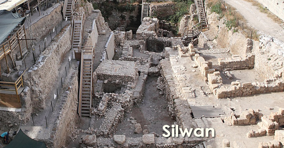
included a tower Two excavators, Ronny Reich and Eli Shukron, have improved the understanding of ancient Jerusalem (See A and B). They started working close to the Gihon Spring in 1995. They found a structure -- a massive fortress surrounding the source of water and the Rock-Cut Pool that was used as a huge reservoir. Kenyon and other previous researchers thought that the Gihon Spring was located unfortified outside of the city walls. Reichs and Shukrons excavations changed this view because they exposed a huge unknown tower (13.8 x 16.6 metres) -- the Spring Tower. Water flowed from the Gihon Spring through a rock-cut channel (channel II) down to the foot of the hill where the meeting point of the Kidron Valley and Tyropoeon Valley was. There was a small pool there (later known as Siloam Pool). The first part of this tunnel was cut from the surface and it was covered with large stones. The second part continued as a rock-cut tunnel. The second way that water flowed from the Gihon Spring was the short rock-cut tunnel to the bottom of the fortified Rock-Cut Pool (10 x 15 metres) that was dug into the hard rock. The maximum depth of the pool is 14 metres. Water was conducted with another shorter tunnel to the bottom of the pool. The pottery shards associated with the floor of the reservoir and parts of the fortification of the pool were dated to the period of the Middle Bronze Age II. This was the first phase in which a water system was built and used. The pool was also protected by a tower -- the Pool Tower. On the northern part of the pool were found the remains of two massive walls that were included in the system of the tower (Page 36-7 ibid). Late Bronze Age In the Late Bronze Age (15501200 BCE) there are only a few material remains. Close to the Gihon Spring we have no pottery from the Late Bronze Age. Also there is no evidence of human activity close to the Gihon Spring. If anything can tell us more about the political status of Jerusalem it is necessary to focus on the Amarna documents. The letters from the Egyptian city Tel El-Amarna are historical sources from the 14th century BCE. This correspondence included letters between Egypt (the Pharaoh Akhenaton that overruled Canaan) and local rulers. According to the Amarna letters Jerusalem (mentioned as Urusalim) was the city of a local king. Jerusalem and Shechem were two main cities that occupied all of the Central Hill Country. Shechem was the Canaanite kingdom in the Late Bronze Age with a number of settlements that extended between the Jezreel Valley in the north and Shiloh. An archaeological view shows us that Shechem was a medium-sized Canaanite city-state and that the region was occupied by independent rural and pastoral population groups. In the case of Jerusalem the El-Amarna letters express that Jerusalem was the seat of the king nominated by the Pharaoh. Jerusalems king lived in a palace with 50 Egyptian soldiers. The king sent rich caravans with tributes to Egypt. As we can see from the letters an Egyptian messenger came to Jerusalem often. In Jerusalem there were uncovered the remains of a few building fragments in the part above the City of David called the Ophel. The Ophel is an area inside the present city walls between the City of David and the Temple Mount. A fragment of Egyptian stele with hieroglyphic inscriptions (probably from the 19th Dynasty) was found north of the Temple Mount. We have six diplomatic letters that were sent by the kings of Jerusalem to the Pharaoh. The correspondence indicates that Jerusalem had its own professional scribes and administrative apparatus. The settlement in Jerusalem was still small during the Late Bronze Age but it played an important role in the geopolitical activity of Canaan. From this time period there is no archaeological evidence that indicates the presence of foreign inhabitants in Jerusalem (Page 40 ibid). Iron Age I The Iron Age I period (1200-1000 BCE) is connected to the person of Joshua and [also later] Davids conquest of Jerusalem. According to absolute chronology we can date the period to between 1207 and 1050 BCE. The Merneptah Stele (the Israel Stele) is a victory stele of the Egyptian King Merneptah (ruled between 1213-1203 BCE) from 1207 BCE. It contains information about the campaign to Canaan in the 5th year of Merneptahs reign and in the stele there is the first mention of Israel. The discovery of the Merneptah Stele indicates that Canaan was inhabited by Israelites at the end of the 13th century BCE. The term does not mean nation of Israel but some tribe or ethnicity (Page 41 ibid). The Iron Age I period is also connected with Joshuas campaign to conquer Canaan in the time of the biblical Judges. Some of the cities had already ceased to exist before this time because most of the Canaanite cities were destroyed at the end of the Bronze Age (for example Arad -- Jericho -- Ai). This means that Joshua could not have captured Canaanite cities where somebody had not been living. But in Jerusalem it was a different story. According to the Book of Chronicles, before Davids conquest Jerusalem was a city of the Jebusites (Jebus). The archaeological records include nothing about this Canaanite tribe therefore it still uses the term Canaanites (ibid). The year of 1200 BCE is the date when something changed. The Sea Peoples invaded Canaan and Egypt lost its influence there. Because most of the Canaanite cities were destroyed and abandoned the Canaanite territory was empty and ready for new inhabitants. We have no archaeological or historical evidence that Jerusalem was also abandoned in the end of the Late Bronze Age. It is assumed that Jerusalem was settled continuously. Jerusalem used the same building elements as in the Bronze Age period (ibid). Iron Age II period (1000586 BCE): The City of David --- Area G The most important square of the Iron Age II period in the City of David is area G. The reason is very simple: this area is very close to the acropolis and it contains strata from the Bronze and Iron Age and it is still close to the Gihon Spring (Page 45 ibid).
During Kenyons excavations on the Stepped Stone Structure in area G she uncovered part of the house from the Iron Age II (the Burnt Room). During the excavations in the years 19781982 there was discovered a fragment of a cultic stand together with the pottery. A similar find was uncovered at Megiddo and Tanach (10th century BCE). The figurine on the cultic stand has the same type of hair dress as is known from the Sea People reliefs (Medinet Habu in Egypt) and from clay anthropoid coffins (Beth Shean). Another artefact from area G is the bronze fist that is also known from another site of Canaan from the Late Bronze Age (10th century BCE). Yigal Shiloh completed the excavation of the House of Ahiel, now dated to the end of the Iron Age II. This house against the Stepped Stone Structure is typical of Iron Age II architecture -- a Four-Room House. In one of these rooms thirty-seven storage jars were discovered. On some of the jars there were rosette impressions on the handles from the end of the Iron Age. In 1985 50 stamped bullae were found inside another building located close to the House of Ahiel. The stamps included the official Judean names from the 7th century BCE. They were probably parts of papyrus and when Jerusalem was destroyed by Babylonians the fire preserved the clay bullae and the organic papyrus burnt. The bullae indicate the presence of administration in this House of Bullae (or maybe in the whole quarter). The House of Bullae was a complex of buildings on the lower terrace. For this reason this area is marked as the Royal Quarter. According to Yair Shohan this house was used for storing documents (Pages 45-6 ibid).
Excavations at the City of David: Inscriptions (Volume 6)
The House of Ahiel was built into the Stepped
Stone Structure and that opened questions of dating this stone complex. Shiloh uncovered
thin terrace walls under the Stepped Stone Structure and he dated them to the end
of the Late Bronze Age. So it means that the Stepped Stone Structure is sandwiched
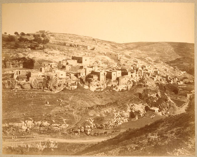
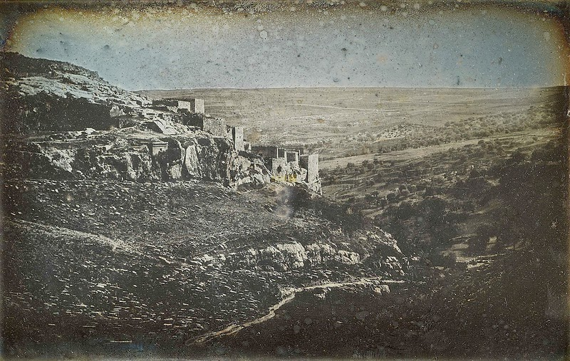
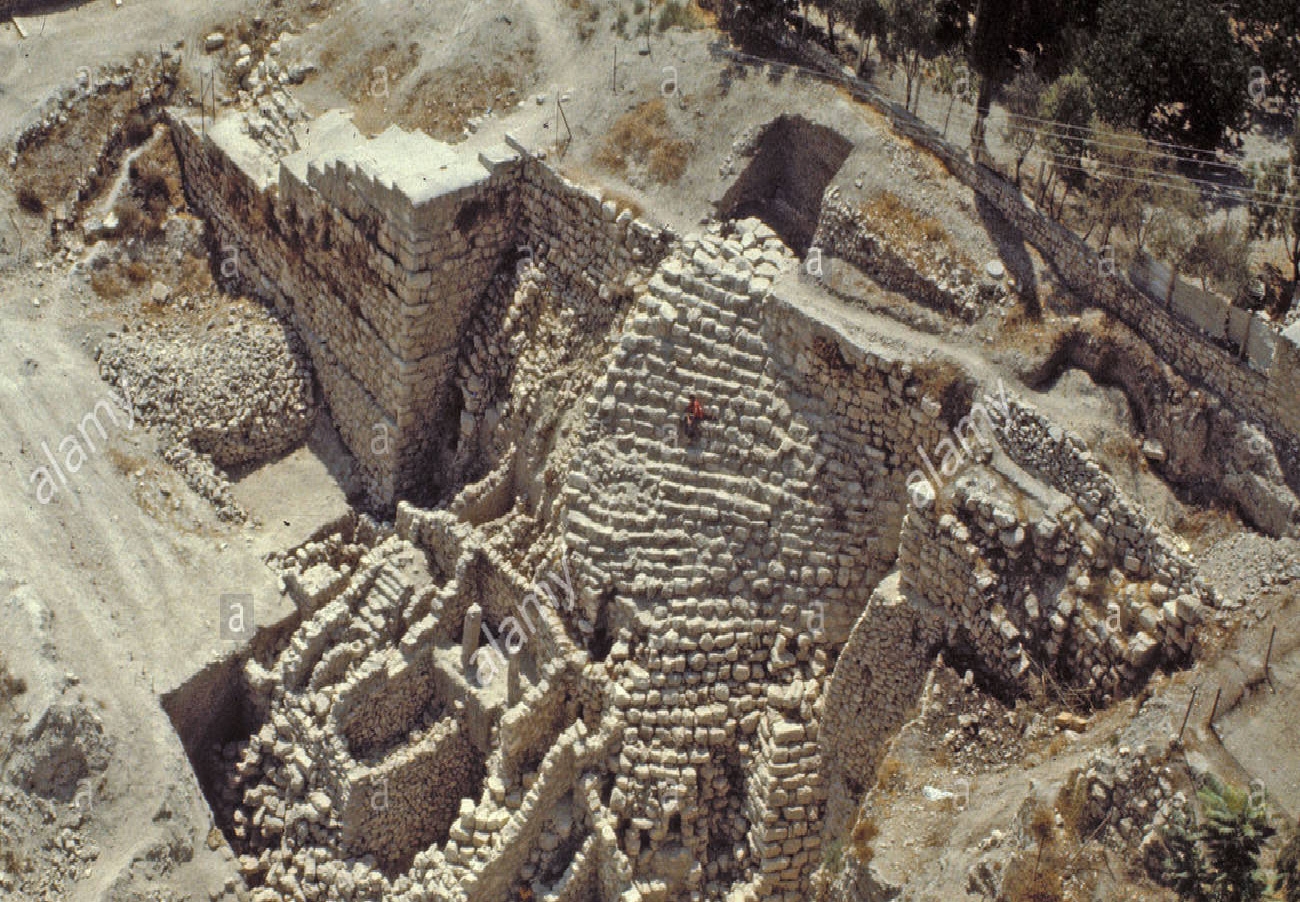
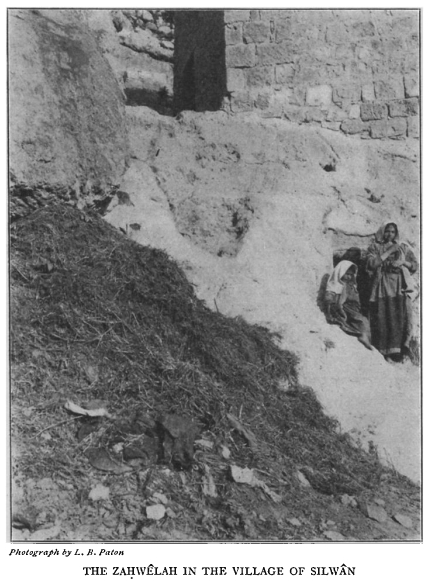
between these thin terrace walls and the Iron Age II houses Post Script:The Babylonians, headed by Nebuchadnezzar, conquered the coastal cities in 604 BC (2 Kings 24:7) and later destroyed Judea and Jerusalem in 587. The temple and Jerusalem were destroyed and some of the population were exiled (16). The village of Silwan was built atop and around the necropolis of the Biblical kingdom. The ancient cemetery is an archaeological site of major significance. It contains fifty rock-cut tombs of distinguished calibre, assumed to be the burial places of the highest-ranking officials of the Judean Kingdom. Tomb inscriptions are in Hebrew. The most famous of the ancient rock-cut tombs in Silwan is the one known as the Tomb of Pharaoh's daughter (2). Silwan Necropolis: Its tombs were cut between the 9th and 7th centuries BCE. It is situated on the rocky eastern slope of the Kidron Valley facing the oldest part of Jerusalem. The Arab village of Silwan was later built atop the necropolis. Although the existence of ancient tombs in the village of Silwan had been known since the 19th century the first careful survey was not performed until 1968. (6).
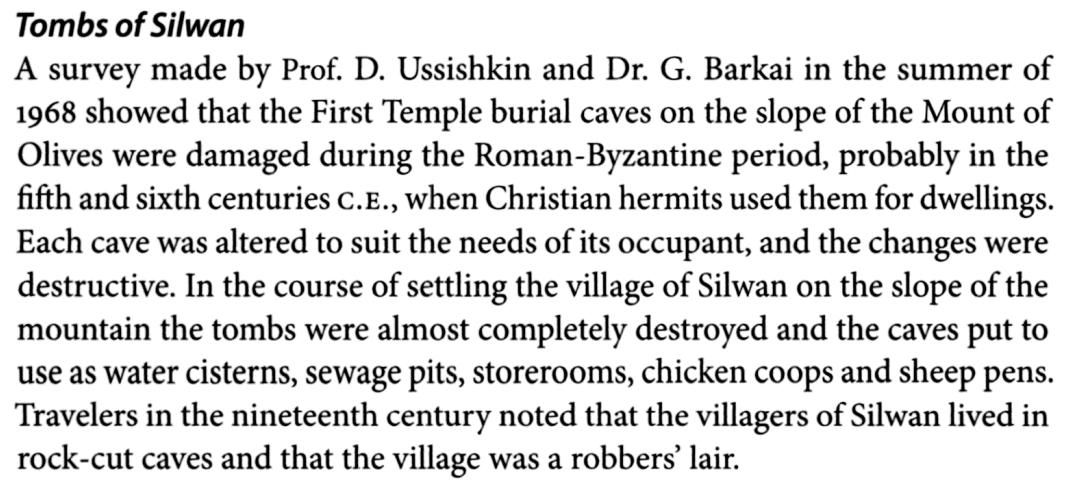
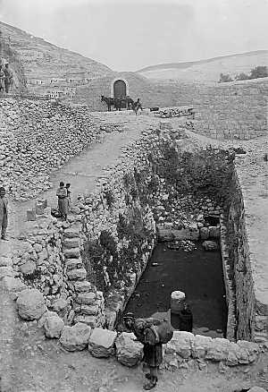
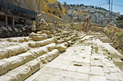
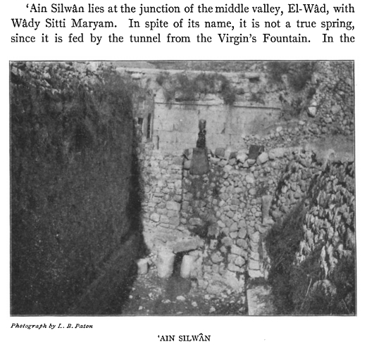
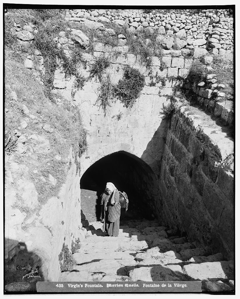
Gihon Spring: The Gihon Spring or Fountain of the Virgin [From the Hebrew Giha which means "gushing forth"] in the Kidron Valley was the main source of water for the Pool of Siloam in the City of David, the original site of Jerusalem. It was one of the world's major intermittent springs and a reliable water source that made human settlement possible in ancient Jerusalem. The spring was not only used for drinking water but also initially for irrigation of gardens in the adjacent Kidron Valley which provided a food source for the ancient settlement. The spring rises in a cave 20 feet by 7. Being intermittent it required the excavation of cisterns which stored the large amount of water needed for the town when the spring was not flowing (5). The Middle Bronze Age Channel (Canaanite): a fairly straight channel dating from the Middle Bronze Age cut 20 feet into the ground and then covered with slabs (which themselves were then hidden by foliage). This led from the Gihon Spring to the Pool of Siloam and was an aqueduct (ibid). Siloam Tunnel: a winding tunnel carved into the rock leading from the Gihon Spring to the Pool of Siloam. According to the Bible King Hezekiah prepared Jerusalem for an impending siege by the Assyrians by "blocking the source of the waters of the upper Gihon and leading them straight down on the west to the City of David" (8). Pool of Siloam: The Pool of Siloam is a rock-cut pool on the southern slope of the City of David located outside the walls of the Old City to the southeast. The pool was fed by the waters of the Gihon Spring, carried there by two aqueducts. An even more ancient pool (Upper Pool) once existed near the Gihon Spring but was no longer used after King Hezekiah redirected the waters to the western side of the city (9). To better understand the Gihon Spring and the aqueducts --- tunnels --- pools associated with it go to the excellent Jerusalem Archaeological Park produced by the Israel Antiquities Authority ---> Water systems > Interactive Map
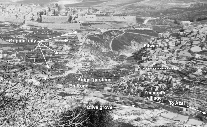
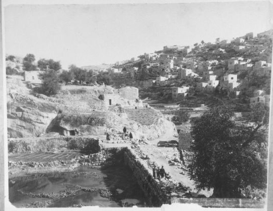
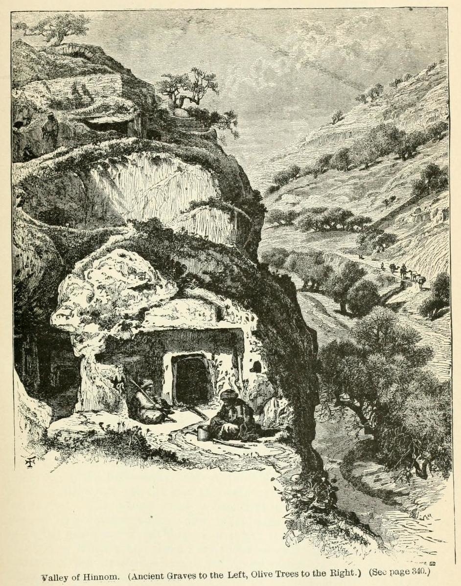
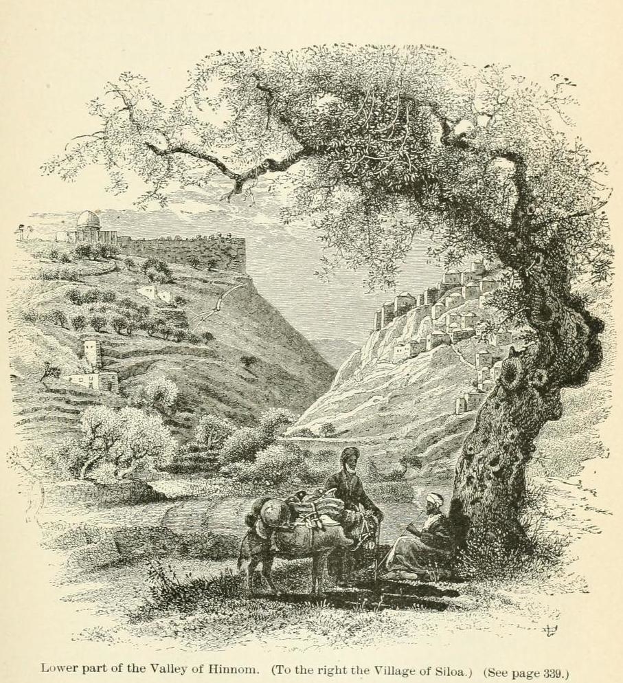
The south-east spur of ancient Jerusalem lies just outside the Ottoman (Ruled 15171917) walls [built 1537-41] of the Old City south of the Temple Mount (1). From 1541 until 1860, when the Jewish neighborhood Mishkenot Sha'ananim was established, the walled area constituted the entire city of Jerusalem (4). Unnamed in most nineteenth century maps, the area outside the walls was partly cultivated by residents of the village of Silwan, which lay across the Wadi (channel that is dry except in the rainy season) Sitti Maryam (Biblical Kidron Valley) on the south-west slope of the Mount of Olives (1). The central point of reference for the Kidron Valley is its confluence of Jerusalems richest concentration of rock-hewn tombs. This area, located on the periphery of the village Silwan, was one of the main burial grounds of Jerusalem in the Second Temple Period. Several of these tombs were also used later in time, either for burial or as shelters for hermits and monks of the large monastic communities which inhabited the Kidron Valley (3). The City of David (now referred to as Wadi Hilweh), an area of Silwan close to the southern wall of the Old City, has been a focus of Jewish settlement since Israel gained control over East Jerusalem in 1967 (2). During the twentieth century Silwani settlement on the hill [opposite] gradually expanded; concomitantly archaeological investigation begun in the last decades of the nineteenth century by the Palestine Exploration Fund was pursued with increasing vigour. It thus transpired that even as the modern Silwani outlier Wadi Hilweh became more densely settled, archaeology began to identify ever more significant remains of Jerusalems earliest history on the self-same spot. Whereas in early modern times only the Fountain of the Virgin (Ain [fountain] Umm el-Daraj) or the Waters of Siloam (Ain [spring] Silwan) possessed any historical or religious significance, archaeological discoveries added new locales that could be associated with biblical events (1).
The village of Silwan was described in the 19th century by travellers to the Holy Land. It was a wretched and relatively small village whose houses incorporated the burial caves or were built next to them. The houses stood on cliffs and to passers-by in the valley they were reminiscent of birds nests. The caves served for human habitation as well as for housing sheep, goats and cattle and for storage. All the travellers mention the dirty conditions of the village. Geikie records: Everything is filthy in the extreme, even for the East (11).
(12) The Holy Land and the Bible by John Cunningham Geike (1888)
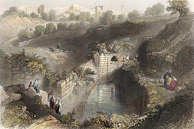
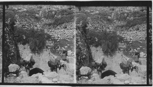
Here truly one is face to face with antiquity. Everything is filthy in the extreme, even for the East, and the villagers, as becomes such a place, have a bad name for dishonesty. About a hundred of them originally came from Dhiban (Biblical Dibon) in Transjordan and form a distinct body; apparently they were the descendants of a colony of Moabites sent from there (ibid). Charles Wilson notes: The houses and the streets of Siloam, if such they may be called, are filthy in the extreme and the villagers are notorious thieves, sometimes not over-courteous to visitors (Page 94 13). The inhabitants gained their livelihood mainly from growing vegetables in the fields below the village and from selling in Jerusalem water which they brought in goatskins from Bir Ayub (En Rogel) and the Siloam pool. The villagers were Moslem (11).
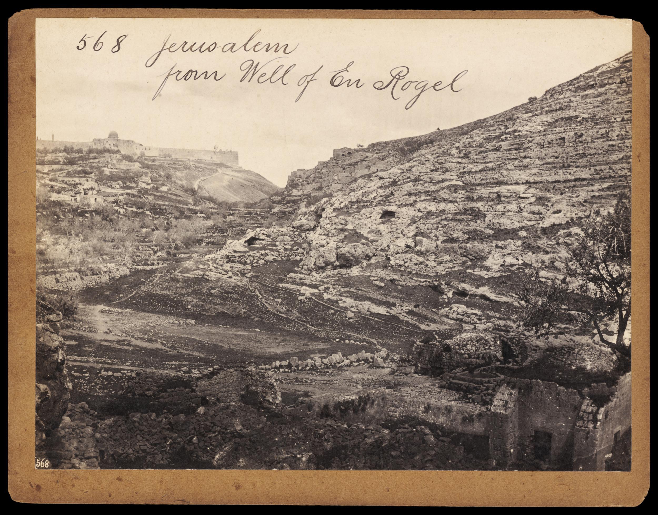
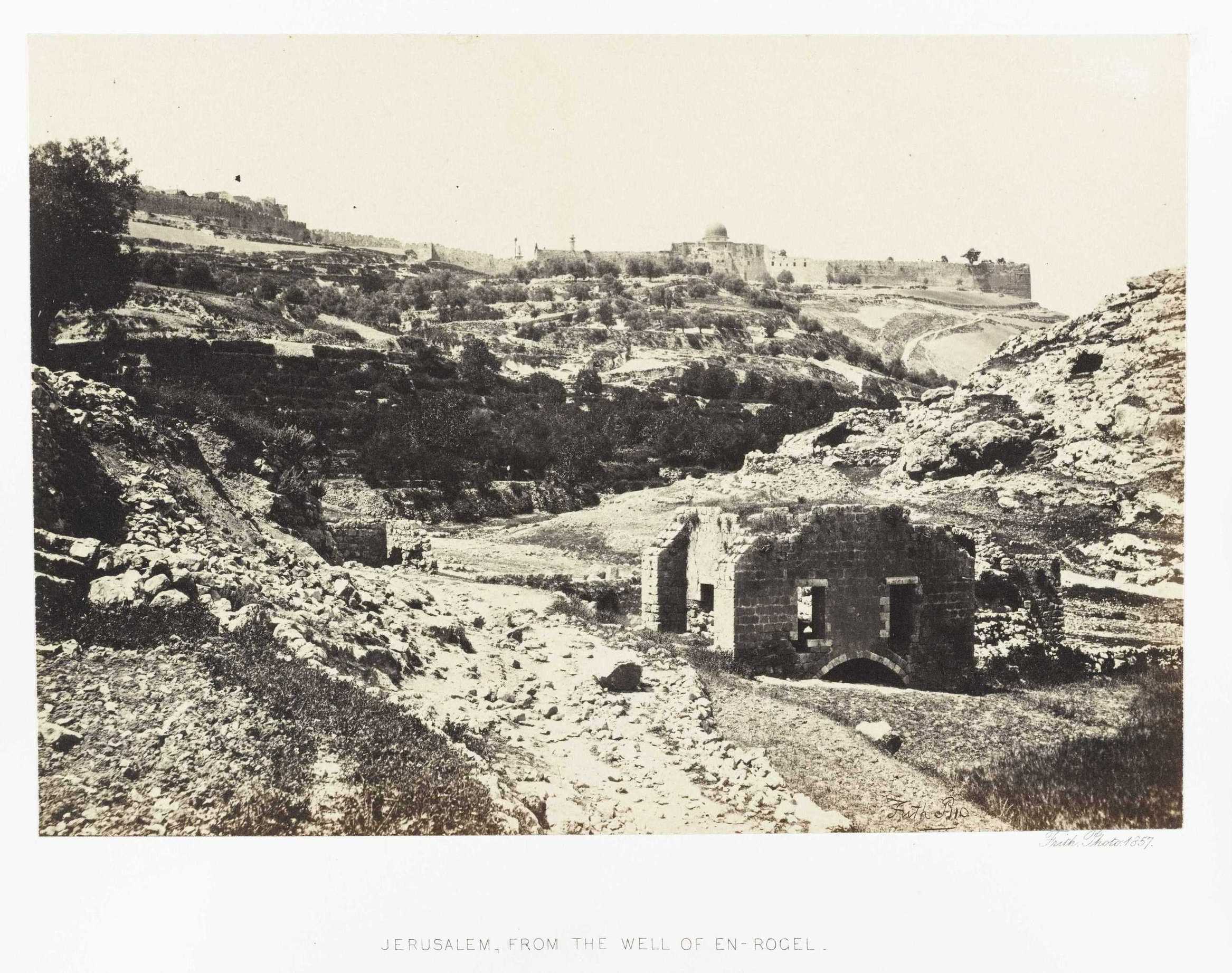
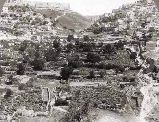
The picture above, taken in the early 1900s from the southern hillside just above the well of En-Rogel, shows that the area is cultivated with many gardens by the villagers of Silwan. The area was well suited for this purpose due to the presence of irrigation water from the nearby pool of Siloam and the well of En-Rogel (Deciphering Zechariah 14:5) The inhabitants of Silwan had a very bad name in Jerusalem. Charles Warren, the famous explorer of Jerusalem, wrote: The people of Siloam are a lawless set credited with being the most unscrupulous ruffians in Palestine (Page 149 14).
(1) Towards an Inclusive Archaeology in Jerusalem: The Case of Silwan
(2) Silwan (Wikipedia)
(3) Kidron Valley (Wikipedia)
(4) Old City (Jerusalem) (Wikipedia)
(5) Gihon Spring (Wikipedia)
(6) Silwan Necropolis (Wikipedia)
(7) Golden Jerusalem by Menashe Har-El (2004)
(8) Siloam Tunnel (Wikipedia)
(9) Pool of Siloam (Wikipedia)
(10) The Siloam Pool: Where Jesus Healed the Blind Man ( Biblical Archaeology Society) May 2011
(11) The Village of Silwan: The Necropolois from the Period of the Judean Kingdom by David Ussishkin (1993)
(12) The Holy Land and the Bible by John Cunningham Geike (1888)
(13) Picturesque Palestine, Sinai, and Egypt by Charles William Wilson (1880)
(14) Underground Jerusalem: an account of some of the principal difficulties encountered in its exploration and the results obtained by Charles Warren (1876)
(15) Tel Jerusalem: The Place Where It All Began (Archaeological Remains From the Epipaleolithic Period
to the Iron Age II Period) by David Rafael Moulis (PDF) 6.1 MB
(16) City of David BibleWalks.com updated on Nov 22, 2014
From Shiloah to Silwan by Raphael Greenberg and Yonathan Mizrachi
The Shiloah Pool and the Second Temple Road (The City of David and Ir David Foundation)
Jerusalem in Bible Times: III The Springs and Pools of Ancient Jerusalem
|